Published September 13, 2017 05:56AM
Find Solitude in the Wyoming Range
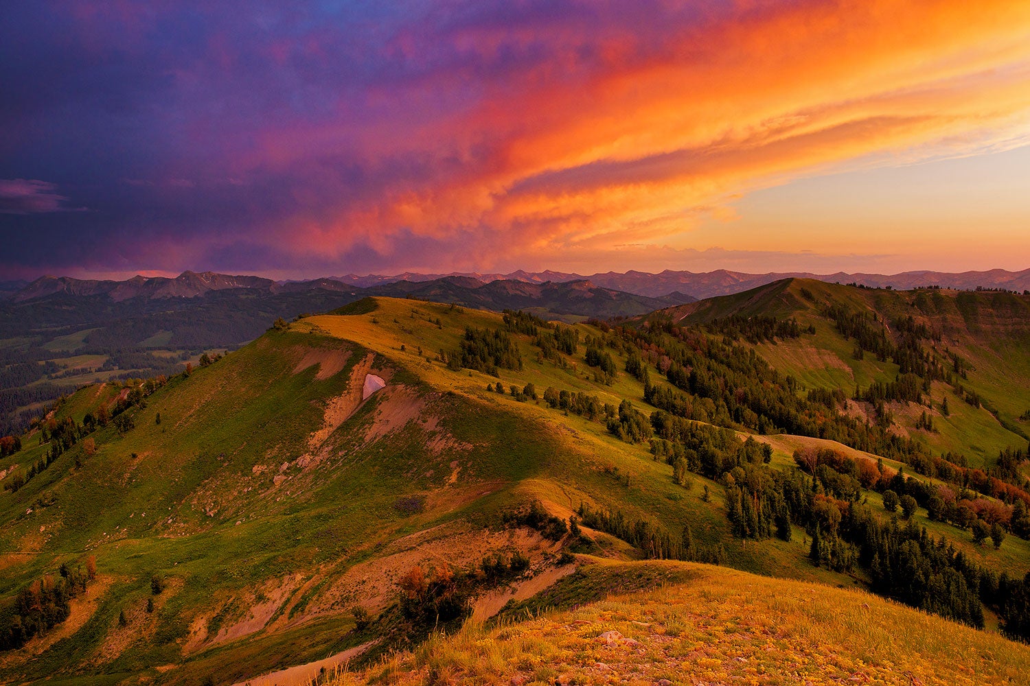
Traverse pinnacled peaks and alpine meadows awash with late-summer blooms through the Cowboy State’s most underrated range.
'Photo by Dave Showalter'
The sun is high above the tallest peaks by the time we spot a trail sign—a tiny post in a tangle of columbine and leafy weeds a quarter mile away. After an hour of wandering off the trail, over creeks filled with trout and through thickets of chest-high willows, we stumble back on course. The trail, if you can call it that, peters out often in this part of the Wyoming Range.
The few humans who do venture into this high country are locals on hunting trips. Backpackers who visit the state head straight for the national parks or the Wind River Range, where the scenery is powerful enough to stir wanderlust—and the trails are more trodden. The Wyoming Range is overlooked, and that’s just fine with us.
There’s always a catch though, and here, it’s the routefinding and bushwhacking. The whole of our 70-mile route follows the Wyoming Range National Recreation Trail, as it’s formally called, but the path isn’t much more than a patchwork of decades-old sheep trails and fire suppression roads. So when we set out from Willow Creek, we lost it almost immediately.
We track down the footpath and spend the afternoon slogging up a faint trail through the lowest part of the terrain, swatting bugs and stopping frequently to take off our shoes and cross ambling creeks. As we climb higher, the horse tracks that marked the early portions of the trail give way to elk hoofprints and a few shriveled piles of wolf scat. My hiking partner Mike, an environmental journalist at a local newspaper, is pretty certain there aren’t any documented wolf packs in this far western corner of Wyoming. About 100 miles north, in Yellowstone National Park and the surrounding terrain, hundreds of wolves roam the landscape. Their range isn’t supposed to extend this far south, but it doesn’t look like anybody has been this way to check in a while.
Dusk sets in late, but even with the extra time we don’t make it to our goal for the day: the base of 8,845-foot Pickle Pass. Instead, we set up camp in a small, muddy clearing on a hillside. Over a campfire, Mike tells me about researchers trying to track elusive lynxes and wolverines through these mountains. Two young red-tailed hawks play chicken in the trees as the evening sky turns deep blue.
ADVERTISEMENT
The next morning, we wake early and climb the steep, broken trail to the pass. At the top, 50 pairs of eyes stare back at us—a herd of elk peering out from clumps of timber. They move silently uphill through the trees and out of sight over the ridgeline, a muscular bull bringing up the rear. Behind us, the spiky, pink silhouette of the Teton Range crests the horizon’s edge.
From here, the trail stays in the high country, skirting around the summits of minor peaks. We spend three more days picking our way through meadows beneath toothy ridgelines before emerging dusty, tired, and satisfied at South Piney Creek, near the southern terminus of the range. It is a frustrating and finicky path, fading out and sending us down dead ends often, but for those with a compass and some persistence, the reward is a wilderness all your own.
DO IT The Willow Creek trailhead, located in the Bridger-Teton National Forest, is just 6 miles southeast of Hoback Junction. From there, you can take the Wyoming Range National Recreation Trail roughly 70 miles to Snider Basin at the South Piney Creek trailhead. Season Late June through September Permit None