Published November 23, 2020 09:58PM
Get Above It in Tennessee's Big Frog Wilderness
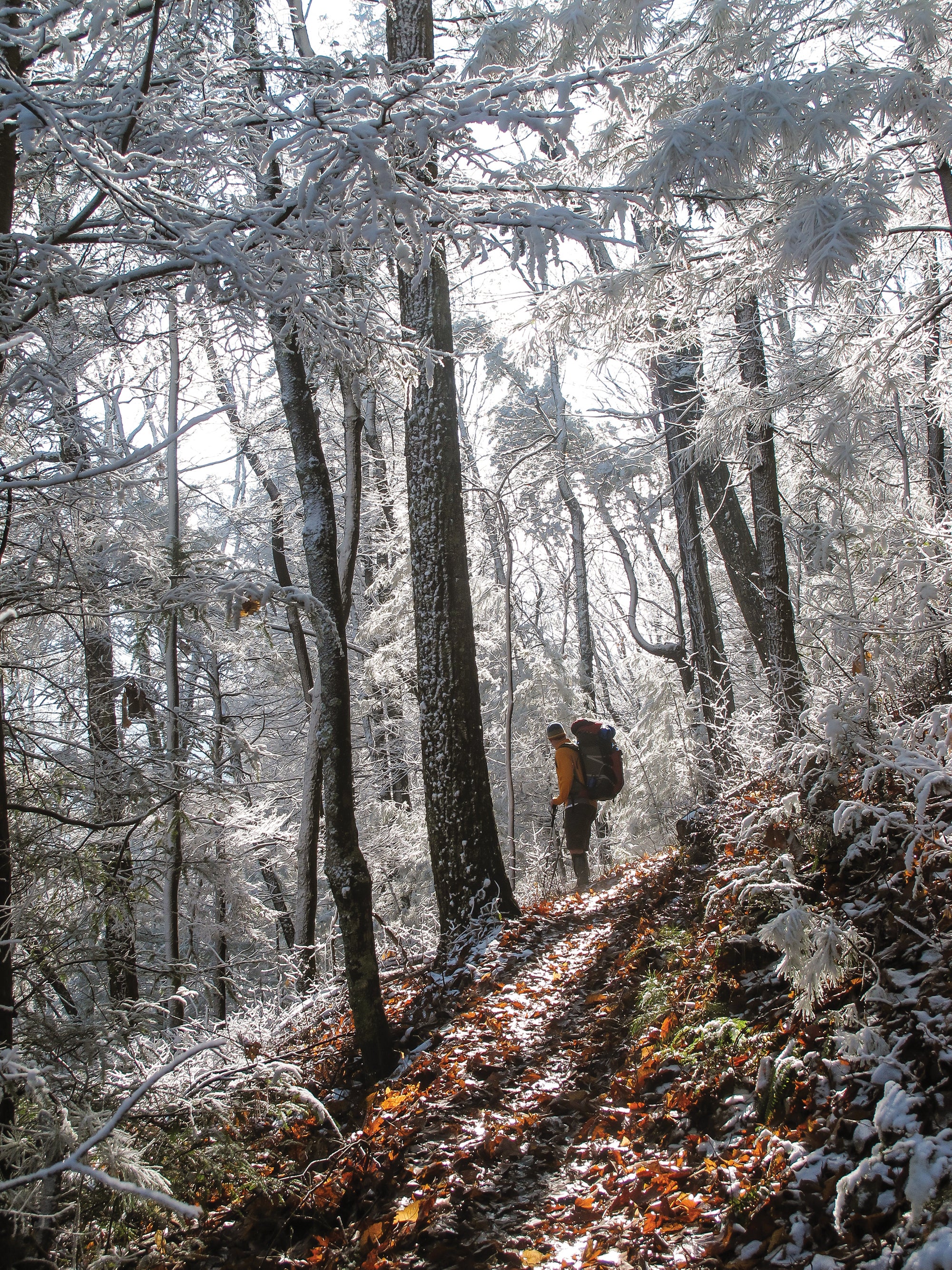
In the winter, the mountains and ridges of Tennessee transform.
'Chris Shiver'
After a night of wind howling through the treetops above my campsite, I wake to a silent dawn. The rain that drummed on my hammock all night turned to ice when a cold front moved in. A thick, freezing fog has settled here on the top of 4,222-foot Big Frog Mountain, outlining pine needles and spider webs in sparkling frost. I break camp in the chill and start the next leg of my hike through a series of rhododendron tunnels. The hunching trees loom over me through the swirling mist. It’s a far cry from the golden sunlight I enjoyed yesterday, when I traversed the forested mountainside and wove in and out of ravines. Now, ensconced in swirling gray, I can’t help but daydream about the rolling, cloud-licked landscape I saw yesterday through the leafless trees. Today I’m descending into the greenery of the Rough Creek valley—with a few more views of the hills, if the clouds burn off. But even if they don’t, I can feel the tangle of ridgelines there just out of sight. Sometimes that’s enough.
Turn-by-Turn From Big Frog Trailhead
1) Follow Big Frog Trail 2.4 miles to Low Gap, then turn west at the three-way intersection onto Grassy Gap Trail.
2) Hike Grassy Gap Trail for 5.2 miles. At mile 2.8 there is an unmarked intersection with Big Creek Trail—continue straight.
3) Stay on Grassy Gap Trail to the T-intersection with Wolf Ridge Trail at mile 7.6 and turn south.
4) Hike Wolf Ridge Trail for .7 mile, then turn left onto Hemp Top Trail at mile 8.3.
5) Follow Hemp Top Trail for 1.9 miles to the campsite at the summit of Big Frog Mountain.
6) In the morning, continue on Hemp Top Trail for .5 mile, passing a spring on the right at mile 10.3, and turn left onto Licklog Ridge Trail at mile 10.7.
7) Hike down Licklog Ridge Trail for 3.8 miles before turning left onto Rough Creek Trail at mile 14.5.
8) 2.1 miles after the turn, Rough Creek Trail intersects West Fork Trail. Look for a sign post missing its sign; it marks Rough Creek Trail turning sharply west away from the creek. Turn onto Rough Creek Trail for 1 mile.
9) At mile 17.6 reach a T-intersection with Big Frog Trail. Turn right and follow Big Frog Trail 1.5 miles back to where you started.
ADVERTISEMENT
Campsite (mile 10.2)
At 4,222 feet, Big Frog Mountain is one of the first big peaks east of Oklahoma. Camp on the summit in one of three large impacted sites settled between hardy oaks and hickory. While the views from the campsites are limited by the surrounding forest,the trees offer protection from the frequent wind.
Branch Out
Find the best views of the hike during day one at the intersection of Grassy Gap and Wolf Ridge Trails. For a little extra mileage, explore northward on Wolf Ridge and score additional views west and into the Tennessee Valley, where blue-shadowed hills seem to roll out forever around narrow, winding ravines. On day 2, about half a mile before your campsite, explore some views a bit closer to the ground on a section of trail that feels straight out of a fairy tale. Large rhododendrons hang over the path here, creating fantastic tunnels that look like a picture-perfect enchanted forest.
Heads Up
While trails here are generally well-maintained, they are not well-marked beyond signage at some major trail intersections. Check your map or GPS often to ensure you don’t miss a turn. Pay special attention at the intersection of Rough Creek and West Fork Trails (35.0372, -84.5030), as the rout leaves the creek on a narrow piece of singletrack. And while there is signage at the four-way intersection at Low Gap, it does not identify the Grassy Gap Trail, so double-check your navigation aide.
ADVERTISEMENT
Do It Trailhead Big Frog on Forest Road 221 (35.0543, -84.5015) Road Conditions Doable with 2WD, but vulnerable to washout Season Winter or early spring, before the foliage grows in, have the best views. Permit None