Updated February 23, 2024 03:57PM
Bright Angel Trail: How to Hike the Grand Canyon's Most Famous Path
The 9.5-mile Bright Angel Trail drops from the rim of the Grand Canyon to the Colorado River through some of the continent's most iconic terrain.
(Photo: Photo by Oleksii Yasinskyi on Unsplash)
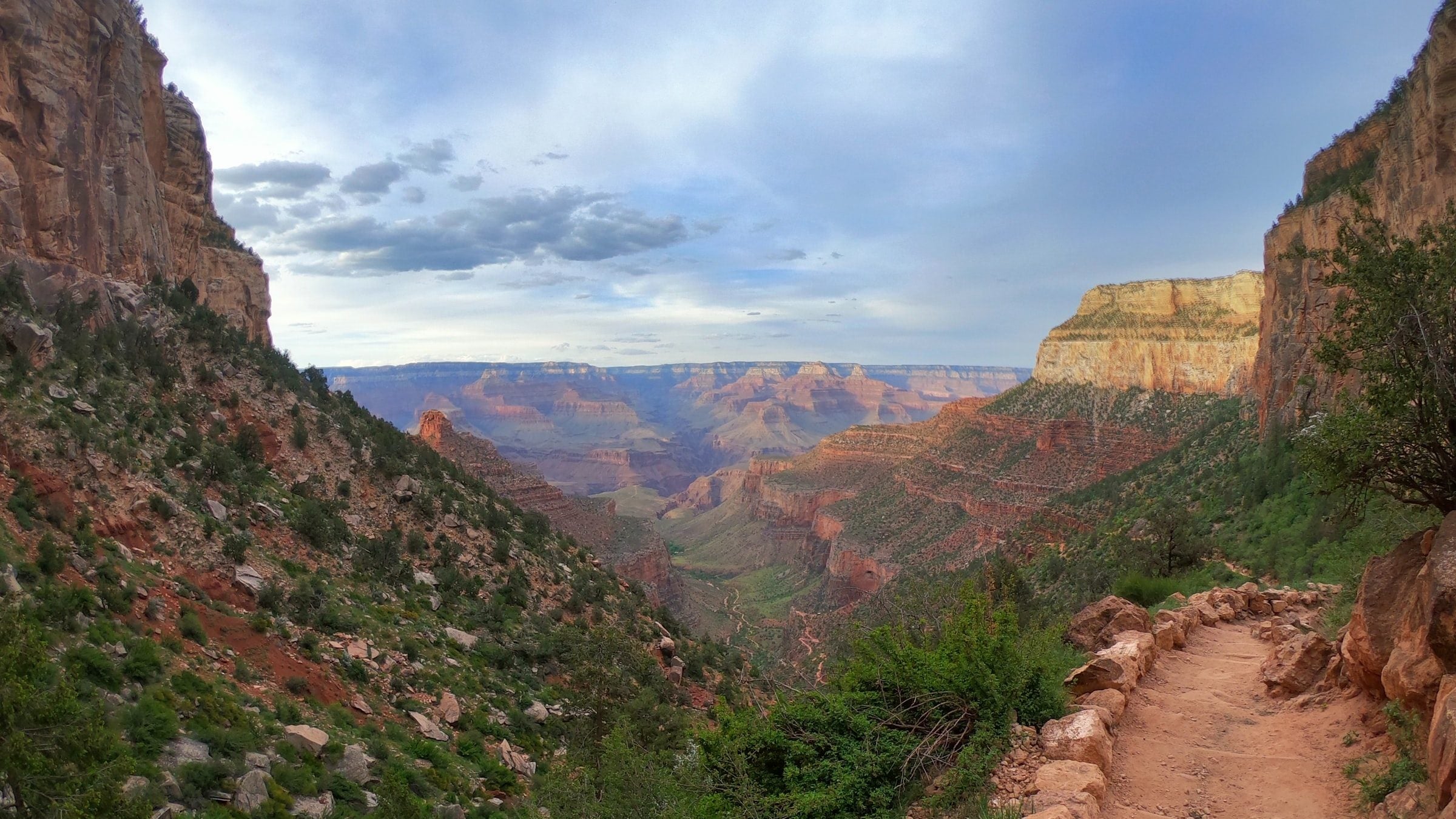
The iconic Bright Angel Trail is the best-known and most popular trail in Grand Canyon National Park. The trail follows the Bright Angel Fault 9.5 miles and 4,500 vertical feet down a break in the canyon wall to the Colorado River. Traversing billions of years of geologic history, the trail offers stunning views into the depths of the canyon. The stepped red and orange cliffs of The Battleship and Cheop’s Pyramid loom above, while the faint blue ribbon of the Colorado River glimmers far below. Whether you’re in for a quick jaunt or the long haul, the Bright Angel Trail won’t disappoint. From a day hike to a multi-day rim-to-rim, here are three of the best ways to experience the trail.
Best Day Hike on the Bright Angel Trail
Distance: 10.7 miles round trip
Total Elevation Gain/Loss: 3,060 feet
Difficulty: Strenuous
Dog-Friendly: No
Kid-Friendly: No
Start from the Bright Angel trailhead on the rim. If you only have a couple of hours, turn around at Mile and a Half Resthouse, 1.6 miles and a 1,000-vertical-foot drop from the trailhead. The switchbacks start fast and stay steep along this first section of trail, so be sure to wear boots that support your ankles. Tucked into the back of the fault, the trail frames its views with enormous sandstone cliffs, scattered with occasional shaded pockets of plant life.
ADVERTISEMENT
For a full day of hiking, head a bit farther down trail to Plateau Point. The 10.7-mile round-trip drops through most of the Bright Angel Trail’s elevation loss on the way to Havasupai Gardens, an oasis that supports orchids and redbud trees. Though the present plant communities are wild, Havasupai Gardens was once cultivated and cared for by the Havasupai and by the Puebloans and Cohoninas before them.
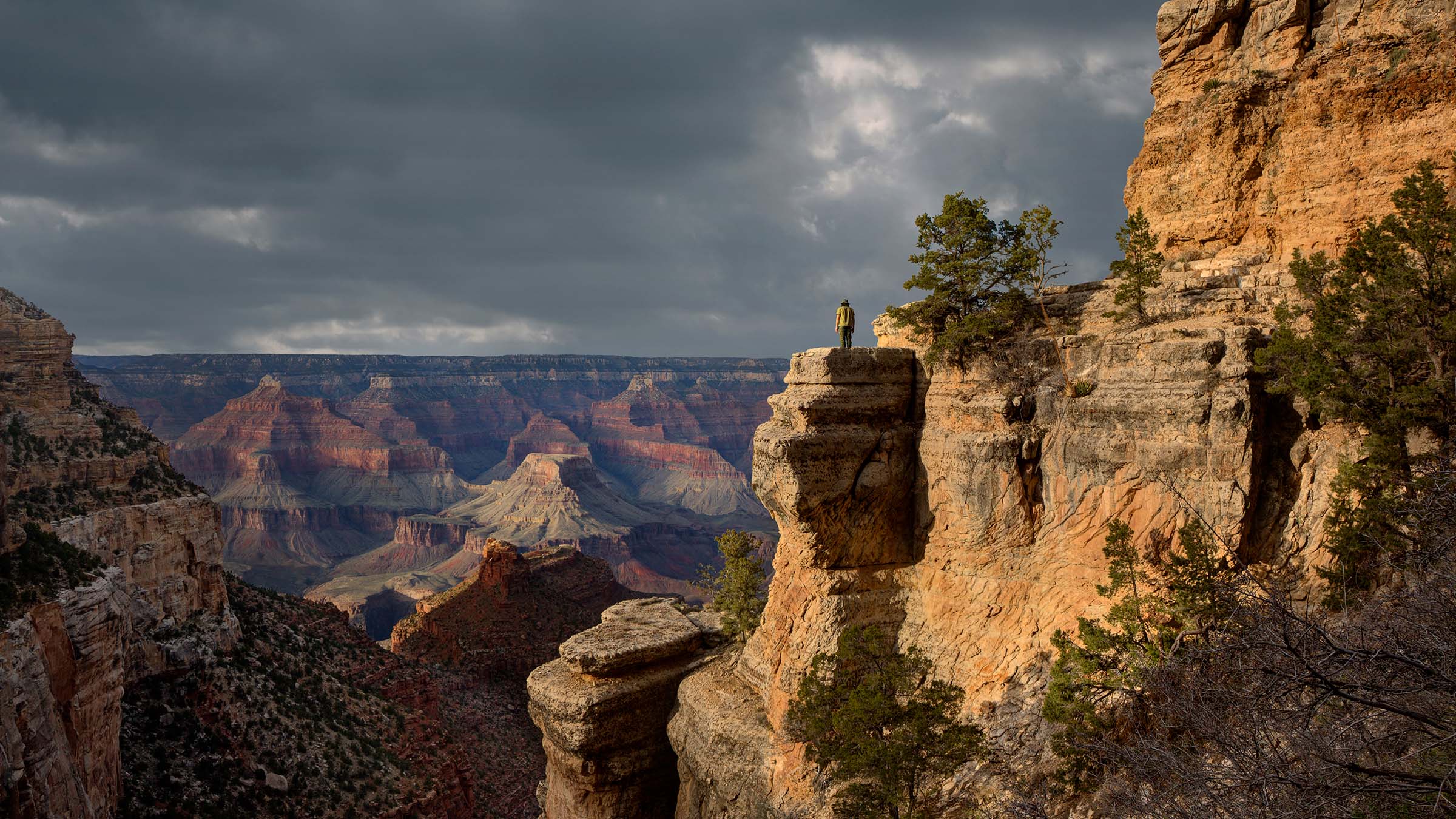
On the way down to the oasis, the trail passes several petroglyph panels left by the people who once used this path for garden access. Ten seasonal structures built for summer farming are still scattered across the oasis. After passing through the garden, veer left for Plateau Point. The finger of stone extends out into the greater canyon and offers all-encompassing views of the Colorado River and canyon walls.
Best Weekend Hike on the Bright Angel Trail
Distance: 19 miles round trip
Total Elevation Gain/Loss: 4,380 feet
Difficulty: Strenuous
Dog-Friendly: No
Kid-Friendly: No
For a comparatively leisurely overnight, pitch camp at the Havasupai Gardens campground and make the last 1.4 miles to Plateau Point a day trip from your base camp. The campground has a ranger station and potable water year-round, with 16 sites available for campers (backcountry permit required). A creek winds through stately cottonwoods beneath the canyon walls, cooling the campground and providing precious shade.
To spend a weekend hiking the whole length of the trail, head down over 100 switchbacks to the canyon floor, where the Bright Angel Campground spreads 32 sites along the north shore of the Colorado. The last set of really severe switchbacks comes just below Havasupai Gardens, on a section of trail called the Devils Corkscrew. Once you reach the shale-heavy geology of the Tonto Platform near mile 4 the trail mellows considerably and meets the river at mile 8.1. The River Resthouse at the meeting point does not have potable water, but there are toilets nearby. After reaching the river, the trail crosses a field of sand dunes (during summer months, this section is best attempted during the cooler morning and evening hours), then crosses Silver Bridge to Bright Angel Campground at mile 9.5.
ADVERTISEMENT
Ultimate Bright Angel Trail Link-Up: Rim to Rim
Distance: 23 miles point-to-point
Total Elevation Gain/Loss: 4,400 feet on the Bright Angel Trail and 4,781 feet on the North Kaibab Trail
Difficulty: Very Strenuous
Dog-Friendly: No
Kid-Friendly: No
Combine the Bright Angel Trail and North Kaibab Trail for a 2-to-3-day epic that crosses the entire canyon. This 23-mile, Rim-to-Rim hike is best done in spring or fall when the North Rim road is open but temperatures are still reasonable.
ADVERTISEMENT
Pick your starting point (Bright Angel or North Kaibab) and set up a shuttle to return you to your car when you’re done. Then head down into the canyon, switchbacking across the cliffs until you reach the Colorado River. From there, climb back up to views deep into the canyon and across to enormous formations of red and orange sandstone. Be sure to reserve your Rim-to-Rim permit early, as only a set number are available every year.
Tips for A Safe Hike
While it’s well-traveled, the Bright Angel Trail is still a serious hike. Here are some things to keep in mind:
- You’ll want a pack with good suspension as you’ll need to carry enough water to keep you and your companions safely hydrated.
- Footwear that breathes well is a must, as temps can climb to blistering heights during the day.
If you are hiking during the summer, don’t underestimate either the difficulty of this trail or the heat. Most of the park’s 200 yearly heat-related rescues are on the Bright Angel Trail.
- Temperatures soar above 100 degrees nearly every day, plan to hike in the early morning and in the evening whenever possible.
- Bring plenty of water with you (plan on 5-6 liters for a day of hiking) and know where the emergency phones are along the trail.
- On day hikes, remember that the way up is much harder than the way down. Go slow, take breaks, and remember that staying an extra night is better than serious heatstroke.
- Consider leaving the sleeping bag and tent at home and going with a light quilt. Temperatures don’t dip especially low even during the night and precip isn’t a common hazard. You’re better off saving the weight and sleeping under the stars instead.
- This is one place where you may want to consider breaking the “cotton kills” rule. A wet cotton t-shirt can help keep you cool on the hottest days when you soak it.