Updated July 7, 2025 09:58PM
The 4 Best Sunrise Hikes to Celebrate Daylight Savings Time
Yes, 'springing forward' means it's dark an hour later. But that just means you've got more time to catch the sunrise from one of these four perfect lookouts.
'Photo by Patitucci Photo'
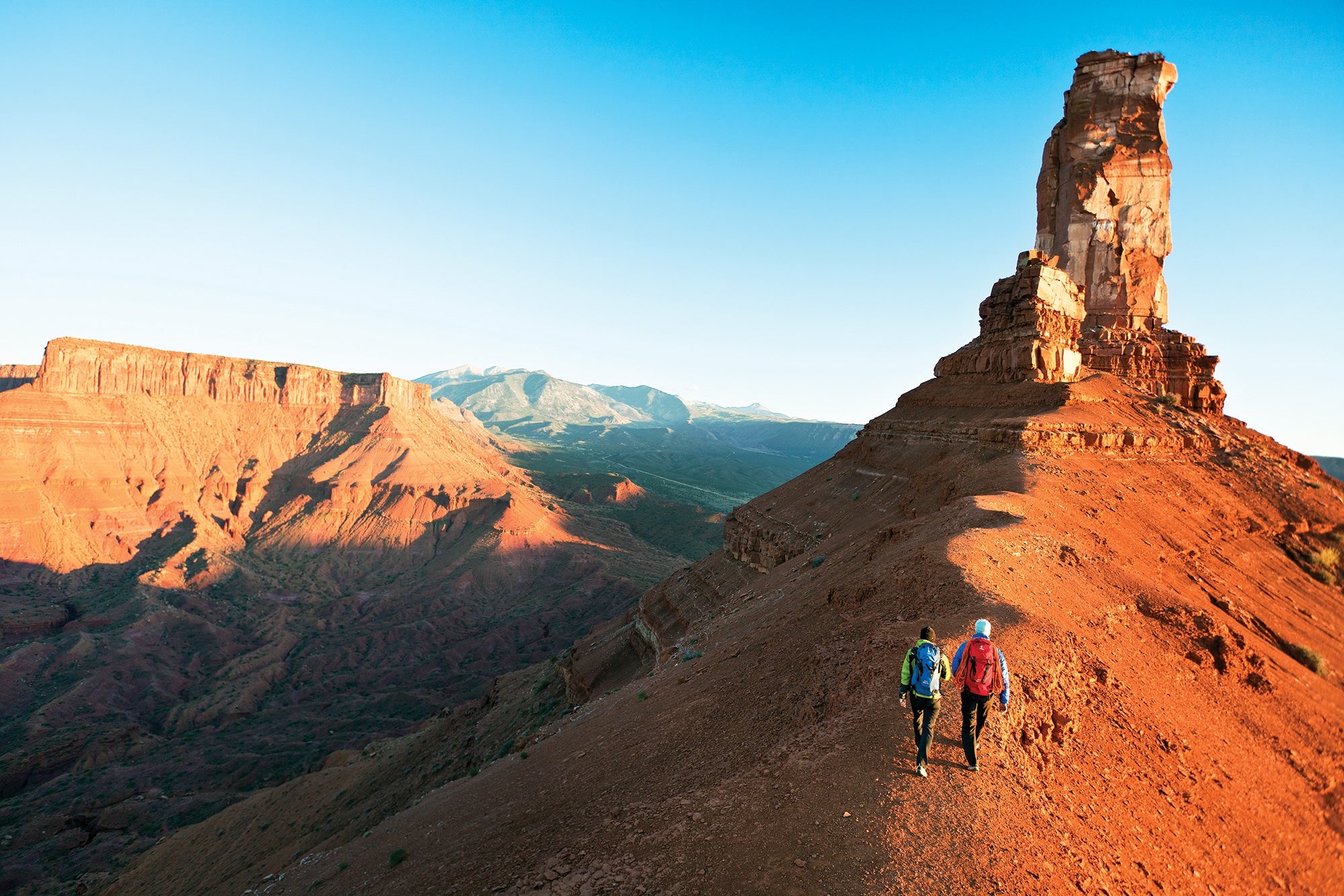
Climbers’ Trail, Castle Valley, UT
This steep climb is a serious wake-up call. But once you’re standing in the notch between desert towers, watching the low sun paint the sandstone red, the early-morning StairMaster workout will feel more than worth it. Set aside two hours for the nontechnical ascent, and head north on the obvious social trail from the climbers’ campground. January predawn temps will likely hang in the 20s, but you’ll warm up fast: The ascent gains more than 1,300 feet in 1.3 miles. High-step up the rocky wash before ascending exposed switchbacks to the col. From the narrow saddle between 400-foot-tall Castleton Tower and its neighbor, the Rectory, see the rising sun peek over the square-topped Fisher Mesa. Spin around to watch the light illuminate the barbs and angles of the Parriott Mesa to the west. Return the way you came, passing prickly pear cactuses you missed in the dark. Start Time 5:30 a.m. Expected sunrise* 7:39 a.m. Contact
Pine Mountain Trail, Mt. Rogers National Recreation Area, VA
This path’s hallmark outcropping rises above the rest of Grayson Highlands, offering a 360-degree view of stars dissolving into dawn among the endless ridges and rhododendron thickets. The best way to get there is on the front end of an 11.3-mile loop from Massie Gap that connects the Spur, Appalachian, and Pine Mountain Trails. Reach Rhododendron Gap near mile 3.3 at the junction of the AT and Pine Mountain Trails, and scan above the namesake bushes to spy your objective on the left: a 200-foot-tall sandstone outcropping. Scramble up the prow to watch the blue shadows lift off 5,728-foot Mt. Rogers to the west as the rising sun uncovers more ridges and hollows than can fit in a frame. Finish out the loop by continuing on the Pine Mountain Trail until it rejoins the AT, which twists south through pastures of wild ponies and across Wilburn Ridge back to Massie Gap. Start Time 5:30 a.m. Expected sunrise 7:46 a.m. Contact
Sunrise Birding Trail, Negwegon State Park, MI
Whoever named this trail was unimaginative but perfectly accurate: This trip promises a sunrise view across Lake Huron, which you’re sure to share with feathered company. Bundle up for midwinter temperatures in the teens and create a 7-mile circuit by linking the east halves of both the Algonquin and Chippewa Trails. At mile 2.2, reach the tip of South Point, a peninsula where you can see the pastel shades of morning’s arrival seep into Michigan from Canada’s half of Lake Huron, 50 miles away. In winter, bald eagles may be hunting near the water’s surface. On the return, take the inland (western) halves of both the Chippewa and Algonquin Trails, where white-breasted nuthatches, blue jays, and black-capped chickadees flit through the leafless trees. (Note: There’s a campsite on South Point, but it’s only open April to November.) Start Time 6:30 a.m. Expected sunrise 7:58 a.m. Contact
ADVERTISEMENT
Rim Trail, Crater Lake National Park, OR
If PCT thru-hikers schedule their hikes around the Crater Lake sunrise, you know it has to be good. Check it out on an 8-mile out-and-back on the Rim Trail from Rim Village. Snowshoe or ski the easy path through hemlock and white-bark pine to the top of 8,013-foot Watchman Peak. Stand on the deck of the old fire lookout (built in 1932) to catch the watercolors splashed over the glassy surface and the sun’s first rays on the slopes of Wizard Island, the forested cinder cone in the lake. Start Time 4:40 a.m. Expected sunrise 7:32 a.m. Contact