Updated July 8, 2025 02:12PM
Denver, CO: Golden Gate Panorama Point
Catch views of the Continental Divide (and mule deer, elk, and black bear) on this 12.3-mile loop in Golden Gate Canyon State Park.
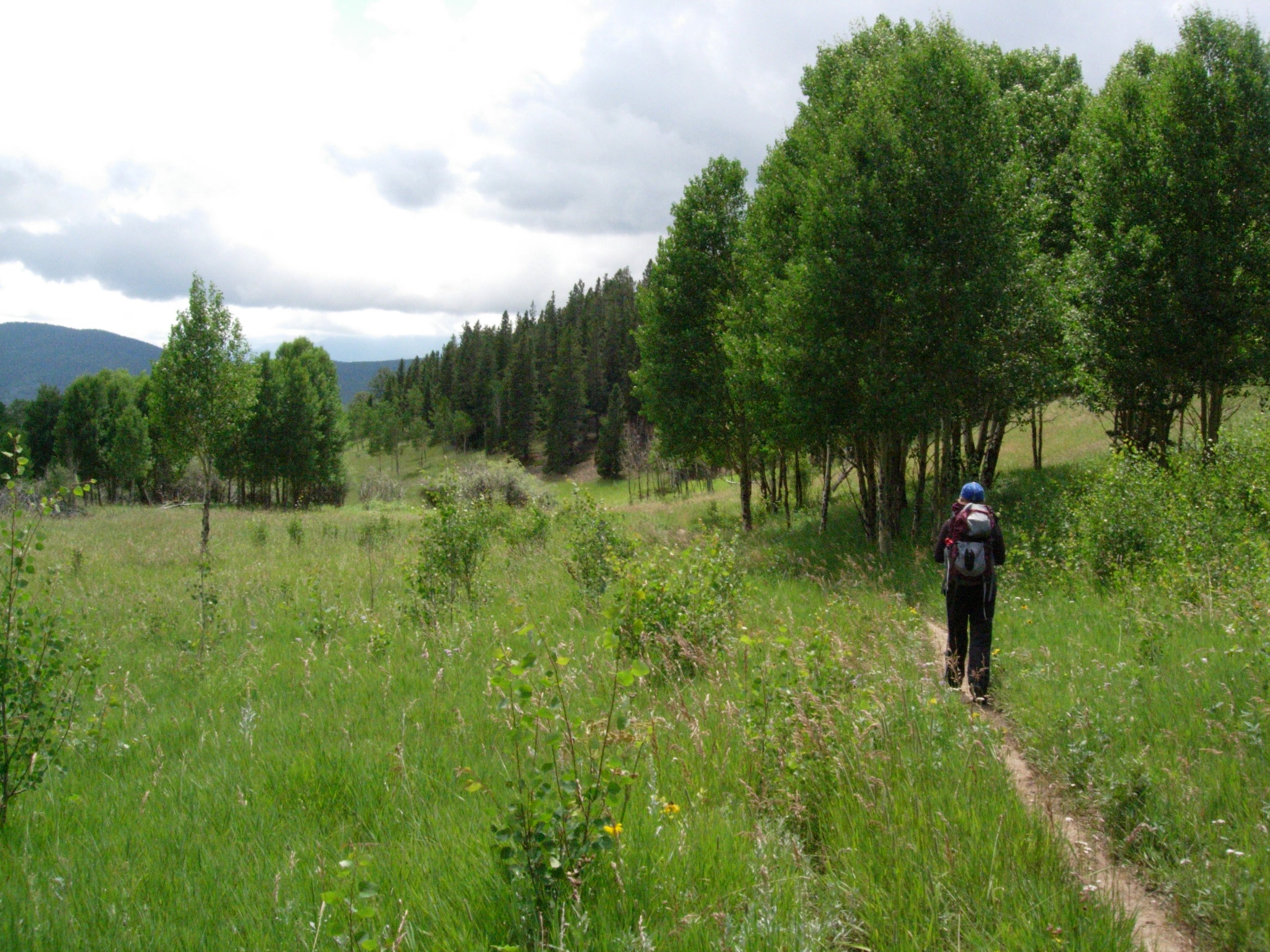
This moderate, 12.3-mile dayhike links five trails and showcases the often overlooked backcountry of Golden Gate Canyon State Park (less than an hour from Denver). This counterclockwise loop begins at the Ralston Roost trailhead and follows the Horseshoe Trail around rocky outcroppings as it climbs toward Greenfield and Frazer Meadows. You’ll pass several backcountry campsites just 1.5 miles from the trailhead.
Skirting the base of 10,388-foot Tremont Mountain, the Mule Deer Trail travels toward Gap Road, crossing it once before reaching Panorama Point where stationary binoculars and relief maps identify 47 distant features along 100 miles of the Continental Divide.
ADVERTISEMENT
Turning downhill, the route traverses grassy meadows and homestead ruins along the park’s western edge before it’s final challenge: a climb up Ralston Roost along the Black Bear Trail. Simple route-finding—look for hard-to-spot trail markers to stay on track—and some hand-over-foot scrambling add difficulty before a rugged downhill back to the trailhead.
-Mapped by Kristy Holland
Hike Golden Gate Panorama Point
MAP:
Download maps of the area at the Golden Gate Canyon State Park website.
Order a custom map of this route by selecting the “Print MyTopo” option in the left-hand menu bar.
Order the USGS topo quads listed above at store.usgs.gov.
PERMIT: Purchase a day-use pass in the Visitor’s Center. For more information, go to Golden Gate Canyon Fees.
CONDITIONS: Check weather at Golden, CO (80403) Weather
INFO: For more information, go to the Golden Gate Canyon State Park website.
CONTACT: 92 Crawford Gulch Road, Golden, CO 80403; (303) 582-3707
OTHER RESOURCES
GEAR
Bent Gate Mountaineering
1313 Washington Ave.
Golden, CO
(303) 271-9382
Vital Outdoors
1224 Washington Ave. #125
Golden, CO
(303) 215-1644
RESTAURANTS
Woody’s Woodfired Pizza
1305 Washington Ave.
Golden, CO
(303) 277-0443
Blue Canyon Bar & Grill
1224 Washington Ave.
Golden, CO
(303) 271-0730


ADVERTISEMENT
Trail Facts
- Distance: 19.6
Waypoints
GGC001
Location: 39.831514, -105.410079
ADVERTISEMENT
The trail begins from the north end of the visitor center parking lot. Optional: Drive a few hundred yards north to the Ralston Roost parking area.
GGC002
Location: 39.832993, -105.408368
From the Raslton Roost parking area (left side of the road), the trail climbs uphill.
GGC003
Location: 39.83379, -105.409041
After a quick uphill, turn right to begin the counterclockwise loop.
GGC004
Location: 39.836945, -105.407181
A tiny wooden bridge crosses a creek to a T-junction. Turn left to follow the Horseshoe Trail under a pine and aspen canopy.
GGC005
Location: 39.841153, -105.416801
Continue climbing as the trail veers right around a rocky knoll.
GGC006
Location: 39.843303, -105.419987
Turn right at the Y-junction toward Greenfield Meadow and campsite spur trails scattered over the next 0.6 miles.
GGC007
Location: 39.844502, -105.42003
Campsite 2 is a favorite: A rocky outcropping perched near the tent-pad provides easy southeastern valley views.
GGC008
Location: 39.845204, -105.419859
A 50-yard trail near campsite 3 leads to a free-flowing pipette of natural spring water.
GGC009
Location: 39.850072, -105.426634
ADVERTISEMENT
A meadow traverse passes campsites 4 and 5 and offers views of Tremont Mountain’s 10,368-foot peak before this T-junction. Turn right onto the Mule Deer Trail toward Aspen Meadow.
GGC010
Location: 39.862284, -105.419923
A couple of steep banked downhill corners on this multi-use trail are well-worn by mountain bike tires.
GGC011
Location: 39.864001, -105.419869
Continue straight at this 3-way junction, bypassing the Snowshoe Hare Trail.
GGC012
Location: 39.868283, -105.421007
You’ll see Gap Road below the trail as you continue through this 3-way junction. A sign indicates 0.8 miles remaining to Panorama Point.
GGC013
Location: 39.871037, -105.428612
Avoid walking on Gap Road by staying left and climbing slightly to parallel the road as it heads west.
GGC014
Location: 39.875416, -105.437309
Cross Gap Road’s gravel surface and turn left to join the Raccoon Trail to Panorama Point.
GGC015
Location: 39.875871, -105.440447
ADVERTISEMENT
A large wooden platform with interpretive information and high-powered binoculars offers sweeping 50-mile views of towns and peaks near the Continental Divide. Relief maps of the view point out: South Rosalie Peak, Loveland Pass, James Peak, Devil’s Thumb, Nederland, the Estes Cone, North Signal Mountain and 40 other landmarks.
GGC016
Location: 39.872199, -105.445747
Continue straight at this 3-way junction that marks the end of the Raccoon Trail and the beginning of an easy 2-mile stretch along the Elk Trail.
GGC017
Location: 39.871037, -105.446243
Continue straight across the Park Road on the Elk Trail.
GGC018
Location: 39.868568, -105.445679
Stick to the trail as it squeezes between Mountain Base Road and private property lines along the park’s Western boundary.
GGC019
Location: 39.866707, -105.445412
Follow the Elk Trail straight at this 3-way junction, bypassing the Coyote Trail.
GGC020
Location: 39.84885, -105.446297
After a small, bridged stream crossing, the trail overlooks the ruins of twin hay barns, remnants of a silver miner’s early 20th century homestead.
GGC021
Location: 39.849749, -105.445018
Turn right at the T-junction to follow the Mile Deer Trail toward Frazer Meadow. A short lefthand spur trail leads to the Ole’ Barn Knoll parking area and restrooms.
GGC022
ADVERTISEMENT
Location: 39.846661, -105.442383
Continue straight across the park road. The trail turns uphill from here and offers views of Ralston Creek and valley farmland.
GGC023
Location: 39.841217, -105.435059
Continue on the Mule Deer Trail at this 3-way junction, bypassing the Blue Grouse Trail.
GGC024
Location: 39.842606, -105.426666
Turn right at the Y-junction to complete this loop route on the Black Bear Trail. Look for trail markers as you climb, the rugged path is hard to follow over outcroppings and around boulders.
GGC025
Location: 39.832768, -105.413902
A sign near its eastern end warns hikers of the Black Bear Trail’s rugged path.
Grassy Meadows
Location: 39.860736, -105.449331
© Kristy Holland
Trout Pond
Location: 39.830818, -105.40987
A wheelchair-accessible loop at the visitor’s center circles a trout pond. With some loose change, you can buy pellets to feed the hungry fish. © Kristy Holland
Well-signed
Location: 39.843769, -105.419934
ADVERTISEMENT
The trail is signed and easy to follow through Greenfield Meadow, even though several trails converge. © Kristy Holland
Old Road
Location: 39.855762, -105.421972
The trail is flat an even along this stretch where it heads north along doubletrack. © Kristy Holland
Big Rocks
Location: 39.868691, -105.42128
Large rocks line the trail in several sections, including the upper reaches of the Mule Deer Trail. © MacKenzie Ryan
Binoculars
Location: 39.875822, -105.440125
© MacKenzie Ryan
Panorama Point
Location: 39.875937, -105.440168
The 100-mile Continental Divide view from Panorama Point. © Christopher Alan Barker
Mount Thorodin
Location: 39.875954, -105.441155
Looking north from the Raccoon Trail you’ll see Mount Thorodin’s 10,540-foot peak. A closer and still stunning addition to the view. © Christopher Alan Barker
Trail Markers
Location: 39.839815, -105.424354
Following the Black Bear Trail over rocks can be difficult. Keep an eye out for strategically-placed trail markers guiding the way. © Kristy Holland
Rugged Trail
Location: 39.832804, -105.413754
ADVERTISEMENT
The Black Bear Trail crosses rugged terrain and warns hikers with this sign near its eastern end. © Kristy Holland