Updated December 3, 2024 10:25PM
Churchill River Canoe Route
Escape time as you glide through an endless chain of connected lakes.
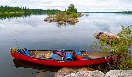
'Nipew Lake, Churchill River, Saskatchewan (Steve Howe)'
This Texas-size province north of Montana and North Dakota is known for its prairies, but more than half of it is actually a forested canoe kingdom (think Boundary Waters on steroids). Canoes are to Canada as covered wagons were to America, and they remain one of the best ways to experience Saskatchewan’s wild country.
For the area’s best soltitude, rapids, and 300-year-old voyageur campsites, splurge for a one-hour float plane ride from Missinipe to sprawling Black Bear Island Lake. Then take four days to boat your way 56 miles back to town. In between long lake crossings, you’ll hit 20 class II-IV rapids. Portage any you choose, and scout everything. (Cheaper: Add at least three days and begin from one of the mostly unmapped car-accessible put-ins on SK-102 north of Missinipe.) Visiting is easy: No reservations or permits needed.
After getting dropped near High Rock Narrows, investigate ochre-colored Ojibway pictographs on a south-facing cliff in the narrows. Then canoe east across Black Bear Island Lake, past Pine Island, to map-marked campsites just beyond your first whitewater at Birch Rapids (class II, mile 14.2).
ADVERTISEMENT
Day two, paddle northeast across Trout Lake, through four rapids near Stack Lake, to tree-shaded rock slab campsites just beneath Rock Trout Rapids (mile 29). Next morning, cross Mountney Lake, then whoop it up on two miles of class III rapids (most have easier sneak routes) to a 5.5-mile crossing of Nipew Lake to campsites near Selby Peninsula (mile 43).
On day four, complete your journey by crossing Hayman Lake, then turning south at the entrance of Burgess Bay down the continual, easy rapids of Donaldson Channel, through Barker and Devil Lakes, to finish in the powerful waves of Otter Rapids (class III), four miles north of Missinipe.
Maps GoTrekkers Churchill River, Sandfly to Trout Lake and Trout to Otter Lakes ($20CAD each; gotrekkers.com)
Guide Churchill River Canoe Outfitters; (877) 511-2726;churchillrivercanoe.com
Plane Osprey Wings Aviation; (306) 635-2112; osprey-wings-air.com
Map & GPS databackpacker.com/hikes/1395711
>> Online Trip Planning Extras
Get There From the airport at Saskatoon, drive north on SK-11N, SK-2N, and SK-102N for 283 miles, to the small town of LaRonge, where it becomes gravel and continues 48 miles to Missinipe.
Travel Contacts
Saskatchewan General tourism info: (877) 237-2273; sasktourism.com
Saskatoon (major airport city)
An amazingly vibrant city, although you might not realize it when traveling right around the airport/Circle Drive/Trans-Canada Highway intersection. Check out the Riverside Park, a lovely pedestrian promenade, walkway and jogging trail along both banks of the East Saskatchewan River near 25th St. E. (Go east on Circle Drive, then south on Warman Road). The Farmer’s Market is nearby, for fresh produce and bistro eats. There are also museums, art galleries, and patio restaurants in the area.
>> Supplies: Wal-Mart Supercentre; 225 Betts Ave.; (306) 382-5454
ADVERTISEMENT
>> Restaurant: Amigos (Mexican food, beer, outdoor deck) 632 10 St. E; (306) 652-4912
>> Restaurant: Saint Tropez Bistro (hi-end gourmet); 238 2nd Ave. S; (306) 652-1250
>> Restaurant: Winston’s English Pub & Grill (pub food, beers and bar in a cozy atmosphere); 243 21 St. E, Saskatoon; (306) 374-7468.
La Ronge
The last significant town enroute to Missinipe, just before the highway turns to gravel.
>> Groceries: North Mart, 612 La Ronge Ave., on the main, lakeshore, street thru town; (306) 425-2173
Missinipe (Churchill River gateway)
This small, primarily summer, hamlet on Otter Lake, on the northwestern corner of Lac La Ronge Provincial Park, is the logistical center for most north Saskatchewan and Churchill River canoeing.
>> Trailhead Camping: There is a quiet public campground at Churchill River Bridge, four gravel miles north of Missinipe, on the only road out of town.
ADVERTISEMENT
>> Pine Island Resort, (Nice cabins, pleasant staff, superb food, on Black Bear Island Lake, one day’s paddle east from High Rock Narrows); (306) 635-2422; saskatchewan-fly-in-fishing.net; winter contact (306)-272-4260
>> Restaurant: Thompson’s Camps Otter Lake Resort (hearty); (306) 635-2144; rstriker@adventuredestinations.ca.
>> Backcountry lodge: Forest House. This remote wilderness pocket mansion sports room for a dozen, a spectacular porch, lakeside sauna house, and a four km trail system. It requires about 4 hours of paddling, and four short portages, to reach. Fly-ins are also available. (877) 511-2726; foresthouse.ca