Chicago, IL: Starved Rock - East Side

Lauded as one of the most beautiful spots in the state, Starved Rock State Park is packed with winding canyons carved deep into rocky bluffs–and it’s all alongside the mighty Illinois River. This 7.3-mile trek starts at the park’s east side and dips into seven canyons that branching from the main trail. Within the first 2.3 miles you’ll explore Illinois Canyon (the park’s longest), Kaskaskia, and Ottawa canyons. After lingering in the shadows, there’s a rugged climb toward the park road that continues up a series of stairs to the bluff top. Be sure to turn right at mile 2.8 for the 3-minute detour to the Hennepin Canyon Overlook and 2-mile views across the river toward the Starved Rock locks and dam.
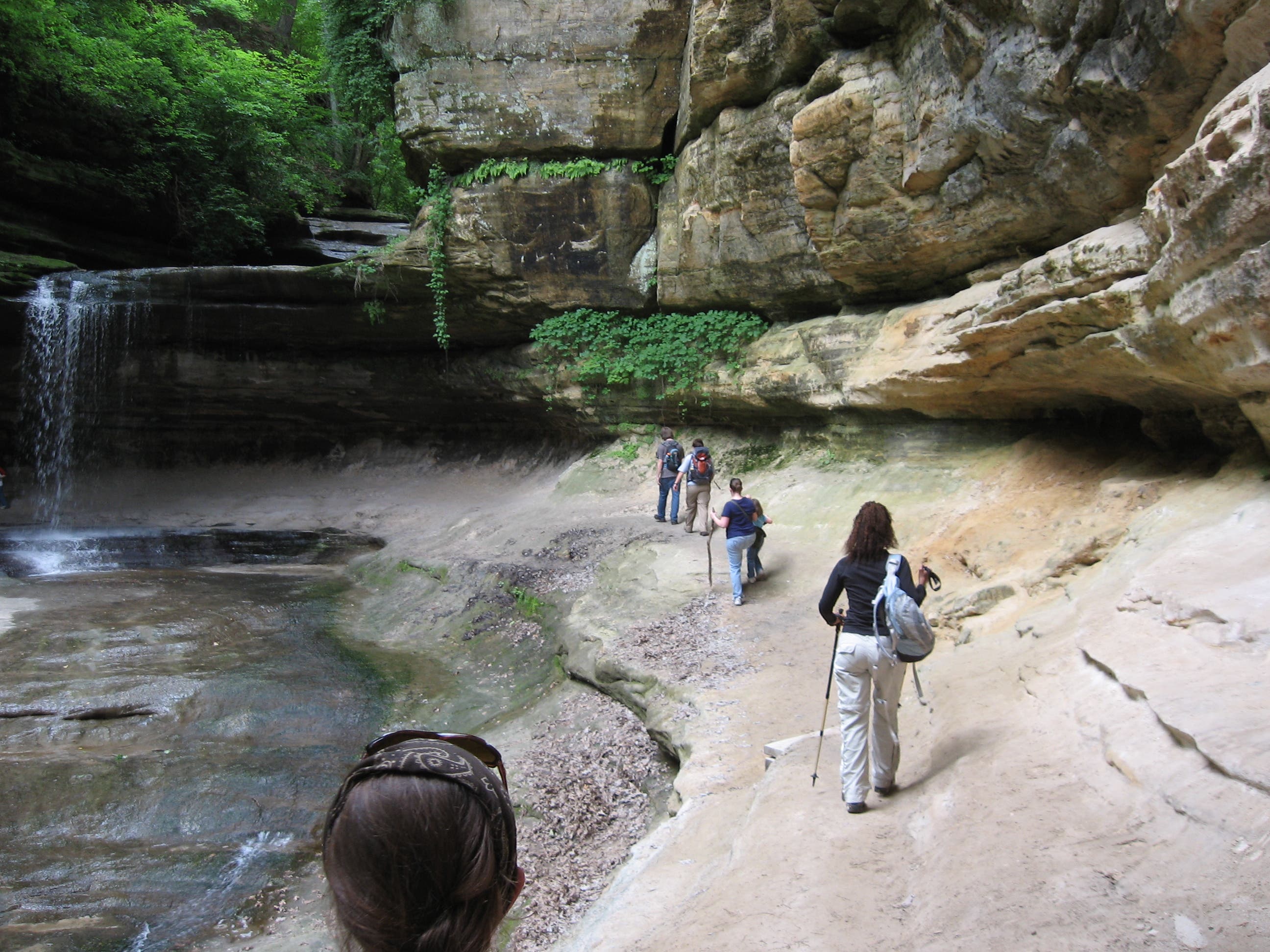
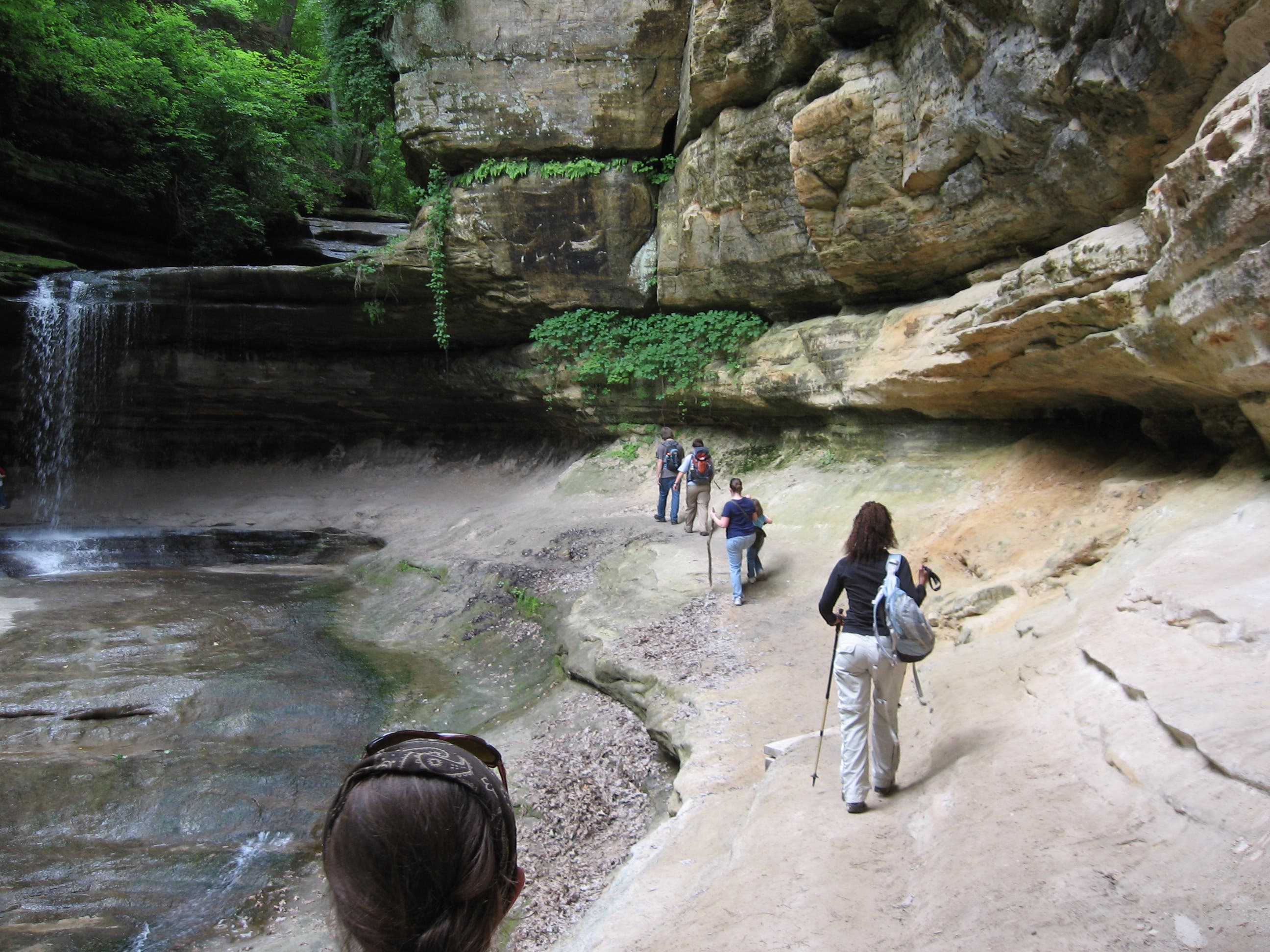
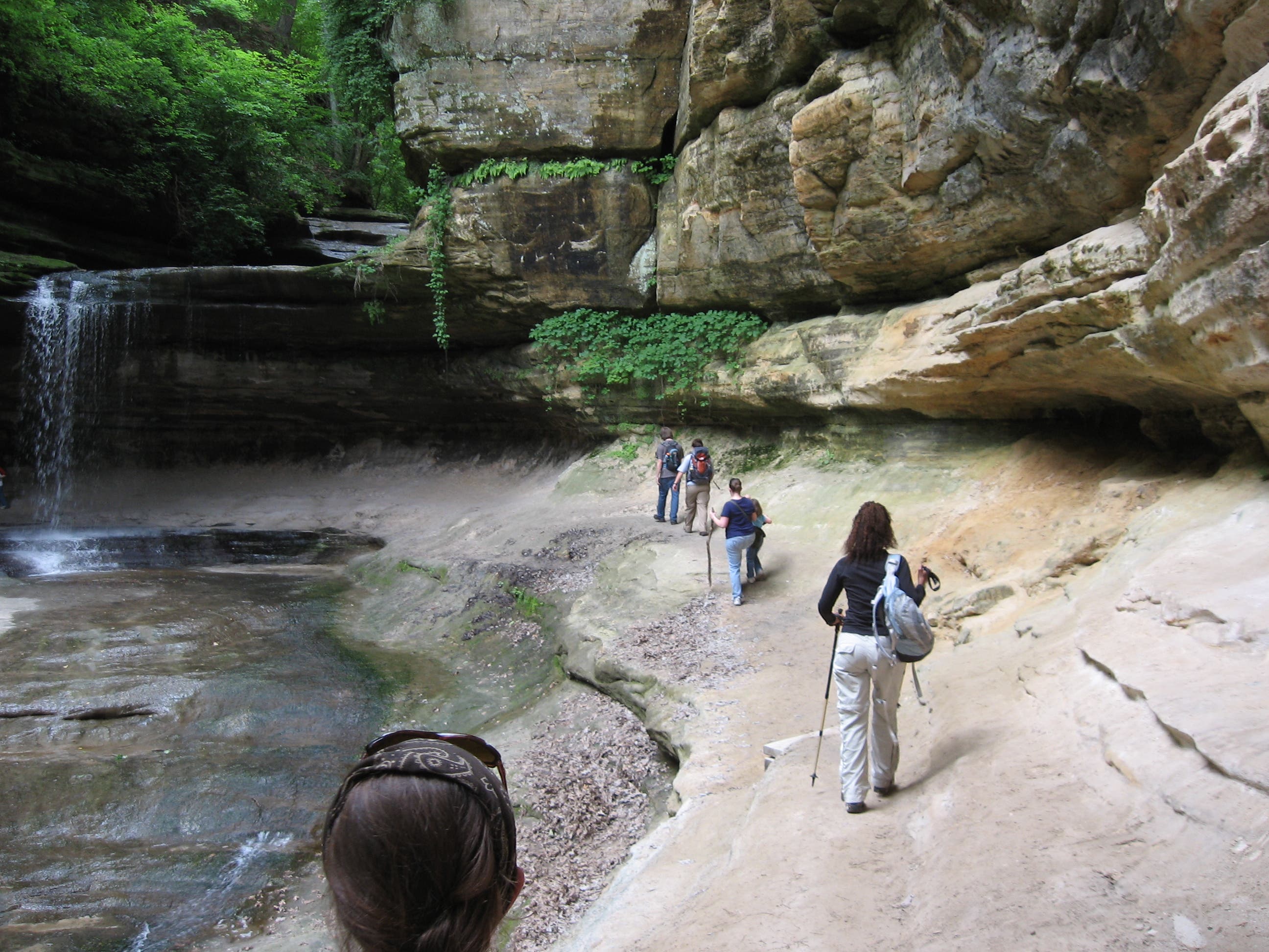
The wooded trail rounds the bluff-top behind Hennepin, Hidden, and Owl canyons before dropping a long staircase to the riverbank. This route ends with a 0.8-mile loop into the depths of LaSalle and Tonti canyons before backtracking toward the trailhead. LaSalle’s two-tiered waterfall is a highlight, so don’t skip it.
The park’s eastern half has more canyons than its western half and its possible to explore their cool, shady depths–getting up-close to waterfalls, and the colorful sandstone walls. There are no services trailside, so be sure to take advantage of facilites at the trailhead and pack plenty of drinking water on warm days. Also, check with the Department of Natural Resources for trail conditions and hunting-season closures.
-Mapped by Ted Villaire
Trail Facts
- Distance: 11.8
Waypoints
SRE001
Location: 41.30926, -88.937371
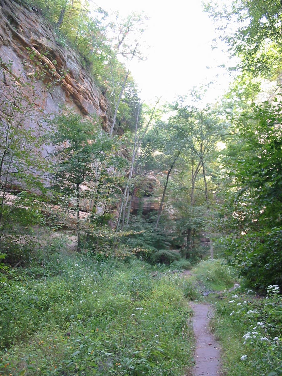
At the east end of the parking lot, the wide dirt trail leads south through a grove of cottonwoods, sugar maples, and basswood. Cross the creek on a jumble of logs, rocks, and concrete blocks. The out-and-back trip into Illinois Canyon is just over 1 mile long.
SRE002
Location: 41.302064, -88.938509
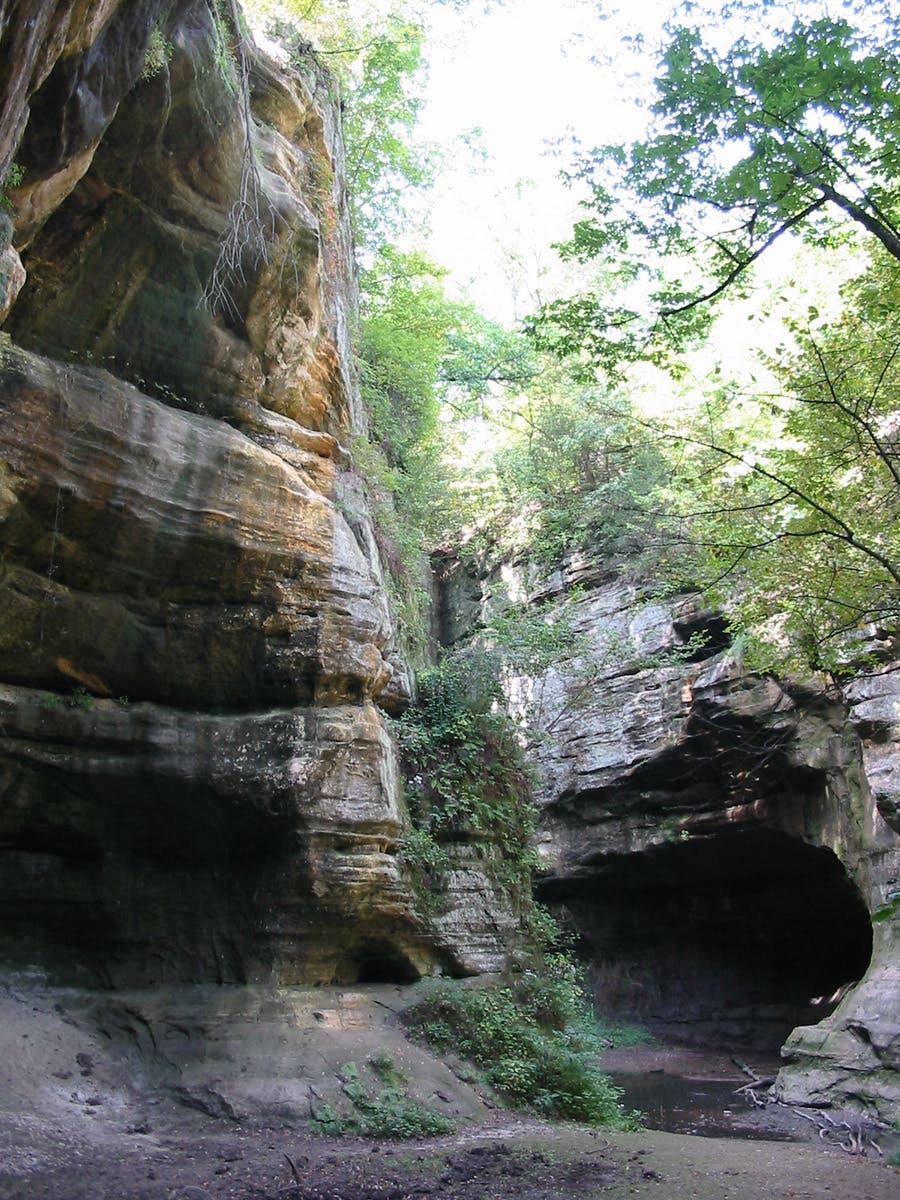
At the end of the canyon, a small waterfall empties into a quiet pool and the cliff walls are bleached white and streaked with yellow. On the return trip, look for the small cave-like openings at the base of the sandstone walls.
SRE003
Location: 41.309237, -88.937522
Back at the parking area, head west. The trail skirts another lot and then crosses a bridge before turning south again.
SRE004
Location: 41.308051, -88.945203
Less than half a mile from the trailhead is another canyon entrance. Bear left here, following signs for an impressive 40-foot sandstone cavern, the Council Overhang. This route also proceeds to the ends of both Kaskaskia and Ottawa canyons for a 0.75-mile out-and-back detour off the main trail.
SRE005
Location: 41.306681, -88.945484
Look for blueish-green lichen on the craggy walls leading to the pool at the end of Kaskaskia Canyon, the left-leading trail.
SRE006
Location: 41.307132, -88.945547
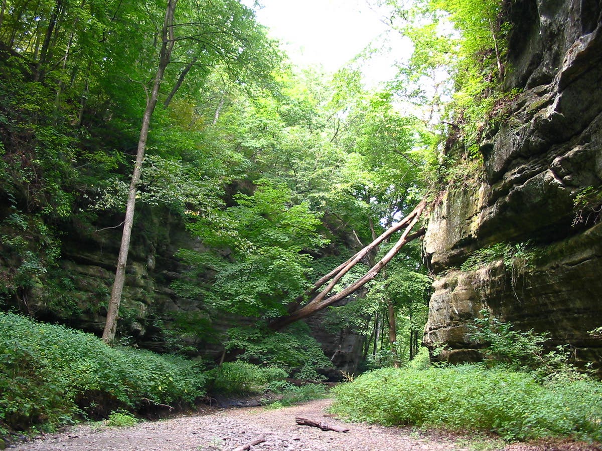
Ottawa Canyon’s tall, straight walls provide shade and the canyon will be noticeably cooler than the surrounding landscape.
SRE007
Location: 41.308551, -88.946536
There is a steep, rough section of trail and a staircase leading to the park road. Watch for traffic as you cross, and climb another flight of stairs toward the top of the bluff.
SRE008
Location: 41.309277, -88.951149
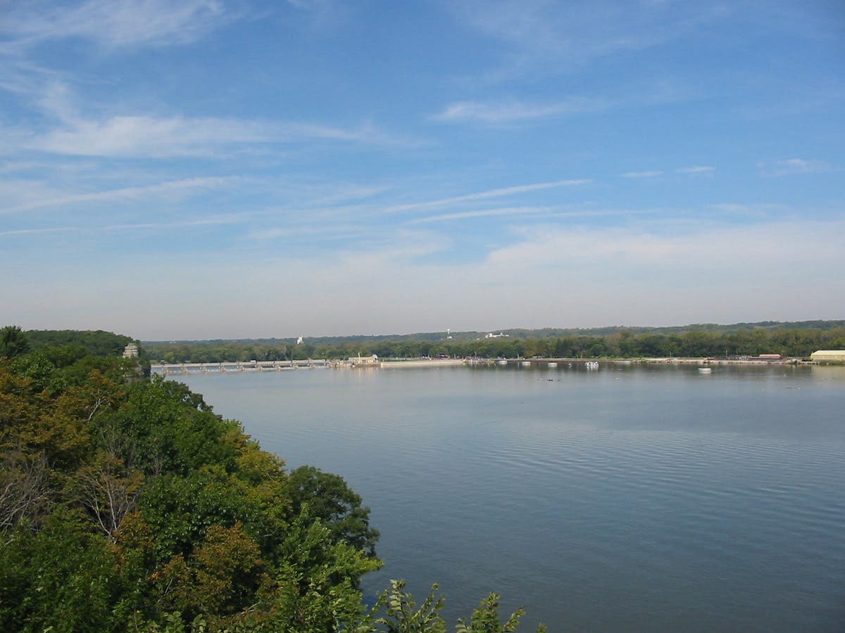
Stay right on the main trail, bypassing a parking-lot-bound spur to the left. In another quarter mile, take the right-hand spur for a short detour to the Hennepin Canyon Overlook for a view of the Illinois River. The main trail winds above the canyon’s south end.
SRE009
Location: 41.311452, -88.959494
Just after passing the steep cliffsides of Hidden Canyon, the river comes into view again at the Owl Canyon Overlook. The contrast between the river and the canyons carved by glacial meltwater is dramatic.
SRE010
Location: 41.311468, -88.96561
The main trail loops to the right and descends about 140 feet over the next quarter mile. A long set of stairs leads from the top of the bluff to the river’s edge.
SRE011
Location: 41.314144, -88.970888
Just before the arched footbridge, turn left into LaSalle Canyon. This route makes a 0.8-mile loop from this point. Stay left to dip into LaSalle and Tonti canyons before backtracing 2.2 miles to the trailhead.
SRE012
Location: 41.310759, -88.971512
LaSalle Canyon narrows quickly and its beige sandstone walls deepen in color and get more rugged as you proceed. Admire the seasonal waterfall at the end of the canyon and follow the terraced trail on its west wall toward Tonti.
SRE013
Location: 41.312193, -88.972626
Ferns and vines drape the walls of Tonti Canyon and lend it a jungle-y feel. Explore the banked sandstone walls, but be careful not to mar their delicate sandy surfaces. Follow the trail to the left and cross several footbridges leading back toward the main trail.
SRE014
Location: 41.314289, -88.971317
Turn right onto the arched bridge above the creek and rejoin the riverside trail to backtrack toward the trailhead parking lot.
Illinois Canyon
Location: 41.306063, -88.938611
One of the park’s longest and widest canyons.
Kaskaskia Canyon
Location: 41.305805, -88.945305
Ottawa Canyon
Location: 41.306723, -88.946038
Illinois River
Location: 41.311469, -88.959475
From the Owl Canyon Overlook, the Illinois River is a mighty, flowing giant.
LaSalle Canyon
Location: 41.310824, -88.971534
It’s possible to walk under the double falls in the back of LaSalle Canyon.
LaSalle Canyon
Location: 41.310704, -88.971484
LaSalle Canyon
Location: 41.311567, -88.970695