Heading out the door? Read this article on the new Outside+ app available now on iOS devices for members! Download the app.
Goose Lake Prairie State Natural Area bears a close resemblance to Illinois’s landscape 150 years ago, when a sea of prairie grass covered the Prairie State. While exploring the state’s largest stand of tallgrass prairie, you’ll find cattail marshes, small ponds visited by waterbirds, and dozens of species of flowers and prairie plants. In July, the prairie explodes with wildflowers of all shades; in September, goldenrod and compass plants form a yellow carpet over the landscape. Near the park’s ponds, watch for great blue herons, kingfishers, and snapping turtles.Mapped by Ted Villaire
Trail Facts
- Distance: 8.4
Waypoints
GLP001
Location: 41.3604698, -88.3176498
Head south from the visitor center parking lot. On this stretch of trail, you’ll likely see red-winged blackbirds perched on the tallgrasses and swallows swooping overhead.
GLP002
Location: 41.3583908, -88.3177567
Continue straight @ T-junction with trail that branches to picnic area.
GLP003
Location: 41.3493538, -88.3157425
Prairie View Trail loops start here. Continue straight @ T-junction.
GLP004
Location: 41.3474655, -88.3089905
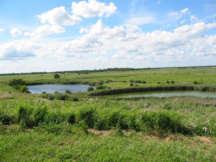
Take the spur trail right up the small hill, a remnant of a former coal strip mine. From the top, you’ll see sparkling ponds and reedy marshes scattered among the huge expanse of grassland. Retrace your steps back to the visitor center.
GLP005
Location: 41.3606339, -88.316864
Start the second part of the hike–the Tall Grass Nature Trail, Marsh Loop, and photo-blind trail–behind the visitor center. From the mapboard, follow the mowed trail right.
GLP006
Location: 41.3581238, -88.3147583
Big bluestem grass, one of the most common of tallgrass prairie plants, lines the trail. This type of grass reaches 10 feet in height late in the summer and takes on hues of steely gray, wine red, and muted lavender. Indian grass, prairie cordgrass, and sedge grasses grow in the wet spots.
GLP007
Location: 41.3587074, -88.3112106
Continue straight @ T-junction.
GLP008
Location: 41.3594513, -88.3108902
Turn right @ T-junction onto Marsh Loop.
GLP009
Location: 41.359417, -88.3073959
Continue straight ahead @ T-junction near the pond.
GLP010
Location: 41.361042, -88.3062363
Continue straight @ T-junction.
GLP011
Location: 41.3670273, -88.3094482
A photo blind on the northern end of the route allows you to discreetly observe the waterbirds in one of the many marshes in the park.
GLP012
Location: 41.3625793, -88.3108368
Turn right @ T-junction.
GLP013
Location: 41.3627625, -88.3163757
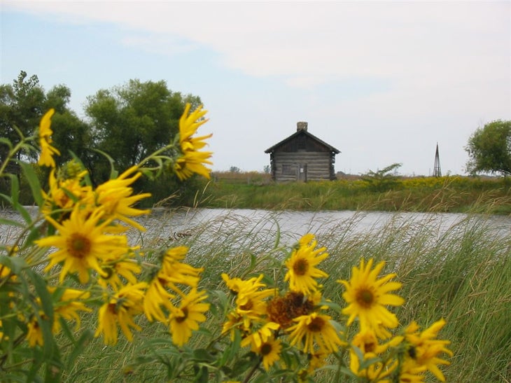
Turn left @ T-junction and check out the Cragg Cabin, a replica of one of the first homes in the area. Originally built in 1830 south of the park, the cabin was a stopover for travelers and for cowboys as they herded cattle through the prairie from St. Louis to the stockyards of Chicago.
GLP014
Location: 41.3609352, -88.3141937
From the cabin, follow the trail right to return to the visitor center.
Prairie View Trail
Location: 41.3476982, -88.3089371
After taking the spur trail up a small hill–a remnant of a former coal strip mine–on the Prairie View Trail, you’ll see sparkling ponds and reedy marshes scattered among the huge expanse of grassland. © Ted Villaire
Observation Platform
Location: 41.3606987, -88.3165207
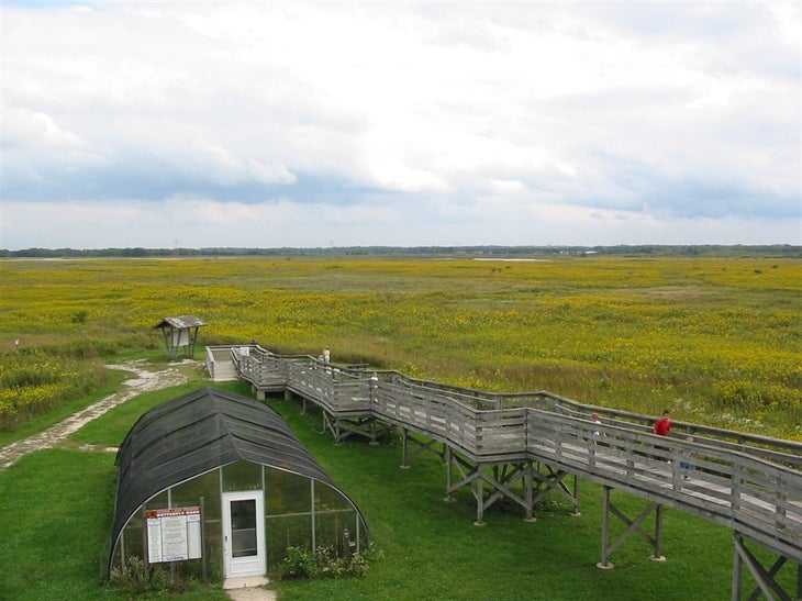
The observation platform attached to the back of the visitor center building: In July, the prairie explodes with wildflowers of all shades; in September, goldenrod and compass plants form a yellow carpet over the landscape. © Ted Villaire
Cragg Cabin
Location: 41.3610382, -88.3140106
Cragg Cabin is a replica of one of the first homes in the area. Originally built in 1830 south of the park, the cabin was a stopover for travelers and for cowboys as they herded cattle through the prairie from St. Louis to the stockyards of Chicago. © Ted Villaire
Prairie Views
Location: 41.3610954, -88.3062973
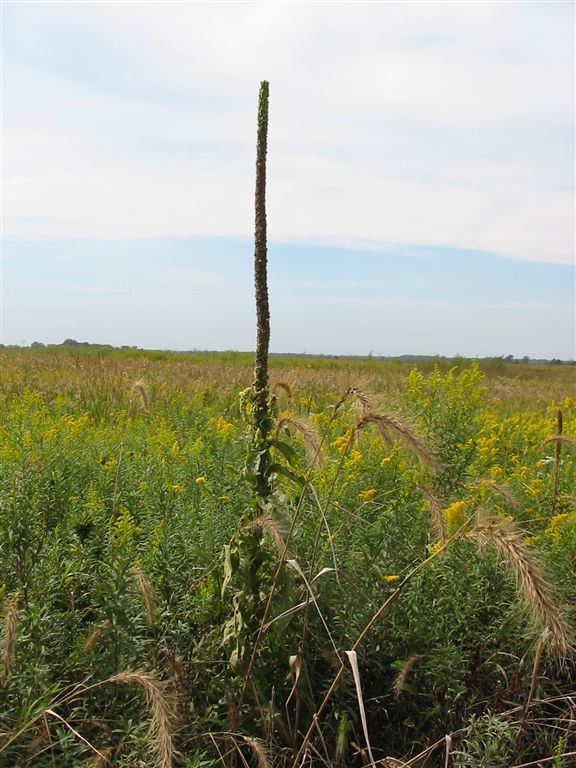
Along the Marsh Loop and heading toward the photo blind, look for tall yellow-flowered compass plants, small crab apple trees, and an attractive prairie grass called Canada wild rye, which has a large, bushy, nodding seed head. © Ted Villaire
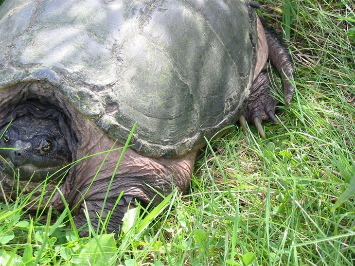
Snapping Turtle
Location: 41.3594246, -88.3073349
The Marsh Loop area is a good place to watch for great blue herons, kingfishers, and ornery snapping turtles. © Ted Villaire