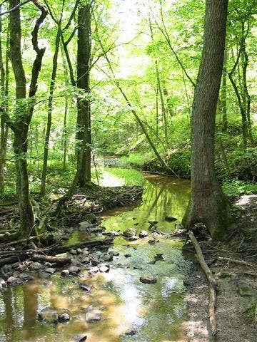
Chicago, IL: Deer Grove Forest Preserve

The Deer Grove Forest Preserve—an 1,800-acre reserve in Cook County just outside Chicago—is home to an extensive hardwood forest sprinkled with wetlands, ravines, the occasional stream, and over 13 miles of trail. This 9.3-mile route links hiking trails on the preserve’s wooded west side with the paved bicycle path on the park’s more open and grassy east side.
From the preserve’s main parking area, follow the Orange Trail to the Yellow Trail and hike through lush, rolling woods and over several limestone bridges as it loops south. In early spring, expect to encounter a few muddy sections as you cut back through the center of the park on the Orange Trail before joining the paved path at mile 4.2. Next, follow the paved Black and Red paths on a 3.6-mile lollipop loop through more gently rolling grassland, wetlands, and picnicking sites on the park’s east side before connecting back to the Yellow Trail and dipping into a couple of ravines en route to the trailhead.
Note: Though some user trails remain, off-trail use has severely damaged natural plant and animal communities in the ravine area of Deer Grove. Please remain on main, marked trails to avoid further damage to ground cover plants and soil erosion.
-Mapped by Ted Villaire

Trail Facts
- Distance: 15.0
Waypoints
DRG001
Location: 42.1475838, -88.0740881
From the trailhead kiosk, follow the multi-use Orange Trail west as it traces the route of an old crumbling road. Plant and animal communities in Deer Grove have been heavily impacted by off-trail traffic and erosion, so stay on the trails to help prevent further damage.
DRG002
Location: 42.1464065, -88.0773067
Turn right onto the Purple Trail at this 3-way junction, then hang a quick left almost immediately onto the Yellow Trail. Bypass the Green Trail up ahead and continue counterclockwise around the preserve’s west side on the Yellow Trail. You’ll cross several old, stone bridges.
DRG003
Location: 42.1346404, -88.0937648
At the large marshy pond on the trail’s right side, look for great blue herons and red-winged blackbirds. Just after the marsh, turn left at the 3-way junction onto the Orange Trail (another stretch of old paved road). There are restrooms and water at the West Deer Grove Trailhead just north of the junction.
DRG004
Location: 42.1409414, -88.0833578
Turn right at the 3-way with the Black Trail. Cruise the gently rolling terrain sprinkled with large oaks.
DRG005
Location: 42.140464, -88.074646
Turn left to rejoin the Yellow Trail at mile 3.4. You’ll cross a park road up ahead and skirt a parking area on your left.
DRG006
Location: 42.1431669, -88.0632305
Cross a stream and turn right at the 4-way junction for a 3.6-mile lollipop loop on the preserve’s east side. Watch for traffic as you cross Quentin Road and follow the Black Trail due east.
DRG007
Location: 42.1439286, -88.0584723
Bypass the Brown Trail and continue straight on the paved bike path at this 4-way junction.
DRG008
Location: 42.144028, -88.0547386
Turn right at the beginning of the paved bicycle path’s 2.7-mile loop. Expect the company of in-line skaters, runners, and cyclists on this popular, smooth trail.
DRG009
Location: 42.1412914, -88.042438
Continue looping through the preserve’s southeast corner on the Red Trail. Ahead, cross the park road, a series of picnicking spots, parking lots, and another 4-way junction with the Brown Trail. You’ll pass a model airplane field as the trail loops north and west.
DRG010
Location: 42.1431907, -88.0632252
As you cross back over Quentin Road, turn right onto the Yellow Trail. You’ll arc northward through dense bottomland woods; if rain has fallen recently, get ready for mud.
DRG011
Location: 42.1464383, -88.0773121
At the end of the loop, bear left onto the Purple Trail and backtrack on the Orange Trail to return to the trailhead.
Rocky Stream
Location: 42.1463787, -88.0778861