Published September 20, 2013 03:31PM
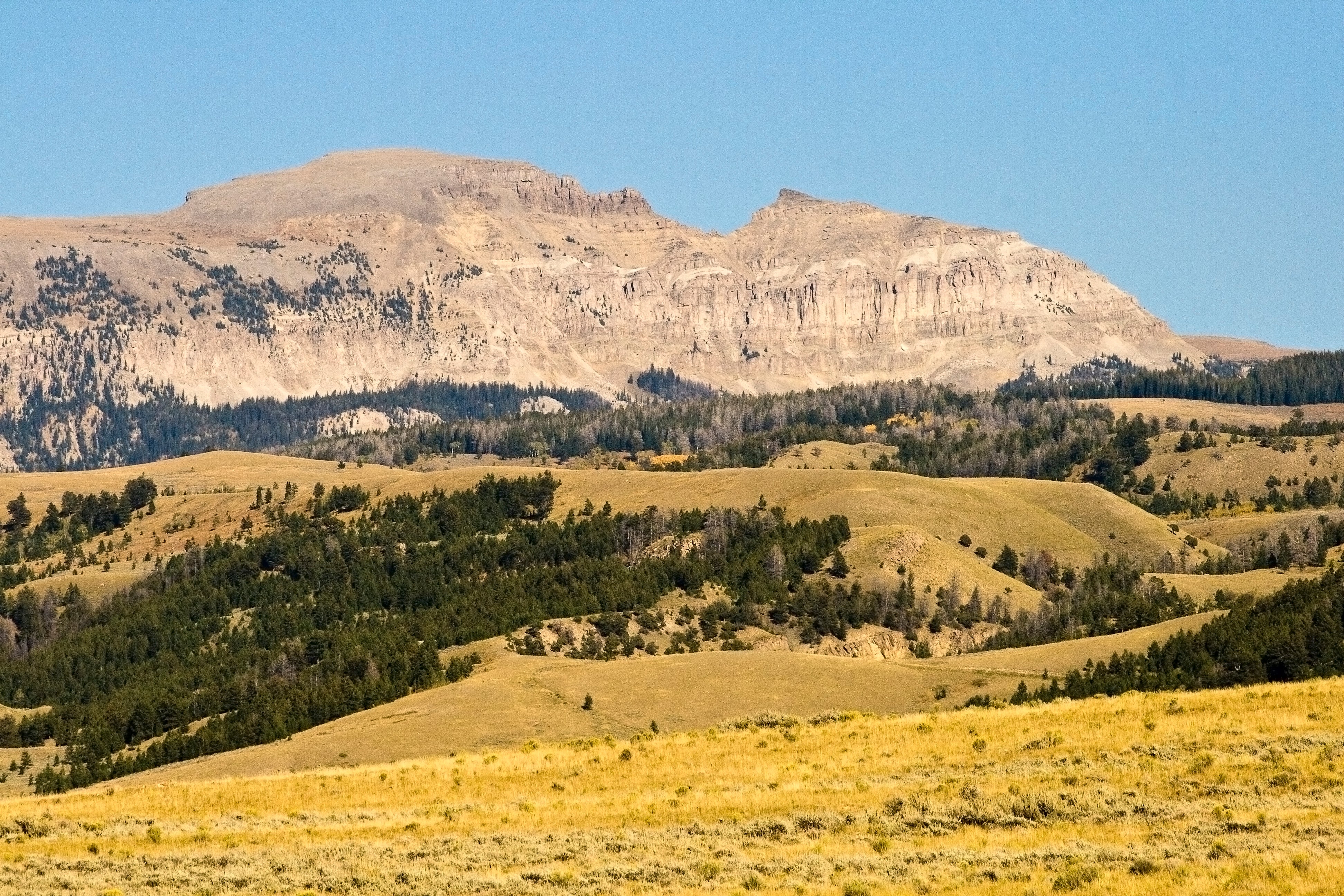
Cheyenne: Sheep Mountain
Roam 6.8 miles mostly off-trail along elk and mule deer trails to undulating granite ridgelines that offer numerous picture-perfect views of the plains and Rocky Mountains.
'Acroterion'
Trail Facts
- Distance: 8.1
- Miles from city center: 78
Waypoints
SMT001
Location: 41.1322822570801, -106.032981872559
Head N along wetland meadows of Fence Creek
SMT002
Location: 41.1415328979492, -106.030151367188
Stay on faint rocky path above creek
SMT004
Location: 41.1440162658691, -106.02269744873
Leave No Trace: Don’t tramp on fragile red lichen
SMT005
Location: 41.1442680358887, -106.01978302002
Sweeping views of sunburnt plains and Jelm Mtn.; head N up rocky prow
SMT006
Location: 41.1521492004394, -106.019996643066
Stay E of trees; patches of snow likely in sunless gullies
SMT007
Location: 41.1553153991699, -106.018531799316
Cross wind-torn scrubs, staying high on ridgeline to unnamed high point
SMT008
Location: 41.1604843139648, -106.02173614502
Path edges uphill; watch for sly mule deer and elk
SMT009
Location: 41.1625823974609, -106.021499633789
Bear L off faint path; traverse sidehill; begin rocky descent to Fence Creek
SMT010
Location: 41.1613655090332, -106.030685424805
Cross creek, following deer trail to lesser ridgeline
SMT011
Location: 41.1602668762207, -106.033752441406
Turn L onto Sheep Mountain Trail; sprawling views of the Snowy Range and Colorado Rockies
WPT012
Location: 41.1465148925781, -106.03296661377
ADVERTISEMENT
Bear L onto old 4×4 trail to finish loop, then return to trailhead
SMT003
Location: 41.1438484191894, -106.027130126953
Route fades; veer R across creek and climb 400 ft. to prominent ridgeline