Updated December 2, 2024 03:15PM
Catch the Best Sunrise of Your Life on These 5 Hikes
These peaks, passes and beaches are the perfect place to spot the first rays of the day.
(Photo: Ascent Xmedia/Stone via Getty Images)
This article is for Outside+ members only. Not a member? Check out a preview here and see what you’re missing.
Every sunrise is special, even in the city, but watching dawn in the wilderness is unforgettable. There’s something about catching the slow seep of golden light over the horizon from some backcountry perch—a high peak, a quiet lakeside, a headland jutting out into the ocean—that surpasses every other morning experience. With an early alarm (and a lot of coffee), you can experience it yourself from one of these five best sunrise hikes.
Sugarloaf Mountain, CO
- Distance: 1 mile out and back
- Elevation Gain: 439 feet
- Difficulty: Easy

With the Front Range to the east and the Indian Peaks to the west, the Sugarloaf Mountain summit offers sunrise views you won’t ever forget. Climb to the open, rocky summit just before the sun comes up (easier in the winter when dawn comes later, but snowshoes are required), then set your camera and wait for the “magic hour.” It might be cold, but you’ll barely notice once the light show starts: The wash of gold, rose, and lavender over the distant snowfields topping the Indian Peaks will provide all the distraction you need from the cold.
Though the peaks are spectacular, there’s more than mountains in the surrounding panorama. The lights of the Boulder-Denver area spread out below the trail, glowing brightly in the last few minutes of the night. Turn away from the urban nightscape for a view a world away, where the bare stone summits of the Indian Peaks Wilderness catch the first rays far before any light reaches the valley.
ADVERTISEMENT
The Route: Sugarloaf Mountain Sunrise Hike
At only .5 miles, this trail is more accessible than many Colorado peaks. In fact, you’ll cover most of the distance and elevation gain on the drive in. After turning off Sugarloaf Road onto the dirt Sugarloaf Mountain Road, head up 1 mile to the Switzerland Trail trailhead and parking lot. Start from the east edge of the parking lot and head up a rocky trail, passing a gate a few yards from the trailhead. The trail wraps a half-mile around the slope and then up to the summit, gaining about 400 more feet of elevation.
The Map: Sunrise Hike to Sugarloaf Summit
Mt. Washburn, Yellowstone National Park, WY
- Distance: 6.4 miles
- Elevation Gain: 1,400 feet
- Difficulty: Moderately Challenging

Bag the highest peak in Yellowstone National Park and catch the sunrise on this 6.4-mile round-trip hike. The lookout tower at the top, one of three in Yellowstone, is still active. Firefighters trained to recognize wildfire signs stay in the lookout continuously from mid-June until the fire season ends each year. Other than firefighters, the mountain is frequented by black bears, grizzly bears, bison, mountain goats, bighorn sheep, and wolves—nearly all of Yellowstone’s most iconic species.
On a clear day you can see for 50 miles in all directions from Washburn’s summit. Though you’ll need to get a very early start, the 360-degree views of the sun coming up over the mountains, geothermal pools, and wildlife-filled valleys of Yellowstone will make the alarm, the drive, and the lost sleep more than worth it. Bonus: Mt. Washburn is one of the most popular day hikes in the park, but few tourists, or even locals, will be headed up while it’s still dark out, so you’ll likely get to enjoy the sunrise solo.
ADVERTISEMENT
The Route: Mount Washburn Sunrise Hike
Start from the Dunraven Pass trailhead, around 5 miles north of Canyon Village. The climbing starts immediately, contouring around the mountain before starting to switchback at mile 1.5. The trail levels off after the switchbacks, then joins Chittendon Road for the rest of the ascent to the lookout tower (keep left). In total, the route gains 1,400 feet over 3.2 miles.
Wildfires May Deter Your Sunrise Hike in Yellowstone

As the fire tower suggests, Yellowstone has a key place in the history of American wildland firefighting. In the early days of the park, the only approach used was total suppression. Put out every fire that starts, anywhere, in any way. This let a thick layer of dead branches, leaves, and grass build up on the forest floor—the perfect fuel for a fire. The federal government abandoned this method after the Mann Gulch Fire in nearby Montana killed 13 smokejumpers in 1949, leading to intense scrutiny of contemporary fire management methods. They shifted to acknowledge the importance of fire in forest ecology.
Yellowstone quickly changed its own fire management methods, letting naturally started fires burn themselves out and setting prescribed burns. They shifted back toward total suppression after an intense wildfire torched 36% of the park in 1988. Today’s policies feature closer fire monitoring, and allow for the suppression of natural fires if necessary and removal of fuel around human-occupied areas.
ADVERTISEMENT
The Map: Sunrise Hike to Mount Washburn Summit
Skyscraper Peak, Mt. Rainier National Park, WA
- Distance: 7.9 miles
- Elevation Gain: 1,700 feet
- Difficulty: Challenging

Skyscraper Peak is aptly named, rising 7,079 feet and towering above the smaller summits surrounding enormous Mt. Rainier. It’s located in, appropriately enough, the Sunrise area of the park, and is the perfect spot to watch a northwest morning start. The 7.9-mile round-trip out-and-back gains 1,700 feet on the way to the peak. It passes Frozen Lake and follows part of Sourdough Ridge on the way.
When the sun comes up, Frozen and the other lake below the pass, Mystic Lake, throw back a cascade of pastels as the sun climbs over the horizon. Gaze down at the White River valley as the temperate rainforest slowly lightens from a single shadow to individual trees. Then turn your attention to Mt. Rainier as the most glaciated peak in the lower 48 brightens into its full glory.
Even in early fall, some flowers still bloom in Sunrise’s meadows. On your descent keep an eye out for cinquefoil, magenta paintbrush, and blue gentians. Marmots sometimes sit in these meadows and you can often hear them beginning to whistle as morning breaks.
ADVERTISEMENT
The Route: Skyscraper Peak Sunrise Hike
The route climbs away from the Sunrise parking area to the eye-opening Sourdough ridgeline, revealing vistas of the lush White River Valley below. Head west on the Sourdough Trail and weave through wildflower-dotted meadows toward Frozen Lake. At the five-way intersection, pick up the Wonderland Trail and trek through more meadows before reaching the steep climb to Skyscraper Pass. At the top of the pass, enjoy dazzling vistas of Moraine Peak and Mystic Lake to the west. Then, tackle the final ascent toward the summit up a quarter-mile scramble through a loose scree field.
Crest Skyscraper’s rounded summit near mile 4 and savor the spectacular, unobstructed views of the Cascades. Mount Rainier looms to the southwest and the table-top-flat Grand Park rises to the northeast. When you’ve had your fill, follow the same route back to the trailhead.
Watch for Marmots Along this Sunrise Hike

The subalpine regions of Mt. Rainier National Park are home to a large population of hoary marmots, the largest member of the squirrel family in North America. They are named for the gray fur that covers their shoulders and upper back—it’s brown everywhere else. At an average of 30 inches long, you might think they’re easy to spot, but their characteristic fur pattern is perfect camouflage on the rocky slopes where they prefer to live. A layer of fat built up over a summer of eating grasses and seeds lets them hibernate from October to February in Oregon and Washington and from September to April in northern Alaska.
ADVERTISEMENT
The Map: Sunrise Hike to Skyscraper Peak
Archie Carr National Wildlife Refuge, Melbourne Beach, FL
- Distance: Less than .25 mile
- Elevation Gain: N/A
- Difficulty: Easy

Emerge from the car in the gray predawn with a jacket and thermos full of coffee. Draw in a deep breath of salty air. The roar of the waves sounds from just beyond a bank of sand dunes. The beach is just a short hike away. Head down the sandy trail and watch the ground lighten from shadow to pale sand, individual grains slowly becoming distinguishable. At last, the sea. Emerge on the beach just in time to see the sun spill over the Atlantic horizon, firing the waves into a rolling tapestry of gold, orange, and red.
The three-quarter-mile along the beach at Archie Carr National Wildlife Refuge is good for more than just dawn watching—though it’s very, very good for that. Biologists consider the beach here to be the second most important nesting site for loggerhead turtles in the world and the most crucial in the western hemisphere. It’s also home to over 140 species of birds and 350 species of fish. As you snap sunrise photos of the waves, keep an eye out for shorebirds like oystercatchers and ibises.
The Route: Archie Carr Sunrise Hike
Start from the Barrier Island Sanctuary Management and Education Center. Take the Barrier Island Sanctuary Trail half a mile out to a point in Indian River Lagoon, where several small islands provide bird habitat (and some excellent camping spots), then loop back another quarter mile around to the outer edge of the park to reach the Atlantic beach.
ADVERTISEMENT
A Rare Find along this Sunrise Hike

The loggerhead sea turtle once inhabited oceans all around the world and had a population of several million. Today, thanks to pollution, overfishing, and bycatch, there are only around 50,000 left. Many of those remaining nest along the Florida coast with 25 to 35% of all the turtles that nest in the United States nest at Archie Carr.
Every year, loggerheads lay an average of 8,000 to 20,000 nests in the refuge—that’s 400 to 1,000 nests per mile of coastline. Green turtles and leatherback turtles also nest at the refuge in smaller numbers. The baby turtles make their way to the ocean, where, if they aren’t eaten by predators or caught as bycatch in fishing nets, they reach maturity at around 35 years old. The temperature of the sand where the turtles lay their eggs determines the sex of the hatchlings—colder sand produces males and warmer sand produces females.
The Map: Sunrise Hike to the Archie Carr Coastline
Guadalupe Peak, Guadalupe Mountains National Park, TX
- Distance: 4.2 miles
- Elevation Gain: 3,000 feet
- Difficulty: Challenging

The highest point in Texas also has some of the state’s top views. Surrounded by smaller summits in the Guadalupe Mountains and, beyond that, the plains, Guadalupe Peak gives hikers views of what feels like forever, and they start just past the trailhead. Guadalupe Mountains is little-known and little-visited as far as national parks go. There are only three summits trail-accessible in the entire park, and you won’t have to share your sunrise with any crowds.
Plan an early start for the 4.2-mile climb, which gains 3,000 feet in elevation. Make sure you bring plenty of water for the exposed, rocky trail. When you finally reach the top of the mountain—aim to arrive 15-20 minutes before sunrise to get the full effect—sit back and catch your breath from the switchbacking miles of climbing. Get ready to watch the first light of the day break over the top of Texas.
ADVERTISEMENT
The Route: Guadalupe Peak Sunrise Hike
Start from the Guadalupe Peak trailhead. The path starts climbing almost immediately, mixing switchbacks and some stairs to head up the rocky mountainside. Pine trees line the sides of the trail at lower elevations, where the trail doesn’t traverse along a cliff ledge. Look for elk and bighorn sheep on the slopes alongside the route. Near the top, the trees disappear, replaced by enormous boulders. A near-scramble up the scree between them brings you to the summit, marked by a 6-foot stainless steel pyramid.
A Brief History of the Guadalupe Mountains

The Guadalupe Mountains were the stronghold of the Nde people, also known as the Mescalero Apache. A war with the Comanche tribe in the eighteenth century drove them into the mountains, where they learned to survive in the austere peaks. They hunted mule deer, elk, and bighorn sheep, and also harvested plants like bear grass, sotol, and agave. As European settlers arrived in the area, they began taking those all-important resources for themselves. When the Nde defended their home, the U.S. sent in the army. By the late 1800s the Nde had nearly been driven from the Guadalupe Mountains. Today, the mountains remain important to the Nde both spiritually and culturally. Members of the tribe still return to the area to harvest agave.
The Map: Sunrise Hike to Guadalupe Peak
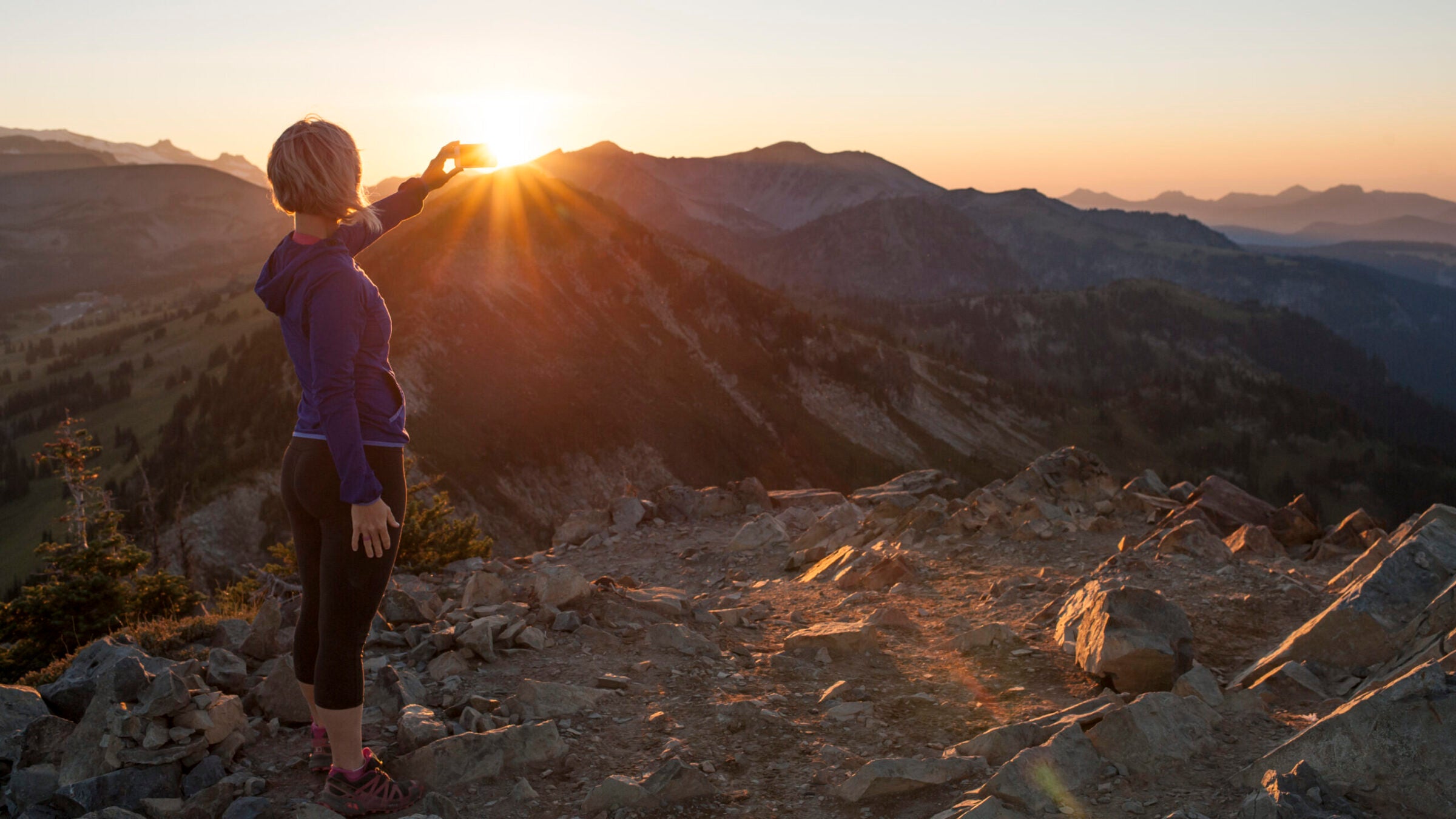
How to Capture the Best Photos on Sunrise Hikes

The 15 minutes before and 45 minutes after sunrise are one of two “magic hours” coveted by photographers. It’s when the incredible light—soft, low-angle, and blazing a rainbow of colors across the sky—makes snapping the perfect photo easy even for beginners. Any camera, even your phone, will work to capture the moment, but to up your game (and your ‘gram) try a wide-angle lens, a neutral density filter, and a tripod. Shoot on the cloudy or shaded white balance setting to bring out the warm tones in the early light.
Extra layers, especially for your hands, will ensure you don’t get frozen out of the photo op before the sun is even up. Try out some liner gloves or fingerless gloves to keep the ability to use the camera without exposing your hands to the elements.