Catalina Island, CA: Two Dump Loop

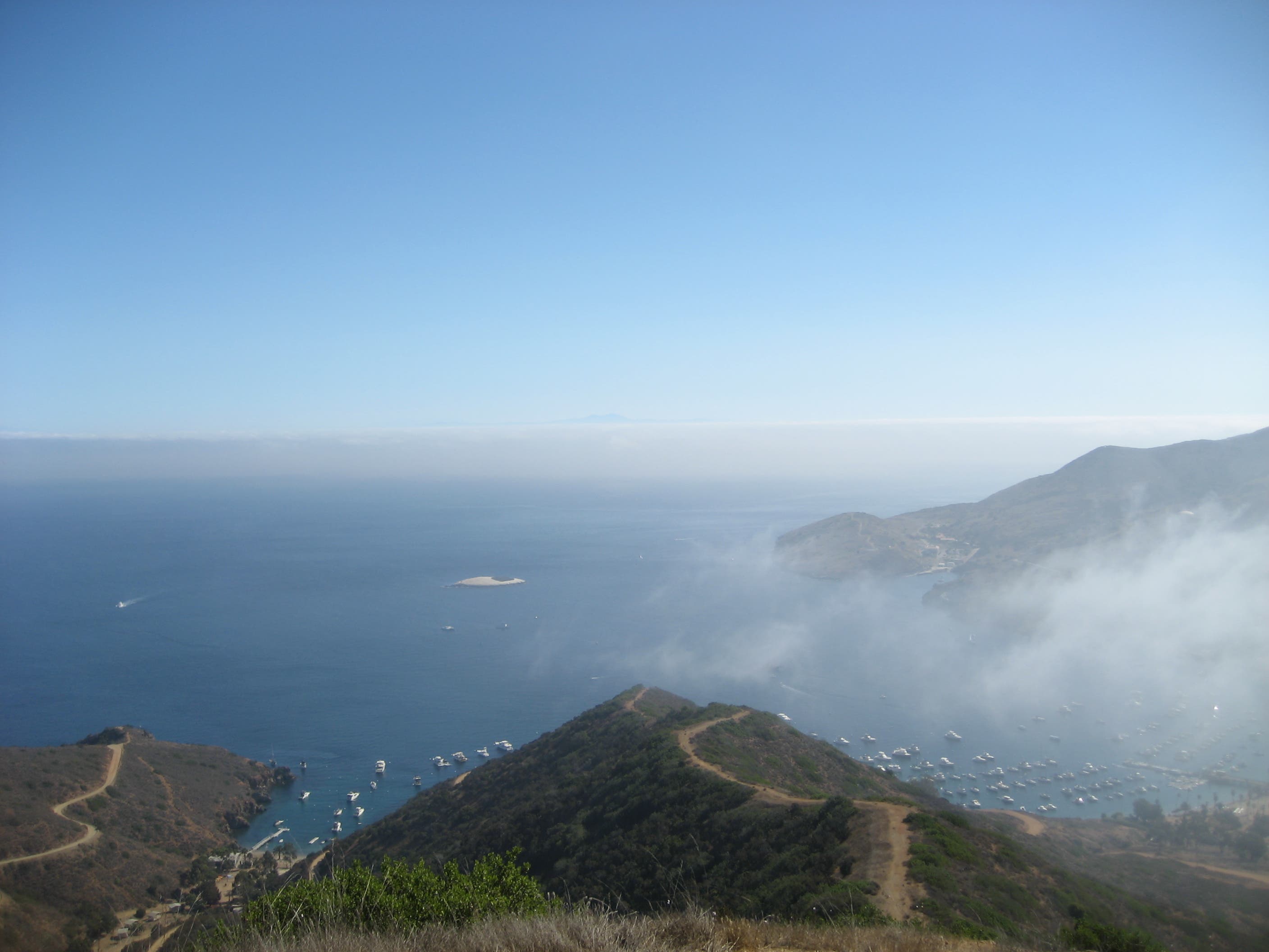
Gaining more than 1,200 feet of elevation in a little more than 2 miles, this loop offers a stiff climb and quick introduction to Catalina Island’s west end. Start at the bus stop in Two Harbors. Follow the Cat Harbor Road for 0.4 mile before turning right to begin the earnest climb to a ridgeline. The cactus-lined path can be loose in some places, but as you rise above this remote, tiny town, you’re afforded spectacular views of the isthmus and the mooring-filled coves on either side.
An easy, rolling path along the ridgeline turns left, rounding the back of a canyon. Look for Ansel Adams-worthy scrub oak remains in the grassy hillsides before joining the Silver Peak Trail just below an overlook. Make the quick uphill before turning back and following the Dump Road down 1,200 feet over the next 1.5 miles to Wells Beach and Cat Harbor. The last mile is a gentle, winding descent back to town that skirts the shores of Cat Harbor .
-Mapped by Frannie Finley

Trail Facts
- Distance: 8.7
Waypoints
TDL001
Location: 33.440779, -118.49848
This hike begins at the bus stop, a short walk from the dock and just to the east of the restaurant. The first 0.4 mile on the main road are relatively flat and easy.
TDL002
Location: 33.43659, -118.50217
Just before the water’s edge at the back of Cat Harbor, a well-worn road leads up and to the right. Follow it to begin the mile-long climb to the ridgeline.
TDL003
Location: 33.43656, -118.5041
The climb intensifies as it follows a smaller, right-hand path from this point (a few hundred yards west of the main road).
TDL004
Location: 33.44025, -118.50662
A flat spot offers brief respite on the climb, and a faint trail leads right to a hammock-shrouded scrub oak.
TDL005
Location: 33.43979, -118.50834
This is the only real switchback on the climb. Turn right to continue up the final push to the ridgeline.
TDL006
Location: 33.44257, -118.50871
The cactus and sage-lined path keeps climbing, but you’re almost to the top.
TDL007
Location: 33.44731, -118.52557
After a mile of rolling up and over the ridgeline contours, a short climb leads to a large open dirt area atop a hill. Turn left for a quick, steep downhill and a mellow climb to the Silver Peak Trail.
TDL008
Location: 33.441609, -118.52617
This mapped route joins the Silver Peak Trail road just below the island’s west-end ridge. The quick uphill detour is worth the views of the Pacific Ocean and Catalina’s rugged backside.
TDL009
Location: 33.44157, -118.52655
If it’s not too windy, this ridge-top overlook is a great place to stop for a snack, or to stretch your legs before turning around and following the steep path downhill.
TDL010
Location: 33.43927, -118.51678
Just after a flat section of trail, you’ll pass a large, round water tank on your left and the old Two Harbors dump on your right. The old dump area is inactive and is a popular grazing spot for deer.
TDL011
Location: 33.433349, -118.50941
The steep, 1.5-mile downhill leads to Wells Beach, a maintenance and work area for the village of Two Harbors. Stay on the main road and watch for old, dirty maintenance trucks as you head uphill and round a bend on the narrow road.
TDL012
Location: 33.43283, -118.50798
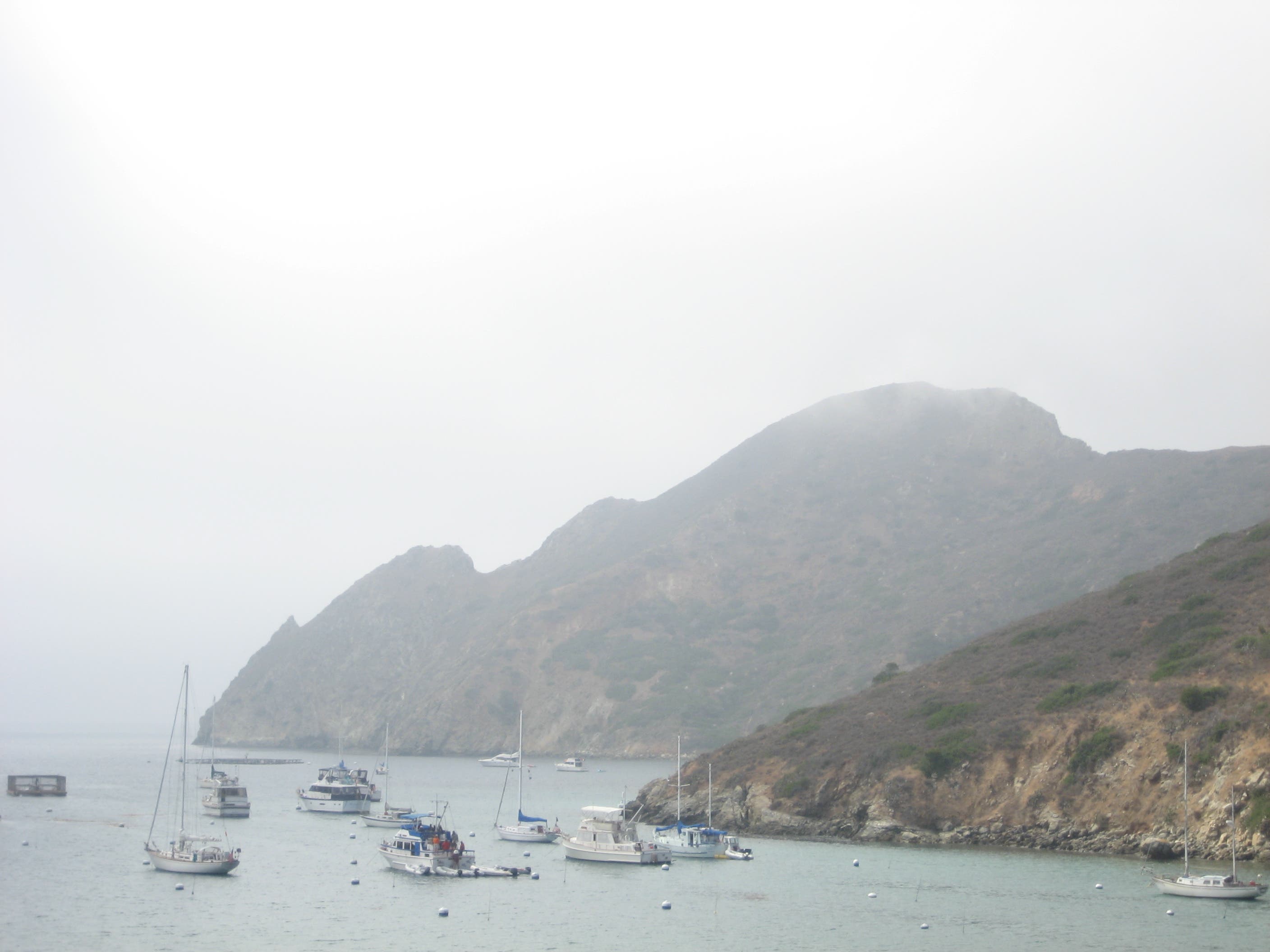
Look back and to the left side of Catalina Harbor for a view of a local landmark, the ridgeline between Mount Torquemada and Cat Head, which resembles the silhouette of a pregnant woman.
Trailhead
Location: 33.4407527, -118.4983635
There isn’t much traffic on the Cat Harbor Road, where this hike begins. © Frannie Finley
Cat Harbor Road
Location: 33.4365269, -118.50214
The Cat Harbor road is the darker-surfaced one on the left. This route follows the dirt trail to the right from this unmarked Y-junction. © Frannie Finley
Footpath
Location: 33.437458, -118.5041142
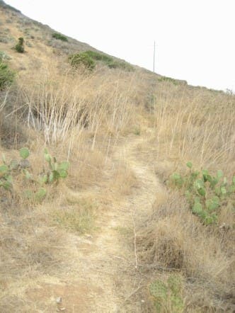
This prickly-pear-lined path begins the intense climb to the ridge above Two Harbors. © Frannie Finley
Two Harbors
Location: 33.439929, -118.5060453
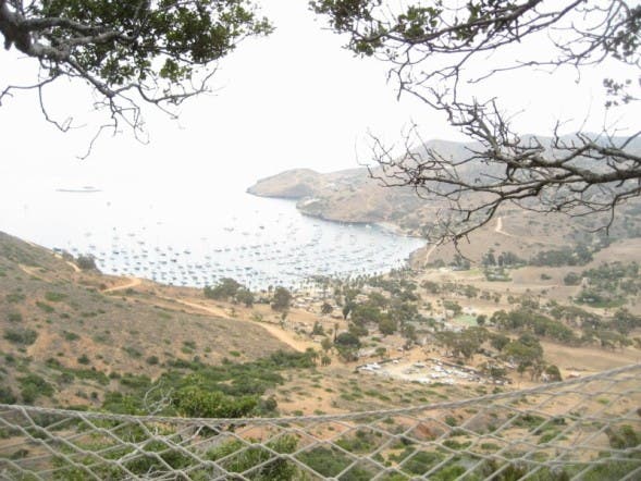
A view of Two Harbors from the hammock. Notice Bird Rock on the upper left and Big Fisherman’s Cove on the upper right. © Frannie Finley
Hammock
Location: 33.4402871, -118.506217
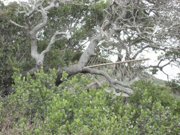
Who knows how long it’ll last, but this hammock is a nice spot for a rest. © Frannie Finley
Mainland
Location: 33.4434385, -118.5096502
You’ll find 100-mile views of the southern California coast on a clear day. In the foreground, is the Isthmus Cove on the right and Fourth of July Cove on the left. © Frannie Finley
Pregnant Lady Landmark
Location: 33.4325158, -118.5076332
A local landmark, the silhouette of a reclining pregnant woman, looms above the moorings in Cat Habor. © Frannie Finley