Canyonlands National Park: Chesler Park to Salt Creek Canyon

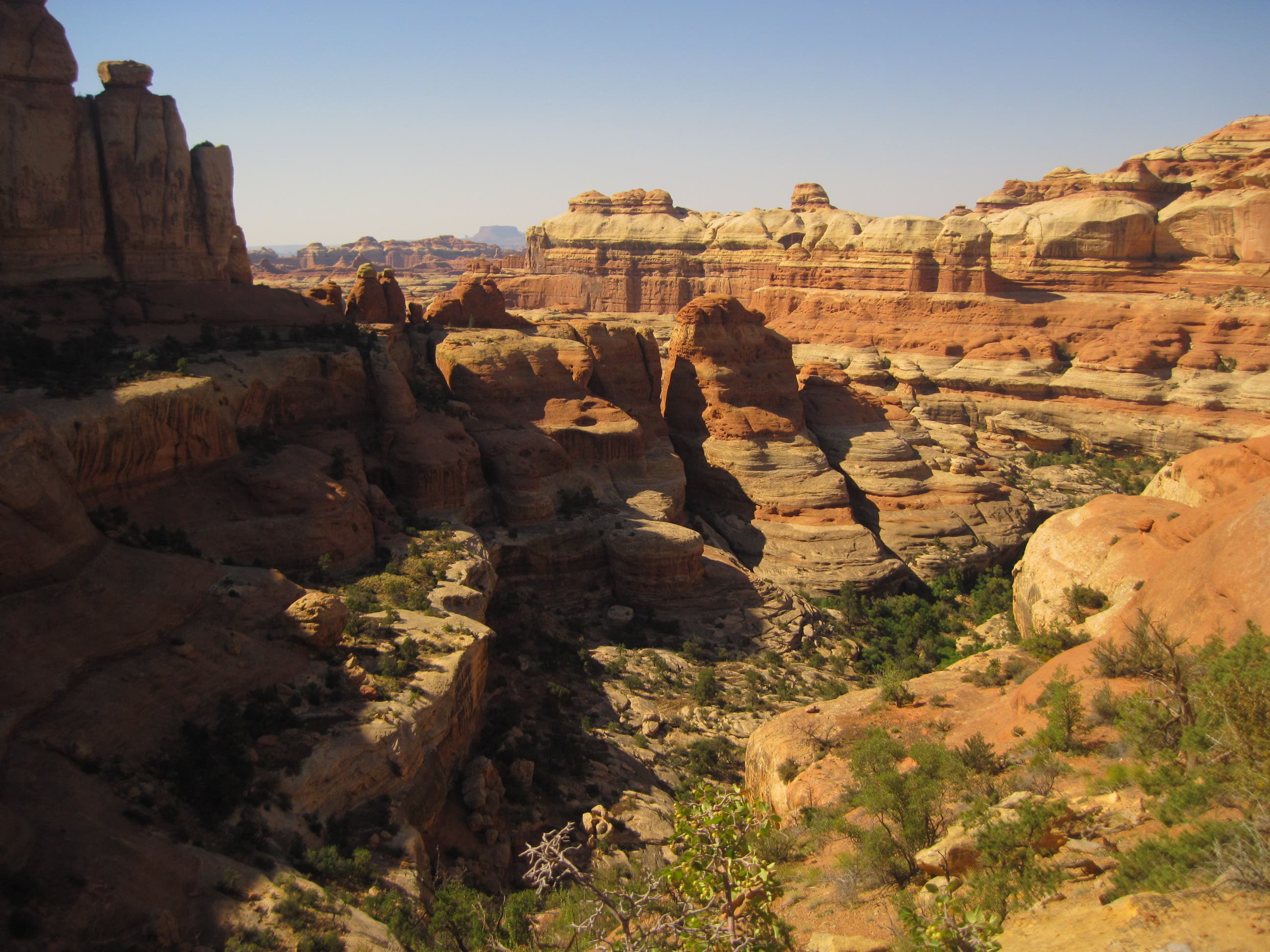
The Needles District in the park’s southeastern reaches is a slickrock playground of labyrinthine canyons, hoodoo gardens, giant arches, expansive meadows, and prehistoric ruins. See the best of it on a 49.3-mile point-to-point that roller coasters from canyon bottoms to butte tops with hundred-mile views.
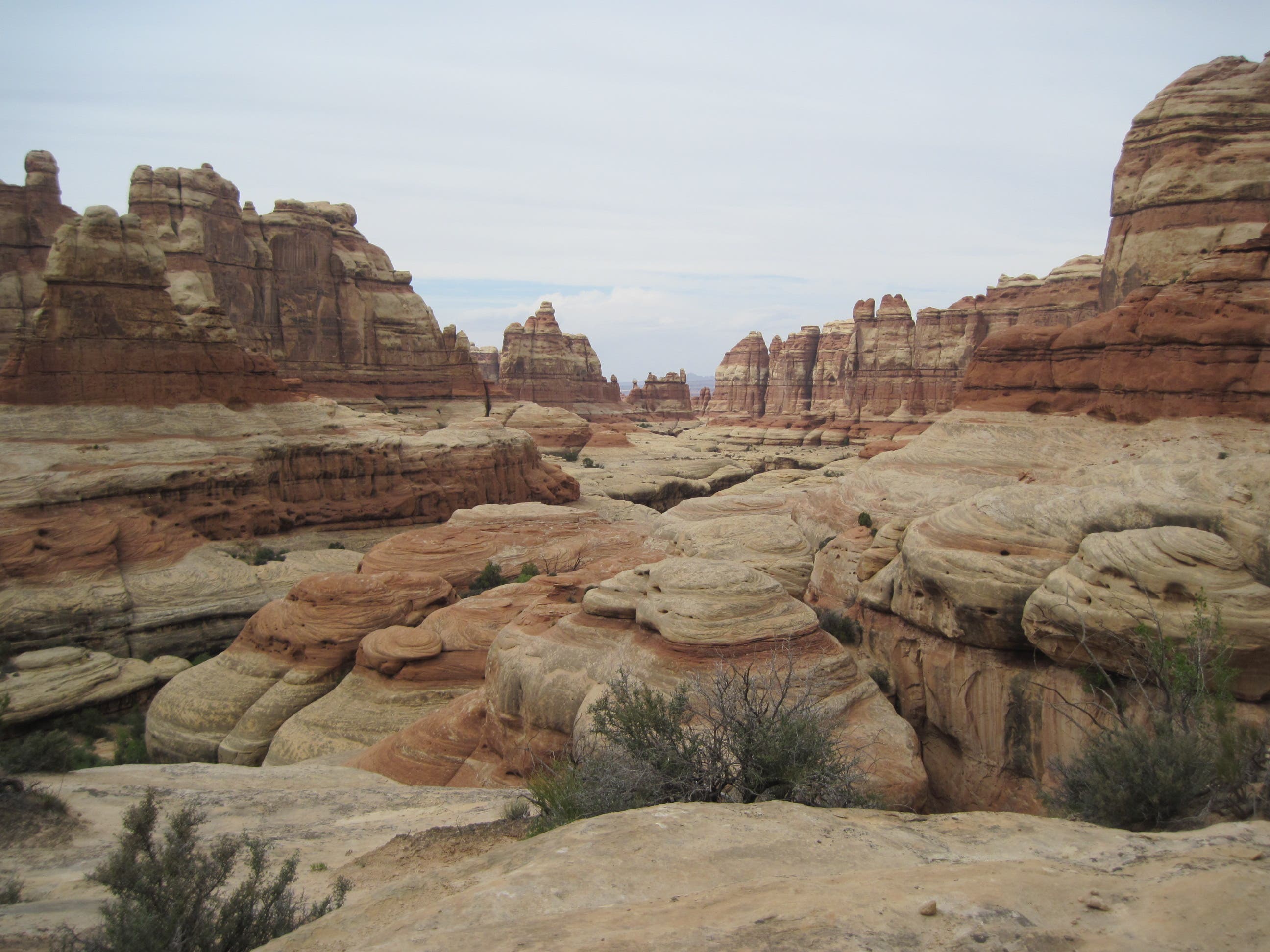
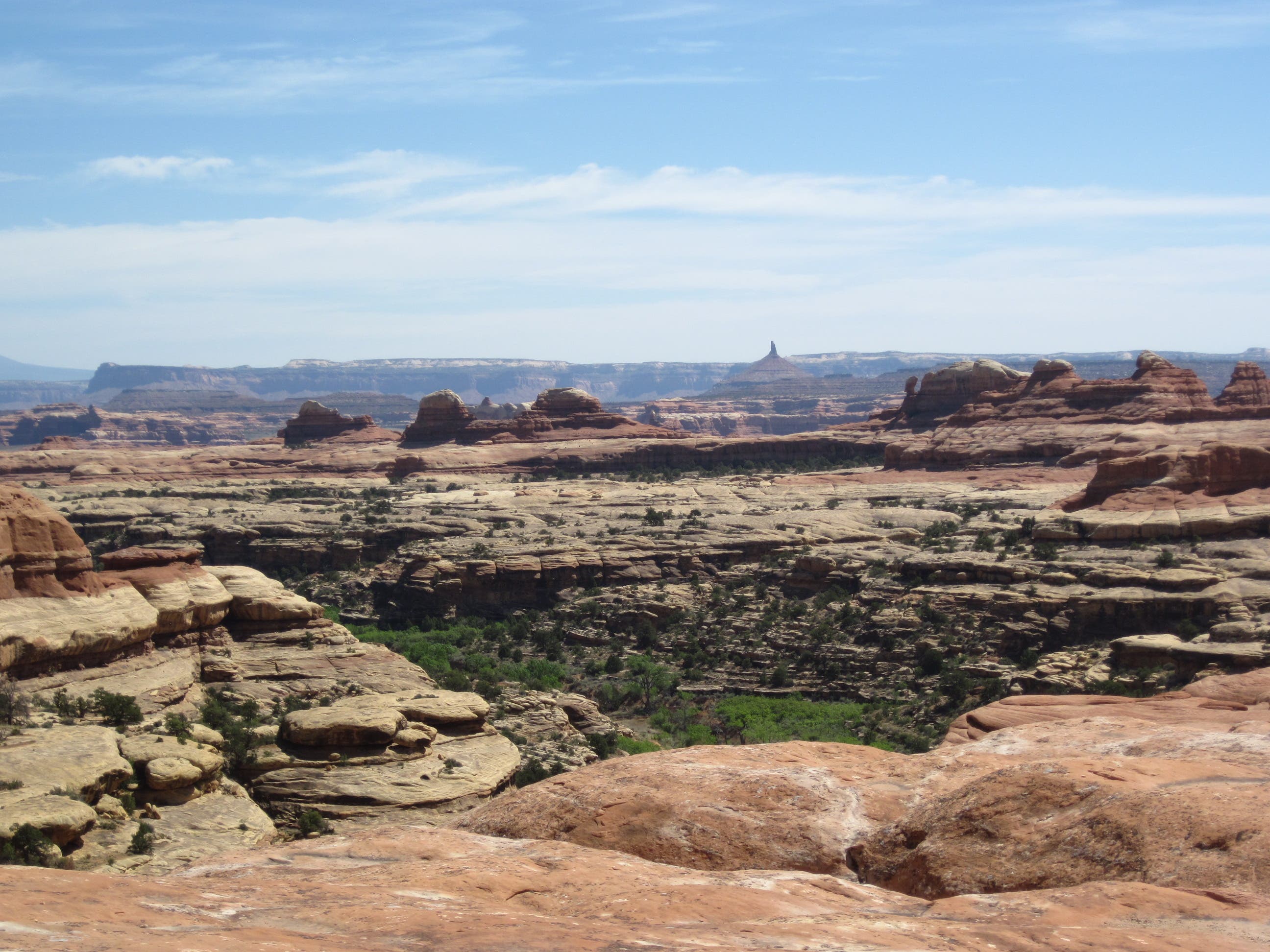
From the Elephant Hill trailhead, hike south to the adjacent mesa top, climbing steadily past aromatic sagebrush and canyons with capped, mushroom-like spires. As you gain elevation, turn around for a pace-halting scene: The snowcapped La Sal Mountains rise to 12,000 feet behind distant mesas and gorges, while pink-and-white-striped rock towers line the foreground. At mile 1.3, bear right before passing through two less-than-10-foot-wide gaps in the slickrock and descending to Elephant Canyon.
Ditch your pack in the wash for a 3.6- mile side trip to Chesler Park, a sweeping meadow enclosed by spires. First, climb southwest up a side canyon and traverse a sandstone ledge above the canyon floor. Next, turn left at mile 2.4, and crest a pass bordered by toothy formations. Soon after, the route enters Chesler’s 960-acre expanse stippled with bunchgrass and rimmed by 800-foot-tall, multi-colored spires. On windy days, you can hear the breeze whistle as it whips around the formations. Return to Elephant Canyon, then head south .6 mile to your first camp at EC2, perched on a slickrock bench.
The next day, go south .2 mile to where the canyon forks. Leave your pack, grab dayhiking supplies, then bear right for a 4.5-mile round-trip to 85-foot-high Druid Arch, reminiscent of Stonehenge; backtrack to your pack.
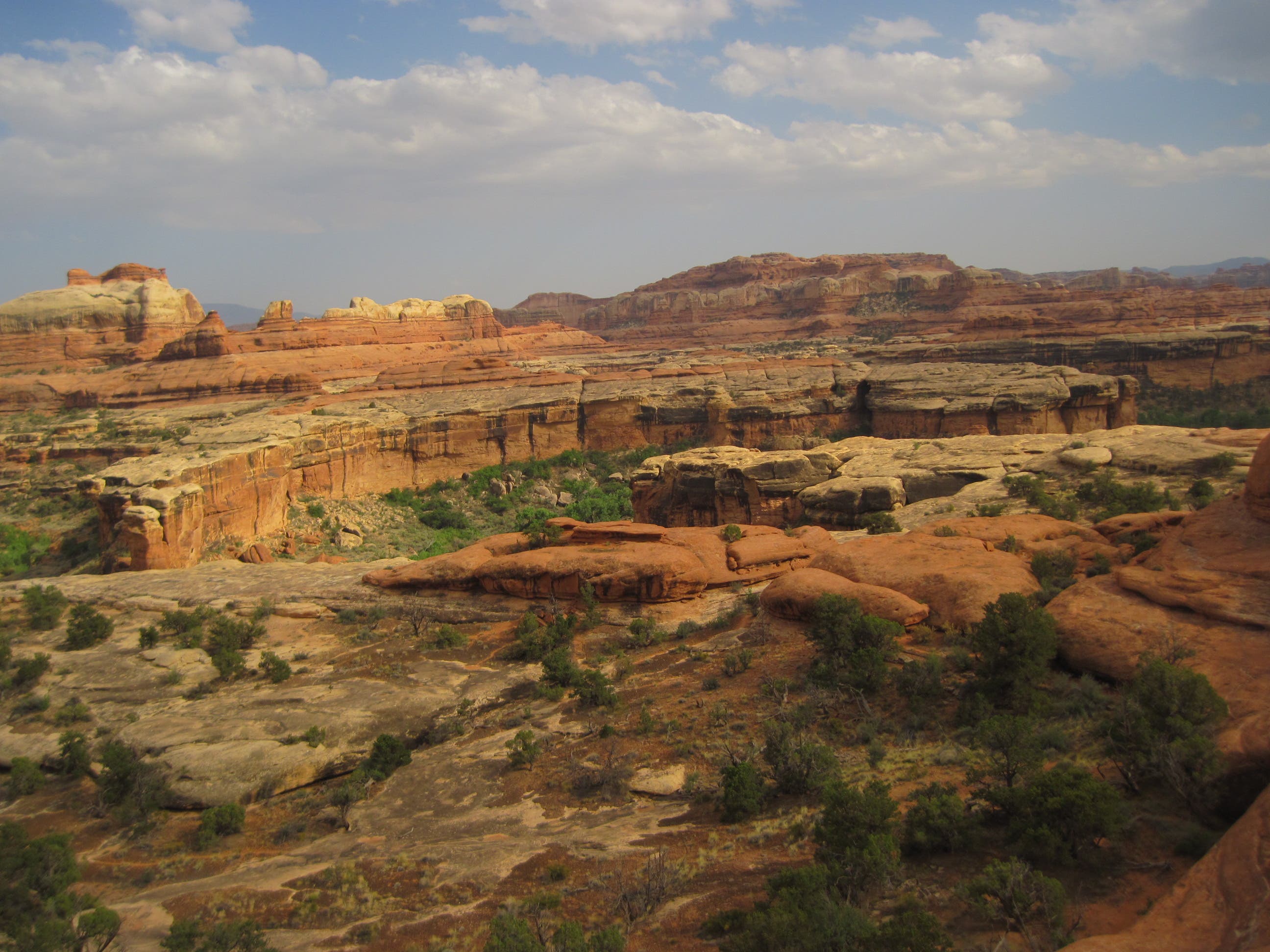
Now head southeast up the east fork of Elephant Canyon, and climb a metal ladder into neighboring Squaw Canyon (mile 11.7). Traverse northeast along the exposed northern rim of the canyon for a mile, then turn left for a grin-inducing obstacle course: jump over a threefoot- wide gap, tightrope walk across logs lining the bottom of a five-foot-wide rock tunnel, then climb up a pourover to a redrock pass. Drop into Big Spring Canyon and follow it northeast 1.4 miles to your second camp at BS2 (mile 14.4).
Day three: Hike northeast less than two miles to Squaw Flat trailhead (take a half-mile detour to fill water in Campground B), then wind south into Squaw Canyon through a wide, hoodoo-rimmed meadow. At mile 18.4, veer left for a slickrock scramble to a 5,480-foot pass; carefully descend a steep pourover with loose rocks into Lost Canyon. Follow the snaking, cottonwoodlined wash northeast for 2.5 miles past pools with bullfrogs and salamanders, and turn right at the junction. Sleep at LC1 100 yards away.
On the fourth day, tackle a dizzying traverse that runs east on ledges roughly 200 feet above lower Lost and Squaw Canyons; downclimb a ladder through a claustrophobic, threefoot- wide slot; then descend stone steps into lower Salt Creek Canyon. In late summer, you may spot black bears snacking on the fruit of prickly pear cactus. Sleep at Angel Arch camp, shaded by two large cottonwoods.
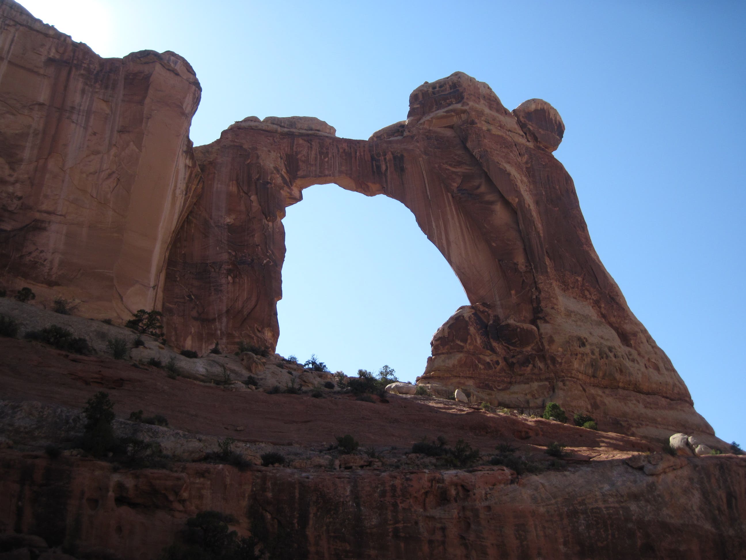
Day five: Start this 9.1-mile day with a four-mile out-and-back to Angel Arch, named for the winged figure that seems to be leaning back on a 135-foottall arch. Next, hike south through grassy clearings with wild rose bushes to Upper Jump, a 15-foot waterfall pouring down tiered ledges. Overnight at SC3 where the canyon broadens (mile 39.9).
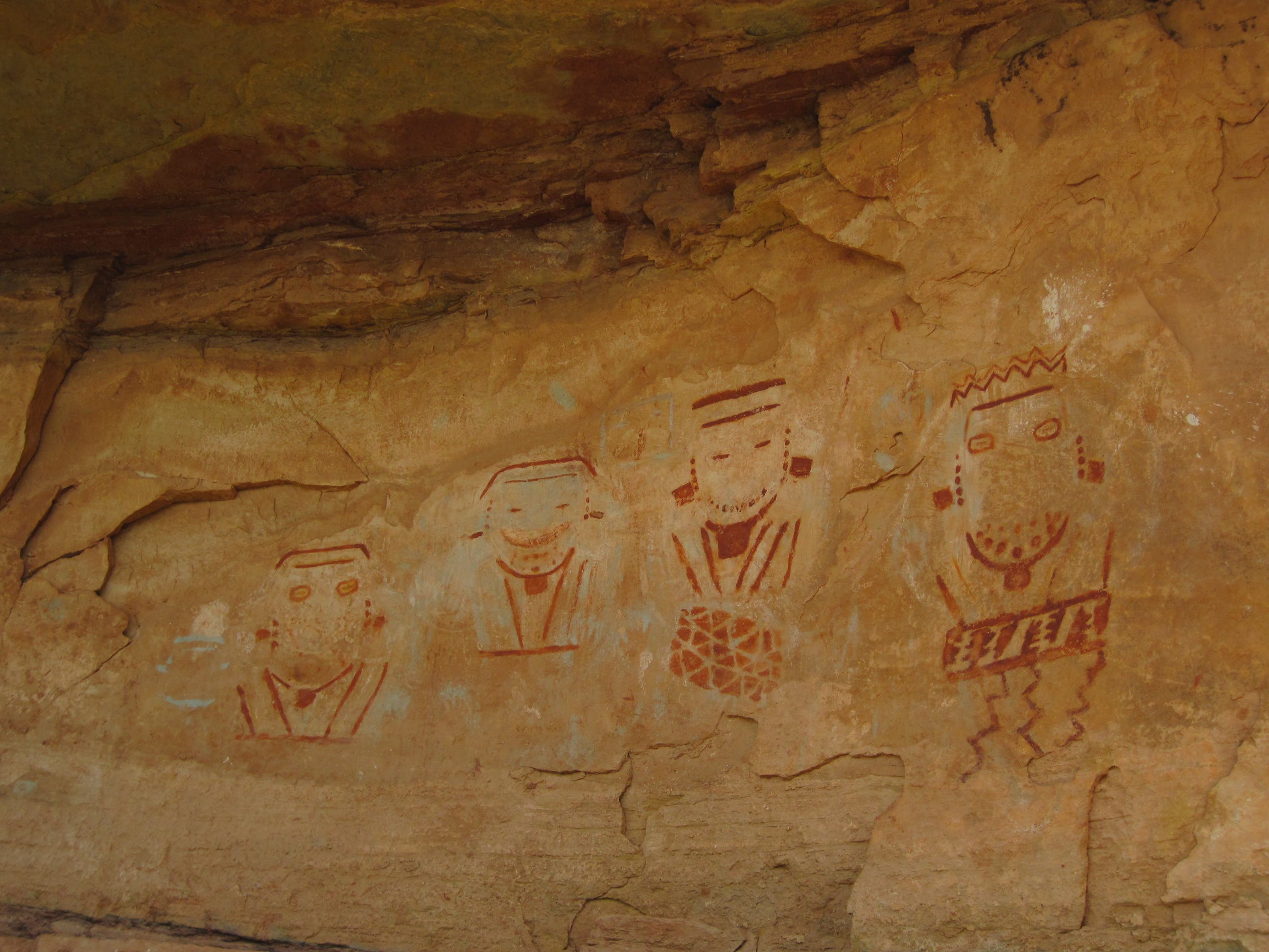
Slow your pace on the sixth day to savor a 5.3-mile stretch of relics left by ancestral Puebloans in 1200 A.D. You’ll pass a round stone-and-mortar granary, pictographs (one resembles four figures playing musical instruments), and cliff dwellings. Camp at SC1 (mile 45.2).
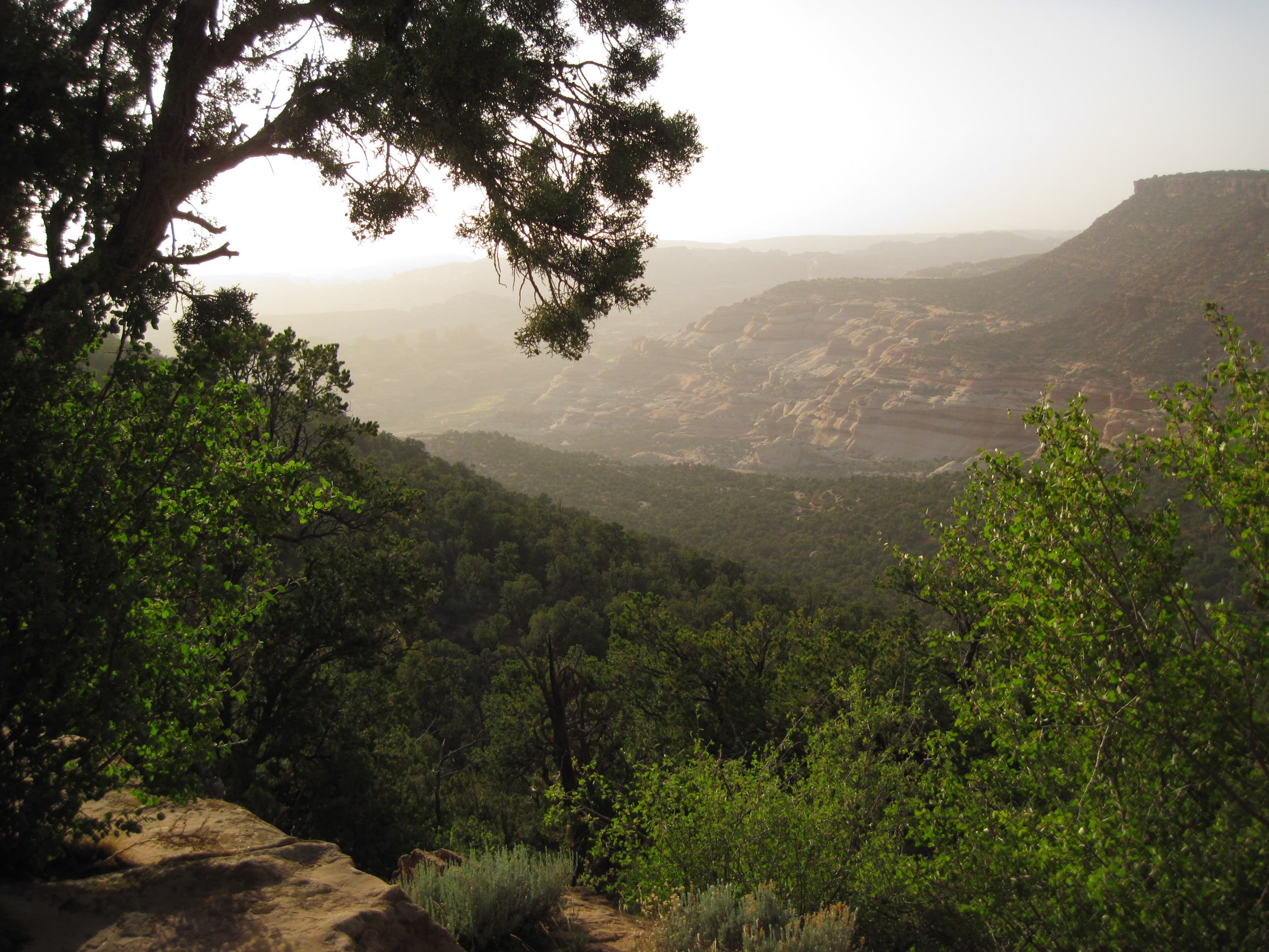
On the last day (4.1 miles), follow the overgrown creekbed south. The lush riparian scenery transitions back to parched desert as the trail gains 1,000 feet in two miles to the rim of Salt Creek Mesa and your shuttle car.
PERMIT $30; reservations recommended during peak season (spring and fall). Walk-in permits are issued one day before the trip’s start date.
WATER Carry in a gallon of water per person per day. Squaw Campground and Lower Salt Creek Canyon are the only reliable places to refill reserves.
CONTACT (435) 259-4351; nps.gov/cany
MAPS Order waterproof topos for all three featured routes—or a map of the entire park—at backpacker.com/promaps.
-Mapped by MacKenzie Ryan
TO TRAILHEAD: Shuttle car: From Moab, drive south on US 191 for 40 miles and turn right on UT 211 W. In roughly 20 miles, turn left onto Beef Basin Rd./CR 107. Continue 17.2 miles to parking at the Cathedral Butte/Upper Salt Creek trailhead.
To trailhead: Backtrack to UT 211 and turn left. In 17 miles, turn left on the unnamed road. In .3 mile, turn right at the Elephant Hill sign. Go 3 miles to parking.
Commercial shuttle: Coyote Shuttle ($225/ two people; coyoteshuttle.com)
Trail Facts
- Distance: 79.3
Waypoints
NEE001
Location: 38.14181, -109.827187
From the Elephant Hill trailhead, hike south to the adjacent mesa top, climbing steadily past aromatic sagebrush and canyons with capped, mushroom-like spires. As you gain elevation, turn around for a pace-halting scene: The snowcapped La Sal Mountains rise to 12,000 feet behind distant mesas and gorges, while pink-and-white-striped rock towers line the foreground.
NEE002
Location: 38.125848, -109.832473
Bear right, following sign to Chesler Park and Druid Arch. Pass through a less-than-10-foot-wide gap in the slickrock, then enter a sage field surrounded by a semi-circular sandstone cliff.
NEE003
Location: 38.125293, -109.837365
Walk through another slickrock gap and descend into Elephant Canyon.
NEE004
Location: 38.123552, -109.839982
Cross sandy wash. Ditch your pack in the wash for a 3.6-mile side trip to Chesler Park.
NEE005
Location: 38.121276, -109.846841
Trail goes left along mouth of a canyon rimmed with hoodoos.
NEE006
Location: 38.120863, -109.847874
Go left at the Y-junction. Climb a sandy, rocky path to a pass bordered by toothy formations and with views of canyons, spires, and the La Sals.
NEE007
Location: 38.118106, -109.849845
Bear left and hike south into Chesler Park.
NEE008
Location: 38.106468, -109.849514
Stop and take in this 960-acre expanse stippled with bunchgrass and rimmed by 800-foot-tall, multi-colored spires. On windy days, you can hear the breeze whistle as it whips around the formations. Return to Elephant Canyon and your pack.
NEE009
Location: 38.1235, -109.840189
Pick up your pack and turn right (south) into Elephant Canyon. Go .6 mile to your first camp at EC2, perched on a slickrock
bench.
NEE010
Location: 38.116404, -109.838065
Spend the first night at EC2, on the right. The next day, go south .2 mile to where the canyon forks.
NEE011
Location: 38.114689, -109.835925
Leave your pack, grab dayhiking supplies, then bear right for
a 4.5-mile round-trip to 85-foot-high Druid Arch.
NEE012
Location: 38.111955, -109.837406
Potential campsite: EC3
NEE013
Location: 38.108388, -109.838523
Follow the rocky wash south. Ahead: You’ll encounter dryfalls and scrambles up slickrock benches. The payoff: Monstrous views north of the Needles and complete solitude. Only the wind and occasional birdsong echoes through the canyon.
NEE014
Location: 38.089029, -109.831155
Stop at the foot of 85-foot-high Druid Arch, which is reminiscent of Stonehenge. Backtrack to your pack.
NEE015
Location: 38.114633, -109.835789
Pick up your pack and head southeast up the east fork of Elephant Canyon.
NEE016
Location: 38.104947, -109.826331
Climb a metal ladder into neighboring Squaw Canyon and traverse northeast along the exposed northern rim of the canyon for a mile.
NEE017
Location: 38.109464, -109.816332
Follow cairns as they wind along the canyon rim. turn left for a grin-inducing obstacle course: jump over a three-foot-wide gap, tightrope walk across logs lining the bottom of a five-foot-wide rock tunnel, then climb up a pourover to a redrock pass.
NEE018
Location: 38.109317, -109.817817
Top of the pass. Next, drop into Big Spring Canyon and follow it northeast 1.4 miles to your second camp at BS2.
NEE019
Location: 38.126546, -109.812246
Camp at BS2. Day three: Hike northeast less than two miles to Squaw Flat trailhead.
NEE020
Location: 38.136483, -109.811012
Continue straight.
NEE021
Location: 38.140366, -109.808176
Bear right at the Y-junction.
NEE022
Location: 38.142998, -109.803763
Squaw Flat trailhead: Take a half-mile detour to fill water in Campground B, then wind south into Squaw Canyon through a wide, hoodoo-rimmed meadow.
NEE023
Location: 38.132714, -109.794905
Go left at Y-junction. Follow the sandy trail south into Squaw Canyon through a wide, hoodoo-rimmed meadow.
NEE024
Location: 38.114405, -109.804959
Veer left for a slickrock scramble to a 5,480-foot pass.
NEE025
Location: 38.107193, -109.802944
Carefully descend a steep pourover with loose rocks into Lost Canyon.
NEE026
Location: 38.107824, -109.801246
Follow the snaking, cottonwood-lined wash northeast for 2.5 miles past pools with bullfrogs and salamanders.
NEE027
Location: 38.109178, -109.794437
LC3
NEE028
Location: 38.114947, -109.783094
LC2
NEE029
Location: 38.121759, -109.777768
Turn left toward Peekabo Spring.
NEE030
Location: 38.121019, -109.77689
Sleep at LC1. On the fourth day, you’ll tackle a dizzying traverse that runs east on ledges roughly 200 feet above lower Lost and Squaw Canyons; downclimb a ladder through a claustrophobic, three-foot-wide slot; then descend stone steps into lower Salt Creek Canyon.
NEE031
Location: 38.120366, -109.776479
Top of boulder climb
NEE032
Location: 38.117283, -109.770302
Views north of Wooden Shoe Arch
NEE033
Location: 38.116743, -109.762703
Crawl through a rock window.
NEE034
Location: 38.114534, -109.754949
Walk through a roughly 15-foot gap, located next to some rock art. In late summer, you may spot black bears snacking on the fruit of prickly pear cactus.
NEE035
Location: 38.075315, -109.765407
Look over your left shoulder to see a crescent arch.
NEE036
Location: 38.06977, -109.767712
Sleep at Angel Arch camp, shaded by two large cottonwoods. Day five: Start this 9.1-mile day with a four-mile out-and-back to Angel Arch. Continue south to the junction.
NEE037
Location: 38.06829, -109.768341
Turn left for the side trip to Angel Arch.
NEE038
Location: 38.051799, -109.756514
Angel Arch: Stare up at this striking arch named for the winged figure that seems to be leaning back on a 135-foot-tall arch. Backtrack to NEE037 and turn left; hike south through grassy clearings with wild rose bushes.
NEE039
Location: 38.056632, -109.769574
Pass through a clearing with breathtaking views of spires.
NEE040
Location: 38.055652, -109.769818
Pass a campsite that’s marked, but not named.
NEE041
Location: 38.052253, -109.773146
Wild roses flank the trail here.
NEE042
Location: 38.043543, -109.770146
Old farm area
NEE043
Location: 38.042129, -109.771116
Trail runs through a wash.
NEE044
Location: 38.043179, -109.764705
Turn left to see the Upper Jump, a 15-foot waterfall pouring down tiered ledges.
NEE045
Location: 38.041984, -109.765067
Look up and right to see rock art.
NEE046
Location: 38.039709, -109.763806
Overnight at SC3 where the canyon broadens (mile 39.9). On the sixth day, slow your pace to savor a 5.3-mile stretch of relics left by ancestral Puebloans in 1200 A.D. You’ll pass a round stone-and-mortar granary, pictographs (one resembles four figures playing musical instruments), and cliff dwellings.
NEE047
Location: 38.039305, -109.761431
The route runs past a small waterfall that pours into a lagoon-like pool surrounded by tall grasses.
NEE048
Location: 38.039676, -109.760707
Ruins
NEE049
Location: 38.034861, -109.751901
Downclimb through narrows.
NEE050
Location: 38.035457, -109.749452
Cliff dwelling
NEE051
Location: 38.034483, -109.749412
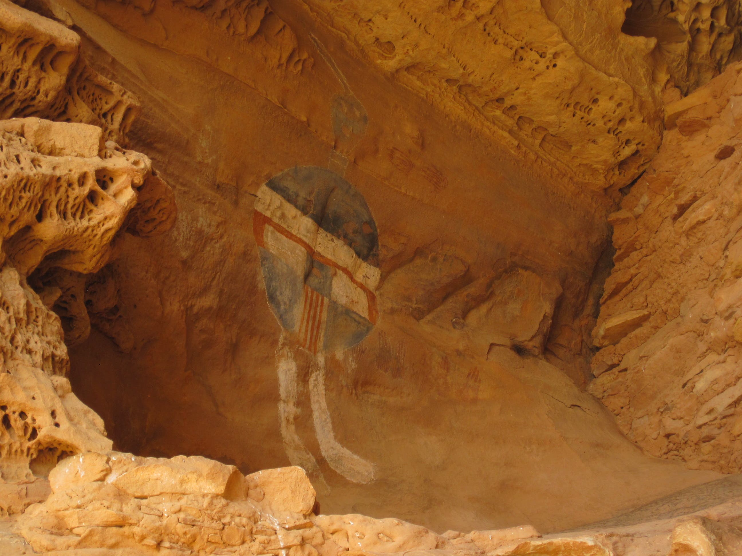
Look left to see another dwelling. Pass the All American Man pictograph.
NEE052
Location: 38.024793, -109.750135
Walk past an area full of cactus.
NEE053
Location: 38.019522, -109.749347
Ruins
NEE054
Location: 38.015948, -109.744657
Arch
NEE055
Location: 38.014123, -109.74429
After the stream crossing, look left across the meadow for views of a dwelling.
NEE056
Location: 38.010573, -109.742642
Skinny arch
NEE057
Location: 38.009632, -109.741496
More ruins
NEE058
Location: 38.006998, -109.741256
Look far right for views of an arch.
NEE059
Location: 37.992411, -109.739911
Ruins
NEE060
Location: 37.99183, -109.739534
Giant dwellings
NEE061
Location: 37.987793, -109.742131
Gate
NEE062
Location: 37.986173, -109.743161
Turn left to camp at SC1 or SC2. On the last day (4.1 miles), follow the overgrown creekbed south.
NEE063
Location: 37.985808, -109.743554
Kirks Cabin
NEE064
Location: 37.983266, -109.745237
Waterfall with pool
NEE065
Location: 37.981428, -109.743606
More rock art
NEE066
Location: 37.961208, -109.729688
Bear left on Salt Creek Trail. Ahead: The lush riparian scenery transitions back to parched desert as the trail gains 1,000 feet in two miles to the rim of Salt Creek Mesa and your shuttle car.
NEE067
Location: 37.949307, -109.706083
Pick up your shuttle car and return to NEE001.
View from Druid Arch
Location: 38.08904, -109.830709
Southeast view from the head of Big Spring Canyon
Location: 38.109339, -109.817361
Peekabo Spring Trail
Location: 38.114571, -109.754491
Angel Arch
Location: 38.051166, -109.75625
View from beneath Angel Arch
Location: 38.051808, -109.756122
Pictographs
Location: 38.039739, -109.763247
All American Man
Location: 38.034506, -109.749035
Upper Salt Creek Canyon
Location: 37.951169, -109.708529