Canyonlands National Park: Alcove Spring to Upheaval Canyon

Although Island in the Sky—the park’s most accessible district—is just an hour’s drive southwest of Moab, you’ll feel like you’re worlds away from civilization as you trek through the bowels of three hiker-dwarfing, 1,000-foot-deep canyons on this 19.3-mile overnight. Bonus: It’s a loop (rare in these parts).
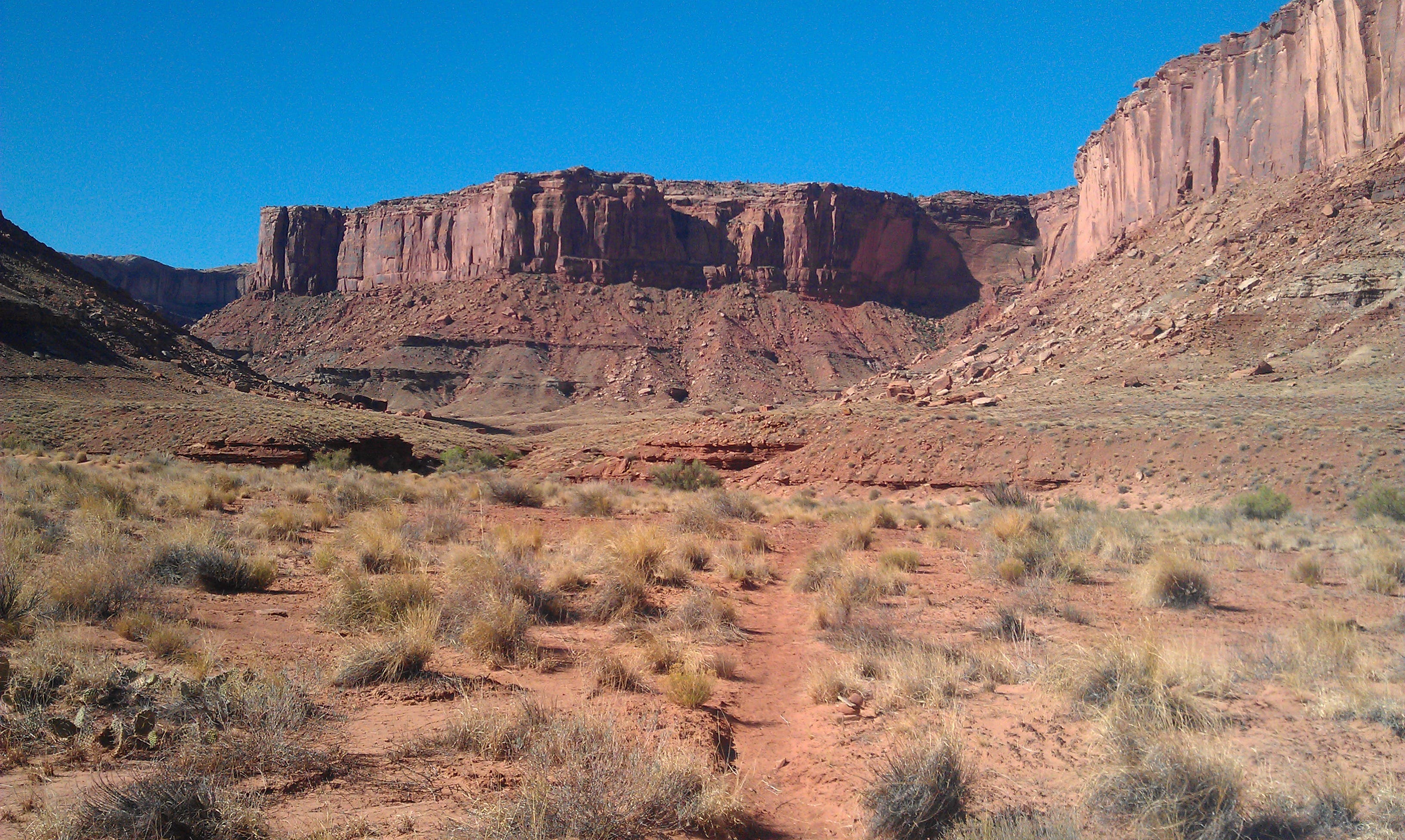
Park at the Upheaval Dome lot and follow the paved road east for 1.2 miles to the Alcove Spring trailhead. At the pull-out, veer left on a hard-packed sand trail that drops off the mesa top into the depths of Trail Canyon. The strenuous descent involves scrambling down ledges, maneuvering across loose rock, and routefinding when the trail grows faint. (Tip: Navigate toward the obvious sandstone fin on the north side of the canyon to avoid being cliffed out.) Scan the ground for the dog-like tracks of coyotes, which congregate at Alcove Spring, a small seep near mile 1.9.
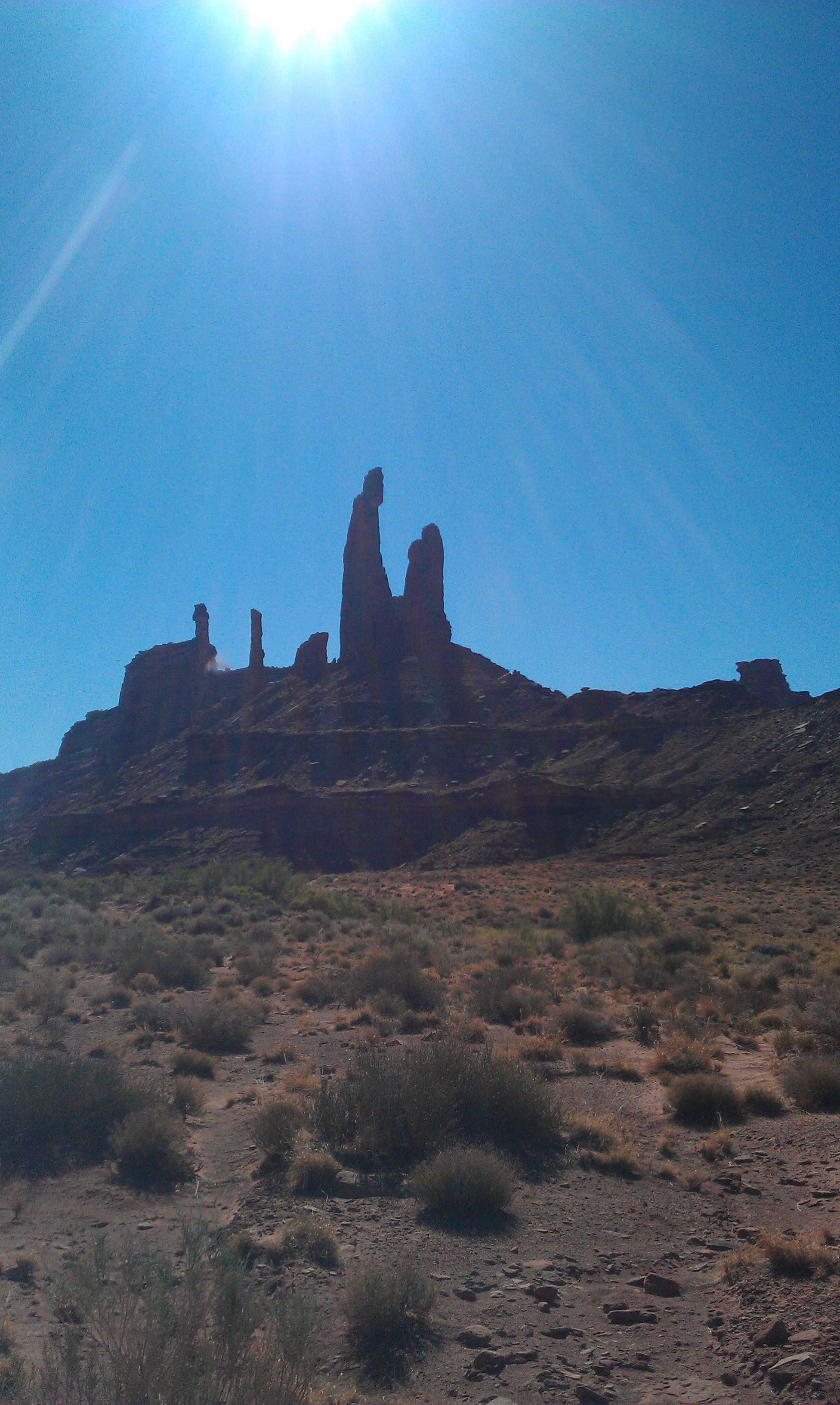
The route hits bottom at mile 2.1; head north 4.5 miles to where Trail Canyon merges with Taylor Canyon at the base of Zeus and Moses, a blood-red, 410-foot-tall pinnacle that resembles a robed man leaning over a child with crossed arms. Turn left into Taylor Canyon and hike west 5.2 miles past vast rock gardens with RV-size boulders that slope up to the base of sheer, fortresslike buttes.
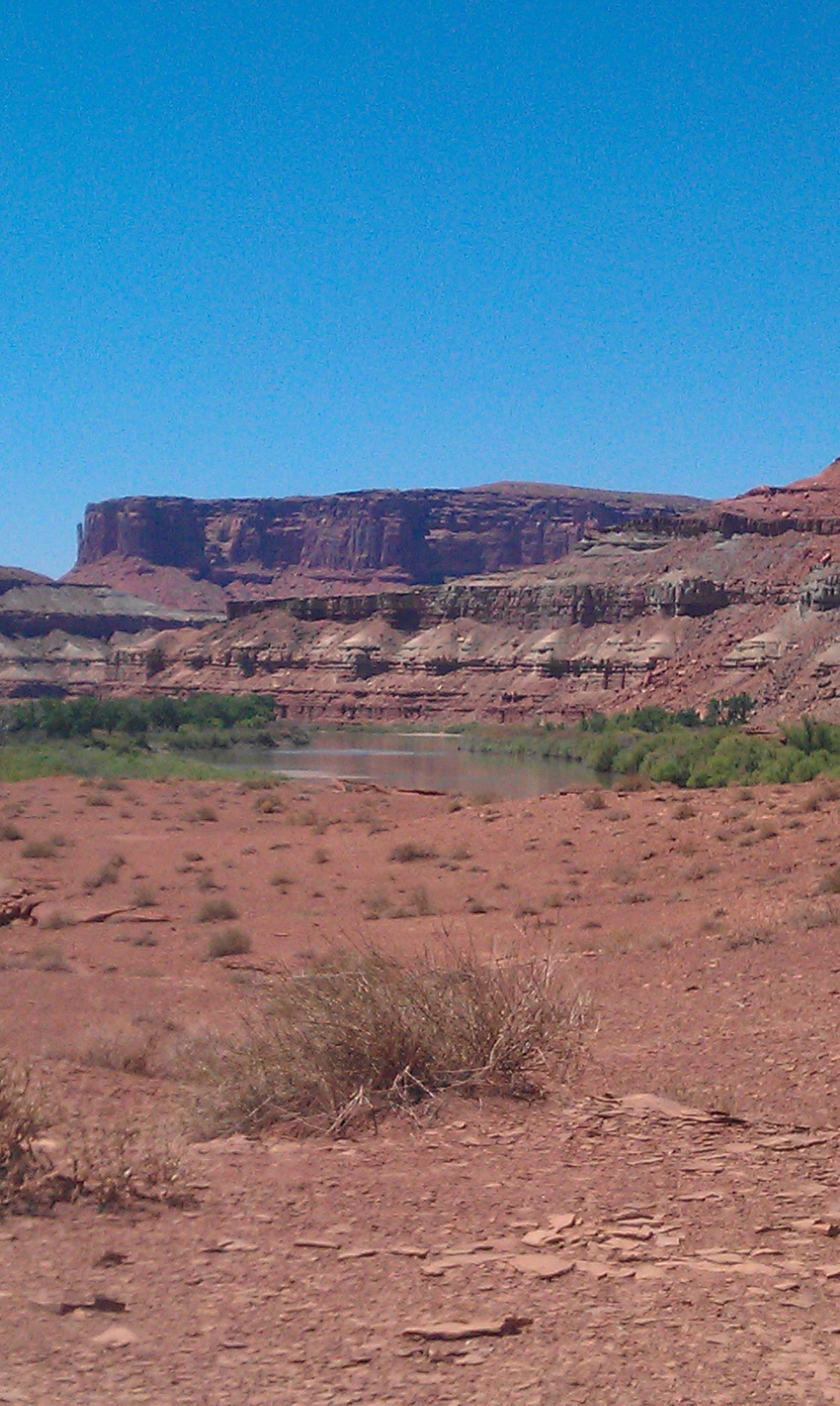
At mile 11.9, continue straight at the Taylor Rim junction and go 50 feet to the Labyrinth campsite ($30; reservations recommended), where the parched desert meets the Green River’s lush banks. Sleep in the designated site above the grassy, cottonwood-dotted river. (Tip: Use a prefilter before purifying the silty water.) The next day, turn right on the White Rim Trail, the park’s famed 100-mile 4WD road (and popular mountain biking route).
Less than a mile later, turn left into Upheaval Canyon and head southeast up the talus-strewn gorge. Expect slow going: The trail fades in and out as it crosses sandpits, rocky Mars-like terrain, and narrow, steep-walled washes. Near mile 16.2, bear right up a tight and twisting wash.
At mile 17.5, the climb ramps up exponentially, gaining 1,300 feet in the final 1.8 miles to the rim. Look out across layered crimson mesas towering above the canyon-cut landscape before closing the loop.
-Mapped by MacKenzie Ryan
TO TRAILHEAD: Head north on US 191 N/Main St. In 11 miles, turn left onto UT 313 W. In 14.6 miles, continue onto Island in the Sky Rd. In 3.6 miles, continue onto CR 142/Shafer Canyon Rd. In 2.3 miles, continue onto Grand View Point Rd. In 7.3 miles, turn right onto Upheaval Dome Rd. Go 4.8 miles and park in the Upheaval Dome lot.


Trail Facts
- Distance: 31.0
Waypoints
UPH001
Location: 38.426379, -109.925553
Park at the Upheaval Dome lot and follow the paved road east for 1.2 miles to the Alcove Spring trailhead. Look for Whale Rock at mile .5 on the left-hand side of the road.
UPH002
Location: 38.423088, -109.908728
At the Alcove Spring pull-out, veer left on a hard-packed sand trail that drops off the mesa top into the depths of Trail Canyon. The strenuous descent involves scrambling down ledges, maneuvering across loose rock, and routefinding when the trail grows faint. (Tip: Navigate toward the obvious sandstone fin on the north side of the canyon to avoid being cliffed out.)
UPH003
Location: 38.428914, -109.907289
Scan the ground for the dog-like tracks of coyotes, which congregate at Alcove Spring, a small seep near mile 1.9.
UPH004
Location: 38.42796, -109.903511
The route hits bottom at mile 2.1; head north 4.5 miles to where Trail Canyon merges with Taylor Canyon.
UPH005
Location: 38.472742, -109.919243
Trail Canyon merges with Taylor Canyon at the base of Zeus and Moses, a blood-red, 410-foot-tall pinnacle that resembles a robed man leaning over a child with crossed arms.
UPH006
Location: 38.475129, -109.919202
Turn left into Taylor Canyon and hike west 5.2 miles past vast rock gardens with RV-size boulders that slope up to the base of sheer, fortresslike
buttes.
UPH007
Location: 38.476337, -109.923104
Pass Taylor campsite
UPH008
Location: 38.478458, -109.938297
Continue straight past a side canyon called The Big Draw.
UPH009
Location: 38.475448, -109.998676
At mile 11.9, continue straight at the Taylor Rim junction and go 50 feet to the Labyrinth campsite ($30; reservations recommended).
UPH010
Location: 38.475126, -110.000033
Labyrinth Campsite: The parched desert meets the Green River’s lush banks at this site. Sleep in the designated site above the grassy, cottonwood-dotted river. (Tip: Use a prefilter before purifying the silty water.) The next day, turn right on the White Rim Trail, the park’s famed 100-mile 4WD road (and popular mountain biking route).
UPH011
Location: 38.468158, -109.998788
Less than a mile past the campsite, turn left into Upheaval Canyon and head southeast up the talus-strewn gorge. Expect slow going: The trail fades in and out as it crosses sandpits, rocky Mars-like terrain, and narrow, steep-walled washes.
UPH012
Location: 38.444576, -109.95659
Near mile 16.2, bear right up
a tight and twisting wash.
UPH013
Location: 38.431172, -109.949152
At mile 17.5, the climb ramps up exponentially, gaining 1,300 feet in the final 1.8 miles to the rim.
UPH014
Location: 38.431256, -109.947513
Crest a false summit. Look out across layered crimson mesas towering above the canyon-cut landscape. Continue climbing east for 1.6 miles to close the loop.
Alcove Spring Trail
Location: 38.423083, -109.908493
Zeus and Moses
Location: 38.47113, -109.919436
Views of the Green River from the Labyrinth Campsite
Location: 38.475126, -110.000033
Upheaval Canyon Trail
Location: 38.46441, -109.994087
Views across Upheaval Canyon
Location: 38.431271, -109.947226