British Columbia, Canada: Nootka Trail

The rugged and rain-lashed shores of Canada’s Pacific Coast harbor some of the continent’s most remote seaside wilderness. On these 22 southbound miles, you’ll see black bears and bald eagles as old-growth stands of red cedar open onto seaweed and rock-studded beaches. If not for buoys and metal tags tacked onto tree trunks, the trail would be indistinguishable from the many wildlife paths that crisscross this coastal paradise.
INFO: $40/person to cross Mowachaht tribal land.
MASTER THE TIDES
•A tide table is indispensable for coastal hikes, where unforeseen high water may trap you short of a campsite or imperil your group with breaking waves.
•Don’t rely on the tide chart from the nearest harbor—the time and height of tides may vary dramatically along a coastline. Before your hike, inquire locally about variation.
•Most of the world’s tides are semidiurnal, with two highs and two lows, about the same height, on a given day. But not everywhere. Along Nootka Island in British Columbia, for example, the two daily lows may vary by five feet or more. You may need the lower low tide to pass a stormy headland.
•The highest water (spring tides) occur around the new and full moon; the lowest (neap ties) are near the half moon.
•The time of high and low water advances about 50 minutes every day. If high tide is at 1 p.m. on Tuesday, it will be about 1:50 p.m. on Wednesday and 4:20 p.m. on Saturday.
•If in doubt, hike past a wave-threatened headland during an outgoing tide.
-Text by John Harlin III and Dougald MacDonald
-Mapped by John Harlin III
Trail Facts
- Distance: 35.0
Waypoints
NTK001
Location: 49.724004, -126.932371
The float plane lands in Louie Bay Lagoon (also called Starfish Bay). Change into your water shoes before wading to shore.
NTK002
Location: 49.723765, -126.932355
Pick up the trail at the southern end of the lagoon and head south to Third Beach. Look for surveyor’s tape (plastic ribbon) that flags the best route for hikers. Note: Unflagged trails are usually black bear trails.
NTK003
Location: 49.718022, -126.936947
After hiking less than an hour through the forest, you’ll catch the first glimpse of the ocean at Third Beach (also called First Beach). If you plan to spend the night here, camp above the driftwood and nearby tide pools. Tip: The fixed ropes in the trees can be used to hang bear bags.
NTK004
Location: 49.717328, -126.9339
To bypass the headlands that border the beach, leave the beach and tackle the steep, sometimes muddy climb that leads to a forest trail (trail entrance is marked with buoys).
NTK005
Location: 49.703487, -126.927774
The route leaves the forest and traces the beach toward Skuna Bay.
NTK006
Location: 49.671766, -126.867843
Skuna Bay: This narrow strip of beach is not nearly as good of a campsite as Calvin Falls, and there may not be water here during dry summers. However, if there are other hikers on the Nootka Trail, chances are Skuna Bay will offer more privacy.
NTK007
Location: 49.657572, -126.841418
Calvin Falls: This waterfall drops roughly 20 feet onto a sandy beach. A popular place to set up camp, the mile-long beach at Calvin Falls offers the best beach camping and the most dependable water (great for bathing). Next, cross the creek below the waterfall (wait until low tide) and trace the beach to Bajo Point; you’ll encounter one stream crossing along this stretch.
NTK008
Location: 49.648862, -126.837137
The packed sand beaches transition to rocky shoreline. Watch your balance as you maneuver across rocks of all shapes and sizes.
NTK009
Location: 49.618179, -126.826622
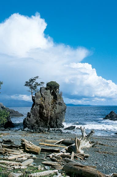
A large offshore sea stack marks Bajo Point. Look for whales, orca, and sea otters resting and hunting among the kelp. (When the tide is low, hikers can walk to Bajo reef.) From here, the route winds across the tidal shelf and crosses pebble beaches. Optional: A tiny trail leads inland to the site of an abandoned Mowachaht village (located in the Aass Indian Reserve); do not disturb anything at this site.
NTK010
Location: 49.611864, -126.793063
It’s slow going along the pebble beaches. Tip: Gaiters help to keep the small stones out of your boots.
NTK011
Location: 49.605899, -126.751585
Wait until low tide to cross Beano Creek (caution: winter storms can change the shape of the drainage). If you’re planning to spend the night, head to the east side of the beach; a few private cabins are located here as well. To refill water bottles, search for fresh pools of water where Beano Creek flows toward the ocean. A spring is located roughly a mile south on the beach. Next: Wait for a low to intermediate tide to continue along the beach.
NTK012
Location: 49.605679, -126.734265
The trickiest stretch of hiking begins an hour east of Beano Creek. At the first of many impassable headlands, take the first (somewhat brushy) or second (fixed rope; marked by buoys) trail up into the woods. Use caution when hiking on the slippery rocks and moss.
NTK013
Location: 49.603924, -126.71957
Callicum Creek: Refill your water reserves if you’re hiking during a dry spell; there may not be any water near the choice cliff-top campsites between here and Maquinna Point. Note: You can also camp at Callicum Creek, though the views are wilder and more spectacular further south.
NTK014
Location: 49.59704, -126.702662
This is the last of the beach camping options (there’s no dependable water source here). Caution: Make sure to camp above the highest tide level.
NTK015
Location: 49.582501, -126.676837
Leave your pack at the trail junction and follow the side trail to Maquinna Point for spectacular coastal views. (Tip: Scrambling leads to the best vistas.)
NTK016
Location: 49.58167, -126.663952
Caves Trail: Take the short side trail to the beach-level caves, which are great shelters for camping during heavy rains (no dependable water source).
NTK017
Location: 49.589592, -126.652783
The Tsa’tsil water crossing is the last major obstacle en route to Friendly Cove. Cross at low tide to avoid the rising tidewaters that rush upstream into Tsa’tsil (water shoes are recommended). Tip: The best place to cross is usually about 150 feet from the mouth; prepare for ankle to waist deep water.
NTK018
Location: 49.590758, -126.620862
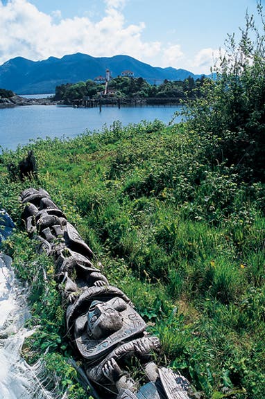
Yuquot Point: Yuquot means “the place where the wind blows in all directions.” This picturesque site was once the summer village for the Mowachaht tribe (often called the Nootka, but Mowachaht is their proper name). Sights: Check out the last totem pole, which lays flat and overgrown just above the beach, and visit the lighthouse, one of the few still staffed in B.C.
NTK019
Location: 49.592725, -126.619629
Friendly Cove: Head to the dock for the ride back to Gold River on the Uchuck III. If you need to contact Air Nootka, Ray Williams, the caretaker and only year-round resident, can place a radio call. Note: There is a $40 per-person fee to the Mowachaht First Nation tribe for crossing several sections of their land.
Seaweed Beaches
Location: 49.603896, -126.718969
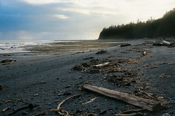
Masses of seaweed, washed ashore by the tide, make beach hiking akin to walking on a slippery sponge.
Driftwood
Location: 49.699434, -126.920843
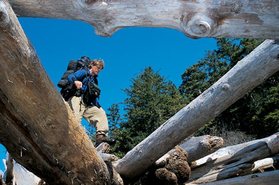
Good balance and non-skid soles are essential when stepping across the great jumbles of driftwood tossed ashore by the Pacific.
Camping near Calvin Creek
Location: 49.658056, -126.843072
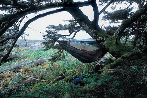
Camping above the high-tide line near Calvin Creek.
A sea stack near Friendly Cove
Location: 49.592075, -126.640906
Totem Pole
Location: 49.590795, -126.619577
The last totem pole in Yuquot once stood at the entrance to a longhouse, or family residence.