Published September 20, 2013 01:54PM
Boundary Waters: Pow-Wow Trail
Scramble around beaver dams, trek through timber wolf territory, and ford countless creeks on this 30.1-mile loop that skirts 15 backcountry lakes in the Boundary Waters Canoe Area Wilderness.
Take two or three days to explore this 30.1-mile lasso loop in the Boundary Waters Canoe Area Wilderness. Pine and cedar trees surround majestic lakes filled with fish, and numerous backcountry campsites dot the trail. Watch for snowshoe hare, grouse, moose, and signs of the largest timber wolf population in the Continental U.S. Be prepared to get your feet wet traversing boggy terrain and fording small streams—there’s only one maintained bridge along the route.
Note: A BWCA permit is required. Make reservations for entry point #86 by calling 877-550-6777.
-Mapped by Steffan Fay
TO TRAILHEAD: From S. 26th Ave. and N. Shore Scenic Dr./MN 61 in Duluth, head northeast on MN 61. In 57 miles, turn left onto MN 1. In 22 miles, turn right onto Wanless Rd. In 0.8 mile, turn left onto Trappers Lake Rd. In 5.8 miles, veer right onto Sawbill Landing Rd. In 2.9 miles, turn left onto NF 369. In 2 miles, continue straight onto NF 379. In 3.6 miles, turn right onto Tomahawk Rd. (toward Forest Center). Follow 1.6 miles to Lake Isabella parking lot.


Trail Facts
- Distance: 44.1
Waypoints
POW001
ADVERTISEMENT
Location: 47.8011703491211, -91.3063659667969
From trailhead parking lot, head west on former railroad bed.
POW002
Location: 47.8005561828613, -91.31494140625
Turn right @ trail sign; head northwest.
POW003
Location: 47.8015213012695, -91.3156433105469
Enter Boundry Waters Canoe Area Wilderness on a straight, old road.
POW004
Location: 47.8079414367676, -91.3196792602539
Pass a campsite next to the Isabella River.
POW005
Location: 47.8080902099609, -91.3195343017578
Cross bridge over the Isabella River (the only maintained bridge on the route).
POW006
Location: 47.8281707763672, -91.3208389282226
Hike through a wetland on a long, narrow mound of dirt and sticks (resembles a beaver dam). The trail is higher than the surrounding marsh for about 0.25 mile. Use caution and take it slowly to avoid wet feet (especially in the spring).
POW007
Location: 47.8317756652832, -91.3214111328125
Turn left @ Y-junction. Hike west toward Fallen Arch Lake.
POW008
Location: 47.8326644897461, -91.3391723632812
Trail passes a beaver dam at the southern end of Fallen Arch Lake. Ahead, trail winds to the west.
ADVERTISEMENT
POW009
Location: 47.8332138061523, -91.3717193603516
Pass a campground at Marathon Lake. The trail veers southwest for the next mile.
POW010
Location: 47.8283309936523, -91.3945541381836
Cross Diana Lake’s outlet on these logs. Be careful; sit down or use hiking poles to avoid a fall.
POW011
Location: 47.8252487182617, -91.4399871826172
Head south, passing a campsite at Campfire Lake.
POW012
Location: 47.8232841491699, -91.4404983520508
Continue straight @ 3-way; the spur trail on the left leads to Quadga Lake.
POW013
Location: 47.8200912475586, -91.4523468017578
Cross Myth Lake outlet and continue hiking west.
POW014
Location: 47.8280830383301, -91.4633255004883
The trail traces the eastern banks of Superstition Lake past an unmarked campsite on the lake’s small peninsula.
POW015
Location: 47.831974029541, -91.4581604003906
Cross Superstition Creek at the north end of the lake. Next, trail veers to the northwest.
POW016
Location: 47.8430976867676, -91.4485702514648
ADVERTISEMENT
The trail passes a very small campsite near Mirror Lake (it’s a long walk down to the water from this site). Continue hiking north.
POW017
Location: 47.8498802185059, -91.447883605957
Pass a beaver dam on Mirror Lake, then veer northeast for 0.5 mile to Path Lake.
POW018
Location: 47.8536376953125, -91.4423065185547
At the southern edge of Path Lake, the trail turns west and traces the lake’s western shore.
POW019
Location: 47.8581657409668, -91.4411697387695
Walk past a large campsite on Path Lake’s level, rocky shoreline.
POW020
Location: 47.8628311157227, -91.4409255981445
Look to the west across Rock of Ages Lake for expansive views of wooded shoreline. Next, the trail winds to the north toward Horseshoe Lake.
POW021
Location: 47.8647842407227, -91.4406585693359
Travel past a campsite overlooking Rock of Ages Lake. A small hill borders the site, offering great views of forest and surrounding granite hills.
POW022
Location: 47.8787002563477, -91.4380645751953
Skirt the southeast corner of Lake Three, then head north.
POW023
Location: 47.8802146911621, -91.4375457763672
Fallen trees make a rustic stream crossing.
POW024
Location: 47.8818283081055, -91.4361038208008
ADVERTISEMENT
Cedar trees flank the trail around this well-used portage. Continue straight @ 4-way intersection, heading north.
POW025
Location: 47.882396697998, -91.4303283691406
Savor the last views of Horseshoe Lake, then turn left and head northeast.
POW026
Location: 47.8747863769531, -91.3966369628906
Go straight and cross portage between North Wilder and Harbor Lakes.
POW027
Location: 47.8659248352051, -91.3893356323242
Cross watercourse between North and South Wilder Lakes.
POW028
Location: 47.8642044067383, -91.3862915039062
This campsite on South Wilder Lake is a good place to spend your second night. Ahead, trail rounds to the east, paralleling the lake.
POW029
Location: 47.8604507446289, -91.3224716186524
Turn right @ T-junction onto a long-abandoned logging road.
POW030
Location: 47.8458862304688, -91.3020706176758
Turn right @ T-junction. Ahead: Continue southwest to Waypoint 7 and turn left @ Y-junction. Retrace route to trailhead.
Trail Junction
Location: 47.8005638122559, -91.3150100708008
Boundary
Location: 47.8015670776367, -91.3156433105469
BWCA boundary sign at entry point # 86.
Isabella Campsite
Location: 47.8079414367676, -91.3196792602539
Campsite near Isabella River.
Isabella River
Location: 47.8080940246582, -91.3195343017578
Isabella River.
Isabella River
Location: 47.8080940246582, -91.3195343017578
Isabella River.
Trail
ADVERTISEMENT
Location: 47.8176345825195, -91.318717956543
You’ll hike this section of trail in both directions.
Wetlands
Location: 47.8281707763672, -91.3209457397461
Raised Trail
Location: 47.8296699523926, -91.3210525512695
This raised trail helps keep you dry, if you’re careful.
Trail Junction
Location: 47.8318099975586, -91.3214797973633
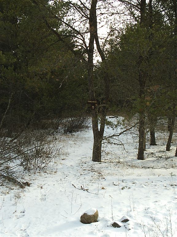
The loop begins (and ends) here.
Tracks
Location: 47.8322639465332, -91.3291625976562
BWCA has one of the last substantial timber wolf populations in the Continental United States.
Beaver Dam
Location: 47.8325614929199, -91.3392486572266
Beaver dam at southern end of Fallen Arch Lake.
Marathon Lake
Location: 47.8332023620606, -91.3716888427734
Marathon Lake has a campground and plenty of wide, open space.
Stream Crossing
Location: 47.8283843994141, -91.3946990966797
Crossing the outlet of Diana Lake.
Diana Lake
Location: 47.8285980224609, -91.39501953125
Diana Lake.
Campfire Lake Campsite
Location: 47.8252792358398, -91.4401931762695
Wetlands and Lake
Location: 47.8200340270996, -91.4524002075195
Just one of 15 peaceful lakes you’ll pass on this trail.
Superstition Lake
Location: 47.8281707763672, -91.4633178710938
Superstition Lake.
Superstition Lake
Location: 47.831916809082, -91.4581832885742
Superstition Lake.
Beaver Dam
Location: 47.8497924804688, -91.4480133056641
ADVERTISEMENT
This beaver dam is part of the trail.
Path Lake
Location: 47.8539695739746, -91.4425506591797
Path Lake.
Path Lake Campsite
Location: 47.8582496643066, -91.4412689208984
The campsite at Path Lake is a big site on level, rocky shoreline.
Rock of Ages Lake
Location: 47.8626403808594, -91.4409484863281
Westward view from the trail above Rock of Ages Lake.
Rock of Ages Lake
Location: 47.8630676269531, -91.4413757324219
Panorama video of Rock of Ages Lake.
Rock of Ages Campsite
Location: 47.8647804260254, -91.4406280517578
Campsite on Rock of Ages Lake.
Lake Three
Location: 47.8786964416504, -91.4381637573242
One of the largest lakes on the route, Lake Three is peppered with islets large and small.
Stream Crossing
Location: 47.8801956176758, -91.4378433227539
These fallen trees make a rustic stream crossing.
Portage
Location: 47.8820152282715, -91.4361267089844
Cross this portage between Lake Three and Horseshoe Lake.
Horeshoe Lake
Location: 47.8824424743652, -91.4304580688476
This will be your last glimpse of Horseshoe Lake.