Published September 20, 2013 01:55PM
Boulder, CO: Mount Sanitas via Mount Sanitas Trail
Navigate an obstacle course of countless log steps, steep rock slabs, and giant boulders on this 2.8-mile hike to a small summit overlooking Boulder.
At first glance, the 6,863-foot summit of Mount Sanitas may seem modest compared to the 8,000-foot peaks dotting the ridgeline west of Boulder, but this 2.8-mile hike (or trail run) packs plenty of punch for a short outing.
Start at the west end of Mapleton Avenue and hike northwest along a brief, 0.2-mile flat stretch up the Sanitas Valley Trail. From here, you’ll navigate a steep obstacle course of log steps, rock slabs, and giant boulders (and climb 1,100 feet in one mile) past overlooks of both the foothills and mountain canyons to the west. At Sanitas’ small summit, take in expansive views of Boulder and the eastern plains before turning around and retracing the steep and rocky route back to Mapleton Avenue.
-Mapped by Kim Phillips
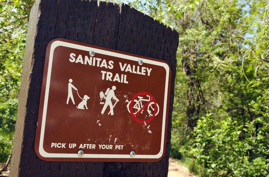
Mount Sanitas Trailhead

Credit: Kim Phillips
First trail junction

Continue straight on Mount Sanitas Trail. Credit: Kim Phillips
ADVERTISEMENT
Rock outcrops

Credit: Kim Phillips
Log steps

Credit: Kim Phillips
Trail views

Credit: Kim Phillips
ADVERTISEMENT
Open woods

Credit: Kim Phillips
Steep steps

Credit: Kim Phillips
Climbing access

Credit: Kim Phillips
ADVERTISEMENT
Rocky overlook

Credit: Kim Phillips
Wildflowers

Credit: Kim Phillips
Wildflowers

Credit: Kim Phillips
ADVERTISEMENT
Views to the southwest

Credit: Kim Phillips
Views of Boulder

Credit: Kim Phillips
Wildflowers

Credit: Kim Phillips
ADVERTISEMENT
Rocky ascent

Credit: Kim Phillips
Views to the south

Credit: Kim Phillips
Rocky terrain

Wildflowers punctuate the rocky terrain. Credit: Kim Phillips
ADVERTISEMENT
Summit views

Views stretch across Boulder from the summit of Mount Sanitas. Credit: Kim Phillips
Trail Facts
- Distance: 2.3
Waypoints
SAN001
ADVERTISEMENT
Location: 40.0205688476562, -105.291694641113
Walk west along Mapleton Avenue for roughly 750 feet to the Mount Sanitas Trailhead on the right side of the road.
SAN002
Location: 40.0207748413086, -105.294143676758
Leave the sidewalk and bear right onto the marked Mount Sanitas Valley Trail. Walk northwest on wide, dirt path.
SAN003
Location: 40.0212326049805, -105.29524230957
Continue straight @ signed 4-way junction onto the Mount Sanitas Trail (Mount Sanitas Valley Trail veers to the right). Ahead, trail cuts through a grassy field punctuated with rocky outcroppings.
SAN004
Location: 40.0214729309082, -105.295860290527
Keep straight @ 4-way.
SAN005
Location: 40.0215759277344, -105.296569824219
Climb up several log steps shaded by trees, then cross a short wooden footbridge. Ahead, the trail winds to the west through open pine forest.
SAN006
Location: 40.0214157104492, -105.29761505127
The steep, rocky ascent begins. Tackle a series of log and rock steps that climb up the ridgeline.
SAN007
Location: 40.0223007202148, -105.298095703125
ADVERTISEMENT
Pass a popular bouldering site on the right. Continue climbing north.
SAN008
Location: 40.022834777832, -105.298561096191
Pass another climbing access on right. Giant sandstone outcrops flank the trail on the right.
SAN009
Location: 40.023738861084, -105.298698425293
Continue steep climb up ridge.
SAN010
Location: 40.0256271362305, -105.299797058105
The trail skirts a massive boulder on the left. Stand on top of this rock overlook for views into Sunshine Canyon to the west.
SAN011
Location: 40.0266990661621, -105.300285339355
This ridgeline vantage point offers expansive views east across Boulder.
SAN012
Location: 40.0279388427734, -105.301376342773
Climb steep rock steps; vibrant wildflowers pepper the grassy slopes that border the trail to the east.
SAN013
Location: 40.0288734436035, -105.302352905273
Squeeze through a narrow gap in boulders that block the trail, then climb northwest up rock slabs dotted with seasonal wildflowers.
SAN014
Location: 40.0298080444336, -105.303062438965
Trail briefly curves around the west side of the mountain. Continue hiking northwest up ridge.
SAN015
Location: 40.0331993103027, -105.305114746094
ADVERTISEMENT
The final 500-foot stretch to the summit travels up another set of rock steps; pine trees flank the trail.
SAN016
Location: 40.0344009399414, -105.305297851562
Mount Sanitas (6,863 ft.): A metal rod marks this small, rocky summit. Rest your legs while taking in the expansive views of Boulder and the eastern plains. Retrace route back to trailhead.
Mount Sanitas Trailhead
Location: 40.0207672119141, -105.294143676758
First Trail Junction
Location: 40.0212249755859, -105.295234680176
Continue straight on Mount Sanitas Trail.
Rock Outcrops
Location: 40.0213661193848, -105.295593261719
Log Steps
Location: 40.0215644836426, -105.296501159668
Trail Views
Location: 40.0215301513672, -105.296859741211
Open Woods
Location: 40.0214614868164, -105.297149658203
Steep Steps
Location: 40.0214042663574, -105.297607421875
Climbing Access
Location: 40.0228233337402, -105.298545837402
Rocky Overlook
Location: 40.0256500244141, -105.299797058105
Wildflowers
Location: 40.0259170532227, -105.299873352051
Wildflowers
Location: 40.0263137817383, -105.300003051758
Views to the Southwest
Location: 40.0265007019043, -105.300155639648
Views of Boulder
Location: 40.0266990661621, -105.300285339355
Wildflowers
Location: 40.0275115966797, -105.301063537598
Rocky Ascent
Location: 40.0279197692871, -105.30135345459
Views to the South
Location: 40.0283851623535, -105.301948547363
Rocky Terrain
Location: 40.0290946960449, -105.302612304688
Wildflowers punctuate the rocky terrain.
Summit Views
Location: 40.0343933105469, -105.305305480957
ADVERTISEMENT
Views stretch across Boulder from the summit of Mount Sanitas.