Boulder, CO: Lost Lake (Winter Route)

This 5-miler offers an easy-going alternative to Boulder’s higher-intensity hikes. Begin by following Hessie Road for a low-grade climb to views of Eldora Ski Area and the Indian Peaks Wilderness above Lost Lake. This route begins where winter road maintenance ends on Hessie Road (1.3 miles from the Hessie Trailhead), offering a peaceful and pretty addition to the trail.
Pass trailhead signs on your left and follow the Devil’s Thumb Trail #902. Stay left at the 3-way junction with the Devil’s Thumb Bypass before turning left again at the Lost Lake Trail #813. The trail switchbacks gently uphill and crosses several bridges as it follows Boulder Creeks South Fork before a final uphill push lands at the lakeshore.
There are 8 designated campsites around the lake and well-worn, user-created trails to follow around its shore. Tip: This popular and easy-to-access trailhead can be overrun on busy weekends. Park only in designated areas, and be prepared for a little longer walk if necessary to avoid a costly parking ticket.
-Mapped by Genny Fullerton
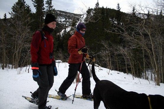
Snowshoers

Winter hikers may find snowshoes useful on the trail, but depending on conditions, it may be possible to proceed without them. ©Shannon Davis
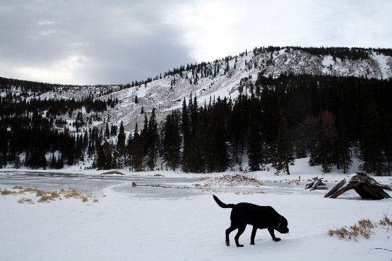
Lost Lake

The frozen surface of Lost Lake. ©Shannon Davis
Trail Facts
- Distance: 4.3
Waypoints
LOS001
Location: 39.9507294, -105.5818024
Park in the designated parking areas along Hessie Road. The road to the Hessie Trailhead isn’t plowed in the winter and accounts for the extended trip length.
LOS002
Location: 39.9515495, -105.594902
Stay left @ Y-junction to continue on Hessie Road.
LOS003
Location: 39.9546394, -105.6031036
At the Hessie Trailhead, cross a bridge and walk past the trailhead sign on your left. Begin the trail portion of this route on the Devil’s Thumb Trail toward Lost Lake.
LOS004
Location: 39.9547005, -105.6051025
Stay left on the main trail for a gradual climb up several switchbacks.
LOS005
Location: 39.955471, -105.6080017
Pause to enjoy the great view of Chittenden Mountain to the northwest and Ute Mountain to the southeast.
LOS006
Location: 39.9554901, -105.612999
Stay left @ 3-way junction, passing the Devil’s Thumb Bypass Trail on your right and crossing a small bridge.
LOS007
Location: 39.9544182, -105.6166
Pass some big, flat inviting rocks on the right. At the Y-junction, turn left again and follow signs for Lost Lake.
LOS008
Location: 39.9529419, -105.6166992
Cross one more bridge on the final climb to Lost Lake.
LOS009
Location: 39.9511795, -105.6173019
Arrive at Lost Lake for a sweet view of the Indian Peaks Wilderness Area. There are 8 designated campsites around the lake; user-created trails crisscross the area. Follow the same route back to the trailhead.
Snowshoers
Location: 39.9558724, -105.6069374
Winter hikers may find snowshoes useful on the trail, but depending on conditions, it may be possible to proceed without them. ©Shannon Davis
Lost Lake
Location: 39.9510694, -105.6168938
The frozen surface of Lost Lake. ©Shannon Davis