Updated February 28, 2024 11:28AM
Flatirons Loop Trail
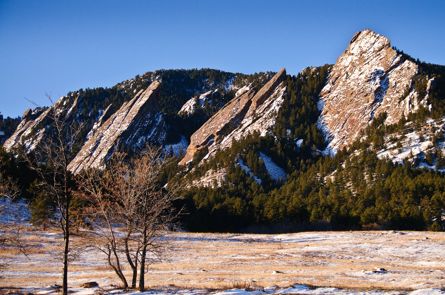
Get up-close and personal with Boulder's signature Flatirons on this popular 2.9-mile loop that leads to a rocky perch high above Chautauqua Park.
Taken at Latitude/Longitude:39.998781/-105.282908 Near Boulder Colorado United States <a href="http://www.geonames.org/maps/google_39.998781_-105.282908.html"> (Map link)</a>
Boulder’s Flatirons Loop Trail is a 2.9-mile local favorite in Chautauqua Park with the greater Denver area extending to the east and the miles of untamed wilderness stretching to the west. Enjoy stunning views of 360-degree views of the surrounding landscapes: metropolitan Denver, a sweeping natural rock amphitheater, and the jagged peaks of the Flatirons. This hike will make you feel like you’re truly straddling the edge of civilization.
Trail Facts
- Distance: 2.9-mile loop
- Elevation: 700 feet
- Difficulty: Intermediate with rock scrambling
- Dog-friendly: Yes
The Route
This quick overview breaks down the Flatirons Loop Trail in sections and gives hikers a good idea of what to expect along their journey from the Ranger Cottage at the hike’s start its highest point and back.
-Mapped by Brian Beer and Kim Phillips
ADVERTISEMENT
Ranger Cottage to Bluebell Shelter

From the Ranger Cottage, follow Bluebell Road (an emergency access road) for an easy climb through a golden meadow. The paved path climbs gently for about 0.5 miles as it meanders through a rolling meadow. After half a mile, bear right onto the narrow Royal Arch Trail. There are restrooms about 100 feet past the junction. Follow the Royal Arch Trail up to a 4-way junction and the Bluebell Shelter, a perfect spot to stop for a picnic lunch.
Bluebell Shelter to Boulder Field

Follow the Royal Arch Trail across a small boardwalk as the trail narrows and you fully leave the meadow and enter a dense pine forest. At the Y-junction, bid adieu to the Royal Arch Trail and bear right to continue onto the Bluebell-Baird Trail. After about 500 feet, the path becomes rockier and steeper. The trees clear as the path weaves through a rugged boulder field.
Boulder Field to Boulder Views

Catch your first panoramas of the expansive eastern plains as you continue along the Bluebell-Baird Trail toward the junction with the First-Second Flatiron Trail. At the intersection, bear left onto First-Second Flatiron Trail and prepare to climb a series of moderate yet rocky switchbacks. After the trail delves into a series of moderate switchbacks, the trees break to reveal a magnificent sandstone rock face that offers plenty of bouldering opportunities. About 50 feet further, trees frame a postcard-like vista of the CU campus.
ADVERTISEMENT
Postcard-like views of Boulder to the Hike’s Highpoint

Half a mile later, you’ll reach the hike’s highpoint—the saddle between the monolithic First Flatiron and Sunset Rock. The area offers views of a sweeping natural rock amphitheater to the west. Hikers with an insatiable appetite for adventure can climb even higher by bouldering up the magnificent rock formations that form the saddle’s frame.
Highpoint to Ranger Cottage

Backtrack to the Bluebell-Baird Trail and bear left to finish the clockwise loop back to the trailhead following signs to the Ranger Cottage. The gradually thinning trees open up to a gentle meadow as the trail widens and smooths out. Follow the path back to the Ranger Cottage and parking area.
Flatirons Loop: Additional Photos


For more great Boulder hikes, check out Outside’s Best Hikes in Boulder.