Boulder, CO: Bear Peak and South Boulder Peak

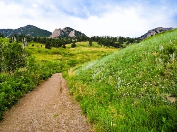
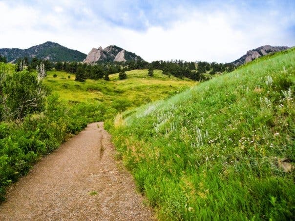
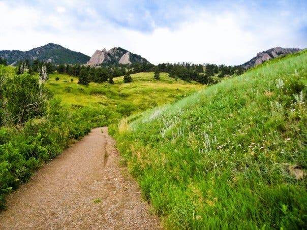
Put your lungs and quads to the test on this 8.3-mile loop that links two rocky summits high above Boulder. The route starts at a small, neighborhood trailhead along Bear Mountain Drive. Follow the dirt path 400 feet to a trail junction; turn left onto a wide, well-maintained trail that climbs gently toward the base of the mountains. Take in views of rolling hills and massive sandstone rock formations. Less than a mile later, bear left onto the Mesa Trail.
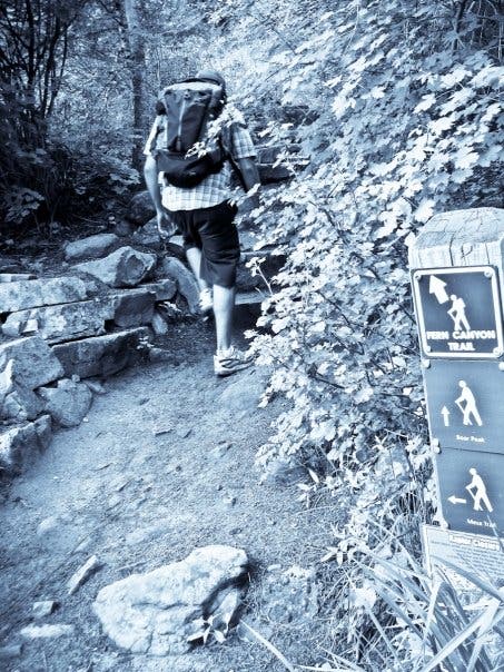
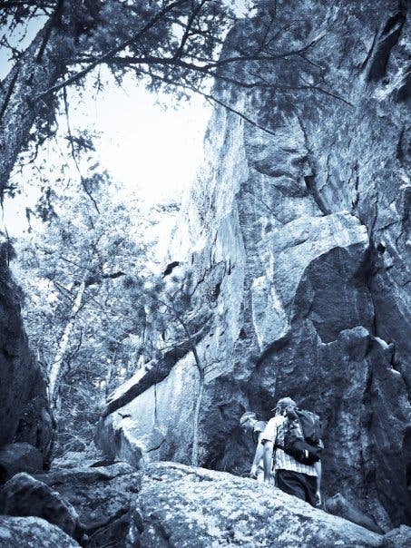
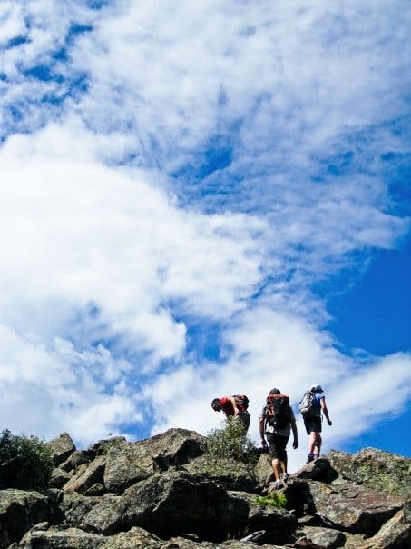
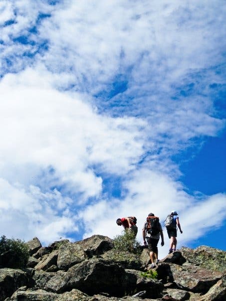
After 1.5 miles, turn right onto Fern Canyon Trail and start the stiff ascent up the trail’s namesake canyon. Prepare for an onslaught of steep rock steps and intermittent switchbacks as the route climbs past giant sandstone slabs and lush greenery. After 2.3 miles, crest a small saddle overlooking Bear Canyon. Catch your breath, then hike south for the remaining 0.4-mile stretch to Bear Peak’s 8,461-foot summit. (The final 300-foot stretch to the summit will require hikers to scramble up jumbled boulders and maneuver across an exposed ridge.)
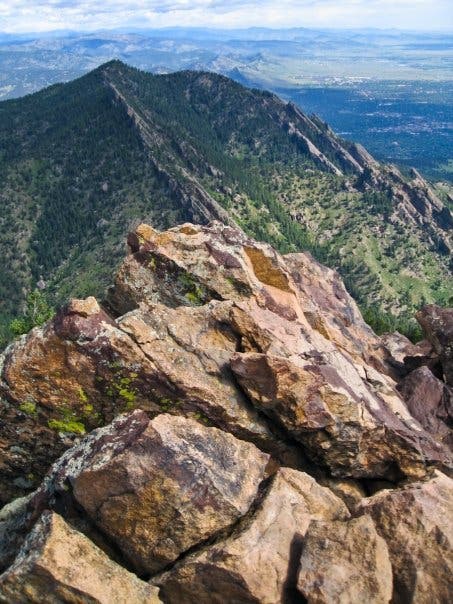
Soak up the dramatic views from the top of this rocky perch, then descend 100 feet to a signed, but easy-to-miss junction. Turn left and descend the rocky backside of Bear Peak. The trail levels as it crosses the saddle connecting Bear Peak to South Boulder Peak, then climbs steeply to South Boulder Peak, a 8,549-foot peak covered with massive boulders. Find a spot to sit and admire the contrasting views: the mountains extend to the northwest and the plains to the east.
Return to the saddle and turn right at the 3-way junction for a steep descent into Shadow Canyon. At mile 4.6, continue straight at another 3-way junction and leave Shadow Canyon. The next 2 miles follow the Mesa Trail north to a T-junction (mile 6.7). Turn left and head west 350 feet to the junction with Fern Canyon Trail. Turn right and retrace your route back to the trailhead.
-Mapped by Kim Phillips
PLAN IT
MAP:
>> View a trail map of the area at OSMP Trail Map.
>> Order a custom map of this route by selecting the “Print MyTopo” option in the left-hand menu bar.
>> Order the USGS topo quads listed above at store.usgs.gov.
CONDITIONS: Check weather at Boulder, CO (80306) Weather
INFO: For more information, go to the Boulder Open Space and Mountain Parks website.
CONTACT: P.O. Box 791, Boulder, CO 80306; (303) 441-3440
OTHER RESOURCES
GEAR
Neptune Mountaineering, Inc.
633 South Broadway #A
Boulder, CO
(888) 499-8866
neptunemountaineering.com
REI
1789 28th St.
Boulder, CO
(303) 583-9970
rei.com
RESTAURANTS
Southern Sun Pub & Brewery
627 South Broadway St.
Boulder, CO
(303) 543-0886
mountainsunpub.com
Tandoori Grill
619 South Broadway St.
Boulder, CO
(303) 543-7339
South Side Walnut Cafe
673 South Broadway St.
Boulder, CO
(720) 304-8118
walnutcafe.com


Trail Facts
- Distance: 13.4
Waypoints
BSB001
Location: 39.974625, -105.266836
From the trailhead next to Bear Mountain Drive, hike southwest on the dirt trail.
BSB002
Location: 39.974384, -105.267367
Pass an interpretive sign on the left. The trail winds northwest toward the first trail junction.
BSB003
Location: 39.974814, -105.267928
Turn left @ T-junction, heading southwest on a wide, well-maintained trail.
BSB004
Location: 39.975352, -105.281671
Bear left @ Y-junction onto the Mesa Trail.
BSB005
Location: 39.973589, -105.283739
Continue straight @ 3-way junction.
BSB006
Location: 39.97112, -105.283501
Bear left and follow the switchback to the south.
BSB007
Location: 39.969496, -105.283326
Turn left onto Fern Canyon Trail.
BSB008
Location: 39.965516, -105.285577
The trail enters Fern Canyon, a lush canyon flanked by towering slabs of sandstone. Prepare your quads for a stiff climb up countless rock steps.
BSB009
Location: 39.965609, -105.292368
Crest a small saddle overlooking Bear Canyon. Catch your breath, then hike south for the remaining 0.4-mile stretch to Bear Peak’s summit.
BSB010
Location: 39.961029, -105.294825
Scramble up jumbled boulders and maneuver across an exposed ridge to the 8,461-foot summit of Bear Peak.
BSB011
Location: 39.960219, -105.295152
Bear Peak (8,461 ft.): Dramatic views extend in every direction from the top of this rocky perch. Next, descend 100 feet to a signed, but easy-to-miss junction.
BSB012
Location: 39.960502, -105.295093
Turn left and descend the rocky backside of Bear Peak.
BSB013
Location: 39.956604, -105.297174
The trail levels as it crosses the saddle connecting Bear Peak to South Boulder Peak. Continue straight @ 3-way junction and start the steep climb to South Boulder Peak.
BSB014
Location: 39.953677, -105.299342
South Boulder Peak: The summit of this 8,549-foot peak is formed from massive boulders. Find a spot to sit and admire the contrasting views: the mountains extend to the northwest and the plains to the east. Return to Waypoint 13 and turn right for a steep descent into Shadow Canyon.
BSB015
Location: 39.951941, -105.293355
Peek through the trees for views of Devils Thumb on the left.
BSB016
Location: 39.946027, -105.28695
Continue straight, heading east. Ahead, the trail leaves Shadow Canyon and winds north on the Mesa Trail.
BSB017
Location: 39.951559, -105.282015
Continue on the Mesa Trail.
BSB018
Location: 39.953603, -105.279982
Continue on the Mesa Trail.
BSB019
Location: 39.958627, -105.280169
Continue straight @ 3-way, heading north.
BSB020
Location: 39.964404, -105.279338
Bear left, heading northwest.
BSB021
Location: 39.969412, -105.281982
Turn left @ T-junction, heading west. Next, the trail reconnects with Waypoint 7. Follow the same route back to the trailhead.
Bear Canyon
Location: 39.973141, -105.272262
Bear Canyon
Location: 39.973067, -105.273195
Bear Canyon
Location: 39.974168, -105.275041
Fern Canyon Trail
Location: 39.969498, -105.283227
Fern Canyon
Location: 39.965346, -105.286907
Bear Peak
Location: 39.96047, -105.295085
Bear Peak
Location: 39.960406, -105.295096
Bear Peak
Location: 39.960311, -105.29512
Bear Peak
Location: 39.960221, -105.29512
South Boulder Peak
Location: 39.954392, -105.298837
South Boulder Peak
Location: 39.953693, -105.299224
Mesa Trail
Location: 39.955741, -105.279778