Published October 15, 2019 11:26PM
Score Mountaintop Views on the Bondcliff and Lincoln Woods Trails
Find quiet eastern forests and expansive vistas on this two-day, 21.8-mile trek through the Pemigewasset Wilderness.
'Harry Lichtman'
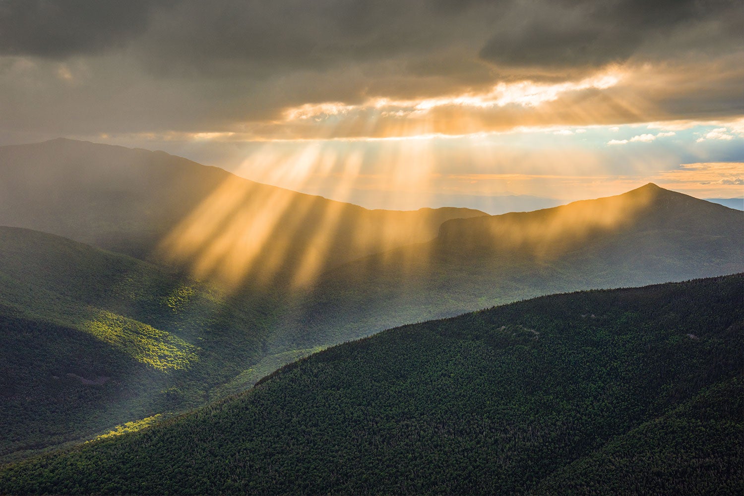
It’s not the climbing that takes my breath away. It’s the way that the trail, enclosed by northern hardwoods for miles, suddenly pops out above them, and there it is: every peak, valley, and forested hill in the Pemigewasset Wilderness, with the summit of Mt. Washington in the distance and not a single sign of civilization in between. It goes on like this for a mile atop Bondcliff, and the easy footing means I frequently swivel around and see all the White Mountain peaks I have climbed, and all the ones I’ve yet to. First is 4,540-foot West Bond, just a mile up the way, which hangs out over the void between here and Franconia Ridge. I push up the trail. I’ve got a date with a sunset.
Turn-by-turn from the Lincoln Woods Trailhead
1) Take the Lincoln Woods Trail 4.8 miles north and east along the East Branch Pemigewasset River to an intersection.
2) Turn north (hiker’s left) onto the Bondcliff Trail and follow it 5.4 miles across 4,265-foot Bondcliff Mountain and 4,698-foot Mt. Bond. There’s a short scramble before you pop above treeline on Bondcliff that locals jokingly call the Hillary Step.
3) Veer .5 mile west on the West Bond Spur Trail to the 4,540-foot summit of West Bond. From the summit, there’s a good view of Lincoln Slide, an avalanche scar down the west face of Mt. Lincoln along Franconia Ridge.
4) Back on the main path, continue .1 mile on the Bondcliff Trail to the short spur to your camp at the Guyot Campsite and Shelter.
5) Retrace your steps 10.4 miles (if skipping a second visit to the top of West Bond) to return to the trailhead.
ADVERTISEMENT
Campsite: Guyot Campsite and Shelter
A .2-mile spur off the Bondcliff Trail delivers you to the Guyot Campsite at mile 11.4. There are four single-tent platforms, two double-tent platforms, and a shelter that sleeps 12 (first-come, first-serve; $10/person per night from Memorial Day to Columbus Day). Latecomers are asked to share tent platforms or camp in an overflow zone which makes for a long schelp to water. Dispersed camping and sleeping in the alpine zone are both prohibited (the latter is OK if there’s 2 feet of snow on the ground).
Fall Colors
Any of the hardwood species in the Pemi is a showstopper in early October, but taken together, they’re almost garish. Look for paper birch (yellow), white ash (yellow fading to purple), black cherry (yellow and orange), red maple (red-orange and yellow), and red oak (dark red) in one of the Northeast’s prettiest displays of fall colors.
Trail Magic
Pack some extra candy bars. The Guyot Campsite is a popular stopping point for AT thru-hikers, and the ones that are still around in fall are the last of the northbound class and still have 357 miles to go to reach Katahdin.
ADVERTISEMENT
Make it Longer
This hike represents the first leg of the 31-mile Pemigewasset Loop, one of New Hampshire’s premier routes. Instead of heading back from Guyot, continue on the AT and Franconia Ridge Trail to climb six additional 4,000-footers, including the peaks of Franconia Ridge, before ending back at Lincoln Woods trailhead. Set aside two nights for the trip.
DO IT Trailhead Lincoln Woods (44.0639, -71.5876); 5 miles east of Lincoln off NH 112E Season June to November Permit None