Published September 20, 2013 02:37PM
Boise: Tripod Peak
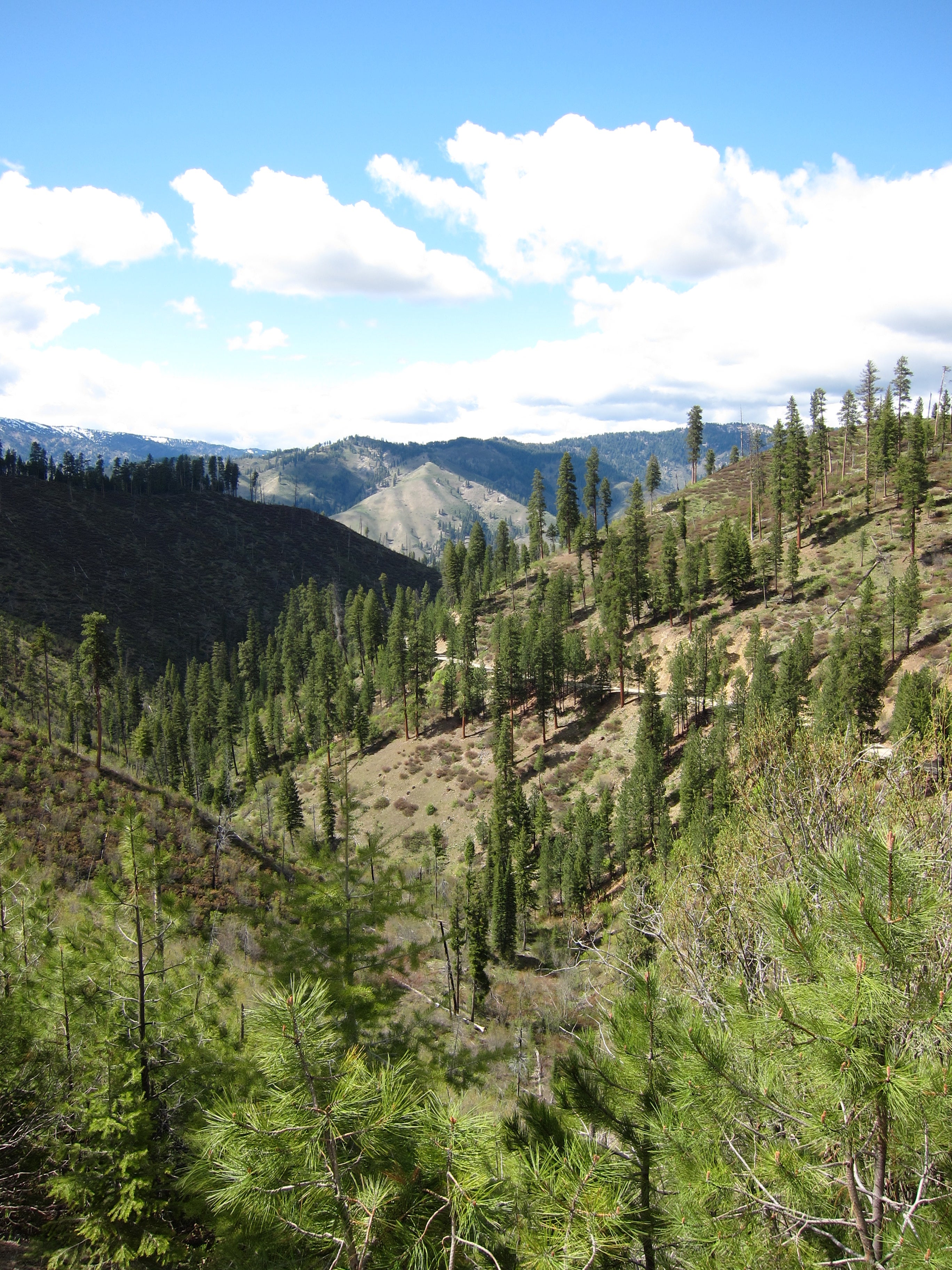
Travel 12 miles through dense evergreen groves and wildflower-dotted meadows to a lonesome fire outpost overlooking Boise National Forest.
'Stephen Hanafin'
Trail Facts
- Distance: 10.0
- Miles from city center: 66
Waypoints
TPT001
Location: 44.3222465515137, -116.146537780762
From trail sign, head NW along narrow road
TPT002
Location: 44.323802947998, -116.147834777832
Turn R onto West Mountain Trail; steep descent into mixed evergreens
TPT003
Location: 44.327808380127, -116.145050048828
Cross streamlet of Sage Hen Creek
TPT004
Location: 44.3311157226562, -116.142059326172
Forage two more side creeks
TPT005
Location: 44.3335304260254, -116.138519287109
Path exits forest into a wildfl ower-splashed meadow; swing N
TPT006
Location: 44.3476448059082, -116.135101318359
Cross another meadow. Views reach to Tripod Peak, today’s goal. Look for the white, wooden lookout tower perched on summit
TPT007
Location: 44.3597793579102, -116.124206542969
Stay L; trail follows a well-worn 4WD road for next half-mile
TPT008
Location: 44.366584777832, -116.121726989746
Leave road for narrow trail on L; keep N
TPT009
Location: 44.3726272583008, -116.124183654785
Swing W; 2 small creeks cut across trail
TPT010
Location: 44.3760452270508, -116.135757446289
Pass collapsed log cabin on L; ascend hill, then turn R @ Y
TPT011
Location: 44.3797950744629, -116.133804321289
ADVERTISEMENT
Go R @ Y onto Tripod Peak Trail; steep summit climb ahead. Rest and take photos at the several granite outcrops
TPT012
Location: 44.3840255737305, -116.12841796875
Tripod Peak (8,082 ft.): Forested ridgelines fade away toward countryside; look N to fi nd Cascade Reservoir; retrace steps