Updated April 1, 2024 03:46PM
Sample The Pinhoti Trail On This 17-Mile Loop In Alabama
Ford creeks and rivers and traipse past rocky overlooks on this 17.6-mile loop along Alabama's secluded Pinhoti Trail.
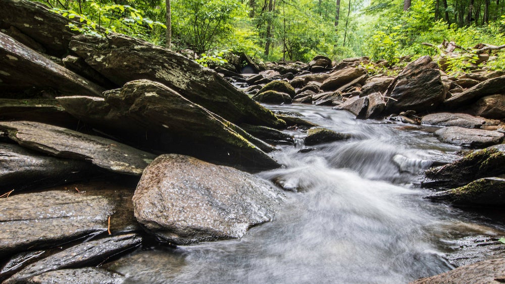
(Photo: Jacqueline Nix via Getty Images)
This 17.6-mile Pinhoti Trail loop follows a well-worn path as it crisscrosses numerous creeks and rivers (some of which can be tricky at high water) through Alabama. White quartz outcroppings offer hikers an opportunity to peer beyond dense tree cover, but the large diversity of plant life along this route allows for plenty to discover underneath the canopy as well. Red and white oak, long and short needle pine, sourwood, and sassafras trees (among others) accompany blueberry shrubs, sumac, and hydrangeas to make for a rich botanical experience.
Caution: Poison ivy is a common leaf as well, especially in the trail’s wetter and cooler areas. Campsites abound on this loop, but there are only so many near a viable water source—many of the trail’s streams are seasonal, drying out in high summer.
When To Hike The Pinhoti Trail
Target mid-to-late April to see dogwoods and wild azaleas blooming and to find reliable water sources, but be careful during and after large storms—creeks and streams can swell to dangerous levels for crossings and fords. Caution: Poison ivy abounds, especially in wet, cool areas.
There are no permits required to hike the Pinhoti Trail. Want more information? Check out the Pinhoti Trail Alliance or contact the Talladega National Forest.
ADVERTISEMENT
Where to Eat After The Hike
- Top O’ The River: 3330 McClellan Boulevard, Anniston, AL 36201 (seafood)
- Mellow Mushroom Pizza: 33 Industrial Drive, Oxford, AL 362031 (pizza)
- Pell City BBQ: 1700 Martin Street North, Pell City, AL 35125
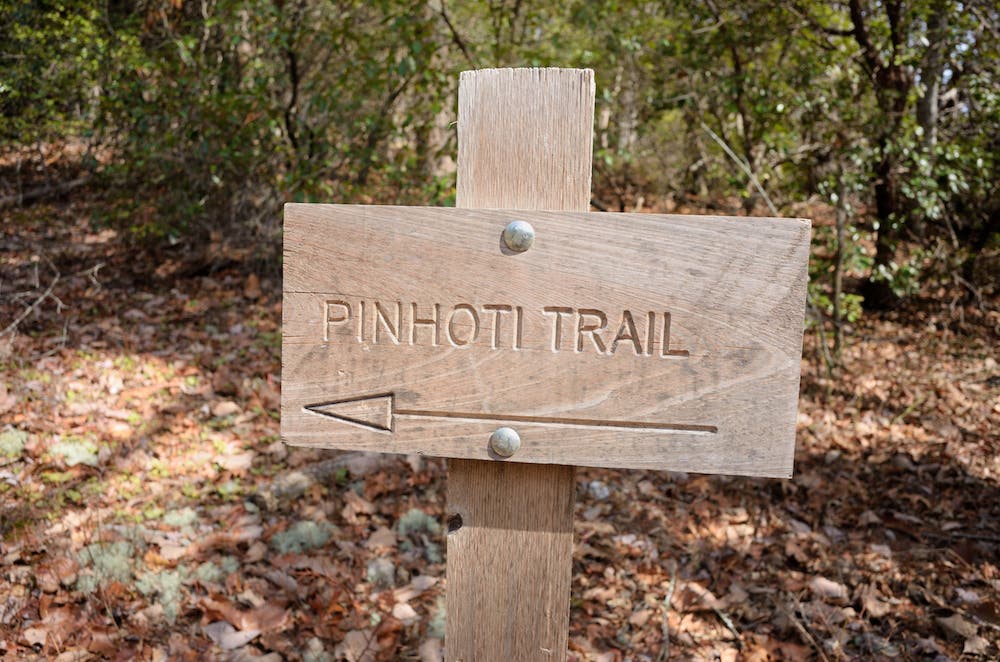
How To Hike The Pinhoti Trail
From trailhead parking lot, cross the street and look for the dirt trail to the left of Adams Gap Road. The signed Pinhoti Trail starts heading uphill about 20 feet from the road intersection. The trail’s first 3 miles cross numerous seasonal streams and small campsites (perfect for those getting a late start on this long loop).
Right before a small campsite 3.3 miles into the trail, make a 90-degree turn to the right and head uphill. From here, the trail gains 900 feet of elevation in the next 1.4 miles—one of the only sustained stretches of climbing on this hike. At 3.9 miles into the hike, take a break from the switchbacks in the rock field found along this uphill stretch.
ADVERTISEMENT
There are a number of overlooks available on this trail: Just before you reach mile 4, bear right to reach a scenic overlook with views of the surrounding mountains. Also, drop your pack and climb the rocks to an overlook to the south of Cedar and Robinson Mountains.
At 5 miles into the hike, the trail passes a reliable water source. Whether you’re camping in the medium-sized campsite nearby or not, it’s a good idea to top off here. When the small, seasonal streams dry up, this is a very dry trail with only so many opportunities to refill your water.
Have to use the restroom? At 7.3 miles, there’s a public restroom: Turn right at the T-intersection and walk a short distance to the outhouse. To continue on the loop, turn left at the T-intersection and then make an immediate right back off the road at the next T-junction (about 100 feet from the first).
ADVERTISEMENT
Over a mile later, get focused and ready to ford the Cheaha Creek, the most difficult river ford of the trip. Caution: This crossing may be dangerous in high water. Uphill from the creek there is a heavily-used shelter. From here, the trail meanders west passing several small campsites and stream crossings. Just over two miles later, you can rest on the wooden deck overlook to enjoy views of the river and a small waterfall before fording the creek again at mile 11. This spot that can be tricky at high water. After fording, bear right and follow the Skyway Trail sign. From here, it’s another 6 miles back to Adams Gap.
Looking for a place to camp? At mile 13, make a 90-degree right turn into a campsite area, cross the river, and then turn left upstream. Red blazes on trees mark your path. Also, at 15.75, the trail descends into a campsite and crosses a creek. On the other side, bear left to continue on the trail.
Just before mile marker 17.5, continue straight at the three-way junction, leaving the Skyway Trail and picking up the Pinhoti Trail as it continues back towards Adams Gap and the trailhead.