Published October 10, 2018 10:54PM
Hike of the Week: Lost Mine Trail, Big Bend National Park, TX
This shoulder-season cruiser delivers you to some of the best views in West Texas.
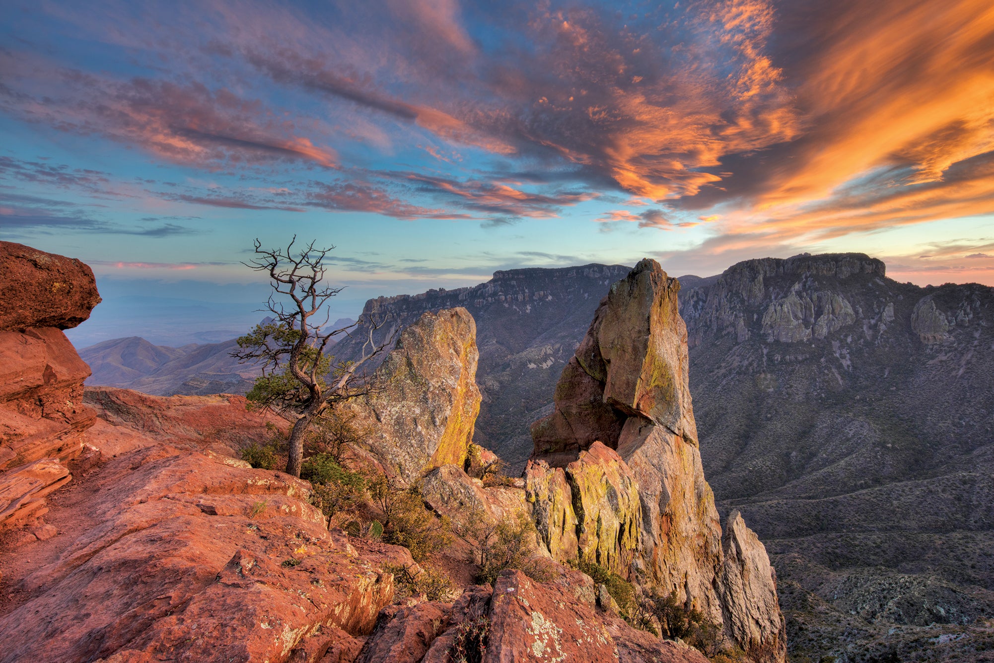
'Imagesfromtexas.com'
Trail Facts
- Distance: 4.8 miles (out and back)
- Time: 2-3 hours
- Difficulty: 2 out of 5
Summary
Elsewhere around the country, people are scrolling through Instagram to get their hiking fixes. Not here. In Texas, March means the best hiking of the year is in full swing. But “best” doesn’t mean easy. Backpackers have to brave long, long stretches without water to reap the rewards: empty trails, canyon views that melt into the horizon, and some of the best campsites in the entire park system.
Start easy, with the 4.8-mile out-and-back along the Lost Mine Trail to this outcropping facing Big Bend’s South Rim. (Find the trailhead near 29.2745, -103.2866.) Let it whet your appetite for a bigger adventure across the way. There, you can embrace the Lone Star State’s prime backpacking season with a 14.5-mile variation of the South Rim Loop. Link the Pinnacles, Boot Canyon, East Rim, South Rim, Laguna Meadows, and Basin Loop Trails to do it, camping midway on the South Rim, a fortress of crumbly rock that lords 2,000 feet above the canyonlands of the Chisos Mountains. Permit Required for camping ($10); obtain from any visitor center.
Tag us @backpackermag and #hikeoftheweek on Instagram, Twitter, or Facebook if you do this Hike of the Week.