Explore These 10 Must-do Desert Hikes for an Unforgettable Adventure

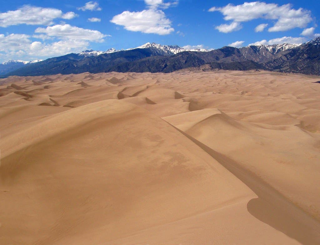
Great Sand Dunes (Photo: Nikhil Nagane / 500px via Getty)
.Visit the desert once, and you’ll keep coming back. From the scorching lowlands of Death Valley to the red-rock canyons of southern Utah, the combination of magical scenery and sweeping vistas is something you won’t find anywhere else. The secret to a good desert hike? Time it right. You can hit these desert trails throughout the year, but there are few better times than spring when mild temps keep the experience comfortable.
Umatilla Rock Trail, Sun Lakes State Park, WA
Distance: 3.1 miles
Elevation Gain: 320 feet
Trail Type: Loop Trail
Difficulty: Easy
Circle the cliffs of solitary Umatilla Rock on this 3-mile loop trail in Eastern Washington’s Monument Coulee, one of the enormous chasms carved 15,000 years ago by outburst floods from Glacial Lake Missoula. Start from the Umatilla Rock trailhead and follow the red-blazed trail northeast, through a tangle of basalt pillars that have fallen away from the narrow fin of Umatilla Rock. The trail winds past Perch Lake before cutting up and over Umatilla Rock itself. It’s a little bit of a scramble, but the view is worth it: From the narrow saddle between the cliff bands you can look down the basin at the scattered basalt towers and sagebrush. See it on Gaia GPS.
Star Dune Trail, Great Sand Dunes NP, CO
Distance: ~6 miles (no actual trail)
Elevation Gain: 741 feet from the base to the summit
Trail Type: Out and back hike
Difficulty: Hiking in sand is not easy.

The colder months are the best time to find solitude on North America’s tallest dune. This hike isn’t the longest, but plan on at least 5 hours round trip—hiking through sand isn’t easy. From the Dunes Parking Lot follow Medano Creek (likely a dry bed at this time of year) along the base of dunes. Star Dune will be visible about 2 miles down the creek bed. Look for a massive pyramid of sand dwarfing the dunes beside it.
Leave the creek bed once you’ve spotted Star Dune and pick a ridge to follow to the summit. There isn’t a specific route to the top—the dune field is constantly changing with the wind, so no one ever hikes the same route up Star Dune twice. Bring a good coat to brave the chill at the top while you admire the vista of mountains, creek bed, and sand. See it on Gaia GPS.
Hermit’s Rest to Dripping Springs Trail, Grand Canyon National Park, AZ
Distance: 6.4 miles
Elevation Gain: 2,600 feet
Trail Type: Out and back
Difficulty: Challenging
Dry falls, fossils, and red rock views across countless canyons await on this 6.4-mile round-trip hike to Dripping Springs. Drop off the rim at Hermit’s Rest, following the Hermit Trail down 1.5 miles and 1,400 feet of elevation to the junction with the Dripping Springs Trail. Beyond the switchbacks (bring microspikes; this spot is notoriously icy when it’s cold), Hermit’s Canyon opens into the vast landscape of the Grand Canyon. Take a few minutes of your descent to look away from the views for something a little closer. After descending through the uppermost limestone layer, you’ll reach the Coconino Sandstone, where fossilized reptile prints trace the edges of ancient dunes.
After reaching the trail junction for the springs, climb 500 feet in 1.7 miles to reach Dripping Springs, a tiny pool surrounded by a burst of unexpected greenery. The spring water needs to be treated before drinking and isn’t considered a permanent water source, though it usually flows all year, so bring all the water you’ll need for the hike (.5 to 1 liter per hour in the summer). Take your time on the climb back out of the canyon to enjoy the same views with a different perspective. See it on Gaia GPS.
San Rafael Knob Trail, San Rafael Swell, UT
Distance: 10.1 miles
Elevation Gain: 1,272 feet
Trail Type: Out and Back
Difficulty: Challenging
The highest point in the San Rafael Swell is a bit of a scramble. But that just makes it a better adventure. Start from Justensen Flats (high clearance vehicles can get a little bit farther, but this is the best parking spot for standard cars). Follow the Devil’s Canyon jeep trail 3 miles to its terminus near the base of the 1800-foot-tall Knob.
An easily spotted use trail branches off from the end of the road. Follow this up almost 2,000 feet above the sand, turning up along the northwest ridge for a short class 3 scramble. It isn’t difficult to cross, but if the rock is icy turn around here; the scramble is very exposed and should only be attempted by experienced scramblers. Past that short crux, follow the trail around the knob to a class 2 scramble up a chute to the summit and 360-degree views of the San Rafael Swell canyon country and the Henry Mountains. See it on Gaia GPS
Alcoholic Pass Trail, Anza-Borrego Desert State Park, CA
Distance: 4.6 miles
Elevation Gain: 784 feet
Trail Type: Out and Back
Difficulty: Moderate
Named for the drinking habits of the early settlers who used this route as a shortcut to Clark Valley, the Alcoholic Pass Trail is a short, steep hike through cholla and ocotillo to the pass above Coyote Canyon. Check road conditions at the visitor center before heading to the trailhead in Coyote Canyon. Those without high-clearance vehicles may need to park at the end of the pavement, adding 2.2 miles to the 2.4-mile round-trip hike.
Follow the trail up the northwest ridge of Coyote Mountain, gaining 784 feet in 1.2 miles. Luckily, the views increase as you climb, providing a great excuse to stop and catch your breath. From above you can see the remarkably straight line of Coyote Canyon where it follows the San Jacinto Fault Zone. From the pass, the panorama expands to the San Ysidro and Santa Rosa Mountains, with 8,716-foot Toro Peak peeking from the valley haze amid the Santa Rosas. See it on Gaia GPS.
Golden Canyon/Gower Gulch Loop, Death Valley National Park, CA
Distance: 7.8 miles
Elevation Gain: 834 feet
Trail Type: Loop Trail
Difficulty: Challenging

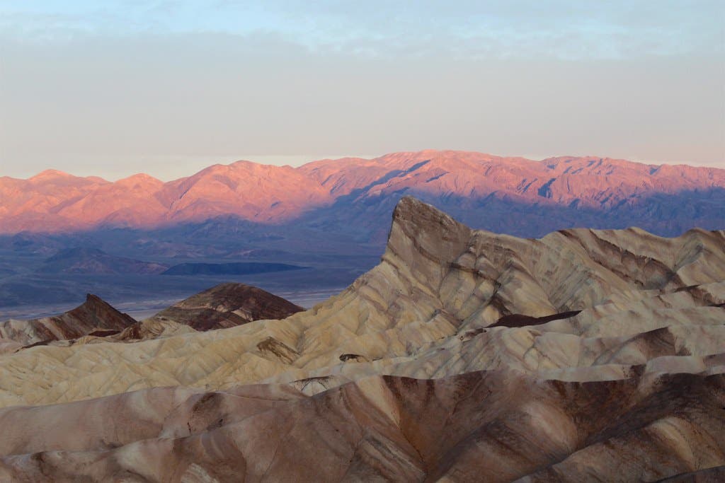
Wander 7.8 miles through canyons, red-rock cathedrals, and fluted badlands on this loop in Death Valley National Park. Start at the Golden Canyon parking lot in Death Valley. The first stretch of trail winds between the canyon’s yellow-hued walls and loops under overhangs and over low ledges. At mile 1 take the half-mile spur trail left to Red Cathedral, a pillar-bound outcrop rising straight from the trail in bright varnished sandstone.
Return to the trail and head to the first junction at mile 2.8. Go east on the Badlands loop and continue straight through the next intersection to Zabriskie Point. The point has one of the best views in the park that looks down at the sharply eroded Furnace Creek Formation badlands and across the flats to the highlands on the other side. Return down the Zabriskie Point Spur trail to the last junction and go straight. Then at the next junction (mile 6.4), go left to reach Gower Gulch. About .3 mile later, you’ll reach the last junction and turn right, following the narrowing canyon back down to the parking lot. See it on Gaia GPS.
Rhyolite Canyon Trail, Chiricahua National Monument, AZ
Distance: 5.2 miles
Elevation Gain: 1,007 feet
Trail Type: Out and Back
Difficulty: Moderate
The unusual rhyolite cliffs that give this canyon its name form the core of the Chiricahua Mountains in southeastern Arizona. This inactive volcanic range is filled with hoodoos, pinnacles, and narrow canyons, carved by wind and water over the last 25 million years. Sample a few of these geologic features on the Rhyolite Canyon Trail, a 5.2-mile out-and-back in the heart of the national monument. Start from the visitor center and slowly gain elevation through oak woods, emerging into the upper canyon and pale hoodoos scattered over the hillside. The upper levels of the canyon have views out over the hoodoos and the lower stretch of the canyon. The trail gains 1,007 feet on the way to the end of the canyon, where it meets up with the Echo Canyon and Hailstone Trails for those who want to extend their hike. See it on Gaia GPS
Bullet Canyon Trail, Bear’s Ears National Monument, UT
Distance: 9 miles
Elevation Gain: 826 feet
Trail Type: Out and Back
Difficulty: Moderate
Find hidden desert pools and spectacular ruins on this canyon hike. Find the trailhead 1 mile up Forest Road 251 and follow cairns from the rim, down the slickrock, and to the bottom of the wash. Stay out of the thickets of willows and tamarisk in the center of the wash, and instead follow the sandy trails farther up the banks. Around mile 1, you’ll spot the first pueblo, high on the righthand wall of the canyon. The walls grow taller the farther you go.
Drop over several pour-offs or bypass them on marked routes. At mile 2.4, follow cairns to a high route on the right wall to avoid the boulders and stagnant water at the bottom of the canyon, keeping in mind the climb down can be more difficult than the climb up. Near mile 4.6, follow a cairned route to a south-facing alcove and Perfect Kiva, an incredibly well-preserved ruin kept in good condition by the BLM. Perfect Kiva is a good turnaround point for a dayhike; for a multiday trip, link Bullet Canyon with Grand Gulch. See it on Gaia GPS.
Panorama Trail, Kodachrome Basin State Park, UT
Distance: 6 miles
Elevation Gain: 574 feet
Trail Type: Loop
Difficulty: Easy to Moderate

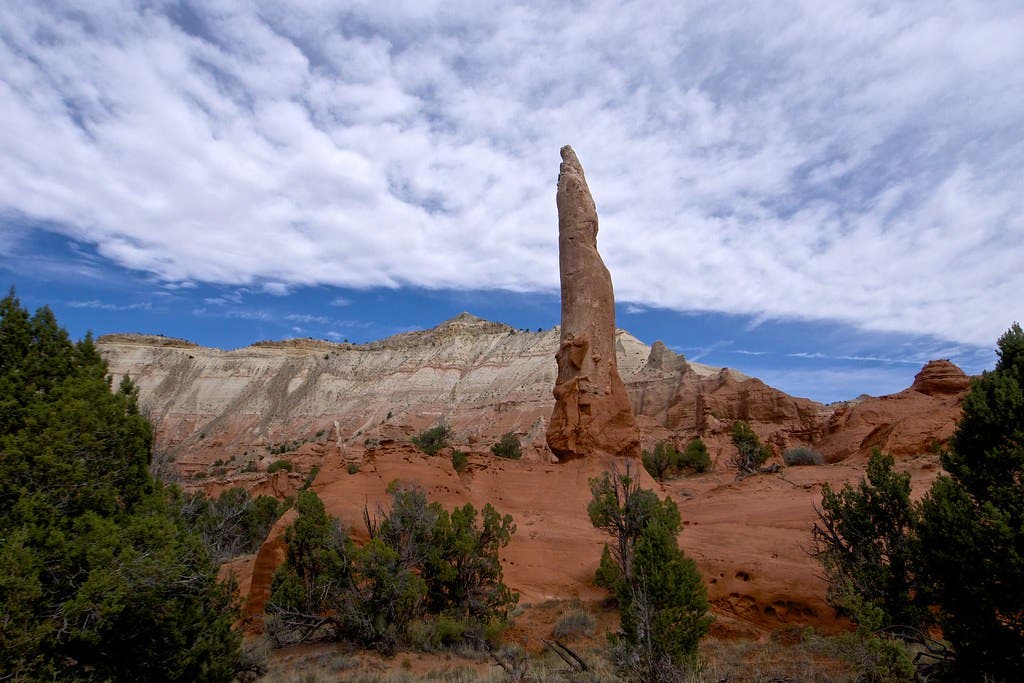
The longest of Kodachrome Basin’s hiking trails winds past several major features of the park. It ends with stunning views across the Paria River Valley and afield to Bryce Canyon. Start at the parking area .5 mile past the park entrance station. Cross a sandy ravine to reach the first junction, then head left. After briefly crossing some brushy flats, reach a second junction and head right to Panorama Point. Pass between two red rock buttes to the highest point of the hike and views across to the park to the white cliffs surrounding the Paria River.
Retrace your steps to the junction and follow the trail to yet another intersection. Go left towards a sand pipe and a cliff-ringed basin. Continue straight through the next two junctions to reach Cool Cave, a red-rock chamber beneath dryfall from a slot canyon. Follow the loop past the cave and go straight through the last junction. Take a left before mammoth geyser to loop through the Secret Passage slot and past Ballerina Spire. Head back to your car to finish the 6-mile series of loops. See it on Gaia GPS.
Church Rock Trail, Red Rock Park, NM
Distance: 3 miles
Elevation Gain: 255 feet
Trail Type: Out and Back
Difficulty: Moderate
Hike through two canyons to a set of sandstone spires on this desert trail. Start from the small parking area near the campground and follow signs and cairns across a wash. Cross the canyon to a series of steps carved into the sandstone wall. Climb to an intersection with the Pyramid Trail. Bypass the Pyramid Trail and continue on the Church Rock Trail as it enters a box canyon. Follow more cairns along rolling sandstone with views across the canyon to enormous cliffs of striated sandstone and scattered shrubs. At mile 1.5, reach the foot of the namesake rock formation, a set of red and white pillars that tower over the surrounding landscape. Retrace your path back to your car to finish the 3-mile out-and-back. See it on Gaia GPS.