Bend, OR: South Sister via Obsidian Trail

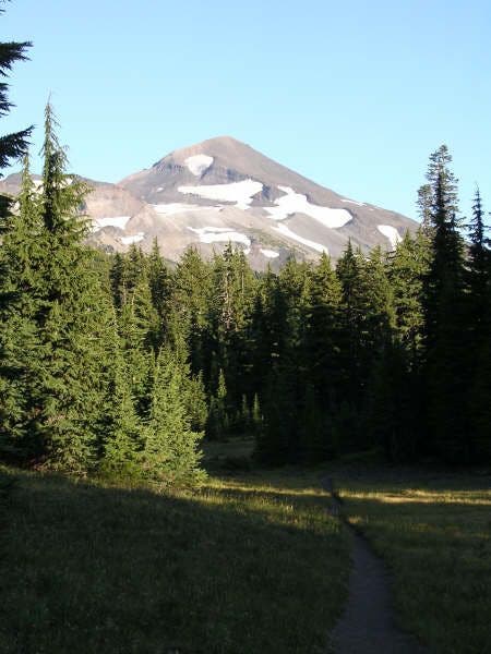
Twenty miles west of Bend, the rugged, glacier-covered slopes of South Sister rise dramatically above Deschutes National Forest. The tallest of a trio of volcanoes known as the Three Sisters (and Oregon’s third tallest peak), South Sister’s summit reveals dramatic views across the Cascade Range.
Follow the Obsidian Trail
Start this challenging trek at Frog Campground and head southeast on the Obsidian Trail. You’ll gain roughly 5,500 feet of elevation and travel from forested landscapes to stark slopes covered with volcanic pumice and obsidian. After 20 miles, rest by a small lake on South Sister’s false summit before the final, 1-mile push to the summit (which gains almost 2,000 feet of elevation). Savor the sky-high views from the crater rim—Middle Sister, North Sister (and Mount Hood, on very clear days) can be seen to the north—then follow the same route back to the trailhead.
-Mapped by Trung Q. Le
Trail Facts
- Distance: 35.1
Waypoints
TSW001
Location: 44.203079, -121.870728
Hike southeast from the Obsidian Trailhead at the east end of Frog Campground. Note: Before you hit the trail, purchase an annual Northwest Forest Pass, or buy a day pass at the trailhead.
TSW002
Location: 44.19632, -121.861999
Continue straight on Obsidian Trail @ T-intersection. The trail to the right leads to Spring Lake and White Branch Creek. Ahead, the dusty path climbs gradually under the covering of trees, shaded from any sunlight.
TSW003
Location: 44.185551, -121.835602
Catch views of North Sister to the east through the gaps in the trees.
TSW004
Location: 44.18327, -121.829598
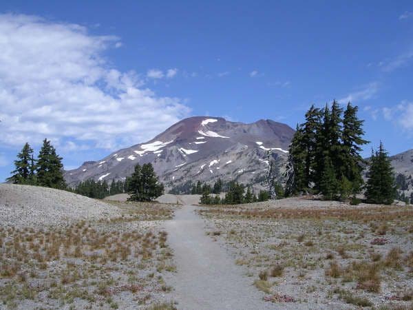
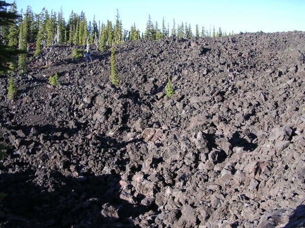
Bear right onto the Obsidian Trail @ Y-intersection with Glacier Way Trail. Ahead, the terrain changes dramatically from forested landscapes to stark, rocky slopes of pumice and obsidian.
TSW005
Location: 44.166851, -121.818298
Bear right @ Y-intersection onto the Pacific Crest Trail (PCT). The trail on the left climbs to Obsidian Falls and Scott Spring.
TSW006
Location: 44.15168, -121.8171
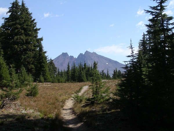
Check out the first of many views of The Husband (to the southwest). The forest begins to open up as the trail inches closer to Linton Meadows.
TSW007
Location: 44.142551, -121.820999
Stay left on the PCT @ the Y-intersection. Depending on the time of year, wildflowers blanket the ground in vibrant colors. For overnight options, turn right @ Y-junction and follow trail roughly 1 mile to Linton Meadows, a popular camping area.
TSW008
Location: 44.125351, -121.821098
Bear left on the PCT @ Y-intersection. The trail to Racetrack Meadows veers off to the right.
TSW009
Location: 44.114101, -121.811203
Pass a large, seasonal pond (good place to filter water).
TSW010
Location: 44.08662, -121.818398
Pass a small lake. Filter water here if your reserves are running low.
TSW011
Location: 44.084122, -121.820297
Bear left on the PCT @ Y-junction. Ahead, the trail rounds to the southeast, passing potential campsites in 0.5 mile.
TSW012
Location: 44.079571, -121.818001
Hike across the Mesa Creek drainage (which resembles a flooded plain). Top off water bottles in the creek.
TSW013
Location: 44.065361, -121.810699
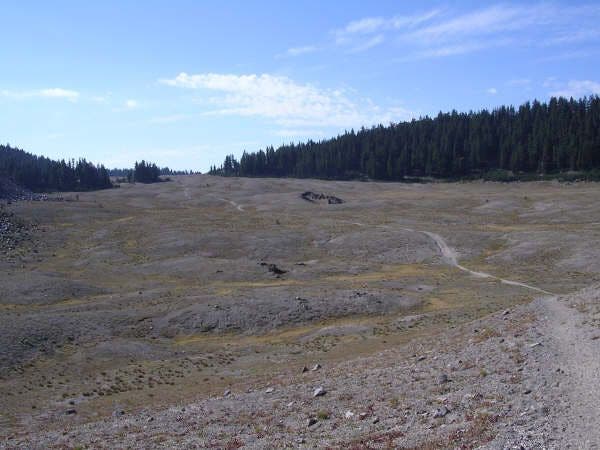
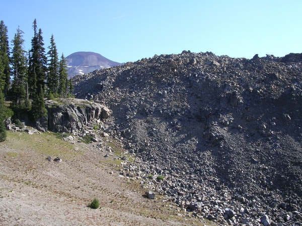
Hike south through the Wickiup Plains. Volcanic pumice blankets this flat, expansive (and barren) area rimmed by conifers. The Rock Mesa obsidian flow rises to the east next to the trail.
TSW014
Location: 44.05983, -121.808899
Bear left (southeast) @ Y-intersection toward Devils Lake. The PCT veers to the right toward Sisters Mirror Lake.
TSW015
Location: 44.053299, -121.802597
Take in the first views of Broken Top volcano to the east. Continue heading southeast.
TSW016
Location: 44.04855, -121.790802
Turn left @ T-intersection toward Moraine Lake. The trail winds to the northeast along Kaleetan Butte.
TSW017
Location: 44.055229, -121.771004
Turn left @ 4-way intersection onto the South Sister Trail. Hike north. (Devils Lake Trail on the right is the standard route to South Sister.) Overnight options: Continue straight @ 4-way for camping near Moraine Lake.
TSW018
Location: 44.062019, -121.769096
Continue straight @ 3-way-intersection toward South Sister. The trail winds through an open area dubbed the “golf course.” Tufts of grass and patches of dirt cover this broad expanse.
TSW019
Location: 44.090778, -121.768898
A blue lake marks South Sister’s false summit. Take a break here and enjoy the view of Broken Top to the east. Next, head north for the final push to the summit.
TSW020
Location: 44.10038, -121.772697
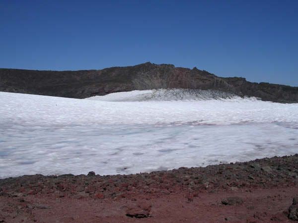
Crest South Sister’s summit (Teardrop Pool fills its crater). Next, turn right and follow the rim to the east and north to reach the true summit.
TSW021
Location: 44.103252, -121.769791
South Sister (10,358 ft.): Savor sky-high views from Oregon’s 3rd tallest mountain. Look north to find Middle Sister, North Sister, and Mount Jefferson (and Mount Hood, on very clear days). Follow the same route back to the trailhead.
North Sister
Location: 44.18528, -121.835289
©Trung Q. Le
Obsidian and Pumice
Location: 44.181957, -121.82756
The Obsidian Trail traverses obsidian and pumice rock fields.
©Trung Q. Le
North and Middle Sister
Location: 44.17297, -121.827217
©Trung Q. Le
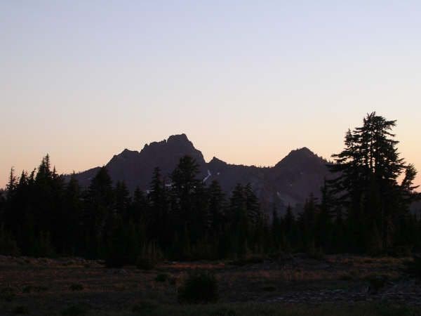
The Husband
Location: 44.15068, -121.816917
View of The Husband at sunset from the PCT.
©Trung Q. Le
Mesa Creek Meadows
Location: 44.078461, -121.817436
©Trung Q. Le
The Wife
Location: 44.066681, -121.811172
©Trung Q. Le
Rock Mesa Obsidian Flow
Location: 44.062859, -121.809715
View of Rock Mesa and South Sister from the Wikiup Plains.
©Trung Q. Le
Wickiup Plains
Location: 44.06477, -121.810394
Looking south at the desolate open plains.
©Trung Q. Le
Broken Top
Location: 44.052803, -121.802162
©Trung Q. Le
South Sister
Location: 44.062798, -121.769241
View of South Sister from the “golf course.”
©Trung Q. Le
Broken Top
Location: 44.084503, -121.768166
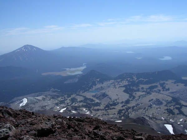
View of Broken Top from South Sister.
©Trung Q. Le
False Summit
Location: 44.092392, -121.770058
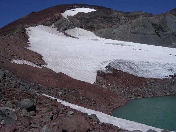
View of the lake at the South Sister false summit. The true summit can be seen up ahead.
©Trung Q. Le
Summit Views
Location: 44.100067, -121.77272
Views south from the crater rim of South Sister.
©Trung Q. Le
Summit of South Sister
Location: 44.100376, -121.772675
View of Teardrop Pool. The true summit can be seen ahead.
©Trung Q. Le