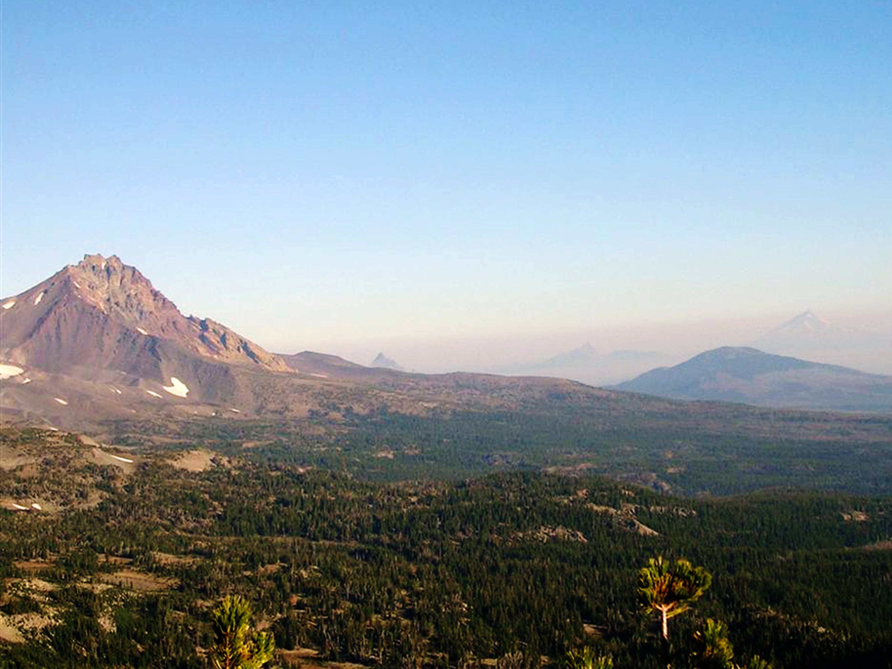
Bend, OR: Broken Top via Park Meadow Trail

Rising twenty miles west of Bend, Broken Top’s crumbling, glacier-carved slopes provide a challenging ascent for experienced hikers. This 15.7-mile out-and-back starts at the Park Meadow Trailhead and heads northwest. The first 4 miles roll through shady forest, crossing Snow Creek, Squaw Creek, and East Fork Park Creek. You’ll also pass through Park Meadow, an expansive grassland that offers the first open views of Broken Top.
At mile 5, turn left onto a climber’s trail that leads to Golden Lake. (You’ll find more striking views of Broken Top from the meadows surrounding the lake.) From here, it’s a slow and difficult ascent to the northwest ridge. Find the best available path through loose gravel, shale, and scree to the low point on the ridge.
After cresting the ridge, it’s a 1.3-mile traverse on loose soil and rock to the base of the summit block. A 10-foot (low 5th class) rock climb and a 300-foot 3rd class scramble lead to the summit. Soak up views of the surrounding Cascade Peaks before retracing your steps to the trailhead.
-Mapped by Trung Q. Le

Trail Facts
- Distance: 25.3
Waypoints
PMR001
Location: 44.1230087, -121.6483002
The trail starts from a large, flat parking area covered by small pumice and volcanic rock. Hike northwest on Park Meadow Trail, a wide and shady horse trail.
PMR002
Location: 44.125721, -121.6601028
Keep straight @ 4-way intersection to continue on Park Meadow Trail. On the left, a side trail leads up to Snow Creek Ditch. A cross country ski trail enters on the right. Ahead, the trail continues its almost unnoticeable descent and narrow slightly.
PMR003
Location: 44.1266584, -121.664958
Cross a footbridge over Snow Creek.
PMR004
Location: 44.1216062, -121.687274
Rock hop across Squaw Creek. From here, the trail gradually ascends to Park Meadow. The trees occasionally open up, offering views of The Three Sisters and Broken Top.
PMR005
Location: 44.1172313, -121.7031956
Pass through Park Meadow, an expansive meadow rimmed by forest. This meadow offers the first open views of Broken Top to the south. In 450 feet, cross the East Fork Park Creek. There are several good camp spots along the creek, as well as throughout the meadows. After crossing East Fork Park Creek, continue straight @ 3-way junction with Pole Creek Trail (to the right).
PMR006
Location: 44.109929, -121.7160702
Turn left onto the climber’s trail @ 3-way intersection. This junction is usually marked by cairns on the right side of the trail. If you notice a large rock formation on the left-hand side of the trail, you’ve passed the climber’s trail. Ahead, hike south across the open meadows that surround Golden Lake.
PMR007
Location: 44.1024409, -121.7157698
Golden Lake: The expansive meadows surrounding the lake offer striking views of Broken Top. There are several established campsites located throughout the meadows. Filter water in the streams that flow into Golden Lake (this is the last available water source).
PMR008
Location: 44.1000679, -121.7154694
The ascent to the northwest ridge is very difficult and slow. The route crosses very loose gravel, shale, and scree. Find the best available path to the low point on the ridge.
PMR008
Location: 44.0910301, -121.7195969
Crest Broken Top’s northwest ridge and head southeast.
PMR009
Location: 44.087101, -121.7082977
Leave behind the scree-filled trail, and travel on loose soil and rock. Maneuver over and around loose rocks and large boulders. Bend Glacier covers Broken Top’s northern slopes.
PMR010
Location: 44.0832787, -121.6997986
At the base of the summit block, you’ll have to tackle a 10-foot (low 5th class) rock climb and a 300-foot 3rd class scramble to reach the summit. Be extremely careful with your foot and hand holds. Broken Top’s crumbling summit is covered with loose rocks.
PMR011
Location: 44.0829391, -121.6994019
Broken Top (9,175 ft.): Soak up views of the Cascades. The Three Sisters rise to the west-northwest and Mount Bachelor can be seen to the south. If visibility is high, Mounts Washington, Jefferson, and Hood can be seen to the north. Follow the same route back to Waypoint 1.
View from the Northwest Ridge
Location: 44.0863828, -121.707015
View of North Sister, Mount Washington, Three Fingered Jack, and Mount Jefferson. ©Trung Q. Le