Bend, OR: Broken Top via Green Lakes Trail

Rising twenty miles west of Bend, Broken Top’s crumbling, glacier-carved slopes provide a challenging ascent for experienced hikers.
Follow the Green Lakes Trail
From the Green Lakes Trailhead, hike north on a well-traveled dirt trail winding through the woods. The path follows and crisscrosses Fall Creek as it gradually climbs to Green Lakes (you’ll be treated to views of numerous small, cascading falls). If you need to refill your water supplies, or enjoy a cool dip on a hot day, follow the numerous scramble trails down to the creek.
After 2.5 miles, the trail travels alongside the massive lava domes that rise to the west. Less than 2 miles later, the route veers to the northeast past Green Lakes, then begins an aggressive ascent to Broken Top’s northwest ridge. After cresting the ridge, it’s a half-mile traverse on loose soil and rock to the base of the summit block. A 10-foot (low 5th class) rock climb and a 300-foot 3rd class scramble lead to the summit. Soak up views of the surrounding Cascade Peaks before retracing your steps to the trailhead.
-Mapped by Trung Q. Le

Trail Facts
- Distance: 20.1
Waypoints
GRL001
Location: 44.0310593, -121.7362976
Head north from the trailhead on a well-traveled dirt trail that winds through the woods. In roughly 50 feet, cross Fall Creek on a footbridge. Ahead, the path follows and crisscrosses Fall Creek as it gradually climbs to Green Lakes (you’ll be treated to views of numerous small, cascading falls). If you need to refill your water supplies, or enjoy a cool dip on a hot day, follow the numerous scramble trails down to the creek.
GRL002
Location: 44.0393295, -121.7332001
Pass one of the larger falls on Fall Creek. Ahead, the roar of the creek softens as the trail climbs away from the creek.
GRL003
Location: 44.0542297, -121.7401962
Cross the footbridge over Fall Creek.
GRL004
Location: 44.0574493, -121.7429962
Cross another footbridge over Fall Creek.
GRL005
Location: 44.0590401, -121.7427979
Continue straight @ 3-way intersection toward Green Lakes. The trail to Moraine Lake enters on the left. Over the next 1.8 miles, you’ll hike next to the massive lava domes that rise to the west. From the trail, the sides of the lava domes resemble vertical rock walls. Prepare for steeper sections of climbing along this stretch.
GRL006
Location: 44.0807415, -121.7309618
Turn right @ Y-junction, heading northeast. In roughly 50 feet, continue straight @ 3-way junction. Note: Ignore the sign that says Broken Top Trailhead is to the right. Hike northeast through the Green Lakes area, and savor views of South Sister to the west and Broken Top to the east. Numerous primitive campsites are strewn throughout this area.
GRL007
Location: 44.0822829, -121.7278719
The trail starts an aggressive ascent up loose rock and scree to Broken Top’s northwest ridge.
GRL008
Location: 44.087101, -121.7082977
The trail crests the northwest ridge. Leave behind the scree-filled trail, and travel on loose soil and rock. Maneuver over and around loose rocks and large boulders. Bend Glacier covers Broken Top’s northern slopes.
GRL009
Location: 44.0832863, -121.6998062
At the base of the summit block, you’ll have to tackle a 10-foot (low 5th class) rock climb and a 300-foot, 3rd class scramble to reach the summit. Be extremely careful with your foot and hand holds. Broken Top’s crumbling summit is covered with loose rocks.
GRL010
Location: 44.0829468, -121.6994019
Broken Top (9,175 ft.): Soak up views of the Cascades. The Three Sisters rise to the west-northwest and Mount Bachelor can be seen to the south. If visibility is high, Mounts Washington, Jefferson, and Hood can be seen to the north. Follow the same route back to Waypoint 1.
View from the Northwest Ridge
Location: 44.0862287, -121.7067146
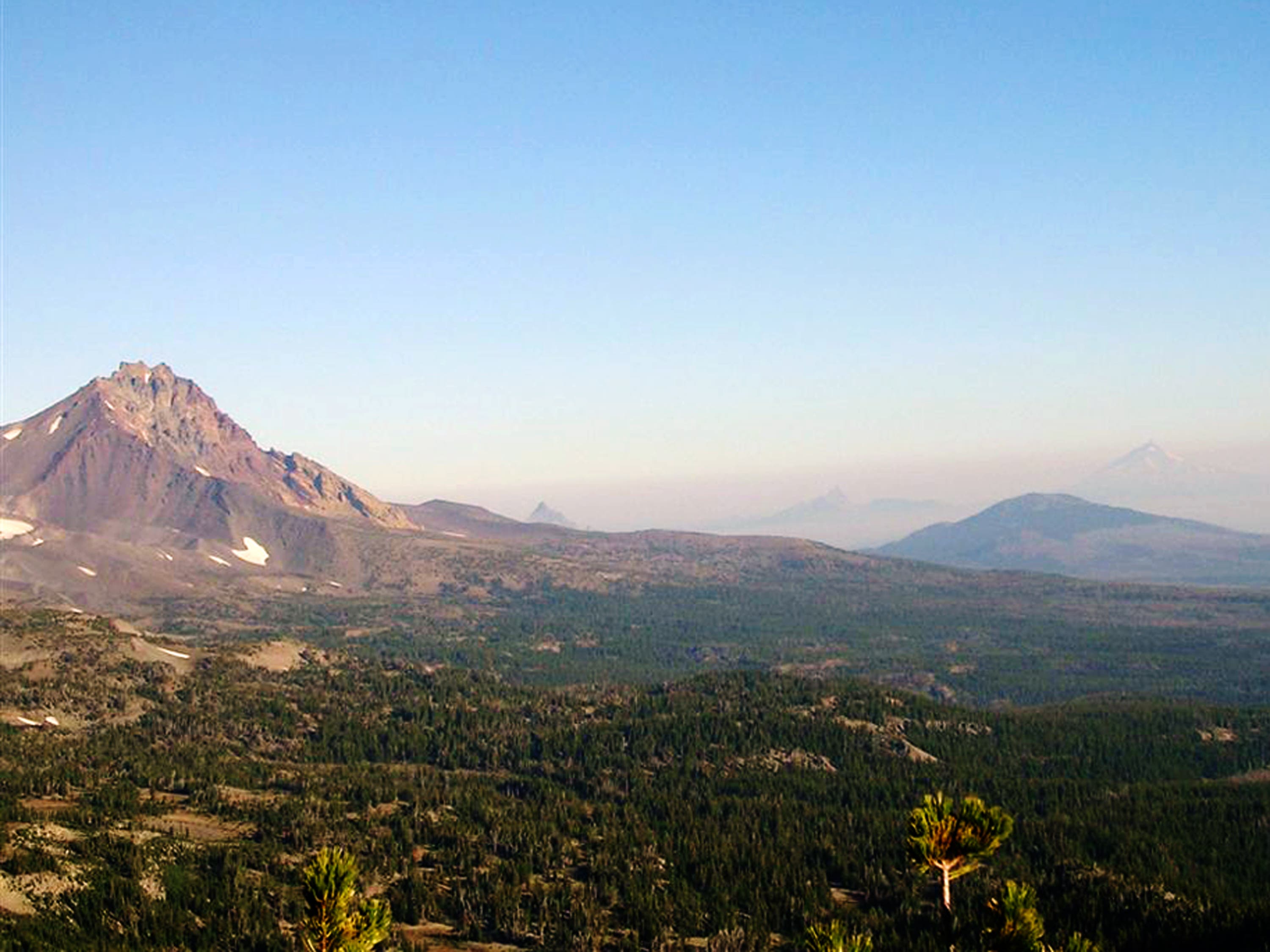
View of North Sister, Mount Washington, Three Fingered Jack, and Mount Jefferson. ©Trung Q. Le