Bend, OR: Broken Top Loop

See the yawning crater that formed when two elemental forces (volcanic and glacial) clashed on this three-day, 22.6-mile trek around Broken Top, an extinct Cascades stratovolcano.
Hike the Broken Top Loop
Start at Little Three Creek Lake trailhead at 6,600 feet and hike northwest 2.8 miles to the Snow Creek Ditch crossing, an often-dry irrigation channel. At a four-way junction, turn west and hike three miles to a bridged crossing of East Fork Park Creek in Park Meadow, which is cast blue by gentians in August. Turn south at an unsigned trail fork, and look for a cairn marking the .5-mile side trail to Golden Lake, your first night’s camp.
Rise early the next day to see dawn on 10,358-foot South Sister. Back at the junction, turn south toward the 7,000-foot pass between South Sister and Broken Top. Cross a cindery lava plain and descend a moraine into the Green Lakes Basin. At Soda Creek junction, turn southeast to begin a gentle climb linking pumice plains to forest. Round the south side of Cayuse Crater, continuing east. In another mile, cross Crater Creek to reach a four-way junction with the Ditch Trail. Look for campsites at treeline or along Crater Creek just north of the trail.
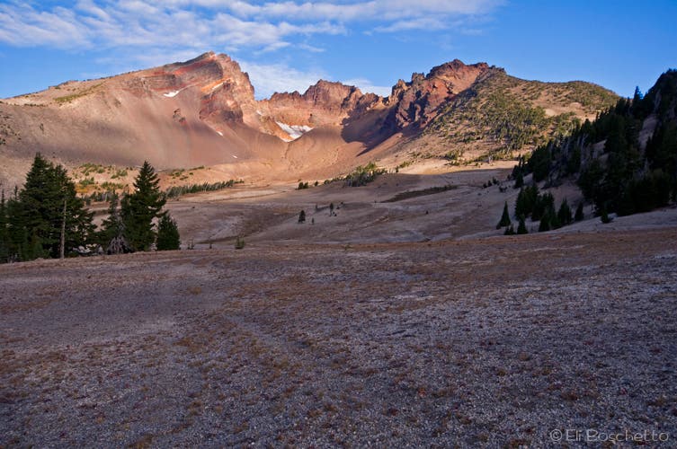
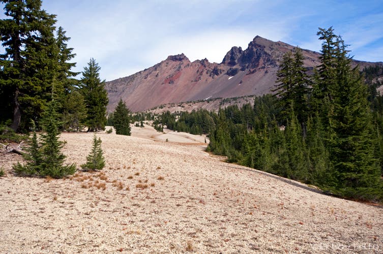
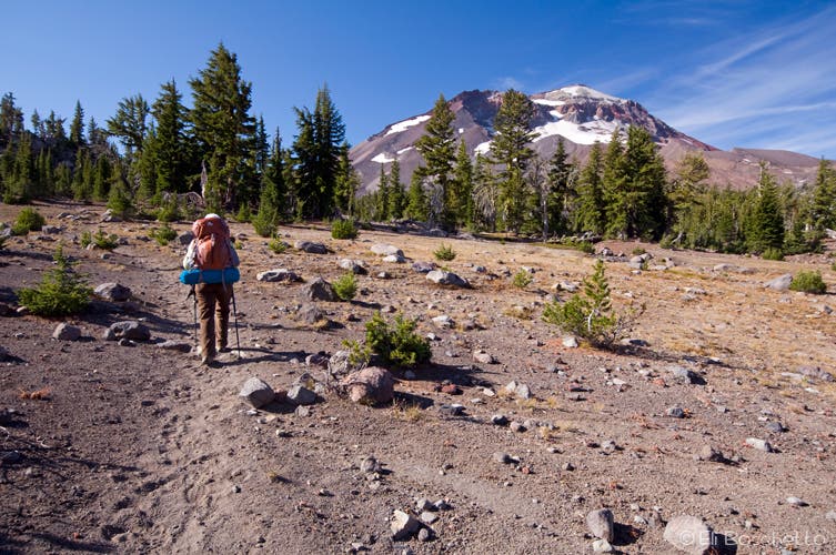
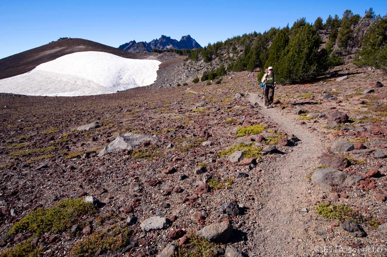
On your final morning, head east .3 mile to cross a seasonal creek (usually dry by mid-summer). Turn north along an intermittent social trail and hike .8 mile to the gap between Broken Top and 8,091-foot Ball Butte. Notice the vibrant red, yellow, and orange layers of volcanic rock in Broken Top’s ice-pitted interior. Head northeast to a use trail and hike .7 mile north to the outlet of Bend Glacier Lake.
Drop packs and scramble .2 mile up the outlet to the shore of the lake for an amphitheater of rock, water, and ice. From there, follow the outlet east cross-country, over a year-round snow bridge to where the drainage turns south. Head northeast for 1.4 miles just below 8,376-foot Broken Hand. Connect to the Tam McArthur Rim Trail, and circle around Three Creek Lake to your car.
Broken Top Loop Trail info
MAP Geo-Graphics Three Sisters Wilderness Map ($6, geo-graphicsmaps.com)
GEAR UP Pick up last-minute duct tape, maps, and fuel at Mountain Supply of Oregon, 834 NW Colorado, Bend. (541) 388-0688
-Mapped by Eli Boschetto, Bosco Mountain Photo


Trail Facts
- Distance: 36.4
Waypoints
BTP001
Location: 44.10168, -121.622383
Start the Broken Top loop trail at the Little Three Creek Lake trailhead.
BTP002
Location: 44.104999, -121.63614
Trail junction; turn left (west) for a 1 mile side trip to Little Three Creek Lake; otherwise, continue straight (northwest) through junction.
BTP003
Location: 44.102148, -121.643586
Little Three Creek Lake; find nice spots along the lakeshore for lunch or a snack. Camp sites also available along north shore.
BTP004
Location: 44.121211, -121.655981
Open view of the Three Sisters before starting forested descent.
BTP005
Location: 44.120033, -121.656751
At mile 2.8, cross Snow Creek Ditch – a dry drainage channel. Jog slightly right to get back on trail.
BTP006
Location: 44.12478, -121.659561
Small creek crossing.
BTP007
Location: 44.125689, -121.660153
Trail junction; turn left (west) and follow signs for Park Meadow.
BTP008
Location: 44.126289, -121.664786
Small creek crossing.
BTP009
Location: 44.121742, -121.687199
Reach another small creek crossing.
BTP010
Location: 44.117386, -121.703076
Here, you’ll find a nice campsite near trail. Note sign prohibiting campfires within 100′ of trail and/or water.
BTP011
Location: 44.116792, -121.703579
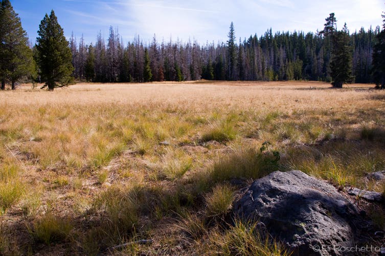
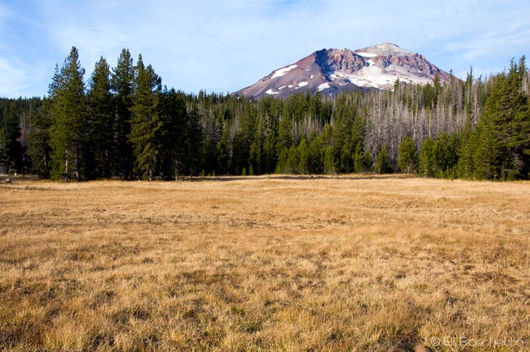
Enter Park Meadow, which is cast blue by gentians in August.
BTP012
Location: 44.115878, -121.704415
You’ll have several nice options for staying the night: choose from campsites on the west side of creek.
BTP013
Location: 44.116578, -121.704692
When you arrive at an unsigned trail junction; turn left (southwest).
BTP014
Location: 44.110133, -121.715877
Look for two large rock cairns marking the side trail to Golden Lake; turn left (south) up rise to find trail.
BTP015
Location: 44.103581, -121.715212
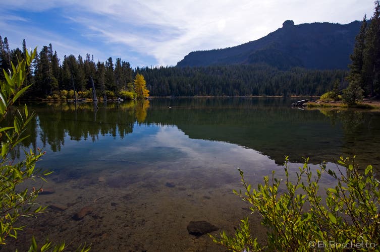
Arrive at Golden Lake. From here, you can see Broken Top.
BTP016
Location: 44.104244, -121.71504
Golden Lake outlet; easy crossing to east side.
BTP017
Location: 44.10393, -121.714648
Nice, sheltered campsites above lake in trees.
BTP018
Location: 44.102782, -121.714429
Exposed campsite near lakeshore with prime view of the Three Sisters.
BTP019
Location: 44.105969, -121.730853
Back at the junction, turn south toward the 7,000-foot pass between South Sister and Broken Top. Continue on trail to descend a moraine into the Green Lakes Basin.
BTP020
Location: 44.096094, -121.733212
Enter the Green Lakes camp zone at Camp 27. Note that camping near the Green Lakes is restricted to numbered sites.
BTP021
Location: 44.094869, -121.732866
Green Lakes camp 26.
BTP022
Location: 44.09368, -121.731337
Here, the trail continues along top of moraine.
BTP023
Location: 44.093576, -121.73108
Nice lunch spot on moraine above Upper Green Lake.
BTP024
Location: 44.084826, -121.72601
Trail fork; veer right (south), keeping along lakeshore.
BTP025
Location: 44.083292, -121.727176
Trail fork; veer left (southwest).
BTP026
Location: 44.082437, -121.727641
The trail forks yet again: veer left (south) at the first fork, then right (southwest) at the second fork.
BTP027
Location: 44.080792, -121.730613
At the trail junction, turn left (south) toward Soda Creek to begin a gentle climb linking pumice plains to forest.
BTP028
Location: 44.078502, -121.729009
Reach a trail fork and veer right (northeast). Camp 10 is near the trail.
BTP029
Location: 44.077941, -121.726616
Cross another small creek and reach a nice view of Broken Top.
BTP030
Location: 44.066689, -121.716587
Small creek crossing.
BTP031
Location: 44.057323, -121.708657
Round the south side of Cayuse Crater, continuing east.
BTP032
Location: 44.058263, -121.704268
Continue straight (east) at the trail junction to join up with Broken Top trail.
BTP033
Location: 44.060637, -121.696193
At the fork, bear left (north) to follow the trail around the springs.
BTP034
Location: 44.061473, -121.696213
Natural springs.
BTP035
Location: 44.06048, -121.689674
Crater Creek crossing.
BTP036
Location: 44.06084, -121.688274
Continue straight (northeast) on Broken Top trail.
BTP037
Location: 44.061635, -121.68806
Watch for more places to set up camp: here, there are sheltered campsites near trees and exposed camp sites below in meadow.
BTP038
Location: 44.061659, -121.683895
Turn north along an intermittent social trail and hike .8 mile to the gap between Broken Top and 8,091-foot Ball Butte.
BTP039
Location: 44.069865, -121.68594
Trail fork; veer right (northeast), following use trail up through gap.
BTP040
Location: 44.071664, -121.684127
Gap between Broken Top and Ball Butte; follow use trail northeast across plain.
BTP041
Location: 44.072278, -121.682789
Trail junction; turn left (north) on another use trail.
BTP042
Location: 44.074464, -121.682534
The trail becomes braided here: be sure to keep right at the two forks.
BTP043
Location: 44.076326, -121.682691
Natural spring.
BTP044
Location: 44.081266, -121.683648
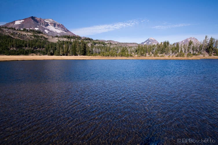
Cirque lake outlet; drop packs and scramble left (west) on faint, rocky trail through gap to view crater lake and glacier. To continue loop, continue cross-country below Broken Hand’s slope.
BTP045
Location: 44.081111, -121.685472
Broken Top’s east cirque lake and glacier.
BTP046
Location: 44.081096, -121.679764
Cross over a year-round snow bridge to where the drainage turns south. Head northeast.
BTP047
Location: 44.084405, -121.67252
Head upslope, between gap to the left (north) of a cluster of trees and pick up faint use trail.
BTP048
Location: 44.084483, -121.671871
At a trail cairn, veer slightly southeast for an easier passage.
BTP049
Location: 44.084194, -121.66764
Trail cairn.
BTP050
Location: 44.08424, -121.666382
Trail cairn.
BTP051
Location: 44.084972, -121.665586
Contour northeast around a red cinder slope.
BTP052
Location: 44.087215, -121.661525
Bear north across cinder plain.
BTP053
Location: 44.089172, -121.661648
1.4 miles from the snow bridge, pick up the Tam McArthur Rim trail at right (east).
BTP054
Location: 44.091885, -121.646516
Big viewpoint: pick out Middle and North Sisters, Three-Fingered Jack, and Mts. Washington, Jefferson, and Hood; Little Three Creek Lake below.
BTP055
Location: 44.091233, -121.641989
Stay left to head east, keeping near rim.
BTP056
Location: 44.08727, -121.629048
Take a left (east), beginning long descent to Three Creek Lake.
BTP057
Location: 44.10087, -121.622292
Cross the lake road and head back to trailhead parking to close the loop.
Junction Meadow
Location: 44.104968, -121.636076
Choose to side trip to Little Three Creek Lake, or continue on the loop from the trail fork in a wide meadow.
Little Three Creek
Location: 44.102502, -121.6429
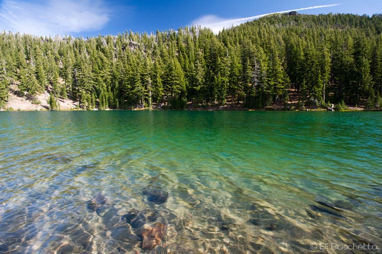
In the shadow of the Tam McArthur Rim, Little Three Creek Lake offers pleasant lunch and camp sites.
Sisters Wilderness
Location: 44.127151, -121.667318
Hike several miles of cool, forested trail on the north side of the Broken Top loop.
Park Meadow
Location: 44.116338, -121.705041
Park Meadow offers nice camping with big, open views of South Sister and Broken Top.
Golden Lake
Location: 44.103304, -121.714354
Surrounded by meadows, in the shadow of Broken Top, Golden Lake has nice campsites with views of the Three Sisters.
Sisters Pass
Location: 44.106817, -121.729245
Approaching the 7,000′ pass above the Green Lakes basin.
Upper Lake
Location: 44.093318, -121.731005
Upper of the three Green Lakes.
Middle Lake
Location: 44.088448, -121.72946
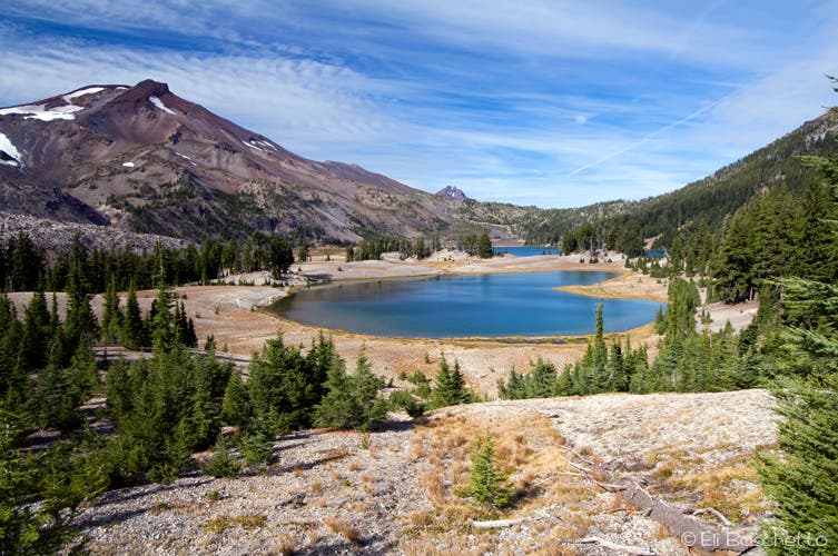
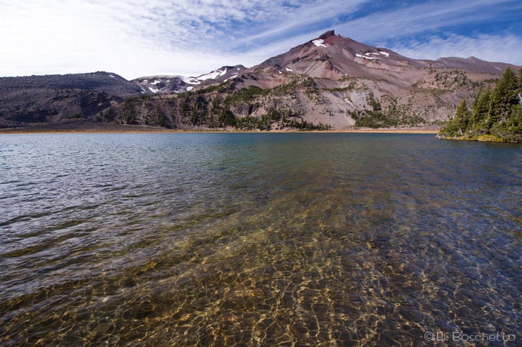
The middle, and largest, of the three Green Lakes, backed by South Sister.
Green Lakes
Location: 44.078768, -121.727915
The Green Lakes basin, with lower lake in the foreground, and South Sister behind.
Pumice Plain
Location: 44.075624, -121.724095
A slope of light-colored pumice and cinders spill from the flank of Broken Top.
Crater Creek
Location: 44.060854, -121.690235
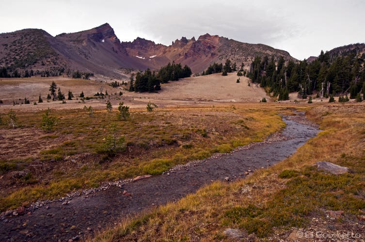
Crater Creek flows down from the Crook Glacier, deep in the bowels of Broken Top’s south-facing cirque.
Cross Country
Location: 44.065325, -121.684356
A light use trail heads upwards towards Broken Top’s massive crater-like cirque.
Crater Lake
Location: 44.080957, -121.685321
A milky lake fills this crater-like cirque below the remains of the Bend Glacier.
Broken Hand
Location: 44.082005, -121.677017
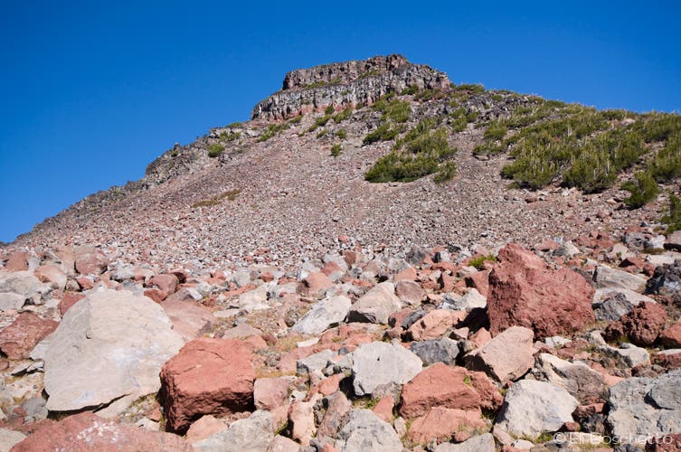
Completion of the Broken Top loop trail requires a cross-country route below the rocky slopes of Broken Hand.
Rim Trail
Location: 44.089527, -121.659894
Finish the Broken Top loop by connecting to the Tam McArthur Rim trail.