Backyard Everests: Mt. Alice

'(imagesofrmnp.com)'

(imagesofrmnp.com)

(imagesofrmnp.com)
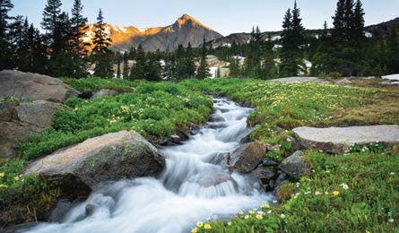
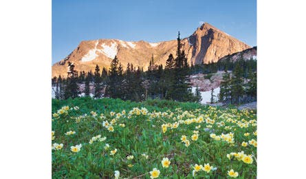
Fly under the radar as the vacationing crowds from points east march antlike up Longs Peak, Alice’s superstar neighbor a few miles to the north. The route to this 13,310- foot summit is a true locals-only find, with a healthy dose of spicy scrambling to make it even more adventurous. You’ll hike past five pristine high-altitude lakes over krummholz and boulders as the terrain changes from subalpine forest to tundra, eventually reaching an easy but exposed ridge to the summit. Choose your own line and make the final scramble to the summit as challenging as you want, and take in views of the steep, rocky walls of Longs Peak and Chiefs Head to the north and Isolation Peak to the south.
DO IT From the Wild Basin trailhead, hike the Wild Basin Trail, passing three waterfalls (Copeland, Calypso Cascades, and Ouzel) in the first three miles. Camp at the Siskin or North St. Vrain campsites at 9,400 feet, and head out early the next morning for a big summit day—by making it an overnight, you’ll see the alpenglow on Mt. Alice’s east face without the alpine start. Follow the trail to Lion Lake No. 1, then take a path past Lion Lake No. 2, and up the ridge southwest of Snowbank Lake to the saddle between Mt. Alice and Chiefs Head Peak, keeping an eye out for bighorn sheep and marmots. Head south from the saddle over Hourglass Ridge and scramble up talus to the summit. Take the easier descent to Boulder-Grand Pass, down to Thunder Lake, and back to your campsite.
CLIMBING MAGAZINE RECOMMENDS Solitude on a Rocky Mountain National Park alpine climb is possible—on the eight-pitch, 5.8 Central Ramp on Mt. Alice, one of the longest 5.8 routes in the park.
GET THERE From Denver, take US 36 for 36 miles to CO 7 in Lyons. Turn west and go 21 miles to Wild Basin Rd. Follow it 2 miles to Wild Basin trailhead.
GUIDEBOOK Rocky Mountain National Park: The Complete Hiking Guide, by Lisa Foster ($28, westcliffepublishers.com)
MAP Trails Illustrated Rocky Mountain National Park ($12, natgeomaps.com)
PERMIT Required ($20). Reserve by phone starting March 1.
CONTACT (970) 586-1242; nps.gov/romo
TRIP DATA backpacker.com/hikes/mtalice
ELEVATION 13,310 feet
GAIN 4,800 feet
MILES 16
ROUTE Hourglass Ridge via Wild Basin Trail
DRIVE 2 hours