Published September 20, 2013 03:30PM
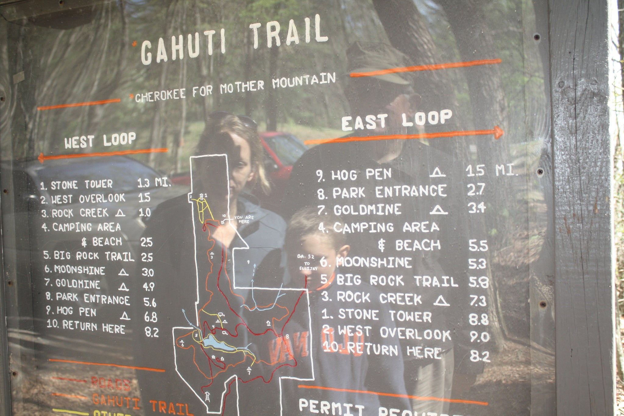
Atlanta: Gahuti Backcountry Trail
This moderate 7.9-mile loop descends into lush tunnels of rhododendron, then rises to lofty views of endless forest in Fort Mountain State Park.
'GA-Kayaker'
Trail Facts
- Distance: 12.7
Waypoints
GMT001
Location: 34.7787780761719, -84.7054290771484
Gahuti Backcountry Trail heads SE, following orange blazes
GMT007
Location: 34.7543487548828, -84.70458984375
Turn L to continue on Gahuti
GMT008
Location: 34.7516975402832, -84.7087020874024
Cross paved road, bearing NW
GMT009
Location: 34.7584037780762, -84.7134628295898
Turn L @ T
GMT010
Location: 34.7596778869629, -84.7116622924805
Cascading waterfall in Goldmine Brook
GMT011
Location: 34.7639389038086, -84.7097473144531
Bear L @ Y, ticking off more orange blazes
GMT012
Location: 34.779598236084, -84.7054443359375
Picture perfect: Overlook peers down into a giant forested valley; follow orange blazes to parking lot
GMT002
Location: 34.7639312744141, -84.6996383666992
Turn L; lush pods of rhododendron
GMT003
Location: 34.764217376709, -84.6972274780274
After crossing wooden bridge, turn R
GMT004
Location: 34.7643013000488, -84.6948165893555
Continue straight and head E (orange blazes)
GMT005
Location: 34.7594261169434, -84.6927032470703
Cross paved road; trail continues a few yards on the L
GMT006
Location: 34.754337310791, -84.6940231323242
Park bench overlooks a sea of leafy ridges and a fertile valley to the SE