Published September 20, 2013 03:31PM
Atlanta: Dockery Lake Trail
Walk 6.8 miles out and back on a rocky singletrack path into an intimate ravine streaming with cold, blue mountain waters. The hike ends at a quiet Appalachian high point.
'Greg Gilbert'
Trail Facts
- Distance: 5.5
Waypoints
DLT001
Location: 34.6730728149414, -83.9767379760742
From NE end of parking lot, hop on Dockery Lake Trail
DLT002
Location: 34.6739196777344, -83.9764099121094
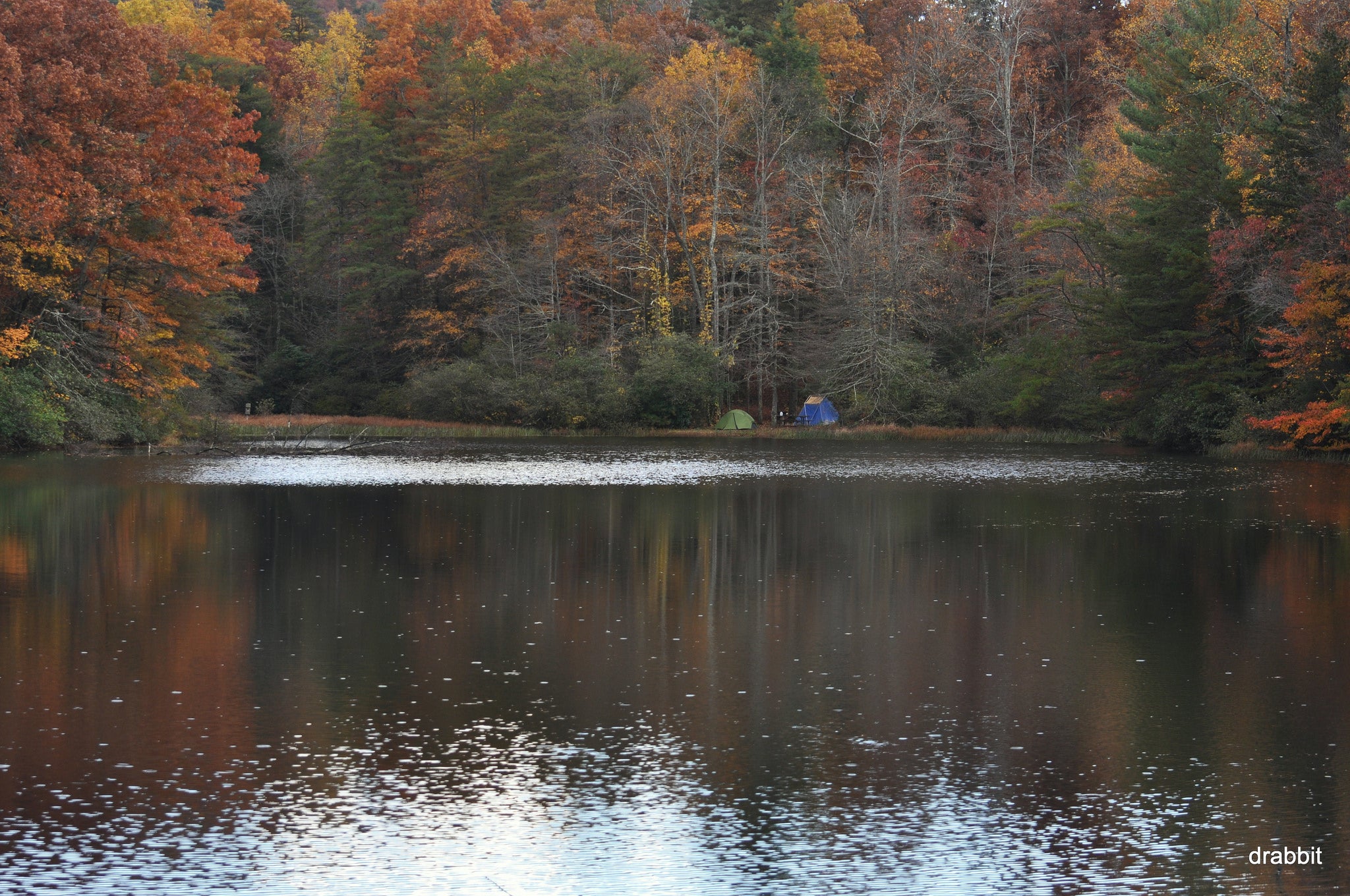
Cross wood bridge, traveling N along lakeside
DLT003
Location: 34.6775321960449, -83.9745788574219
Views of distant ridges to the E
DLT004
Location: 34.6792068481445, -83.9806137084961
Cross stream
DLT005
Location: 34.6815299987793, -83.977424621582
Fill water bottle near cascading stream
DLT006
Location: 34.6842231750488, -83.9774856567383
Creek runs wide and swift; good primitive campsites in flats
DLT007
Location: 34.6856155395508, -83.9784545898438
Climb along Pigeon Roost Creek as the Tennessee Valley Divide springs up on the L
DLT008
Location: 34.6983451843262, -83.9796981811524
Wooded col; views only in autumn and winter when the leaves have fallen from the mature oaks and maples
DLT009
Location: 34.7040824890137, -83.9847717285156
Dockery Lake Trail comes to a T with Appalachian Trail. Eat a quiet lunch with distant mountains views, then return to your car the way you came.
ADVERTISEMENT
Optional add-on: To make this hike a loop, turn S onto the AT and follow to Windy Gap, then turn E on GA 60 back to Dockery Lake Campground. Adds 2.2 miles to total mileage.