Asheville, NC: Mount Mitchell via Black Mountain Crest Trail

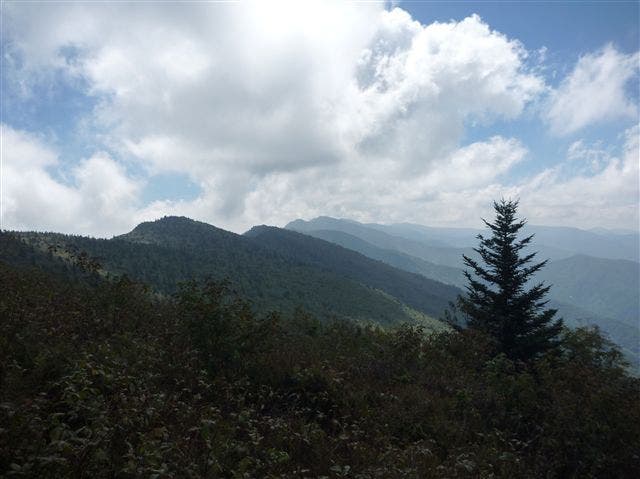
Renowned as the most rugged trail in the East, this ridge-top 11-miler climbs to a parade of increasingly breathtaking panoramas before leading to the legendary Mount Mitchell. Fill up water bottles at the deliciously cool Bowlens Creek (the only reliable source until Deep Gap, mile 7.3) and head south to get started. The bulk of the route’s elevation gain occurs in the beginning, with over 3,000 feet of vertical crammed into the first four miles. After cresting your first 6,000-foot peak (Celo Knob, 6,585 feet), you’ll hover between 5,000 and 6,000 feet for the remainder of the trip.
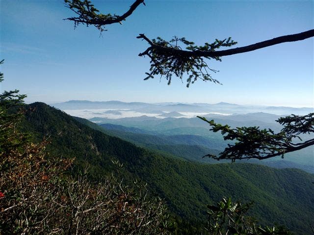
Enjoy sprawling ridgeline vistas as you pass Horse Rock, Gibbs Mountain and Winter Star en route to Deep Gap, the only spot along the route where camping is permitted. Use the short but steep side trail (yellow-blazed Colbert Creek Trail) to fill up on water before taking on the nasty climb to Potato Hill and Cattail Peak. The thigh-searing ascent rewards with additional panoramas from openings above the lush woodland.
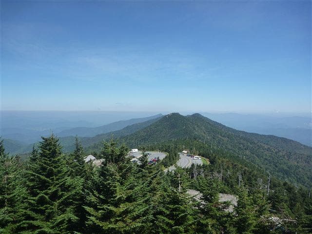
Continue past Balsam Cone and Big Tom before cresting Mount Craig, the final hurdle before Mount Mitchell. Craig marks the end of the Black Crest Trail and the start of the Mount Mitchell Trail. Expect a bump in crowds as you hit the parking lot prior to trekking the last 0.2 mile to Mount Mitchell’s 6,686-foot summit. Climb the observation tower for limitless vistas of the idyllic hill country below before turning around for a quick backtrack to your car in the parking lot.
Notes: This is a shuttle hike, and parking is available at both the Mount Mitchell and Bolens Creek trailheads. Camping is also available at the Bolens Creek trailhead.
-Mapped by Peter Shellabarger


Trail Facts
- Distance: 18.0
Waypoints
BMC001
Location: 35.877228, -82.284709
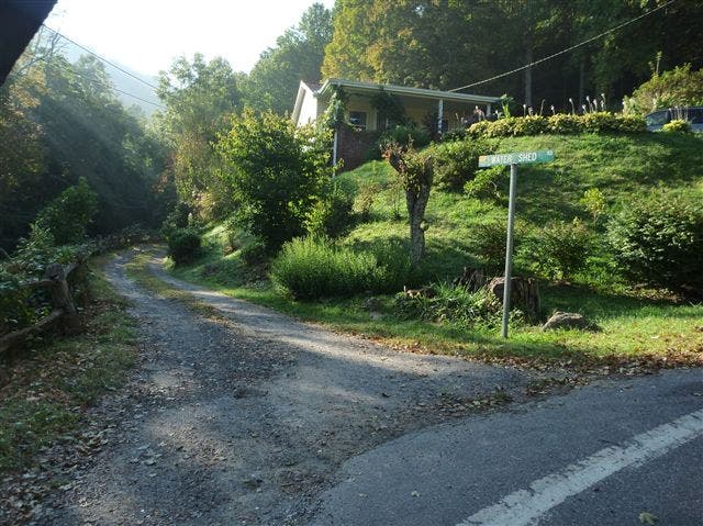
Turn left on Water Shed Road to head toward the trailhead.
BMC002
Location: 35.874017, -82.282221
Leave your car in the lot at the Bolens Creek Trailhead and head southeast to get started.
The trail is easy to follow, but devoid of blazes.
BMC003
Location: 35.85825, -82.257352
Seasonal water source located here.
BMC004
Location: 35.855474, -82.251742
Bushwhack your way to the top of Celo Knob (6,585 feet), the first of the hike’s numerous 6,000-foot summits.
BMC005
Location: 35.847839, -82.247386
The trail swings just west of Horse Rock (6,211 feet). Take a side-trip to the top for another high-country vantage point.
BMC006
Location: 35.840777, -82.248201
Pass Gibbs Mountain (6,198 feet), another quick side-trip away.
BMC007
Location: 35.817465, -82.249274
The trail crosses Winter Star (6,188 feet). A small side trail to the east leads to a USGS marker denoting the summit.
BMC008
Location: 35.816143, -82.251377
Deer Mountain, just below Winter Star at 6,076 feet, is visible to the east of the trail.
BMC009
Location: 35.812388, -82.252054
Deep Gap is the only site along the trail where camping is permitted. It also marks the junction with the yellow-blazed Colbert Creek Trail, which forks east to a water source 0.2 miles below. The trail is steep and primitive. After filling up, take on a strenuous climb from Deep Gap to Potato Hill.
BMC010
Location: 35.813637, -82.247944
Water source off the Colbert Creek Trail.
BMC011
Location: 35.801482, -82.253114
Savor gorgeous vistas from Potato Hill (6,317 feet) after the grueling climb from Deep Gap.
BMC012
Location: 35.797339, -82.257067
Reach Cattail Peak (6,516 feet) and cross into Mount Mitchell State Park.
BMC013
Location: 35.789561, -82.255956
Cross over Balsam Cone (6,585 feet), the route’s 7th peak above 6,000 feet.
BMC014
Location: 35.779839, -82.259845
Roll over Big Tom (6,585 feet) before peaking Mount Craig, which looms less than 0.5 mile to the south.
BMC015
Location: 35.777617, -82.261789
Ascend Mount Craig (6,637 feet), the final peak before Mount Mitchell. Enjoy the magnificent views of Mitchell to the south before beginning the hike’s home stretch.
BMC016
Location: 35.767607, -82.264537
The Black Crest Trail ends here, yielding to the Mount Mitchell Trail. From here, the hike’s final summit sits just 0.2 mile away.
BMC017
Location: 35.764839, -82.26512
At 6,686 feet, Mount Mitchell is the highest point east of the Mississippi River.
Water Shed Road
Location: 35.877159, -82.283907
Turn left at the inconspicuous Water Shed Road to head toward the trailhead.
Water Source
Location: 35.858344, -82.257557
Seasonal water source located here.
Black Mountains
Location: 35.851109, -82.249575
Gain sweeping panoramas of the Black Mountains from Celo Knob.
Potato Hill Panoramas
Location: 35.803196, -82.252579
Notch breath-taking vistas of the valley below Deep Gap from Potato Hill.
Vertical Trail
Location: 35.784886, -82.258501
The trail ascends upward at a sharp grade as you push toward Mount Craig.
Mount Mitchell Panorama
Location: 35.764552, -82.264423
Hey, did you know that Mount Mitchell was the highest point east of the Mississippi?