Appalachian Trail: VA 606 to VA 663

Shelters: Wapiti Shelter; sleeps 8.


Trail Facts
- Distance: 24.1
Waypoints
WPT003
Location: 37.2417488098144, -80.8645858764648
Big Horse Gap. Cross FS 612
WPT036
Location: 37.2463989257812, -80.853385925293
AT turns W
WPT003
Location: 37.1886825561523, -80.8924331665039
Tiny stream
WPT016
Location: 37.2130165100098, -80.8543472290039
Gravel road
WPT021
Location: 37.2212677001953, -80.8406295776367
Bridge over stream
WPT033
Location: 37.2248840332031, -80.8207321166992
Stream
ZZZ040
Location: 37.1706504821777, -80.9021072387695
VA 606
WPT005
Location: 37.1908340454102, -80.8915634155274
AT turns E
WPT018
Location: 37.1867828369141, -80.8996276855469
Campsite
WPT007
Location: 37.1963996887207, -80.8822479248047
AT turns E @ trail jct.
WPT022
Location: 37.2213668823242, -80.840446472168
AT turns E; campsite
WPT027
Location: 37.224250793457, -80.8275527954102
Campsite
WPT009
Location: 37.1997337341309, -80.8769989013672
Tiny stream
WPT008
Location: 37.1982345581055, -80.8800506591797
Small stream. AT turns E
WPT024
Location: 37.2220993041992, -80.8376846313476
AT turns E
WPT026
Location: 37.223014831543, -80.831916809082
Bridge over small stream
WPT014
Location: 37.2101669311523, -80.8572845458984
Tiny stream
WPT010
Location: 37.1997680664062, -80.8756637573242
AT turns W; stream
WPT030
Location: 37.2248344421387, -80.824951171875
Stream. AT turns W
WPT023
Location: 37.2213668823242, -80.8401184082031
Bridge
WPT031
Location: 37.2246513366699, -80.8244323730469
Trail to Wapiti Shelter
WPT011
Location: 37.2025833129883, -80.8686370849609
Old trail to the E
WPT028
Location: 37.2245178222656, -80.8271865844726
Cross trail
WPT001
Location: 37.1859741210938, -80.901611328125
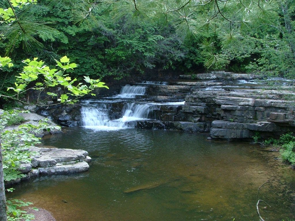
Falls of Dismal
WPT017
Location: 37.2137489318848, -80.8543701171875
Bridge over Dismal Creek
WPT013
Location: 37.2093162536621, -80.858512878418
Side trail to the E
WPT004
Location: 37.2529830932617, -80.8588027954102
Jeep road
WPT015
Location: 37.2110824584961, -80.8569183349609
Jefferson National Forest
WPT004
Location: 37.1887817382812, -80.8919677734375
Campsite
WPT029
Location: 37.2250518798828, -80.826301574707
Bridge
WPT017
Location: 37.1859016418457, -80.8968353271484
Blue-blazed trail to falls (.3 mi.)
WPT016
Location: 37.1707000732422, -80.9014358520508
Trail register
WPT019
Location: 37.2158164978027, -80.8498306274414
Side trail to the E
WPT006
Location: 37.1932334899902, -80.8851699829102
Bridge
ZZZ041
Location: 37.2560348510742, -80.8556976318359
VA 663. Road to Wood Hole
WPT025
Location: 37.2224998474121, -80.8346328735352
Bridge
WPT032
Location: 37.2242164611816, -80.8227310180664
Side trail to the E
WPT002
Location: 37.2419662475586, -80.8629302978516
Road crossing
WPT012
Location: 37.2031173706055, -80.8684692382812
AT turns E
WPT018
Location: 37.2153663635254, -80.8507995605469
Bridge over stream
WPT037
Location: 37.2420845031738, -80.8623657226562
FS 103
WPT034
Location: 37.2284660339356, -80.8157806396484
Stream
WPT035
Location: 37.242000579834, -80.8162689208984
Viewpoint: See Pearisburg lights at night. Ridgeline hiking on Sugar Run Mtn.
DSCF4991
Location: 37.18603515625, -80.901481628418
DSCF4938
Location: 37.2214317321777, -80.8397979736328
DSCF4934
Location: 37.2139053344727, -80.8543090820312