Appalachian Trail: Springer Mountain to Woody Gap

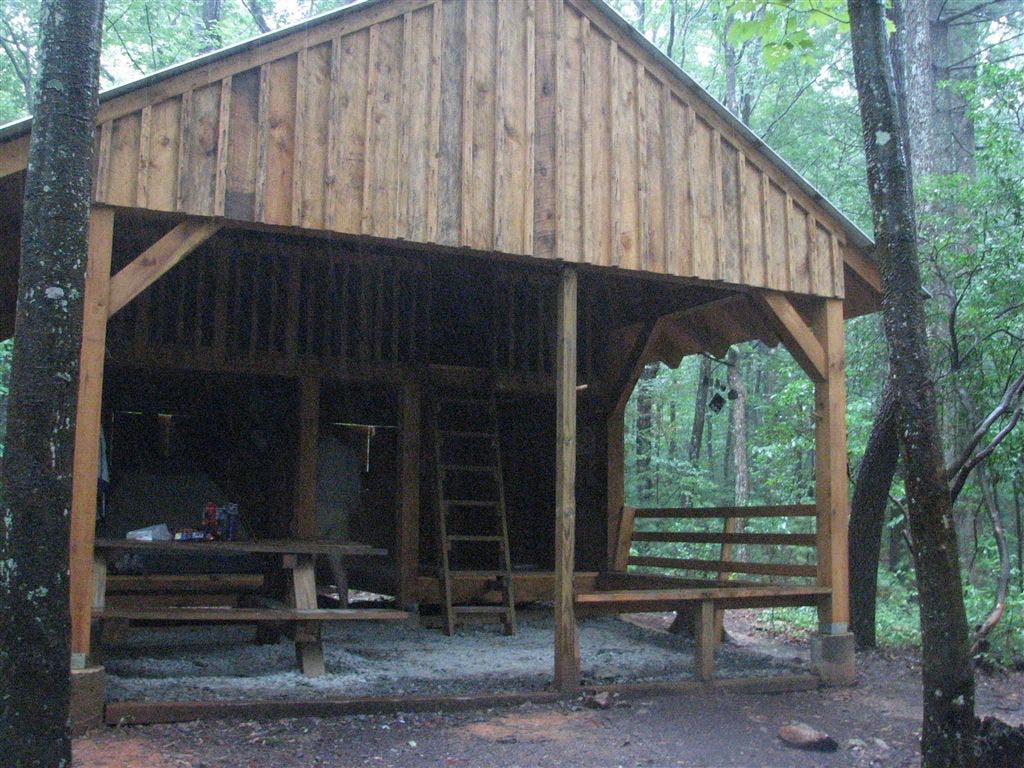
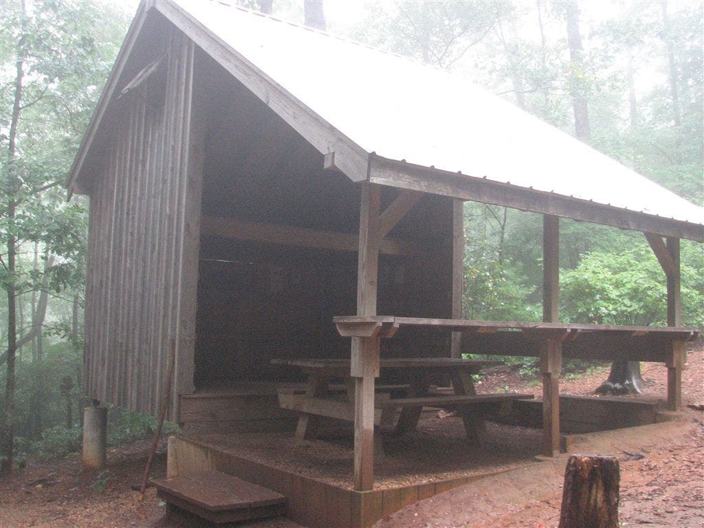
Shelters: Stover Creek Shelter: sleeps 6; no privy. Hawk Mountain Shelter: sleeps 12; privy. Gooch Mountain Shelter: sleeps 14; privy.


Trail Facts
- Distance: 31.1
Waypoints
AT0001
Location: 34.6266174, -84.1939163
Springer Mtn. (3,782 ft.): The southern terminus of the AT
AT0002
Location: 34.6286659, -84.1944199
Side trail to shelter; water; camping
AT0003
Location: 34.6301346, -84.1946335
Bear L @ Y with Benton MacKaye Trail to stay on AT
AT0004
Location: 34.6375351, -84.1952133
Cross FS 42
AT0005
Location: 34.6376495, -84.1951675
Parking along FS 42
AT0006
Location: 34.6402321, -84.1914673
Straight @ 4-way with Benton MacKaye Trail
AT0007
Location: 34.6441994, -84.1915359
Small stream crossing
AT0008
Location: 34.6475334, -84.1933823
Straight @ 4-way with Benton MacKaye Trail
AT0009
Location: 34.6490173, -84.1978149
Stover Creek
AT0010
Location: 34.6502686, -84.1974487
Stover Creek Shelter
AT0011
Location: 34.6502686, -84.1980667
AT turns W @ jct. with side trail to Stover Creek Shelter
AT0012
Location: 34.6512833, -84.1981659
Cross Stover Creek
AT0013
Location: 34.6517677, -84.1985016
AT switchbacks
AT0014
Location: 34.65625, -84.195282
Small stream crossing
AT0015
Location: 34.6596985, -84.1896515
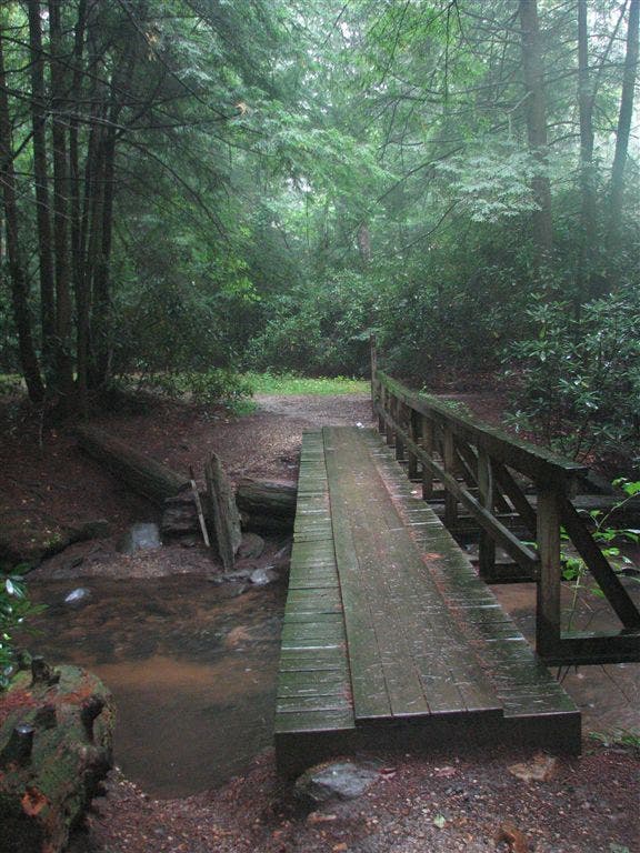
Bridge over Stover Creek
AT0016
Location: 34.6597824, -84.189064
Campsite (room for 1 tent)
AT0017
Location: 34.6625175, -84.1845169
Benton MacKaye Trail enters on the R
AT0018
Location: 34.6629982, -84.1843491
Campsite (room for 5 tents)
AT0019
Location: 34.663166, -84.1845169
Campsite (room for 3 tents)
AT0020
Location: 34.6633492, -84.1843643
Stover Creek
AT0021
Location: 34.6636658, -84.1840134
Three Forks; cross FS 58
AT0022
Location: 34.6663818, -84.179863
Campsite (room for 2 tents)
AT0023
Location: 34.6671181, -84.1772003
Long Creek; side trail to the W to campsite (room for 3 tents)
AT0024
Location: 34.6672516, -84.1754837
Side trail to the W to Long Falls
AT0025
Location: 34.6672668, -84.1727371
Wide trail shortly; evergreens
AT0026
Location: 34.6666985, -84.1716537
Benton MacKaye Trail to the W leads to Long Creek Falls
AT0027
Location: 34.6651649, -84.1695175
Old road
AT0028
Location: 34.6653328, -84.1620865
Cross dirt road; field to the E
AT0029
Location: 34.6653328, -84.1615677
Logging road; gravel
AT0030
Location: 34.6653824, -84.1610489
Double track
AT0031
Location: 34.6647987, -84.1601486
Campsite (room for 2 tents)
AT0032
Location: 34.6650848, -84.1428146
Trail to the W to Big Hole Tree (25 ft.)
AT0033
Location: 34.66465, -84.1368179
Side trail to the E leads to Hawk Mtn. Shelter; campsite (room for 4 tents)
AT0034
Location: 34.6636658, -84.1295853
Hightower Gap; FS 69 and FS 42 jct.
AT0035
Location: 34.6641998, -84.1255341
Campsite (room for 1 tent)
AT0036
Location: 34.660183, -84.1187134
Campsite (room for 2 tents)
AT0037
Location: 34.6578827, -84.1147995
Side trail to the W
AT0038
Location: 34.6554832, -84.1053848
Horse Gap. AT adjacent to FS 42
AT0039
Location: 34.6536331, -84.1009674
AT turns W
AT0040
Location: 34.6534996, -84.1000824
Partial views to the WSW
AT0041
Location: 34.6535149, -84.0990295
Campsite (room for 2 tents)
AT0042
Location: 34.6530685, -84.0942001
Side trail leads to campsite (room for 2 tents)
AT0043
Location: 34.652832, -84.0940323
Sassafras Mtn.
AT0044
Location: 34.653183, -84.0845184
Cooper Gap. Jct. with FS 42, FS 15, and FS 80. Campsite (room for 4 tents) and parking
AT0045
Location: 34.6530342, -84.0806351
AT veers W @ jct. with side trail to the E to overhanging rock
AT0046
Location: 34.655899, -84.0801468
Justus Mtn.
AT0047
Location: 34.6554184, -84.0802689
Campsite (room for 2 tents)
AT0048
Location: 34.6573486, -84.0711365
Phyllis Spur
AT0049
Location: 34.6568336, -84.0640869
Trail jct.
AT0050
Location: 34.6566315, -84.0639496
Campsite (room for 2 tents)
WPT007
Location: 34.657383, -84.0568466
Justus Creek; small stream crossing
WPT002
Location: 34.6550331, -84.0497131
Side trail to shelter
WPT039
Location: 34.664032, -84.1837463
Campsite (room for 3 tents)
WPT042
Location: 34.6728172, -84.0161819
Ramrock Mtn.; side trail to the E leads to views to the SSW. Campsite (room for 1 tent)
WPT040
Location: 34.6702347, -84.0052643
Campsite (room for 2 tents)
WPT047
Location: 34.6643333, -84.0274353
Jeep road
WPT043
Location: 34.6717339, -84.017334
Jacks Gap
WPT053
Location: 34.6548347, -84.0435333
Campsite (room for 1 tent)
WPT006
Location: 34.6575661, -84.055748
AT passes side trail
WPT044
Location: 34.6701851, -84.0206528
Views to the SSE; campsite (room for 1 tent)
ZZZ003
Location: 34.6776161, -84.0001297
Woody Gap; parking; trash; picnic tables; restrooms; views to the S
WPT051
Location: 34.652916, -84.0327988
Campsite (room for 2 tents)
WPT054
Location: 34.6549835, -84.0491486
AT turns E @ jct. with side trail to shelter
AT0051
Location: 34.6562004, -84.063385
Justus Creek; side trail to the W
WPT003
Location: 34.6548653, -84.0516129
AT turns W @ jct. with side trail to the E
WPT041
Location: 34.6728516, -84.0130844
Side trail to the W
WPT008
Location: 34.6559334, -84.0629196
Campsite (room for 2 tents)
WPT048
Location: 34.6525154, -84.0314026
Gooch Gap; side trail to the E to water; nice campsite (room for 6 tents)
WPT055
Location: 34.6558151, -84.0498657
Gooch Mtn. Shelter
WPT049
Location: 34.6522179, -84.0321808
FS 42
WPT045
Location: 34.6684685, -84.0255814
Liss Gap
WPT050
Location: 34.6522827, -84.0324631
Campsite (room for 8 tents)
IMG_6105
Location: 34.6535339, -84.1002197
WPT046
Location: 34.666935, -84.0289993
Campsite (room for 3 tents)
WPT052
Location: 34.6553154, -84.0350037
Tiny spring (may be dry)
WPT004
Location: 34.653801, -84.052803
Blackwell Creek
IMG_6149
Location: 34.6633682, -84.1843185
IMG_6169
Location: 34.6503487, -84.197464
IMG_6094
Location: 34.6556511, -84.0500031
IMG_6139
Location: 34.6652184, -84.1825638