Appalachian Trail: Beagle Gap to Blackrock

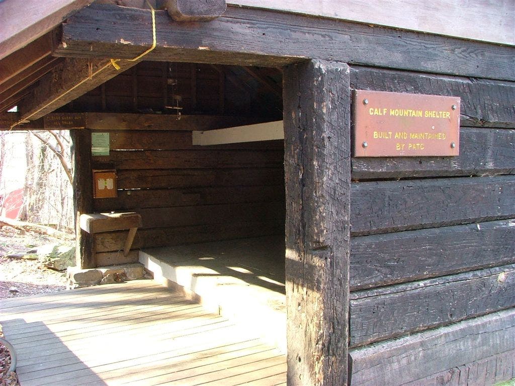
Shelters: Calf Mountain Shelter: sleeps 6.


Trail Facts
- Distance: 24.3
Waypoints
WPT016
Location: 38.2192993164062, -78.7394866943359
Blue-blazed trail to summit. Trayfoot Mtn. Trail
WPT032
Location: 38.096866607666, -78.7782135009766
Spring
WPT004
Location: 38.0816345214844, -78.7838821411133
Calf Mountain
WPT022
Location: 38.1895484924316, -78.7568130493164
Skyline Drive mile marker 88.9
WPT026
Location: 38.1492156982422, -78.7745819091797
Skyline Drive mile marker 92.4; parking
WPT001
Location: 38.0855178833008, -78.7854537963867
Calf Mtn. Shelter
WPT027
Location: 38.129264831543, -78.7843704223633
Skyline Drive mile marker 94.1. Turk Gap. Turk Branch Trail and parking
WPT033
Location: 38.0965156555176, -78.7801971435547
Bucks Elbow Rd.; .1 mi. to Jarman Gap
WPT037
Location: 38.0856666564941, -78.7815170288086
Blue-blazed trail leads to shelter
WPT036
Location: 38.090015411377, -78.7835845947266
Power line
WPT024
Location: 38.1781845092773, -78.7649154663086
Trail to Riprap parking
WPT023
Location: 38.1826324462891, -78.7618865966797
Riprap Trail
WPT018
Location: 38.2147178649902, -78.7441635131836
AT turns W @ trail jct.
WPT013
Location: 38.2220649719238, -78.7351837158203
Blue-blazed Trayfoot Mtn. Trail
WPT002
Location: 38.0855178833008, -78.7842025756836
Piped spring
WPT021
Location: 38.1954002380371, -78.7524185180664
Saddle
WPT030
Location: 38.1062507629394, -78.778564453125
Power line
WPT034
Location: 38.0910339355469, -78.7821655273438
Spring
WPT040
Location: 38.2232513427734, -78.7333679199219
Blackrock parking
WPT025
Location: 38.1534156799316, -78.774284362793
Wildcat Ridge Trail
WPT019
Location: 38.209716796875, -78.7476348876953
Skyline Drive mile marker 87.2
WPT028
Location: 38.1276016235352, -78.7877655029297
AT turns E @ jct. with Turk Mtn. Trail
WPT006
Location: 38.0732841491699, -78.7936325073242
Skyline Drive mile marker 99.5. Beagle Gap and parking
WPT038
Location: 38.0852165222168, -78.7836685180664
Spring
WPT005
Location: 38.0772171020508, -78.7919692993164
Trail to Calf Mtn. summit
WPT003
Location: 38.0854682922363, -78.7818984985352
Blue-blazed trail leads to shelter
WPT035
Location: 38.0907821655273, -78.7831802368164
Potomac Appalachian Trail Club/Shenandoah National Park sign
WPT031
Location: 38.0976829528809, -78.7788848876953
South Fork Moormans Rd.
WPT029
Location: 38.1141319274902, -78.7844161987305
Skyline Drive mile marker 95.3/Sawmill Run Overlook
WPT017
Location: 38.2146987915039, -78.7441329956055
Blue-blazed trail leads Blackrock Hut
WPT020
Location: 38.2070350646973, -78.749153137207
Skyline Drive mile marker 87.4. AT does not cross road
WPT014
Location: 38.2203178405762, -78.7402191162109
Blackrock boulder field
WPT015
Location: 38.220100402832, -78.7405700683594
Blackrock Trail
DSCF2383
Location: 38.0856170654297, -78.7855529785156
DSCF2352
Location: 38.1776504516602, -78.77001953125