Published September 20, 2013 02:31PM
Albany: Mount Frissell
Stand in three states, then summit a wooded peak while passing the highest hill in Connecticut on this 4-mile dayhike in the Taconic Mountains.
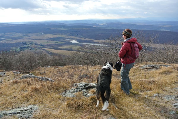
(Photo: James Dziezynski)
Mapped by Ed Wheeler
Read more about the hike from the Connecticut side at this Mount Frissell trip report.
Trail Facts
- Distance: 3.2
Waypoints
FRI001
Location: 42.0339088439941, -73.4717864990234
Head NW on worn 4WD road
FRI002
Location: 42.0371627807617, -73.4754104614258
Continue NW for gentle descent to creekbed. In .2 mi., cross Monument Brook
FRI003
Location: 42.039867401123, -73.4781265258789
Begin gentle ascent winding through lush ferns, hardwoods, and pines
FRI004
Location: 42.0426559448242, -73.4817810058594
Head NW around Mt. Frissell’s SW slopes. CT’s highest point is not Frissell’s summit, but a spot on its shoulder 1 mi. ahead
FRI005
Location: 42.0459403991699, -73.4870071411133
Stay straight on jeep trail @ 4-way. In 200 ft., cross into New York for brief .2-mi. stretch
FRI006
Location: 42.0494194030762, -73.489387512207
Turn R @ 4-way, heading E onto red-blazed trail that traces the NY/MA state line
FRI007
Location: 42.0495300292969, -73.4873199462891
ADVERTISEMENT
The 3-ft. stone pillar in the middle of the trail marks the point where CT, MA and NY meet. Continue E along CT/MA state line on trail lined with blueberry bushes: watch for rattlesnakes
FRI008
Location: 42.0496292114258, -73.4827880859375
CT’s high point is marked with a 4-in. green metal stake. Trail swings NE into MA. Look SE to Bear Mtn., CT’s highest peak entirely within the state
FRI009
Location: 42.0511093139648, -73.4820098876953
Mt. Frissell (2,453 ft.): This remote crag’s wooded crown is more than 1,000 ft. below MA’s highest point, and the views are scarce. Sign logbook and go home