Updated July 7, 2025 05:58PM
The 10 Most Memorable 10-Mile Hikes in North America
Ten trails. Ten unmatched miles each. Get maximum bang for each boot step on hikes that our most-traveled contributors call their all-time favorites.
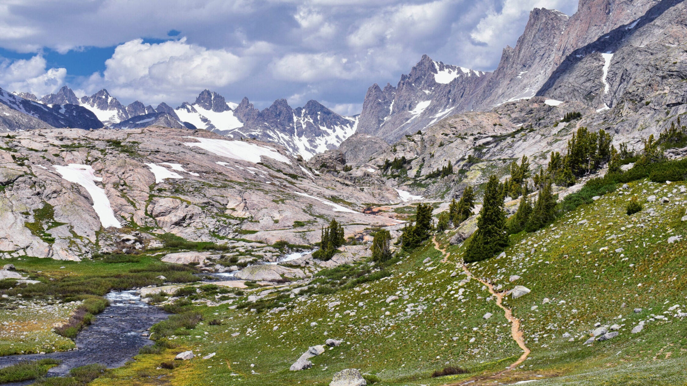
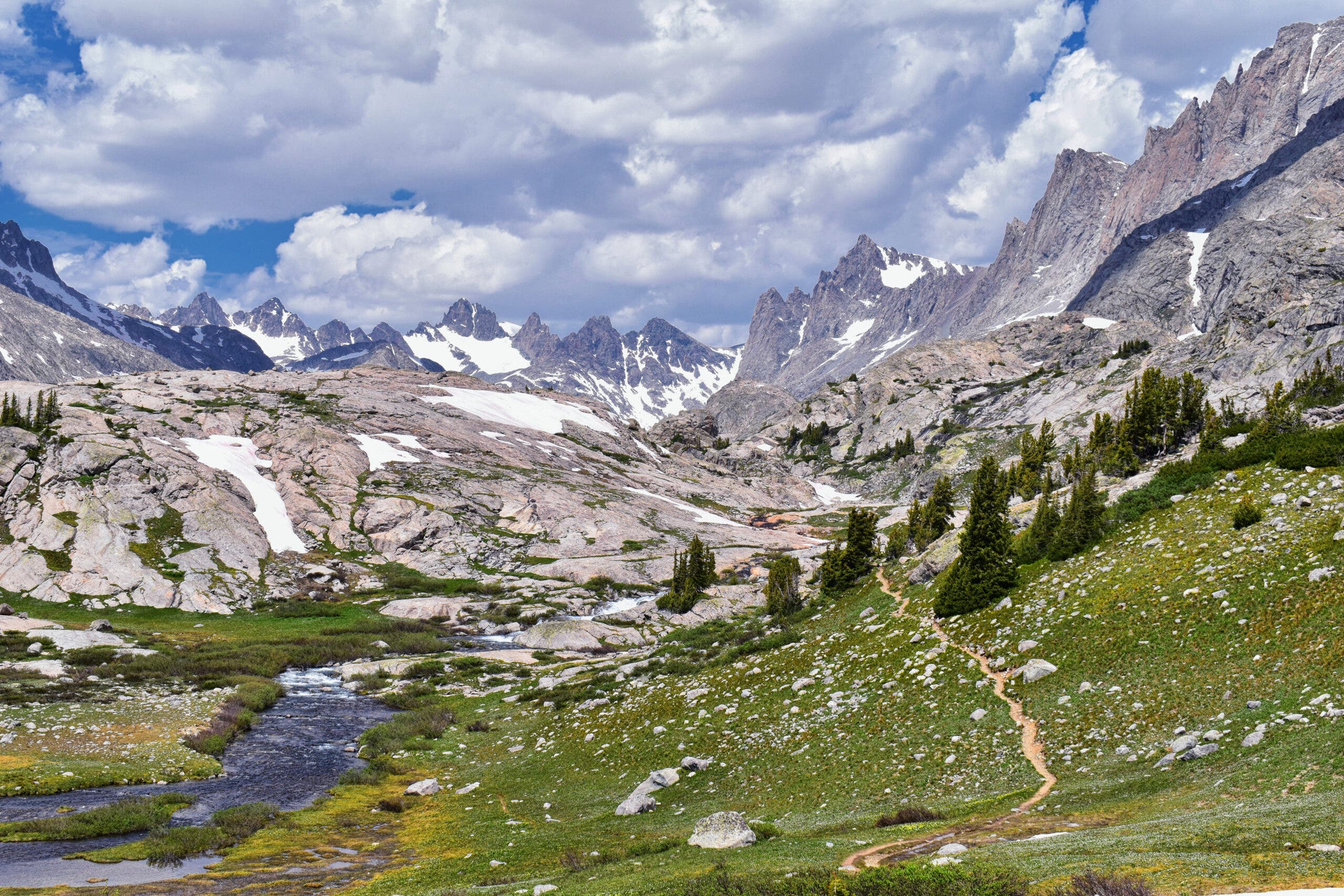
Upper and Lower Jean Lake in the Titcomb Basin along the Wind River Range, Rocky Mountains, Wyoming, views from backpacking hiking trail to Titcomb Basin from Elkhart Park Trailhead going past Hobbs, Seneca, and Island Lakes as well as Photographers point. (Photo: Jeremy Christensen/iStock via Getty Images)
Ten miles is the perfect trip length—a full day or a short backpack, with enough time in the woods that you can leave all your worries behind but not enough that your clothes will clear a room when you return to civilization. And while ten miles of any trail is good, ten miles of incredible wilderness hiking is an experience you will never forget. Check out our picks for the ten best ten-mile hikes on the continent, and start planning your next trip.
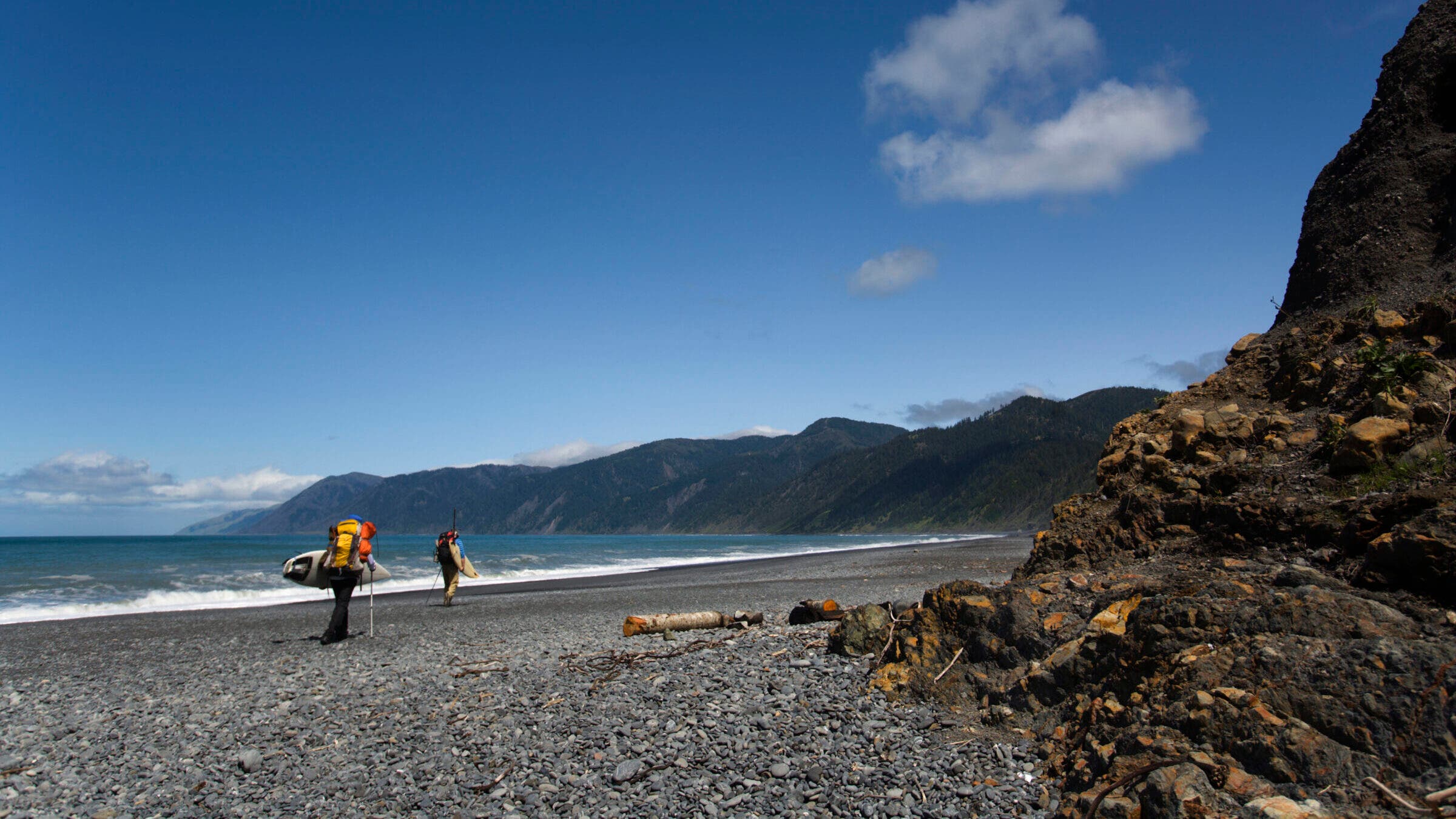
The Lost Coast, Sinkyone Wilderness State Park, CA
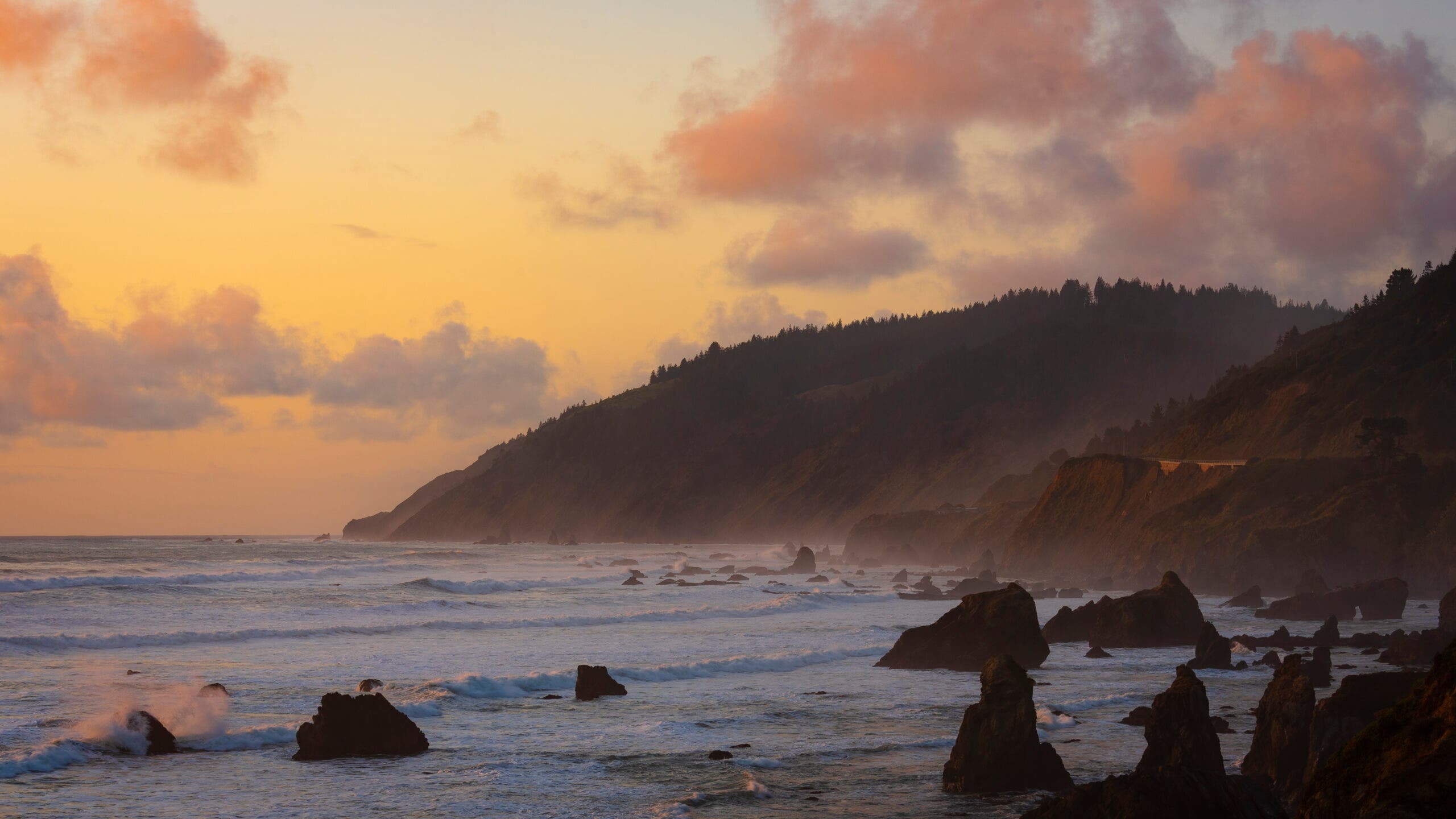
Find yourself among the redwoods and isolated coves of California’s wildest shoreline.
—Dennis Lewon
ADVERTISEMENT
The first time I hiked the Lost Coast, I was in college and it was spring, the sky was bright and clear, the irises blooming, and the beach campsites utterly deserted. Perfect conditions, at a perfect time in life. So when I heard other hikers have found the trail too wet, too cold, too hard, or all three, and vowed never to return, I wondered: Is my memory unreliable, corrupted by a golden moment I can’t repeat? To find out, I returned again and again over the years, and have experienced the notorious summer fog that erases everything but your buddy a few feet away, and rain so hard that I had to coax my friend to even get out of the car. On my most recent hike there, the poison oak grew so robustly it crossed the trail in places. I remain smitten.
Starting from the Usal trailhead and heading north, the Lost Coast Trail climbs through a grove of skyscraper redwoods infused with fairy-tale light; the red-green glow filters softly through the canopy and settles on emerald ferns that shine as if lit from within. By itself, the half-mile walk through the ancient trees is a life-list experience. Then you eject onto an open bluff, more than a thousand feet above the Pacific Ocean, with a whale-spotting vista that’s sure to stall your progress.
Next, you plunge into another redwood grove. Then you’ll push through waist-high red and pink and white wildflowers that pop in early summer. And you’re still just 30 minutes from the trailhead. Which, in short, is what puts the southern section of the Lost Coast in a class by itself. It’s perfect from the very first mile, and never lets up for the next 15 (the dozen miles north from Usal harbor my favorite views and beaches).
ADVERTISEMENT
True to the trail’s name, the coast itself remains alluringly out of reach, protected by a no-go zone of steep cliffs. The rugged terrain–which famously defeated road engineers constructing the Pacific Coast Highway–forces the trail to bounce between fern grottoes and ridge-hugging overlooks. By the time you reach Little Jackass Creek, at mile 7.3, you’ll have gained and lost a combined 5,503 feet of elevation. Now follow the creek down to a private beach, with space for one idyllic campsite. Wash the trail sweat off in the icy surf, build a little driftwood fire, and dig your tired feet into the cool sand. You’re far from lost.
You’re Not Alone
The Lost Coast is home to a whole host of critters, from ticks to peregrine falcons to black bears. Make sure you give the larger mammals their distance, especially bears and sea lions. Peregrine falcons and ravens love the rising thermals off the cliffs of the Kings Range; keep an eye out above to spot a passing raptor. Black bears frequent several of the campsites along the trail, and bear canisters are required for backpackers on the northern section. Ticks are especially common on the second half of the trail; long sleeves, long pants tucked into socks, and thorough body checks are the best way to ward them off.
The Trail
From Legget on US 101, go 15 miles west on CA 1 and turn right on Usal Rd. at mile marker 90.91 (warning: the unmarked dirt road may be impassable after heavy rains). Shuttle: Use the Lost Coast Shuttle or leave a car at Orchard Camp. The best ten miles are Usal trailhead to Wheeler Beach Camp (mile 11), but you can also continue to the northern trailhead at Orchard Camp (mile 16). From Usal Trailhead, head into forested ridges, then head through old-growth redwoods back towards the coast.
ADVERTISEMENT
Black Angel Trail, White Mountain National Forest, NH
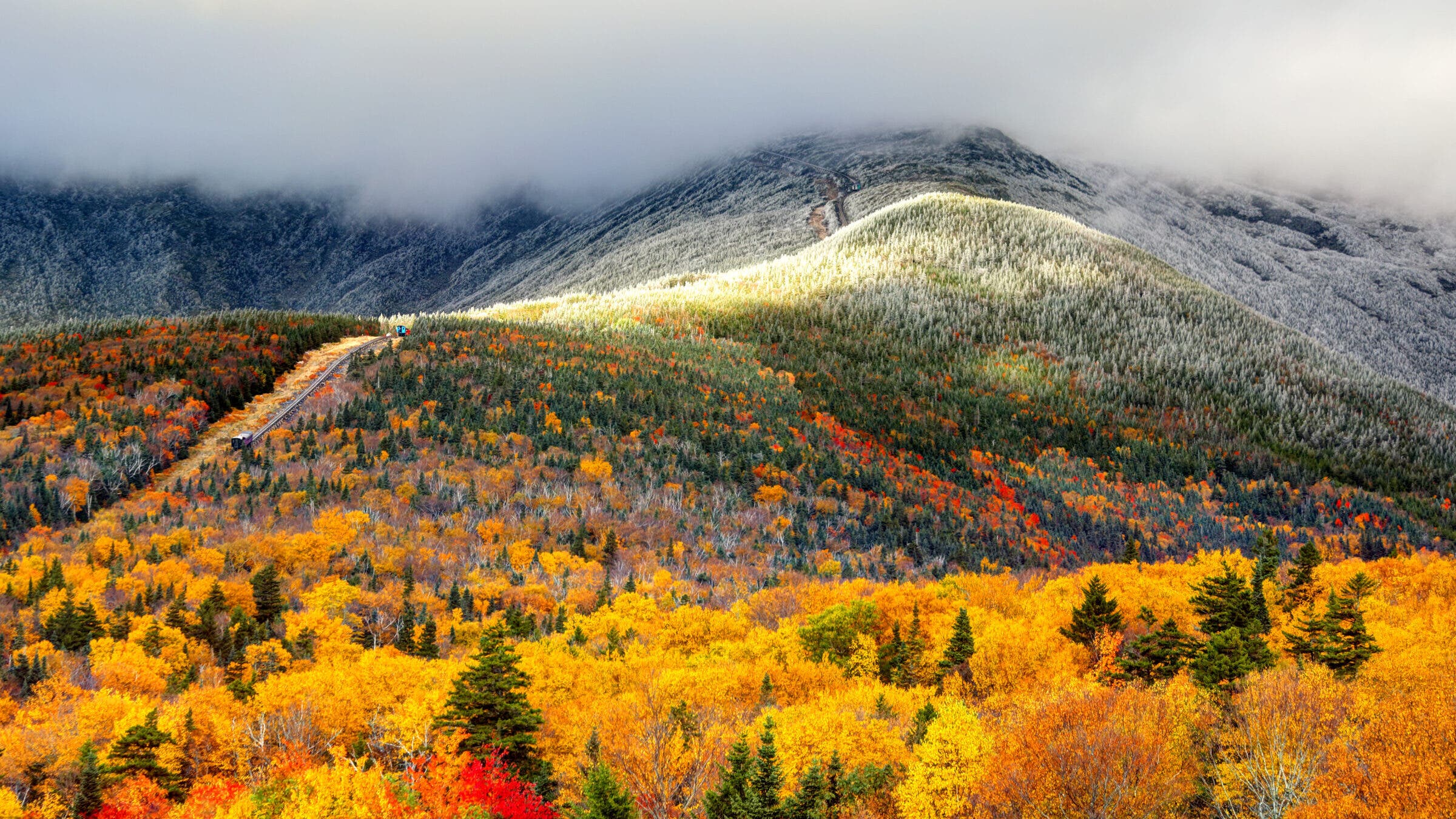
Sneak into a forgotten corner of the Northeast’s busiest forest.
—Larry Garland, as told to Courtney Holden
ADVERTISEMENT
Like so many hikers, I hike to get away from it all. Unlike most, I get to do it for work, as a cartographer for the Appalachian Mountain Club. In 2005, I became a redliner: My task was to hike every trail—which appear as red lines on our maps—in the Whites. I’m one of only four people to have hiked every one of them, more than 1,400 miles in total.
This forest is crawling with myriad, damn-fine 10-mile stretches, but I say the best in the whole 794,000 acres is the Black Angel Trail. It’s the embodiment of what hiking, at least for me, is all about: isolation and solitude in nature’s undomesticated playground. The Black Angel Trail is best tackled as part of a 16.9-mile figure-eight loop from the Wild River Campground. You’re deep in federally sanctioned backcountry—wilderness with a capital “W” as we call it—so there are no paint blazes on trees to help you find your way. All of this creates a buffer that keeps the crowds away.
On the Carter-Moriah Range, the nose of Carter Dome looks out to its mightier brother, Mt. Washington, and down on vistas over the Wild River Wilderness. If you’re sick for peace and quiet in the Northeast, what lies next is the prescription for you. Veer east to the Black Angel Trail, and drop off the ridge into a veritable no man’s land.
ADVERTISEMENT
The 3,100-foot descent down through birch glades inspires a contemplative spirit, so slow down as you stride from the virgin-timber realm of softwood pines and firs, then through sugar maples, birches, beech, and cherry trees. Do yourself a favor and go in early October for the best leaf-peeping of your life; you’ll be alone with your thoughts in an area of the wilderness overlooked by peakbaggers focused on the Presidentials.
The Science Behind the View
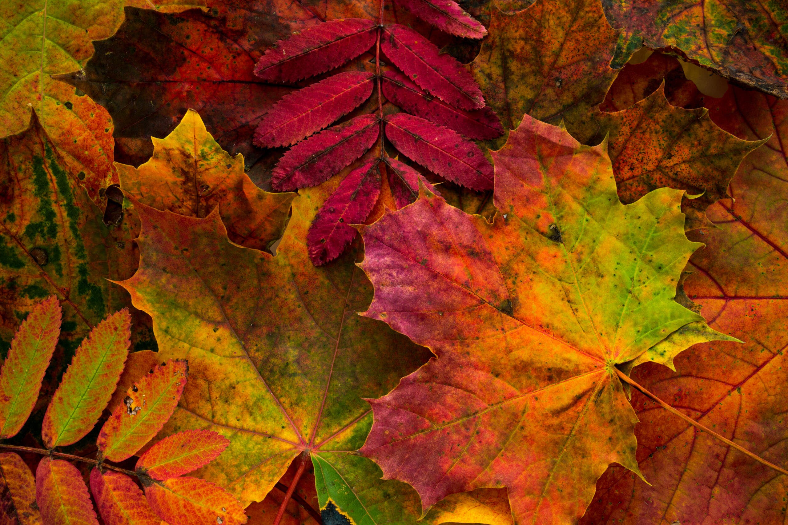
During the sunny days of summer, deciduous plants use chlorophyll to convert the long hours of sunlight into energy, then into new plant mass. That chlorophyll is what gives leaves and grass their green color. In the fall, as the sunlight weakens and the days shorten, the chlorophyll breaks down. This lets other pigments usually masked by the chlorophyll, like yellow and orange carotenes and xanthophyll, come forward. Other chemical changes in the leaves create new pigments, like those that turn dogwoods and sumacs purple and sugar maples deep red. As the leaves change, the tree also seals off the scar behind the stem, so that when the leaf falls under its own weight it doesn’t leave a wound on the branch.
The Trail
Start from the Wild River Campground. At 2.6 miles in, you come to a river ford that the guidebook warns may be problematic for “people with short legs or heavy packs”. Continue in a southwesterly direction, dodging the muddier sections as you follow the river up to its headwaters near the watershed divide and No Ketchum Pond. You can camp here at Perkin’s Shelter or push on, keeping right at the trail junctions to a 1,500-foot, 2.5-mile climb to Carter Dome. At the next junction, head east on the Black Angel Trail. Loop back around to the first junction and then head right, away from Wild River and towards Cedar Brook, to take the Black Angel Trail back to the trailhead.
ADVERTISEMENT
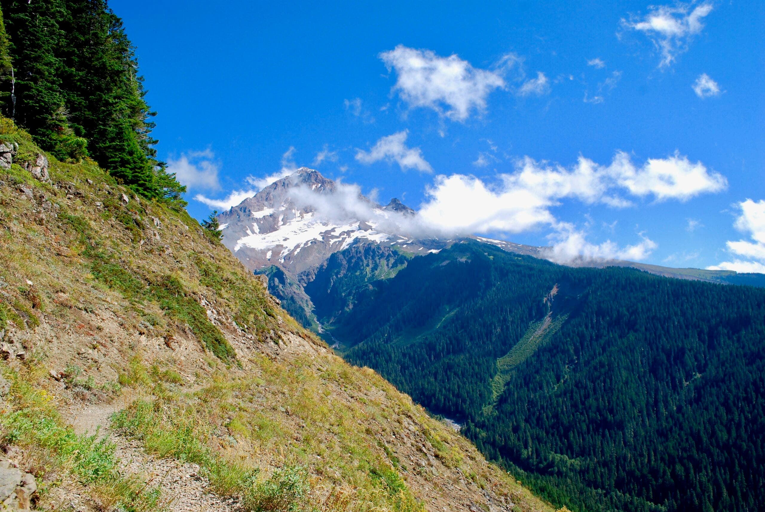
Timberline Trail, Mt. Hood
Make tracks around Oregon’s gentle giant.
—John Harlin
Volcanic dust poofs into the air with each of my wife Adele’s footfalls. Step, puff, step, puff…her boots strike the Timberline Trail near Cooper Spur. Glaciers reflect the bright morning sun high above on Mt. Hood. Ten more miles before dinner. These are my favorite 10 on the Timberline on any day, but on this one my heart thumped with pure joy. The trail plunged along Gnarl Ridge, across alpine meadows, through scrub, and into subalpine forest. Soon it led into the cold waters of Newton Creek; we could see where it continued up the other bank. We held each other’s arms tightly to brace against the current.
The path then wandered under ski lifts; crested a ridge with views to more volcanoes in the south; angled down again into the White River’s broad scar of a drainage, victim of a thousand and one floods.
ADVERTISEMENT
The day’s views stayed familiar—after all, Mt. Hood is our local peak. But that doesn’t mean I’ve tired of them. Each year we enjoy pieces of the Timberline, and 11,240-foot Mt. Hood, covered in snow and draped in wildflower meadows, is our constant companion.
What’s a Stratovolcano?
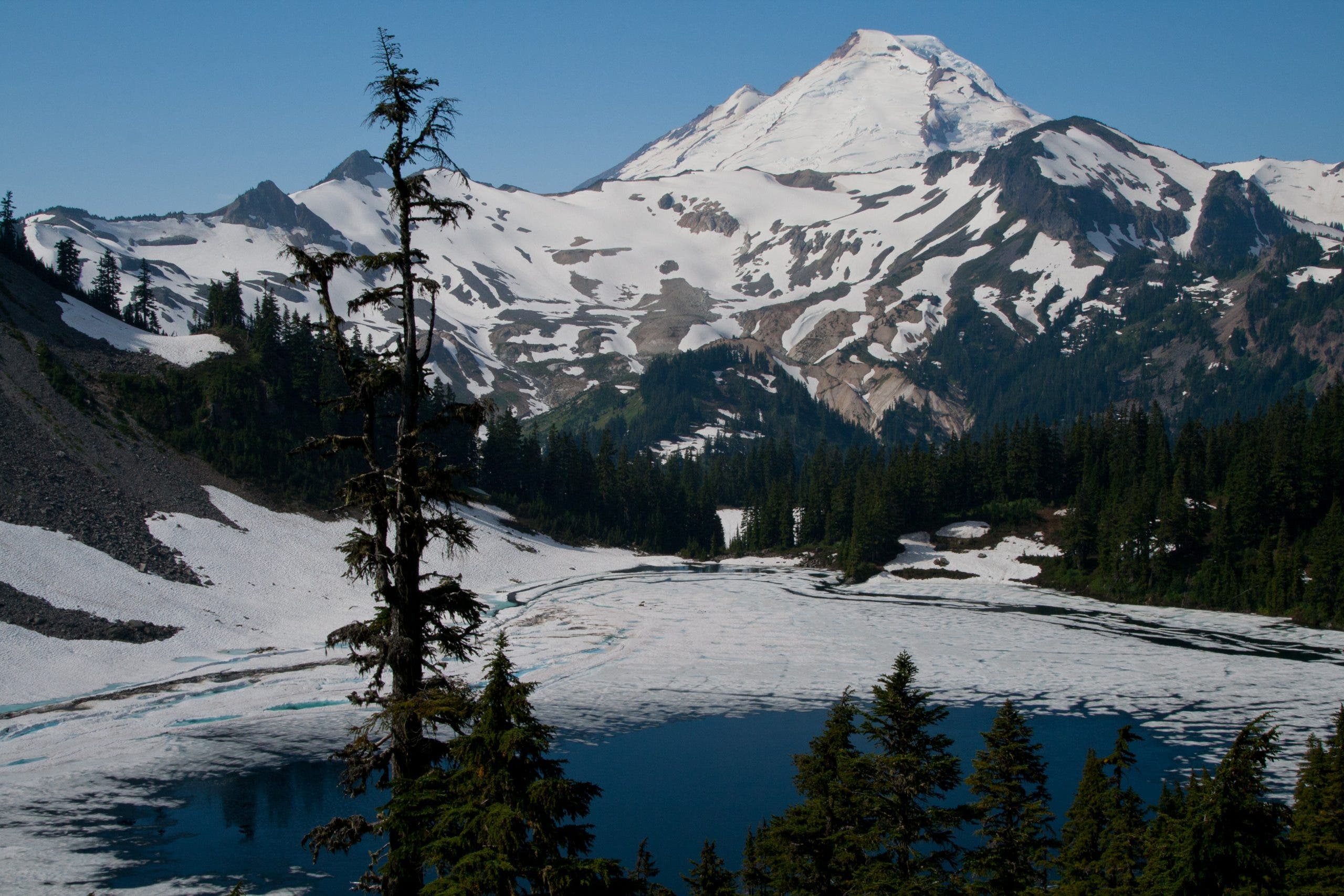
There are three basic types of volcanoes: Shield volcanoes, cinder cones, and stratovolcanoes. Broadly speaking, the type of volcano depends on the type of magma it draws from. Relatively runny mafic magma (which cools into basalt) oozes out and flows downhill, forming broad, gently-sloped shield volcanoes. Felsic magma (which forms rocks like granite and rhyolite) is much sticker and more explosive, forming steep-sided cinder cones with explosive eruptions that throw “bombs” and gaseous clouds high in the sky. Stratovolcanoes are between the two, with eruptions that produce enough flowing lava to build a sturdy cone but also tend to be quite explosive. Mt. Hood, like all the other volcanoes in the Cascadian volcanic arc (peaks like Mt. Rainier, Mt, Baker, and Mt. Shasta), is a stratovolcano—and potentially an active one.
The Trail
Start at Cloudcap Trailhead, climbing on the Timberline Trail towards Cooper Spur and the Elliot Glacier. Remain on the Timberline Trail across Gnarl Ridge, dropping past Newton Creek (with an optional side trip to Newton Creek Falls). Cross into Mt. Hood Meadows ski area, then arrive at Umatilla Falls Trailhead at mile 10.
ADVERTISEMENT
Pilgrim Creek Trail, Bridger-Teton National Forest, WY
Trek into the emptiest, most grizzly-packed meadows, all within sight of the Grand Teton.
—Tracy Ross
As a freshman in college, I found enlightenment in the faces of a trail crew on a Student Conservation Association flyer. I could see it in their tired, happy expressions: Trail crews had the summer job thing figured out.
ADVERTISEMENT
So in the spring of 1991, I signed up to work on a crew in the Buffalo Ranger District of the Teton Wilderness, on the southeastern boundary of Yellowstone National Park. My home for the summer was the Pilgrim Creek Valley, which fans between Wildcat Ridge and Bobcat Ridge and throbs with one of the densest grizzly populations in the West. Back then, the wilderness still smarted from the 1988 wildfires that burned 794,000 acres. But the entire place coursed with water, and lush pocket meadows thrived amid swaths of charred timber. Now the forest is recovered, with oxbowed streams and groves of flickering aspens. The 11.2-mile hike in from the Pilgrim Creek trailhead to Wildcat Peak (where we worked) is arduous. You cross Pilgrim Creek 15 times in the first three miles, before diving into a neck-high willowed jungle. Then you pitch up a steep, sun-baked hillside, then back down into the willows for another 2.5 miles. When you reach the first creek you can cross without wading, you’re nearing the Wildcat Peak junction. Go north, climbing 1,000 feet over 3.5 miles to a wide divide separating the Rodent Creek drainage and Wildcat Peak. Here, the trail peters out, but keep a bearing on Wildcat’s summit and bushwack toward it, picking up the Wildcat Peak Trail .5 mile from the top.
Rewards? Absolutely. Dead ahead is the supremely toothy Grand Teton, snapping at the clouds. Look back, and see the 10-mile trail that turned me into a lifelong wilderness lover. We camped in meadows exploding with blue columbine, Indian paintbrush, and purple monkshood. We saw no other footprints, no fire rings, no tent sites—a backpacker’s Eden. We measured our hands against countless grizzly tracks with claw marks the lengths of our fingers—and I cycled from screaming with fear at unknown sounds to popping the safety on my bear spray to singing with joy after a solo encounter with one big female. According to the Hiking Wyoming guidebook, even the personnel at the Blackrock Ranger Station call Pilgrim Creek a primitive area within the wilderness, and few know what’s back there.
I, however, grew to know exactly what was back there. For 27 days over three nine-day hitches, we crosscut and chopped a six-mile tread into Wildcat Peak. The work beat me down and built me up, so that by the end of the summer, when I looked in the mirror, I saw the same tired-but-happy expression as the kids on the SCA flyer.
How Big is That Ecosystem?
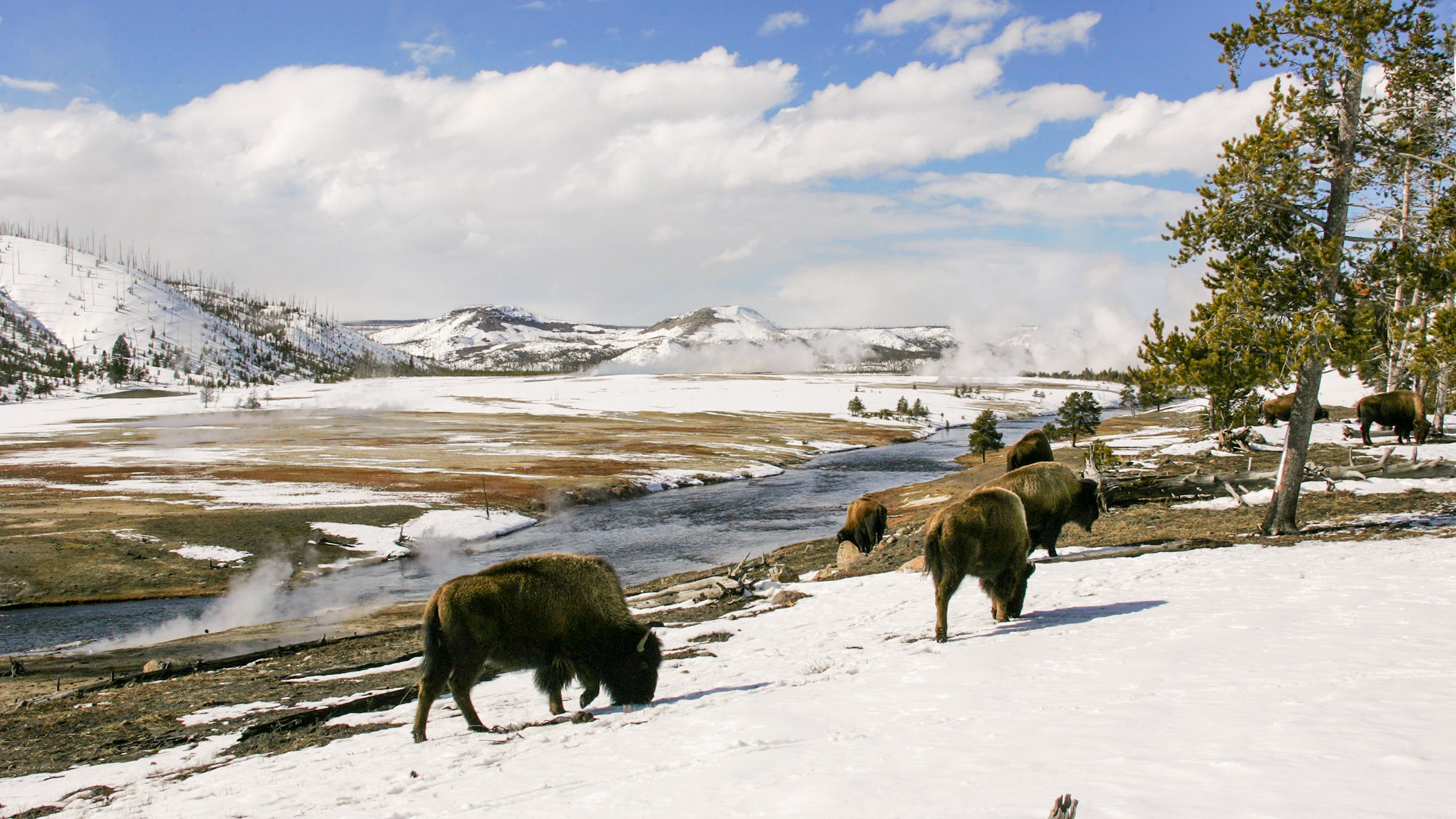
The Greater Yellowstone Ecosystem, stretching over 3,437 miles of Montana, Wyoming, and Idaho, is one of the largest intact temperate ecosystems on the planet. The heart of the system is Yellowstone Park itself, home to the highest concentration of wildlife in the lower 48 and half of the active geysers in the world. The range of habitats contained in the ecosystem contributes to its incredible diversity of flora and fauna; lodgepole pine forest, mountain meadows, sagebrush steppe, and grasslands support elk, bison, grizzlies, wolves, lynx, pronghorn, and a whole host of smaller mammals, along with birds, reptiles, amphibians, insects, and fish. Grand Teton National Park is also included as part of the system, with its high mountains, black bears, moose, and elk.
ADVERTISEMENT
The Trail
From Jackson, take US 191 37.6 miles to Pilgrim Creek Rd. Turn right, and reach the trailhead in 2.1 miles. From the Pilgrim Creek Trailhead, head upvalley, crossing the stream several times, then turn onto the Wildcat Peak Trail. Follow this trail 3.5 miles to a pass, then head off-trail towards Wildcat Peak. Pick the trail back up near the summit. To return, retrace your steps to the trailhead.
Skyline Trail, Jasper National Park, Alberta
Go to hiker heaven on Canada’s finest high-country path.
—Jonathan Dorn
ADVERTISEMENT
Little Shovel Pass made me a backpacker. Not the occasional-weekend- in-the-woods type, but the guzzled-the-Kool-Aid-and-asked-for-a-bigger-cup variety who daydreams in meetings and haunts the discount racks at REI and who, in 1997, accepted a 25-percent pay cut—with a baby on the way—to take an assistant editor job at this magazine.
I’d hiked plenty of miles before tackling Jasper’s Skyline Trail. With my wife, I’d explored New England’s forests, bumped into bears in the Olympics, and sweated out sections of the Appalachian Trail. But the panorama that unfolded at 7,347 feet atop the switchbacks of Little Shovel Pass—and the way-above-treeline views that slackened our jaws all the way to Centre Lakes—were a eureka moment. Before, I’d seen backpacking as a pleasant, wallet-friendly escape from the rat race. After hiking that 10.8-mile stretch—and realizing just how soul-stirring a grand landscape can be—the pursuit of mountain scenery became a way of life.
The Skyline today has tight quotas— the price of fame and a fragile alpine environment—but it rivals a Grand Canyon rafting permit in worth-the-wait payoff. Tracing ridges strewn with cinquefoil, pulsatilla, and lupine, the 27.6-mile Maligne Range traverse dips into fragrant spruce and lodgepole forest haunted by caribou and black bears for a few miles at start and finish, and at five backcountry campsites.
ADVERTISEMENT
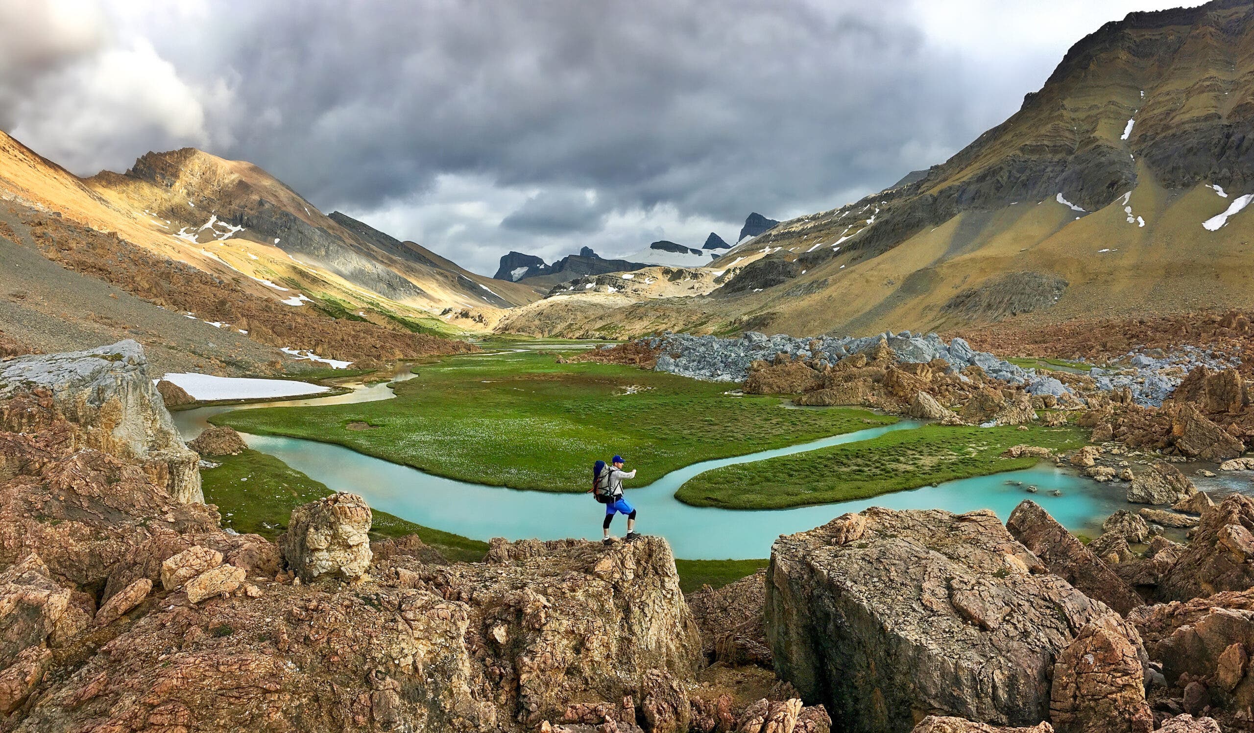
Smack in the middle—on those 10.8 miles—you’ll ramble across the most sustained stretch of tundra this side of Denali, serenaded all the way by pikas and marmots. Watch for bear activity; we saw a grizzly-excavated hole that looked like the work of a backhoe.
Keep your eyes to the horizon, too: From Little Shovel Pass to the Snowbowl to Shovel Pass to The Notch to Amber Mountain’s descent to Centre Lakes, the ever-improving vistas take in everything that draws photographers to the Canadian Rockies. Maligne Lake’s glacier-blue waters—so brilliantly azure they transcend every cliché. Thousands of acres of icefields flowing through notches in the massifs that tower above the Athabasca Valley to the west. The shark-toothed Queen Elizabeth Ranges to the east. And—from The Notch—the hulking giants of Mts. Edith Cavell (11,033 feet) and Robson (at 12,927 feet, British Columbia’s highest peak).
Whatever you do, budget three days for the Skyline. The middle might be the slowest 10 miles you ever hike.
Remnants of Ancient Ice
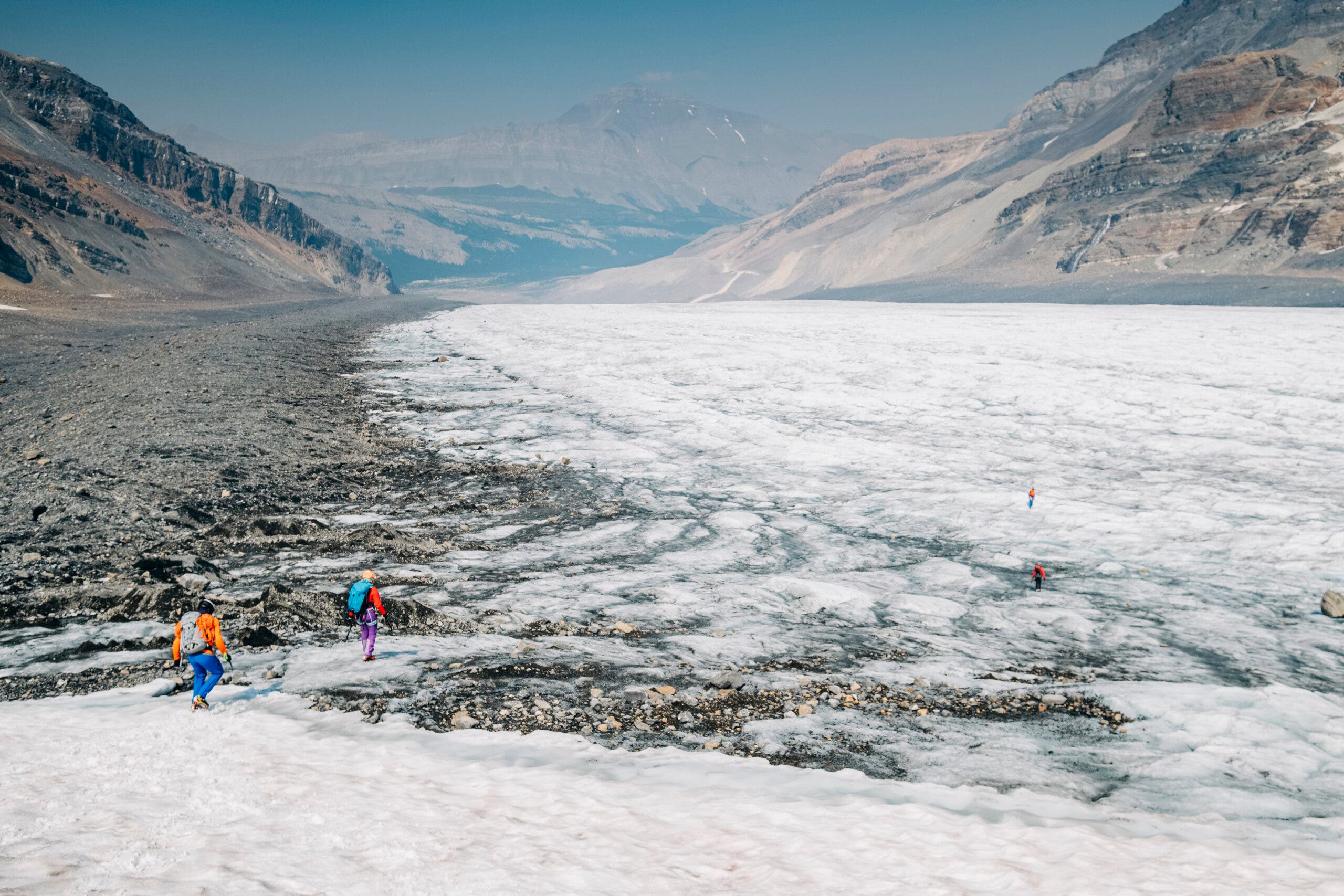
The Columbia Icefield in Jasper National Park, surrounded by most of the park’s highest peaks, is one of the last remaining pieces of the Cordilleran Ice Sheet, which once covered much of western North America in glacial ice over a mile thick in places. Though most of the ice sheet melted away when the ice age ended, this piece in the high mountains of Jasper held on; it’s the largest ice sheet in the entire Canadian Rockies, and gets over 20 feet of snow per year.
ADVERTISEMENT
The Trail
Leave a car at the Signal Mountain Trailhead, then take another car or a shuttle to Maligne Lake. Most hikers end their first day at Snowbowl campground, 7.5 miles down the trail. On day two, hike 11.2 miles to Tekarra Campground, situated next to a swift mountain creek with views of the surroounding peaks. Day three finishes off the route with an 8.7 mile hike out to the Signal Mountain Trailhead.
The Jewels Route, Grand Canyon NP
Time one of Arizona’s trickiest passages just right, and you’ll mosey from one idyllic, fern-lined grotto to the next.
—Annette McGivney
ADVERTISEMENT
I am down on my knees pumping from a silty puddle, praying I can get one lousy liter—we’ll need that and more to reach what I’ve heard is the best 10 miles in the entire Grand. The previous night my friend, Jane, and I made a waterless camp at the junction of the South Bass and West Tonto Trails, five miles from the South Bass trailhead. We planned, or more accurately, hoped, to top off here in Serpentine Canyon.
Located in the remote western end of the park and snaking into the deep side canyons of the Tonto Plateau, the Jewels Route is, in total, a 48-mile prize I’d been lusting after for years. These inaccessible spots—each named for a precious gem (Ruby, Turquoise, Sapphire, Agate)—are legendary for their seasonal grottoes and solitude, even though the Park Service does its best to discourage visitors. “There are no permanent springs,” warns the NPS website. “Only unreliable, unpredictable seasonal trickles.” Plus, there are no bailouts, prompting the park to dub the stretch from South Bass to Boucher Trail the most difficult section of the trans-canyon trail system.
At least 10 hikers have died here in the last 50 years by making the same mistake we might be. But we roll the dice—seems a reasonable gamble since we are here after a very wet winter. So with three liters between us, we clamber up the trailless scree slope of Serpentine and search for a cairn on the blinding-bright expanse of the Tonto.
ADVERTISEMENT
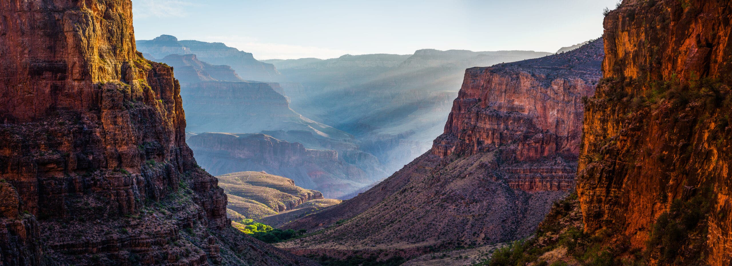
Our boots crunch on a fine pavement of gray-green Bright Angel shale as we weave our way through a sea of blackbrush. The hulking orange Havasupai Point rises against the South Rim while the distant white spine of the Sagitarius Ridge defines the North Rim. Perched halfway between the top of the rim and the river, the Tonto Plateau is a balcony with best-seat-in-the-house views of the canyon. Periodically, we venture to the edge and peer 2,000 feet straight down to the blue-green Colorado.
We arrive at the lip of Ruby Canyon with barely a half-liter. The sun is unrelenting, and my head throbs. We look into the dark, seemingly bottomless drainage. We hear a pattering, like light rockfall, echoing off the canyon walls. Sheep? We cock our heads: water gurgling over slickrock!
Our timing is perfect; the seasonal springs in Ruby are ripe with snowmelt and feeding a lush, riparian oasis. A string of clear pools glint in the sunlight. Damselflies hover and zag. Bright green ferns, moss, and monkey flower pad the canyon walls.
The next day, after lounging in Ruby all morning, we confidently march across the parched Tonto for 5.8 miles to Turquoise Canyon, our next camp, where another perfect oasis awaits. You can continue on the Tonto to Hermit trailhead or turn back and just bag these 10 miles. Or stay another day. No matter what, you win.
ADVERTISEMENT
Looking Down
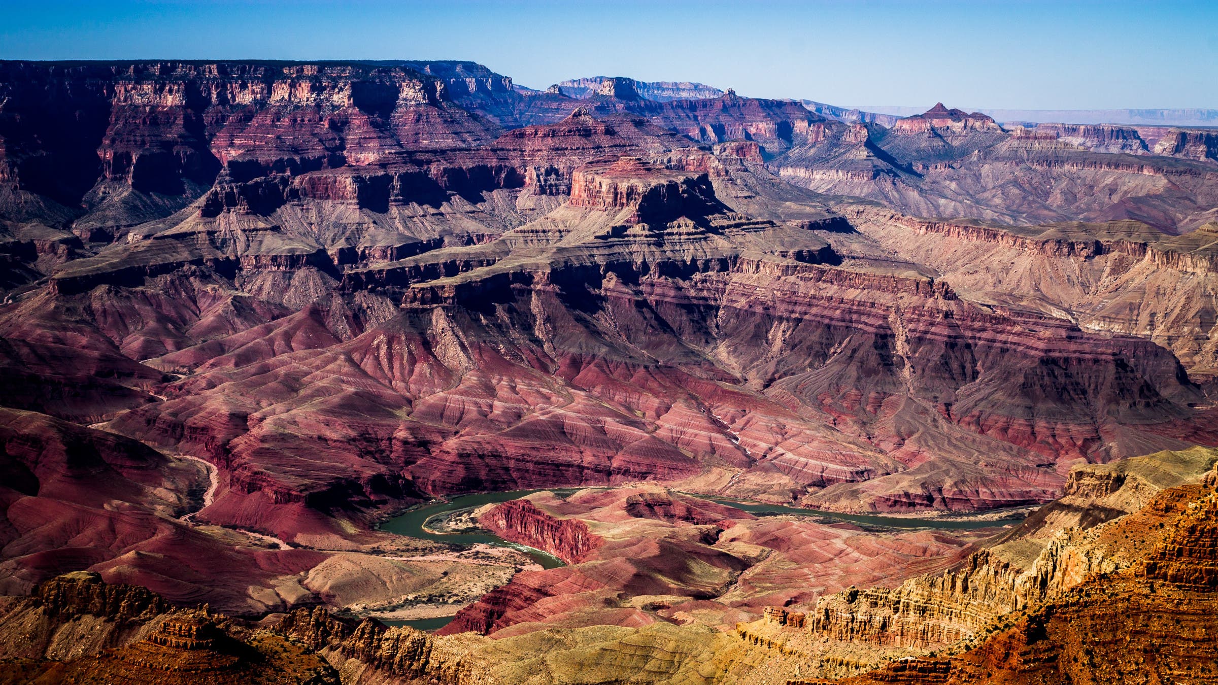
The rock layers of the Grand Canyon are more than just scenery—they offer a glimpse into the deep past of the planet. The oldest rocks in the canyon, known as the Vishnu Basement Rocks, formed during the Proterozoic Era, which stretched from 2.5 billion to 541 million years ago. These rocks are mostly igneous (volcanic) or metamorphic, and the group is dominated by granite and schist. The middle layers of rocks, known as the Grand Canyon Supergroup, are only slightly longer but completely different geologically: this group is mostly sandstone and mudstone and formed in a shallow sea. The easiest to spot are the reddish layers of the Paleozoic Strata, which formed several million years after the lower layers in another shallow sea. These layers are filled with fossils of corals, small fish, and brachiopods.
The Trail
Leave one car at Hermit’s Rest, then start your hike from the Bass Trailhead. Descend the South Bass Trail for 4 miles. At the junction with Brush Canyon, go right on the West Tonto Trail. Two miles later, reach Serpentine Canyon and your first camp. The next day, head six miles to Ruby Canyon, camp 2. On day 3, hike another six miles to Turquoise Canyon. The longest day is day 4, heading 14 miles past Sapphire and Agate Canyons to the campsite at Boucher Creek. On the last day, hike the final 10 miles to Hermit’s Rest. The only reliable water is Boucher Creek; seasonal flows run in Ruby, Turquoise, Sapphire, and Slate. Best bet for water and reasonable temperatures: February-April.
ADVERTISEMENT
Mt. Eielson, Denali National Park
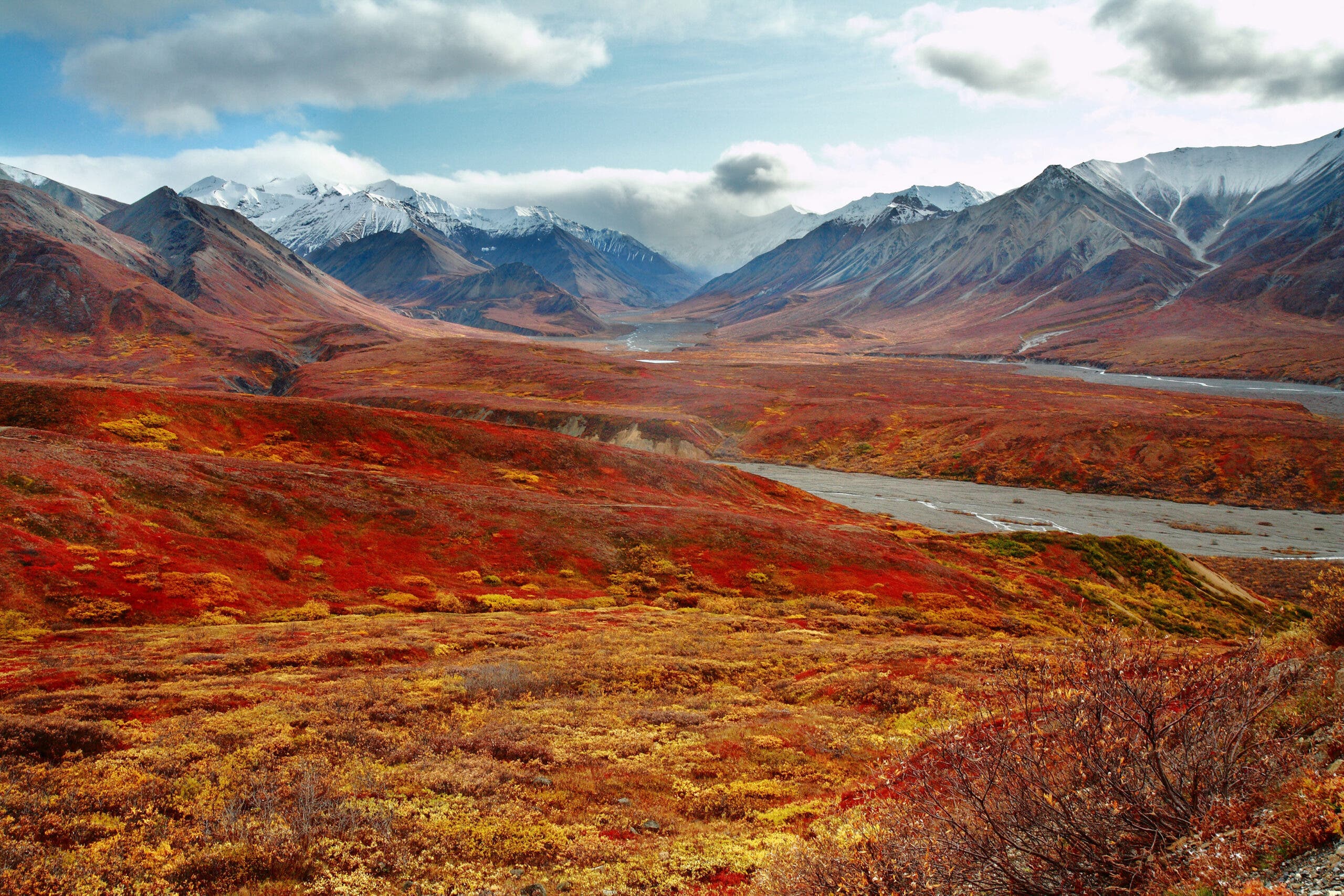
Get guaranteed mammoth wilderness in America’s wildest national park.
—Gus Axelson
I took one step into the backcountry and felt like I had been set free from a cage. It’s not that I didn’t enjoy my first year as a dad, but I needed to reconnect with the man I was before my nights were sleepless, lullaby-infused grudge matches. My wife knew it, too, so she sent me to Denali National Park, with her brother, Brett.
My timeline was naturally tight: only a few days to get my fix. So I asked a park ranger for the quickest route to badass country, and he drew up a 10-mile horseshoe crossing Gorge Creek and angling up Sunrise Creek to the Sunrise Glacier, where we’d pick our way through to a pass and then return via Green Dome to Thorofare Pass.
ADVERTISEMENT
From the Eielson Visitor Center, we picked our way southwest down a steep ridge toward Gorge Creek. Minutes into the trip, I nearly stepped in a pile of soapberry-filled bear scat the size of horse manure. Bingo—instant wilderness on a larger scale than I’d ever encountered.
At about mile three, we forded a quarter-mile-wide braid of the Thorofare River. Two miles later, I stood beneath a 20-foot-tall wall of blue ice, a dark maw at its base where meltwater surged into Sunrise Creek. We camped upvalley, hemmed in by rock and ice and 7,000-foot peaks.
The next day, the morning sun lit our path: a steep 1,000- foot ridge we’d need to climb to find the pass. Halfway up, rubble trundled from above. A baseball-size rock hit my ankle. Then a volleyball-like rock careened past, exploding upon impact, right where we’d camped. I’d asked for wild, and got it. New priority: making it home safely to my son. We retreated and camped in a small side valley.
ADVERTISEMENT
The next morning, I got up early to cook breakfast. As I mixed pancake batter, I noticed a boulder in the willows. Then the boulder moved. Bear! We yelled and waved. I was dusted with mix, a human Krispy Kreme. Finally, she turned slowly like a freighter and plodded away.
So when you need a big dose of badass, come to Denali. Maybe you’ll score a permit for Sunrise Creek, maybe not. But it doesn’t matter: Any 10 miles here will do.
Big Sky Country
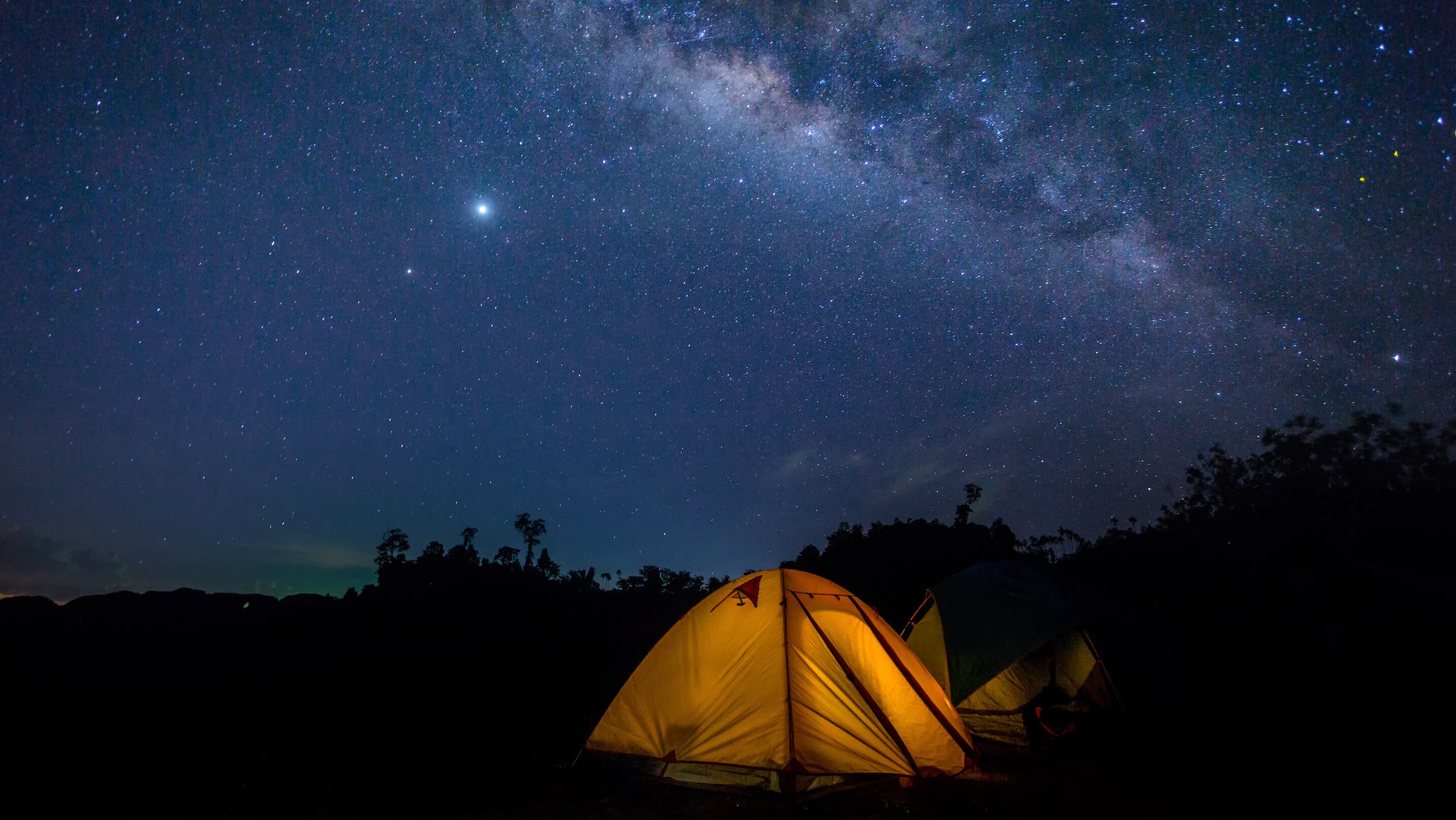
Alaska’s wide-open skies, when the weather is good, are perfect for stargazing—and, in Denali, almost free of light pollution. What’s visible in the night sky changes with the seasons, but during peak summer camping season, there’s a few easy-to-identify patterns in the northern hemisphere. The easiest to find is the big dipper, Ursa Major. Follow the two stars at the front of the “dipper” to find the North Star, Polaris, and the constellation Ursa Minor. Though it is almost always referred to in the singular, the North Star, Polaris, is actually a triple star system; Polaris A, the primary star, is a yellow supergiant, while the smaller Polaris B and Polaris Ab are both dwarf stars. If you’re lucky, you might spot another famous Alaska attraction–the Northern Lights.
The Trail
Take the park bus to Eielson Visitor Center. Head south on a trail towards Gorge Creek, which peters out about halfway there. The rest of the route is off-trail, so bring your map and compass. The first waypoint past Gorge Creek is Sunrise Creek. From there, head uphill to Sunrise Glacier, then head over a pass to Green Dome and then Thorofare Pass, where you can pick up the park shuttle again.
ADVERTISEMENT
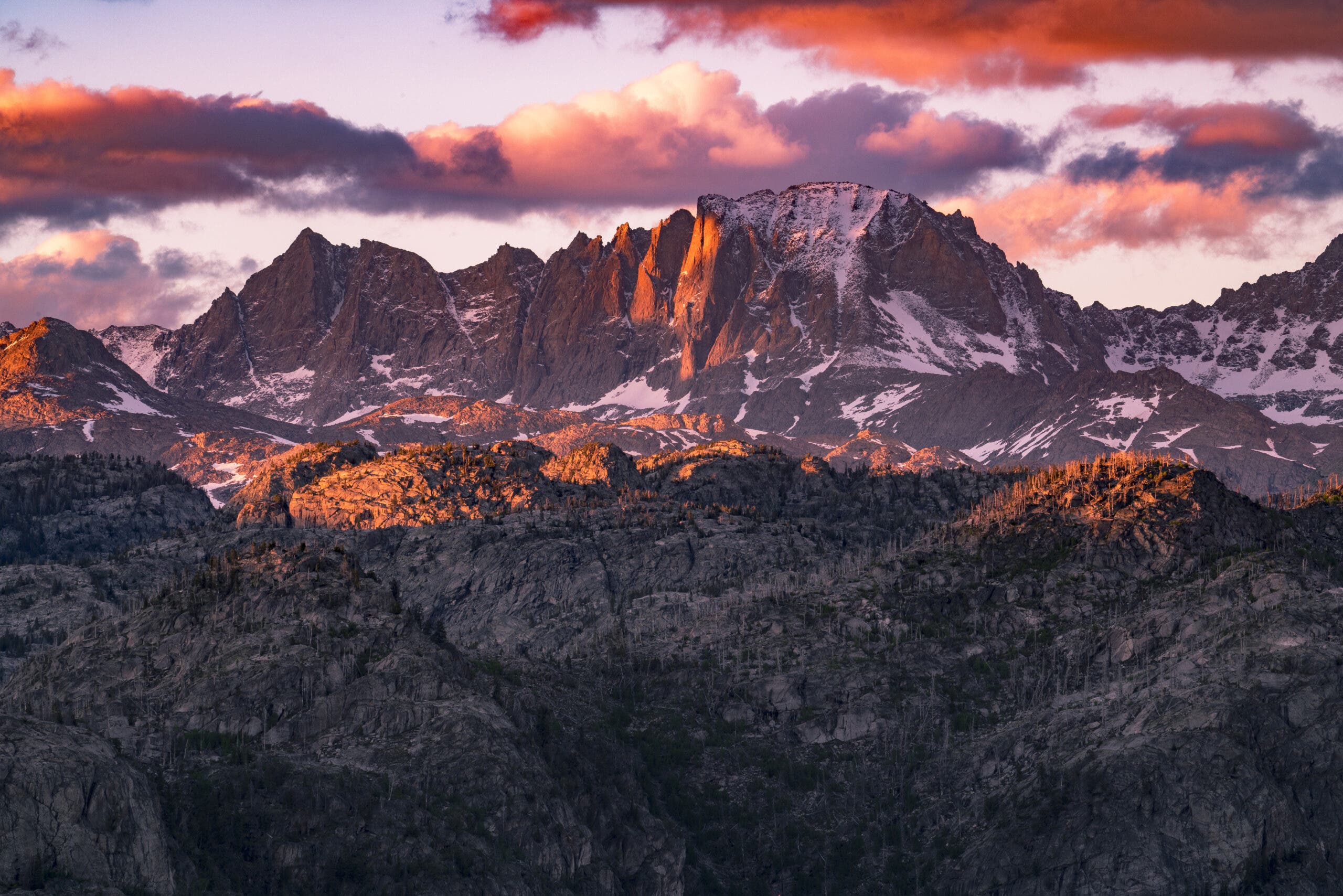
Titcomb Basin Trail, Wind River Range
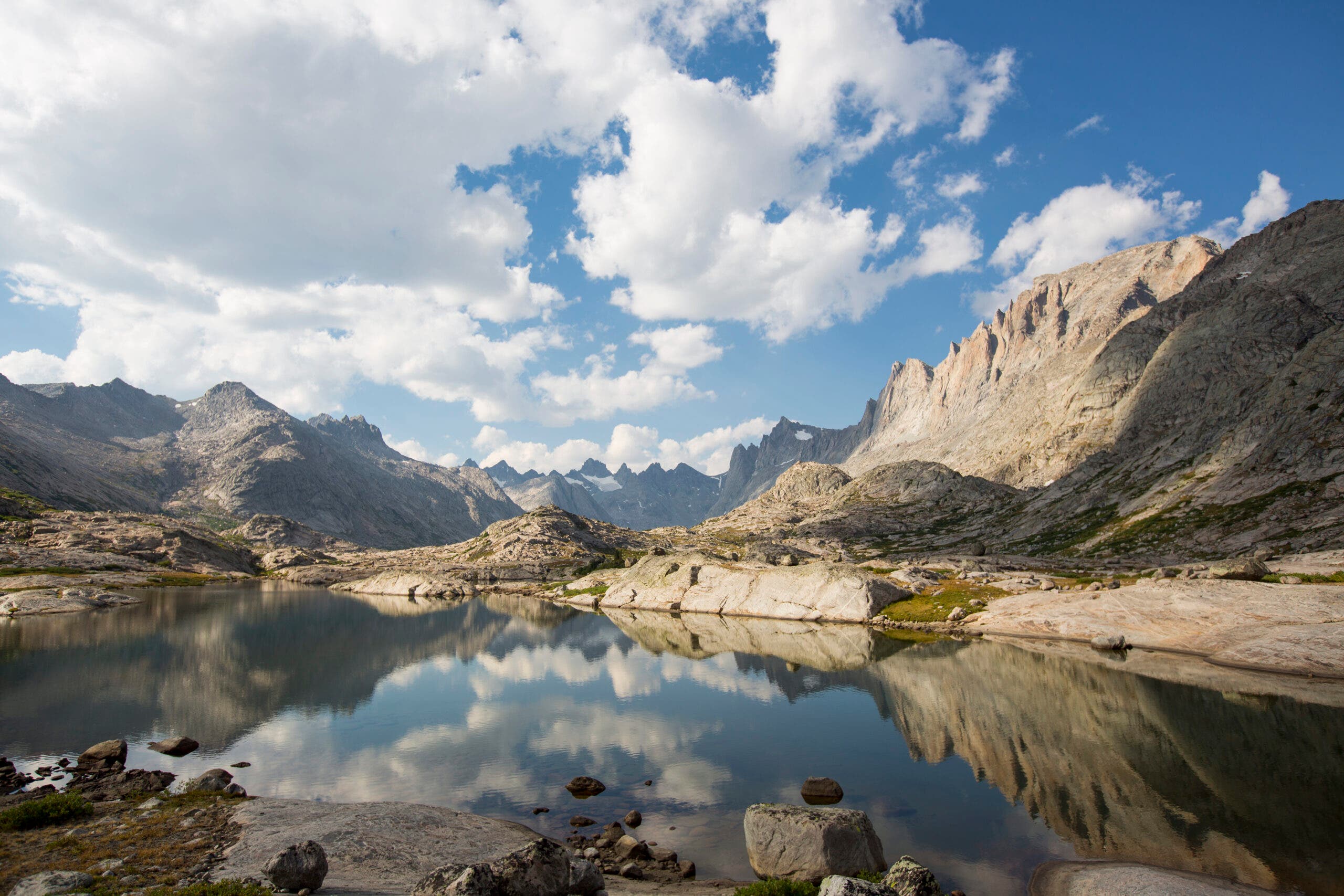
Head to Wyoming to trek beneath North America’s most beautiful alpine ridge.
—Mark Jenkins
Maybe I shouldn’t admit this, but … I don’t like trees. After hiking a few fabled sections of the Appalachian Trail and not once getting a decent panorama—just buggy, in-your-face leaves—I gave up green tunnels. Give me rock, ice, and skies as big and fickle as my imagination—brilliant blue in the morning, billowing black by afternoon.
ADVERTISEMENT
If you want to see earth like this, buck naked but for the skimpiest bikini of alpine flowers, there’s no better place than the Titcomb Basin Trail in the Wind River Range of north-central Wyoming. But you’re going to have to pay for it. It’s a 12-mile slog uphill to reach Titcomb Basin. Starting at the 8,800-foot Elkhart Park trailhead just above Fremont Lake on the west side of the range, you march through scraggly pine forests and humpy rock outcrops for 11 miles to reach the south end of Island Lake, hook onto the Indian Pass Trail for one mile, then camp at any of the three major Titcomb Lakes. I’ve skied it and hiked it and postholed it, and it’s a bloody long day any way you split it. But once you’re there—as long as you’ve had the good sense to go before or after July, when the hypertrophic mosquitoes plunder the place—the 10,500-foot Titcomb Basin is peerless.
Titcomb Basin (pronounced tit-come and named after brothers Charles and Harold, who explored the area in 1901) is a classic U-shaped, glacier-bulldozed valley. Hiking north from the southernmost Titcomb Lake, you pass through teal-green tundra with one of the most stunning ridge crests in the United States high above you. I’ve hiked trails from Tibet to Timbuktu and found nothing more gorgeous. Fremont Peak, with its multiple faces and gendarmes, is a Picasso of an attractive but dangerous woman; then Mt. Sacagawea, with her long, dark, sadly beautiful face; then the punk-rock coiffure of Mt. Helen. To the west are the Titcomb Needles, the Great Needle, The Buttress. After four miles, the official trail ends and you’re on your own. The balance of your 10 miles comes in above-treeline, off-trail striding and scrambling that will spoil you forever. Hop boulders and skip through flowering meadows for a few more miles until you find yourself encircled by granite and glaciers, an orgy of mountains. Now climb one of the peaks. Doesn’t matter whether it’s a technical ascent or a hike. You’ll get the view of a lifetime. What’s more perfect than that?
Granite, Granite, and more Granite
Titcomb Basin was carved from the 2-3 billion year old granites and metasedimentary batholiths (large blocks of sedimentary rocks like sandstones and mudstones that have been lightly metamorphosed) of the Wind Rivers by the Pinedale Ice Cap during the last glacial maximum. Much of the visible rock is granite or similar; the metasedimentary rocks are in the “basement” of the range, below the exposed layers. All that granite, though, makes for amazing views and climbing, and the sharp-edged peaks the Wind Rivers are famous for.
The Trail
Start at the Elkhart Park Trailhead. Follow the Pole Creek Trail through lodgepole pines to Photographer’s Point at mile 4.5, where you get views of some of the highest summits in the Wind Rivers. The trail then descends to Eklund Lake. Take a left at the junction here towards Seneca Lake. Seneca Lake makes a good first camp for many backpackers. Go left from the lake to heads up to Lost Lake. From there, follow the signs to Island Lake at mile 16.1. Camp here and spend as many days as you want exploring the trails running through the basin.
ADVERTISEMENT
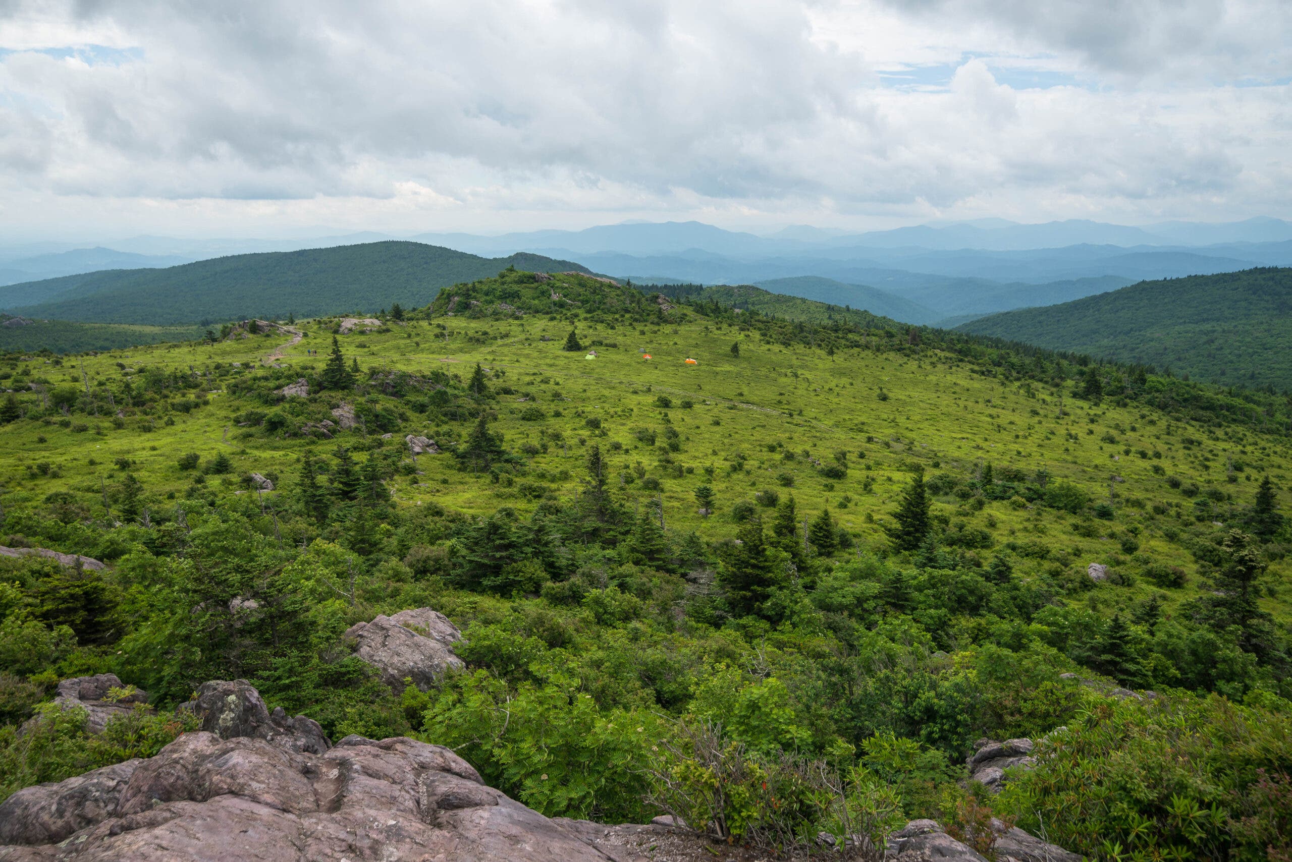
Grayson Highlands State Park, VA
Score big rewards for little effort.
–Jennifer Pharr Davis, as told to Ellie Levitt
In six years of hiking, including treks on six continents and speed records on the Long and Appalachian Trails, I’ve seen my share of jawdropping vistas. But when I want a soul-satisfying hike I can count on year in, year out, I always return to this 10-miler in Virginia’s uplands.
It has a sky big enough to rival any in Montana, a heavenly blue that arcs over an open grassland with rocky outcroppings laced with rhododendrons in June. This loop combines creekside rambling, top-of-a-grassy-world views, trailside waterfalls, rhododendron tunnels, blueberry patches, and wild ponies. Step for step, it’s the most rewarding place I’ve ever been.
ADVERTISEMENT
You could exhaust a memory card by mile six, where a sidehike leads to to 20-foot Cabin Creek Falls. Take your time—it’s just four miles back to the trailhead, and it’s best hiked at sunset.
Where the Wild Horses Are
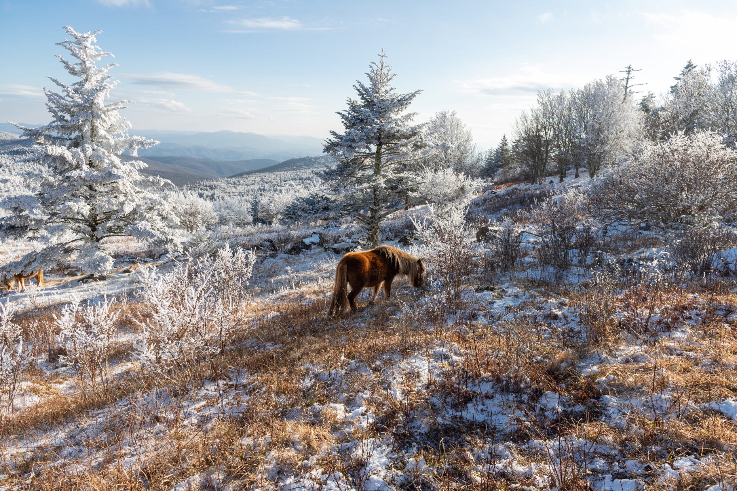
The wild ponies of Grayson Highlands were released there by the US Forest Service in 1975 to control runaway brush growth around the park’s iconic balds. The herd has thrived there, and there are now about 150 of them roaming the forests and ridgelines of the highlands. The same year they were released, the Wilburn Ridge Pony Association was created to make sure that they stay in balance with the local ecosystem and keep the population from exploding.
The Trail
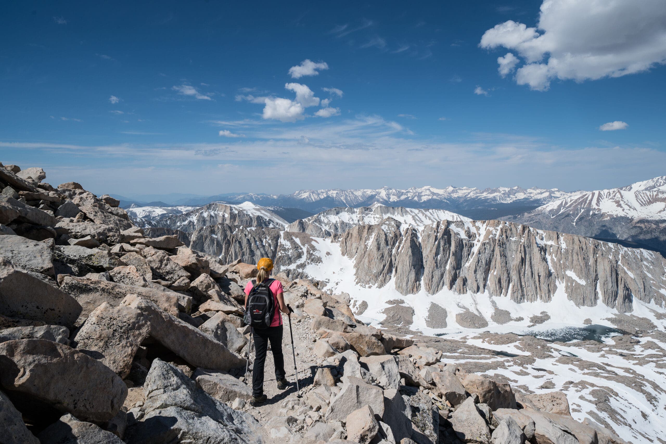
Mt. Whitney, CA
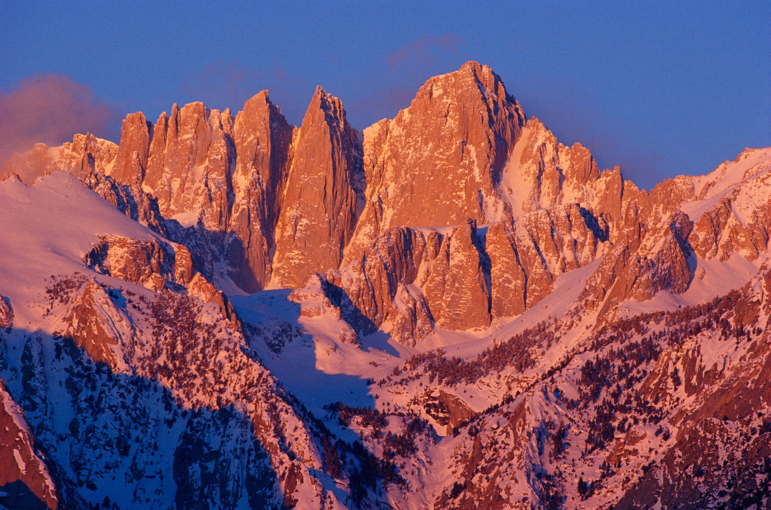
Experience the highest point in the Lower 48 through different eyes.
—Trevor Thomas, as told to Casey Lyons
No blind person had stood on top of Mt. Whitney before. Ever. I planned my PCT thru-hike so my two partners and I would be there on June 27, Helen Keller’s birthday (we made better time and went through six days early).
We wanted to start from Guitar Lake, but we heard that’s where the snowline was and we didn’t want to sleep on ice. So we began at a camp a mile past the Crabtree Ranger Station, following the John Muir Trail for five miles and 3,700 vertical feet to the summit—and the same back down.
ADVERTISEMENT
This isn’t the normal summit slog from Whitney Portal. We would climb the peak on the backside’s deep wilderness, and rise steeply above treeline and the half-dozen tarns that pool below this scree-laced tower. The guidebooks all rave about the scenery—a great stretch of serrated, gray-brown peaks linked together like teeth on a giant chain saw—but I experience it in a different way.
When I hike, I navigate by passive echolocation, like a bat, listening to the sounds I make come back to me. Whether it’s us talking or rocks tumbling nearby, it gives me a signature, and I have a basic idea of what my surroundings will be like—whether it’s open or there’s a cliff. Normally, I tune in on the footfalls of the hiker in front of me and put my foot exactly where he did. But when we got to Guitar Lake, we hit snow, and in such an open bowl, the sound carries. I could tell it was huge, but it was hard to judge exactly where to step.
Halfway up the face, the slope steepened to 40 degrees and I knew it. My feet are so sensitive now that I can feel the paint lines on the sides of the roads through my boots, and I know when the snowpack is unstable. It was dicey, but I took it slowly until the slope flattened over the last cornice.
ADVERTISEMENT
The sound was incredible. It was like a vacuum, and I knew there was nothing above or beside me. Sheer openness. People ask me: Why climb if you can’t see what’s there? I can’t see the view, but I can feel it. I use my other senses to take in a mountaintop. I think of the smells, the wind, the sun on my face. That summit is the most beautiful thing I’ve ever felt—and my sighted partners agree.
How Hard is It to Climb Mt. Whitney?
About 30,000 people try to summit Mt. Whitney every year, but only about 10,000 succeed. To keep the trail from becoming overcrowded, Inyo National Forest now runs a lottery for the tickets. But what makes that failure rate so high? The first factor is elevation—at 14,505 feet, Whitney is 65 feet taller than the next-highest mountain in the contiguous United States, Colorado’s Mt. Elbert. That elevation can be a challenge for hikers, especially since most of them are coming from sea level and many try to summit and return in just one day. In the summer, weather contributes too, with storms often building in the afternoon and turning back hikers who started their climb late. Finally, there’s fitness. With 6,000 feet of elevation gain, climbing Whitney is no walk in the park, and hikers are often unprepared for how strenuous the journey will be.
The Trail
From the Whitney Portal Trailhead, start heading up towards the peaks. Some hikers stop at Outpost Camp, at mile 3.75, or Trail Camp, at mile 6, to extend their time in the “Whitney Zone” by a day or more; the incredible scenery is well worth the slower pace. Continue climbing, eventually following the exposed ridge of the peak, until you reach the summit at mile 10.4.
ADVERTISEMENT