Published May 1, 2001 12:00AM
Canada's Great Divide Trail
For 30 years, some wide-eyed dreamers have been chiseling a 745-mile route through the Canadian Rockies. The result is a labor of love set to become one of North America's most magnificent long trails.
(Photo: Cavan Images via Getty Images)
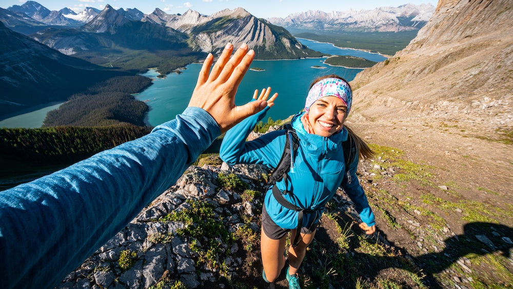
To the north of the Lower 48, there’s a trail that tickles the spine of the Rockies and is possibly the most spectacular long-distance hiking route in North America. This trail weaves back and forth some 745 breathtaking miles between the provinces of Alberta and British Columbia, traversing country far grander and wilder than any contiguous mountain wilderness in the United States. If tacked onto the northern terminus of the Continental Divide Trail (CDT)-as some believe it should be-the combined routes would create, without a doubt, the most eye-popping, jaw-dropping, challenging wilderness trail on Earth.
And chances are, you’ve never heard of this amazing footpath.
It’s called the Great Divide Trail (GDT), and because it winds through big, rough country, it’s not for the unprepared. Like most Canadian trails, particularly those outside the national parks, the GDT is less pronounced and signed than those in the Lower 48. The hiking season is short and the weather volatile. Snow can fall at any time of the year, conceals much of the route through June, and remains on high passes well into July and August. Prolonged, heavy rain is common. Many streams must be forded, often near their glacial source, which makes for frigid water and daily fluctuations in flow that may halt your progress. Biting insects buzz through the air in squadron strength through much of the hiking season. Black bears, grizzlies, and even wolverines are all along the route, so food must be safely hung at all camps. Resupply points and potential rescue sources are remote.
ADVERTISEMENT
Sound daunting? It is, but if you can handle the fact that the trail is a work in progress and that periodically you’ll be challenged when it vanishes into the wilds, the reward is well worth the effort. On the GDT, you’ll find a true wilderness experience in one of the most magnificent settings in North America.
That the GDT exists at all is a testament to the dedication of some hikers who’ve refused to let a 30-year-old vision die. The idea of a Canadian Rockies trail originated in the mid-1960s when the Girl Guides (Canada’s equivalent of the Girl Scouts) first floated the idea. Inspired, a Parks Canada consultant, Jim Thorsell, led a summer 1967 trail-use survey, which found that a Great Divide Trail was doable and that “the time is now right.”
The idea languished due to Parks Canada officials’ concerns about increasing visitation. Thorsell, meanwhile, continued to champion the idea and in 1970, he published the Provisional Trail Guide and Map for the Proposed Great Divide Trail. The following year, the Canadian Rockies Trail Guide was published, which also contained a description of the route. The publicity led federal officials to express support for the GDT, but 9 years after the concept surfaced, there was nothing to show for it but paper.
ADVERTISEMENT
Enter the Alberta Wilderness Association, which favored the long-distance trail. Their advocacy led the Alberta provincial government to recommend a system of trails stretching southward along the Continental Divide. The idea caught the attention of a college student named Cliff White, who knew of Thorsell’s research. During his first year at the University of Calgary, he met several others who also were intrigued by the long-trail concept, so they “put in for a government youth grant to study the GDT’s possible routing. We qualified, and in 1974, six of us took off to do a trail survey,” he says.
It was “the original shoestring trip,” says White, who’s now a conservation biologist at Alberta’s Banff National Park. “We got to hike all over and get paid for it-kind of. There were three groups of two. We had three old cars we wrestled down muddy back roads, then we’d spend days hiking around, surveying the terrain.” The downside was the food budget, which was only $500 for the summer. “We ate a lot of hideous stuff, like textured vegetable protein,” team member Jenny Feick remembers. “And we put a lot of miles on those boots, surveying more than 2,000 square miles on both sides of the Rocky Mountain Divide, from Banff to the Montana border.” The students plotted and surveyed every feature, natural and cultural, along the proposed route.
Immediately following what Feick calls “that magnificent summer” of 1974, she and fellow “Gang of Six” members Dave Higgins and Mary Jane Cox formed the nonprofit Great Divide Trail Association (GDTA). For the next 11 years, the GDTA organized volunteer trail crews that established and marked nearly 100 miles of track spanning the 245-mile stretch between Banff and Waterton Lakes National Park on the Montana border.
ADVERTISEMENT
“It was easy to get government approval on the Alberta side, but impossible in British Columbia,” says James Prescott, an active GDTA volunteer since the late ’70s. “Basically, they’d say, Just because you run a trail down it, we won’t guarantee that 2 years from now it won’t be clearcut.'” In 1986, the trail stalled close to the British Columbia border.
Meanwhile, Parks Canada officials gradually warmed to the idea of the GDT, in part due to a new permit system that controlled backcountry users’ numbers. As a result, the current hiking route utilizes preexisting paths and rugged cross-country routes in the national and provincial parks of Mt. Robson, Jasper, Yoho, Banff, Mt. Assiniboine, and Peter Lougheed, before heading southward through Height of the Rockies and Elk Lakes Provincial Parks. Farther south, in the Forest Reserves of the Highwood, Crow’s Nest Pass, and Castle regions, the route remains a patchwork of power line cuts, two-track roads, and cross-country bushwhacks.
“The Great Divide Trail isn’t dead,” says Prescott, “but it’s been on life support for a long time.”
ADVERTISEMENT
So what are the chances that this route will someday become a well-established path like its Lower 48 cousin, the Continental Divide Trail? The fickle winds of politics may be combining with a citizen groundswell to offer renewed hope. Organizers point to a more enlightened environmental attitude in British Columbia’s provincial government, which could allow for a protected trail corridor southward. The GDTA, as well, is waking from a long dormancy.
A new guidebook, Hiking Canada’s Great Divide Trail, may further hasten the resurrection. “After doing the trail, Julia and I decided it would be a waste to simply can’ all that information,” says author Dustin Lynx, who thru-hiked the GDT with his wife in 1996. “So I put it together into a guidebook.” One interesting twist to Lynx’s well-organized, thorough guide is that it highlights a scouted route that extends some 170 miles north beyond the GDT’s traditional end in Mt. Robson Provincial Park. The extra miles would carry hikers through the Willmore Wilderness to Kakwa Provincial Park, beyond which there’s another 125-mile stretch that leads to Monkman Provincial Park. “From what I’ve seen, the area around Monkman would make for difficult route finding, with deep gorges as major obstacles, but I think it’ll make fabulous hiking,” says Lynx.
Those committed to the GDT say that the key to completing the project will be a strong constituency of hikers who are willing to step forward and tell land management officials to finish this trail. “We’ve always had a dedicated core of people who’ll do the trail work,” says Higgins. “What we need now are organizers, people willing to work with government and motivate local grassroots support for the southern sections of the trail.”
ADVERTISEMENT
Here’s how you can help:
- Contact the Great Divide Trail Association.
- If you’re a student who is considering a career in land management, recreation, environmentalism, or even politics, inquire about a GDTA internship or thesis topic that will help the GDTA expand its southward efforts.
- If you’re energetic and have spare time, volunteer for administrative duties.
If there’s a moral behind the story of the GDT, it’s that trails, particularly grand ones, aren’t created with the stroke of a pen, nor even the swing of a thousand Pulaskis. They’re living entities that need nurturing. They’re the realization of many accumulated voices and visions. And certainly, the Great Divide Trail is one grand vision that shouldn’t be allowed to die.
Expedition Planner: Great Divide Trail
Getting there: Main trail access points are:
- Waterton Lakes National Park, north of Glacier National Park, Montana, on Canada Highway 5
- Castle Mountain Ski Resort, via highways 507 & 744, west of Pincher Creek, Alberta
- Coleman, near Crow’s Nest Pass, along Canada Highway 3, southwest of Calgary, Alberta
- Elk River Road, via highway 43, north of Elkford, British Columbia
- Kananaskis Lakes, via highway 40, southwest of Canmore, Alberta (permits required)
- Hawk Creek trailhead on highway 93 in Yoho National Park, northwest of Banff (permits required)
- Natural Bridge, near the town of Field, British Columbia, on highway 1 north of Banff (permits required)
- David Thompson Heritage trailhead, Blaeberry River Road, northwest of Golden, British Columbia (permits required)
- Saskatchewan River Crossing, highway 93, between Banff and Jasper (permits required)
- Old Fort Point trailhead, highway 16, north of Jasper, Alberta (permits required)
- Kakwa Lake trailhead, off highway 16, north of McBride, British Columbia
For detailed directions, see Hiking Canada’s Great Divide Trail (see Guides).
ADVERTISEMENT
Permits: The national parks (Banff, Jasper, Kootenay, Waterton Lakes, and Yoho) all have a limited-permit system, which requires that you make reservations and pay a fee. To camp in the provincial parks of Mt. Assiniboine, Peter Lougheed, Mt. Robson, and the main campground at Elk Lakes, you’ll need to obtain a permit and pay a fee. You’ll find contact information for all in Hiking Canada’s Great Divide Trail (see Guides).
Guides: Canadian government maps differ in format and distribution from U.S. Geological Survey topos. Canadian maps come in 1:50,000 scale (with UTM/GPS grids, best for ground travel) and 1:250,000 scale (best for overview). Trails are rarely shown. The most practical, and least expensive, solution is to use 1:250,000-scale government maps ($6.50 U.S.) for overview and orientation, and the GDT guidebook maps for actual travel. A variety of privately published “recreation maps” are available for the more popular parks.
Seven government topos cover the GDT’s length: Six 1:250,000-scale topos, 82-G Fernie, 82-J Kananaskis Lakes, 82-N Golden, 83-C Brazeau Lake, 83-D Canoe River, 83-E Mt. Robson, and the 1:50,000-scale 83-L04 Kakwa Falls. You can purchase government topos at any Government Agent office in Canada. In smaller towns, this is usually in the grocery store or mall around which such communities are centered. You can also phone- or Web-order maps from private firms with searchable Web indexes, such as Map Town Ltd., (877) 921-6277; www.maptown.com.
Hiking Canada’s Great Divide Trail, by Dustin Lynx (Rocky Mountain Books; $21.95), is written by and for thru-hikers, but broken down into manageable sections. Detailed route descriptions, excellent maps, alternate routes, and tips garnered from first-person experience combine with thorough contact and resupply information to make this book mandatory for anyone planning excursions along the GDT.
The Canadian Rockies Trail Guide, seventh edition, by Brian Patton and Bart Robinson (Summerthought Ltd; $19.95) is far and away the most comprehensive guide to trails in the national and provincial parks of the Canadian Rockies.
Both of these guides are available at www.backpacker.com/bookstore.