Updated December 3, 2024 07:48PM
Adirondack Park: Algonquin Peak
Ascend 3,600 feet to Algonquin Peak, the second highest summit in New York, for top-of-the-world views of Adirondack peaks and lakes.
Second only to its southeasterly neighbor, Mount Marcy, the 5,114-foot summit of Algonquin Peak rewards sturdy hikers with unparalleled views of the Adirondacks and beyond. Begin hiking from the Adirondak Loj parking lot on the Van Hoevenberg Trail (which also accesses Wright Peak, Avalanche Lake, and Mount Marcy) on a slight descent through young hemlocks. Soon the trail crosses a footbridge over a wet area before beginning a gentle southward ascent over intermittent waterbars.
About a mile in, the terrain becomes more rugged and the grade more pronounced after passing the junction to Marcy Dam. Here, the trail picks up a steady climb often aided by sturdy stone steps. After 2.3 miles, pass under a 50-foot cascade (with a nice base pool in wet summer months). After the junction to Wright Peak (a steep, 0.6-mile detour to bag another 4,000-footer), the route becomes more technical and physically challenging. On the final mile to the summit you’ll scramble over large boulders, cross logs over mud holes, and navigate sidehill slab as you ascend to low-lying krummholz dwarf trees and unobstructed views back north to Lake Placid and Wright Peak. Entering an alpine hiking zone, look for yellow blazes and cairns to stay on track and avoid traipsing through revegetation areas.
ADVERTISEMENT
After 3.8 miles, crest the open rock summit of 5,114-foot Algonquin Peak. Various overlooks offer outstanding views of the Adirondacks and beyond. Look east to the Great Range and further out to Giant Mountain. Below to the southeast is Lake Colden and Flowed Lake. Mount Marcy rises beyond Mount Colden (also southeast). A trail leads southwest off Algonquin towards Iroquois Peak, but this route backtracks to the trailhead.
-Mapped by Lisa Densmore, DensmoreDesigns.com


Trail Facts
- Distance: 12.2
Waypoints
ALG001
Location: 44.182973, -73.962699
From the parking lot at Adirondak Loj, begin following the blue NYSDEC markers into the woods on the smooth, wide dirt path called the Van Hoevenberg Trail.
ALG002
Location: 44.183219, -73.960712
Continue straight at the junction with the Mr. Van Ski Trail. From here, the trail continues a gentle descent, narrowing briefly through a stand of hemlocks.
ALG003
Location: 44.172672, -73.959117
At the junction with the Marcy Dam Trail, go right (southwest) on the path heading toward Algonquin and Wright peaks. The trail soon becomes rockier and the ascent more noticeable.
ALG004
Location: 44.168744, -73.965847
Continue straight as the Whales Tail Ski Trail departs to the left. The climb is steady now, paralleling a seasonal stream.
ALG005
Location: 44.159439, -73.979592
With 1.4 miles remaining to the summit, the trail passes a 50-foot waterfall.
ALG006
Location: 44.152788, -73.985732
ADVERTISEMENT
At the junction with the Wright Peak Trail, continue straight towards Algonquin Peak. Ahead, you’ll scramble over several large boulders and then cross some logs laid over a mud hole. Sidehill slab greets you on the other side as you ascend through a corridor of conifers. Ahead you’ll enter into low-lying krummholz and views open up north to Lake Placid, the Olympic ski jumps, and Whiteface Mountain.
ALG007
Location: 44.14366, -73.986687
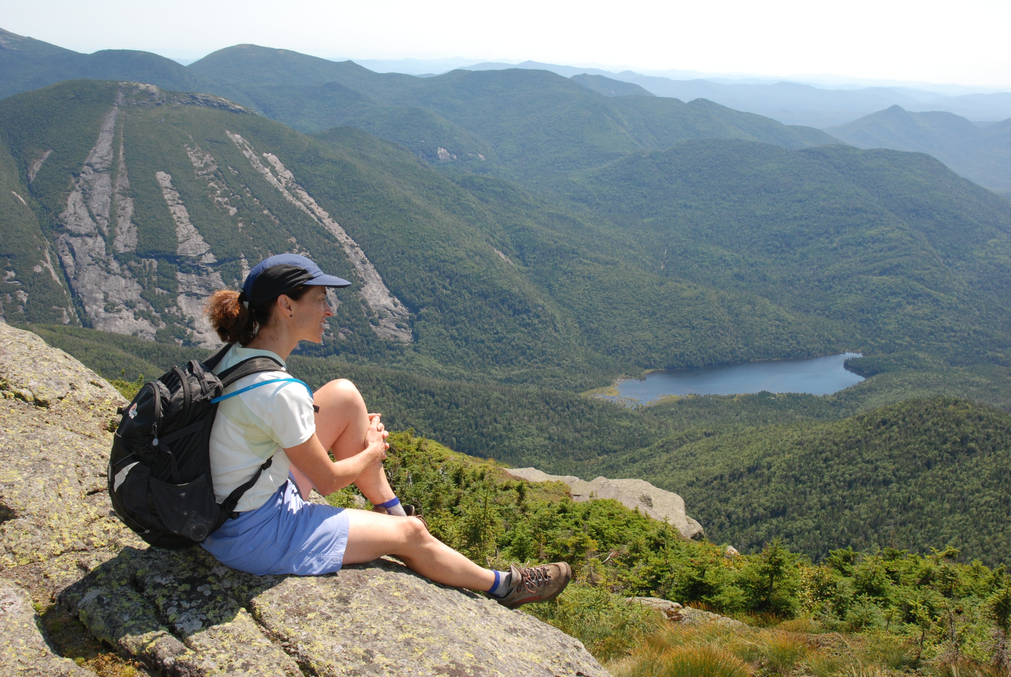
Algonquin Peak (5,114 ft.): The broad rock summit offers several different overlook points. Avalanche Lake, Lake Colden, and Flowed Lake are below to the southeast, wedged between Algonquin and Mount Colden (with Mount Marcy behind Colden). The slides of the Great Range are to the east, and the distinct cirque of Giant Mountain is farther east. The trail continues southwest off Algonquin to Iroquois Peak, but this route backtracks to the Adirondak Log parking lot.
Algonquin Summit
Location: 44.143606, -73.986558
Looking southeast over Lake Colden and Mount Colden.
Trailhead
Location: 44.182977, -73.962659
Footbridge
Location: 44.180234, -73.959403
Alpine Descent
Location: 44.144391, -73.986665
High exposure in the alpine zone below the summit.
Wright Peak
Location: 44.143776, -73.986493
Looking down to Wright Peak from Algonquin.