Rip & Live: Lost

'Rock cairns Like this one can help you stay oriented. (by Kirkendall)'
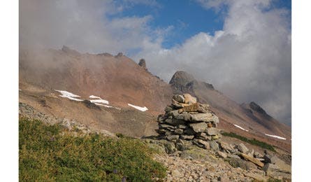
Rock cairns Like this one can help you stay oriented. (by Kirkendall)
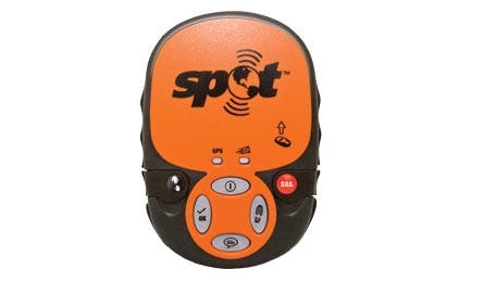
A satellite communicator can be a lifesaving tool.
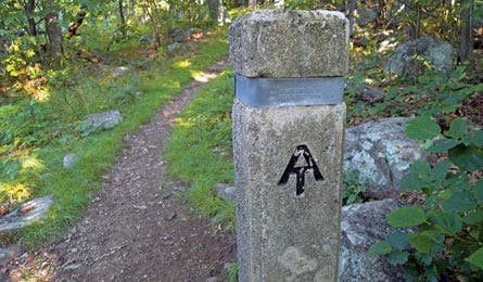
This signpost is a clue that you’re on the right track. (by Seaver)
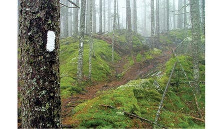
A white blaze is a standard trail marker. (by J. Chow)
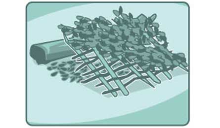
Survive overnight with a shelter like this. (by Supercorn)
STAY ORIENTEDLOOK FOR LANDMARKSS.T.O.P. (Sit. Think. Observe. Plan)SIGNAL FOR HELPSURVIVE OVERNIGHTREAD YOUR RESCUERS’ MINDSCARRY A BEACON?
Stay Oriented / Look For Landmarks
Sit. Think. Observe. Plan / Signal For Help
Survive Overnight / Read Your Rescuers’ Minds
Carry a Beacon
Stay Oriented
Use these tricks to place yourself on a map.>> Calculate distance. As you travel and cross-reference your map, esti- mate miles traveled. A typical hiker covers up to three miles per hour, not including breaks. Add 30 minutes for every 1,000 feet of climbing, and subtract 10 minutes for every 1,000 feet of descending. Or iden- tify landmarks on your map like peaks and river crossings, and time your progress between them to gauge pace.
>> Aim off. Hiking a beeline is almost impossible in wilderness terrain. If your intended target, like a bridge or town, is near a road or river use this tactic: Aim 3 to 5 degrees to the left or right of your ultimate destination. When you hit the road or river, you’ll know which direc- tion to turn to hit your goal.—Look for Landmarks
Notice trail markers and be prepared to backtrack.
“Staying aware is the most important thing you can do to avoid becoming lost,” says Robert Koester, who researched more than 50,000 search-and-rescue incidents for his book, Lost Person Behavior. His best advice? Bring your eyes up—don’t focus on your feet—and scan your surroundings: up close, far away, and behind. Good navigators notice landmarks and continuously reference their map and compass. Haven’t seen a trail marker in a while? That could be the first clue that you’re lost. Backtrack to the last landmark you recognize, and stay alert for these reassurance markers beside trails.
BLAZE
Some trails, like the AT, are marked by a stan- dard paint blaze (left). But in wilderness areas, a blaze could also look like two rectangular cuts (a smaller one on top of a larger one) in the bark on both sides of a tree; blazes are common at junc- tions and trails in designated wilderness areas.
BLAZER (MARKER FLAG)
Colored markers (usually made of aluminum or plastic) nailed into trees at eye level or at least 30 inches high. Be alert for color changes where trails separate—color-blind hikers can get disoriented when marked trails cross.
CAIRN (ROCK DUCK)
Pyramid-shape stacks of rocks ranging from one to six feet tall. Expect larger piles in alpine or snowy terrain, or in areas with typically low- visibility conditions, like coastlines.
GUIDEPOST
Poles, fence posts, or any straight markers made of wood, concrete, metal, or plastic. Posts are often combined with number, color, or symbol codes (shown) to differentiate paths.
Stay Oriented / Look For Landmarks
Sit. Think. Observe. Plan / Signal For Help
Survive Overnight / Read Your Rescuers’ Minds
Carry a Beacon
S.T.O.P. (Sit. Think. Observe. Plan.)
Off track? Use this easy acronym to remind yourself that staying put is usually the best choice.
>> Sit. Unless your current location poses immediate danger, stop hik- ing. Rest and have a snack while you decide what to do next.
>> Think. Consider the places where you may have gone wrong. Try to recall landmarks or reference points you can use to pinpoint your location on a map. Assess your supplies, and the skills and resources of group members. Estimate the time and distance you traveled off- course and decide if you can backtrack, or if you should await rescue.
>> Observe. Use your compass to determine north, or set up a sun- tracking station (see backpacker.com/suntracking). Consider any approaching weather and other situational hazards that could worsen over time, like a limited water supply. Prepare to address them as early as possible and look for resources nearby. Scout access to hilltops (for potential cell reception or signaling opportunities) and water.
>> Plan. If you are confident that you can backtrack to a known spot, do it in the daylight and allow plenty of time to find shelter and water before dark. Check your direction of travel often, and mark your path with rocks or sticks in case you become disoriented again. If it’s too late to continue, or you’re not sure of your location, prioritize your group’s needs and stay put for the night. Tomorrow, reassess.
—
Signal for Help
3 ways to alert your rescuers
[[1]] Beckon search planes by building 8- to 12-foot letters out of high-contrast materials (like black rocks on snow, or bright clothes on grass). Universally understood: SOS (help), X (serious injury), or V (require assistance).
[[2]] Your cell phone may reach 911, send texts, or ping reception towers, which can help res- cuers estimate its location, even if it displays “no service.” Hilltops offer the best chance at connecting. Power down between attempts to conserve batteries.
[[3]] Create flashes visible up to 50 miles away with a signal mirror (improvise with your compass’ sighting mirror). Aim by holding two fingers at arm’s length, in a “V” shape pointed at your target, and manipulate the mirror so that the majority of light passes toward it through your fingers. Try to create a flashing SOS pattern every minute or so; three short, three long, and three short bursts.
Stay Oriented / Look For Landmarks
Sit. Think. Observe. Plan / Signal For Help
Survive Overnight / Read Your Rescuers’ Minds
Carry a Beacon
SURVIVE OVERNIGHT
>> Conquer fear. Don’t let the onset of darkness cause you to panic. Hysteria drives lost hikers to keep moving (getting more lost) and boosts heart rate and muscle tension. Both responses compound stress. Try belly breathing to relax: Lie down on your back and place one hand on your chest and the other on your abdomen. Inhale through your nose, expanding your belly, and hold it for seven seconds before exhaling through your mouth. Repeat for up to 10 breaths.
>> Prioritize water. Dehydration undermines decision-making and endurance, and three days is your survival limit without fluids. If your supply is scant, look for a water source. If it’s plen- tiful but you have no way to purify it, collect the clearest water you can find. It’s better to stay hydrated than hold out for purification; most water-borne illness won’t strike for weeks, and by then, odds are you’ll be close to medical care.
>> Build a shelter. Settle on a suitable location—near water, but high enough to avoid potential flooding and cold-air inversions that settle into depressions. Fashion a modified lean-to (see Illustration above): Gather materials (body-length sticks, saplings, and bits of bark, moss, or leaves) anidentify a fallen log or upturned root ball that will act as your shel- ter’s support. Pile dry boughs to create an insulating bed beside the log and lean 5- to 8-foot branches against it, above the bed and approximately one foot apart. Interlace them with saplings to form a slanted roof, and cover the frame- work with leaves or bark to form a water-resistant surface. The structure should be just big enough for you to wiggle into without knocking it down.
—
Read Your Rescuers’ Minds
Don’t make assumptions. Here, we debunk missing-hiker myths so you can think like a rescuer. Make the right decisions and you’re more likely to be found quickly.
Myth: Disoriented hikers travel downhill.
Truth: More than half are found uphill or at the same elevation as the base of rescue operations (usually a nearby trailhead); increasingly, hikers in trouble walk uphill in search of cell reception.
Correct Action: Hiking to an open hilltop is OK if it will connect you with rescuers. If you veer up, leave notes or signals (like arrows made of sticks) at saddles, drainage entries, or other intuitive decision points.
Myth: A hiker’s dominant hand dictates his preferred turning direction.
Truth: Right-handed people don’t nec- essarily turn right. People veer away from annoyances such as dense vegetation or wind. Without visual clues (in the dark or in fog) most people will eventually wander in a circle.
Correct Action: Rescuers will predict your route by weighing variables at key terrain changes (trail junctions, saddles, drainages, etc.). They’ll usually assume you took the path of least resistance, so don’t forge through dense brush or cross streams.
Myth: Shortcuts save time returning to the trailhead.
Truth: The trail is the shortcut, and the safest, often most direct, route.
Correct Action: Stay on established paths. Don’t cut switchbacks or try to beeline to your destination.
Myth: Lost people stay put at night.
Truth: As many as one-third of off- course hikers continue traveling after dark, which increases the likelihood of getting hurt or even more disoriented.
Correct Action: In this case, the myth hints at good advice. The sooner you stop moving, the more you increase the odds that searchers will find you.
Stay Oriented / Look For Landmarks
Sit. Think. Observe. Plan / Signal For Help
Survive Overnight / Read Your Rescuers’ Minds
Carry a Beacon
Carry a Beacon
Is an emergency alert your only choice?
What if you broke the rules: took off with- out telling anyone, didn’t check your map, and now you’re hopelessly lost? According to Howard Paul, a 25-year veteran of the Alpine Rescue Team, a Colorado-based search and rescue unit, it could take weeks for a sheriff or ranger to initiate an inves- tigation based on your abandoned car at the trailhead. “The best advice is to S.T.O.P. [see Sit. Think. Observe. Plan], but if that formula for organizing your thoughts doesn’t help you get back on track, and nobody back home is going to start looking for you or initiate a search, your last, fail-safe option should be to carry a SPOT Communicator or a personal locator beacon,” he says. Paul warns against using beacons as a crutch (“It doesn’t build a fire, or give you shelter, and reliability isn’t 100 percent,” he says). But, he adds, “We respond to those alerts as if they’re life-threatening emergencies. In the Lower 48, that means help is less than eight hours away.”