Updated July 10, 2025 01:57PM
Out Alive: Caught in a Whiteout
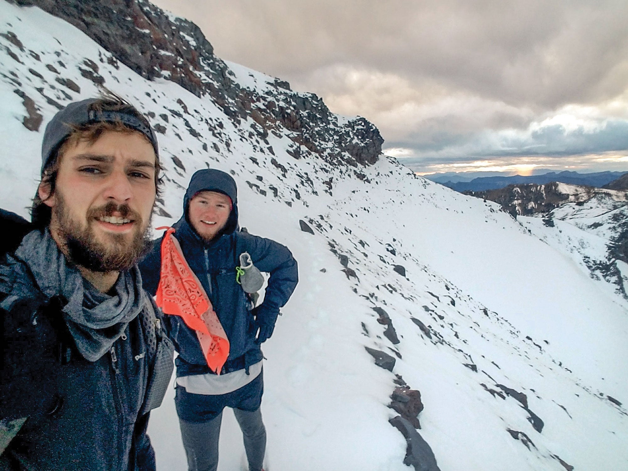
Dylan “Flip” Zitawi, 25, and Colton “Rook” Lulfs, 21, spent 60 hours in a snow pit near Indian Pass, Washington, when a blizzard struck in 2017.
'Courtesy'
It seemed like everywhere we wanted to go, wildfires beat us to it. My hiking partner Rook and I hit the northern half of the Pacific Crest Trail at the peak of fire season, which in 2017 left large swaths of California and Oregon charred and impassable. It was almost as comical as it was frustrating to have our hike delayed by four weeks because we had to road walk 400 miles. As the days passed, Rook and I became convinced that we were the last north-bound thru-hikers of the season.
Still, by mid-October we were only 150 miles from the Canadian border, and the lower elevations were sunny and dry. We figured we could make it in six days, but the forecast showed the potential for snow up high. We packed snowshoes and 10 days of food in case our weather window closed on us, and reluctantly added a SPOT device at the request of Rook’s mom. Maybe we’ll have a stroke of luck for a change, I thought.
We managed 17 miles the first day and 21 the second, but when we crossed 4,985-foot Indian Pass, near Seattle, the trail vanished under a blanket of white. A passing hiker delivered the news: A massive storm was approaching fast.
ADVERTISEMENT
Rook and I weighed our options. We could hike 90 miles forward in uncertain conditions or 44 miles back to the last road. We felt we had the right gear, and as long as we moved efficiently, we thought we might be able to outrun the storm. It wasn’t until we set up camp and pulled out our phones that we realized we had another factor to worry about: Rook’s smartphone was soaking wet, and the map files on mine were corrupted—We’d lost our only means of navigation.
I wanted to tag that border, but not at the expense of our lives; we weren’t experienced winter hikers, and without a GPS, we didn’t trust ourselves to stick to the snow-covered trail. We decided to play it safe and retrace our footsteps over the pass in the morning.
But when we woke up, we found ourselves packing up in a storm. The weather toggled between rain and nuking snow, and the wind slowed our pace to a half-mile per hour. Soon, the snow was up to 2 feet deep, and we were postholing even in snowshoes. On the pass, we dropped into drifts as high as our chests. Visibility shrank down to just a few feet.
ADVERTISEMENT
We’d planned to hike 20 miles, but by the 11-mile mark, the sun was setting. We were soaked and exhausted, so we decided to hunker down just below the pass and wait out the worst. Yelling to each other over the wind, we fought to dig out a pit for our flimsy ultralight tents, digging with our trekking poles and cook pots. We pitched our tents wall-to-wall and packed the edges of the flys with snow to keep out the blowing flakes.
We woke up to collapsed tent ceilings and a still-raging storm. The slopes around us were loaded and we didn’t have any avalanche training or gear, but we were keeping warm just fine and had more than enough food. We agreed to stay put. If the sun reappeared soon, we could wait a few days for the snowpack to settle and then move on. To pass the time, we told stories through our tent walls. By this point, Rook probably knew me better than anyone else in the world.
He spent most of his time melting snow, and I chain-rolled cigarettes to the tunes we played out of my still-functioning phone. We oscillated between trying to stay positive and staring gloomily at the ceilings of our respective cells.
ADVERTISEMENT
We also debated using our SPOT device, unsure if we should call for rescue or not. In our minds, any step could trigger a slide. But our communication options were limited. We could call for a rescue, but we couldn’t give any detail. The message would ping our GPS coordinates from the satellite to a distant rescue coordination center, and from there to a local SAR team, who would presumably launch into action to find us. But after the S.O.S call, the rest of the world would hear only silence from our end. Everyone was going to think the worst.
It took more than a day of sitting in our tents, watching the relentless snowfall make travel more and more dangerous, to convince us to hit the button.
We waited, expecting a chopper to stir its way through the froth of clouds any minute. But it didn’t. About 24 hours after sending the S.O.S, we started to realize what we’d done: We tied ourselves to this spot by hitting that button. If we moved on, we could get lost or buried in a slide, and rescuers might never find us. But what if we stayed put and help wasn’t coming? The snow was still piling up outside and showed no signs of quitting. How long could we last before we ran out of food to eat and fuel to melt snow? A few days?
ADVERTISEMENT
Quitting the PCT no longer seemed like the worst thing that could happen. I’d promised my girlfriend that I’d make it back. Now, even that seemed questionable.
After two days tent-bound, we thought we heard a helicopter. But the sound faded almost as soon as it arrived. We’d been in the pit so long we were imagining things.
About 48 hours after pressing the button, we decided to push on regardless of the weather; we didn’t know how long it would take to hike the 10 miles to the nearest road in deep snow, and we needed to go before we ran too low on food and fuel to make it there. As daylight broke through the wall of white around us, we stood in silence next to the flames of our cookstove.
ADVERTISEMENT
Around 7 a.m., the snow stopped. We looked at each other and nodded. We knew we were in a minefield of avalanche triggers, but conditions were just as likely to get worse as they were to get better, and we couldn’t last out there forever. It was time to go.
As we started packing up, we heard buzzing. Overhead, a chopper emerged from the clouds. Our luck had finally changed.
Key Skill: Get Rescued With An Alert Beacon
1. Assess the need.
Only send an S.O.S. if life or limb is at risk and there’s no cell service that could enable two-way communication (which is more helpful to rescuers). If it’s reasonable to hike out or wait for the weather to improve, try that first. If you’re in a group, only activate one device.
2. Give it some space.
Satellite communication requires a clear view of the sky, which means signaling can be unreliable in narrow canyons or dense forest. Find a spot at least 10 feet away from rocks, trees, and people, and set the device with the antenna pointing directly upward.
3. Stay put.
Once you’ve activated the device, you’re committed to that spot. Moving can delay rescue and increase the risk to rescuers.
ADVERTISEMENT
4. Be patient.
It can take anywhere from two to 20 minutes for a message to send, or up to a couple of hours with a poor line of sight to the sky. If the weather’s too bad for crews to set out, plan to hunker down; rescue could take up to several days.