Published May 20, 2010 07:13PM
Lost in the Frank Church Wilderness: What Does It Really Mean to Be Utterly, Hopelessly, Truly, Lost?
We air-dropped a blindfolded Jim Thornton into the middle of a 2-million-acre wilderness to find out.
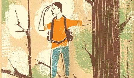
'Illustrations by Edel Rodriguez'

Illustrations by Edel Rodriguez

Illustrations by Edel Rodriguez
You can take the blindfold off now, yells Dan, the bush pilot, over the propeller’s whine. When we first left the central Idaho mountain town of McCall this afternoon, I’d tried to maintain my bearings behind the blindfold by tracking the angle of the sun’s rays on my skin. It didn’t work. Five minutes after takeoff, my overheated skin and I were as lost as we’d ever been.
Removing the blindfold now does nothing to change this.
It’s late morning on a clear September day, and my pupils spasm at the sudden flood of light. We’re a hundred feet off the ground and descending fast toward a meadow rimmed by mountains. Fir trees stretch in every direction, many of them toppled by fire, wind, or pine beetles.
ADVERTISEMENT
The plane’s rubber wheels bump through the autumn-gold grass and prairie dog holes before rolling to a stop. Torr, the copilot, asks me my first impressions of The Frank–the nickname local folks use for Idaho’s 2.3-million-acre Frank Church-River of No Return Wilderness. If you throw in the Bitterroots to the north, the whole magnificently tangled mess of protected brush and boulders, skeletons and scat, elk and edelweiss, is nearly the size of Connecticut.
“I think a better nickname is The No Return,” I answer.
Torr and Dan smile in bemusement as I heft my 48-pound pack. I’m not exactly an experienced hiker, yet they have been charged with leaving me–lost–in the Idaho woods.
“You guys have any last-minute advice?” I ask.
“We could blindfold you again and spin you around a couple of more times,” suggests Torr.
I decline. Short of surgically extracting my hippocampus (more on that later), I can’t get more lost.
Three minutes later, the Cessna 206 is reduced to a tiny dot in the sky. I indulge in a short scream–half-joke, half-catharsis–confident no other human can hear. Then I shoulder the pack and begin hiking in the hopes of figuring out where I am and how to get out.
ADVERTISEMENT
In terms of navigational technique, I’m relying strictly on instinct and old wives’ tales. Two chestnuts come to mind. First: If you follow water downstream long enough, you will eventually reach bikini-clad surfer girls. Second: Despite the first tip, your best bet when lost is to stay put and let the rescuers find you. Many lost victims ignore the latter out of ignorance or obstinacy; I’m ignoring it on purpose.
That’s because my goal, my assignment, is to try to find my way out of the Frank on my own–in the process, illuminating what really happens when a hiker goes astray. The rules are simple: BACKPACKER arranged to air-drop me into the middle of a vast wilderness, with no clues as to location. The editors furthermore provided enough food and gear for five comfortable days, at which point I could presumably survive on stored fat and cannibalized muscle tissue.
To give me some chance of determining my actual whereabouts, the magazine threw in dozens of maps and a compass, with which I might be able to hike out (success!) or at least locate an extraction point (tie?). For humanitarian and liability reasons, they included an emergency beacon and satellite phone.
ADVERTISEMENT
After hiking for 18 minutes in the 87°F air, I’m thirsty, exhausted, and on the verge of prickly heat. It’s all I can do to avoid sat-calling for an immediate medevac. Instead, I take a break, drink half of my water, then soldier onward through the dying–and no doubt snake-ridden–meadow grass.
The word “lost” comes from the ancient Indo-European leu, which means “to loosen, divide, cut apart, untie, or separate.” Lost love, lost minds, lost hope, lost causes: There’s no shortage of metaphorical ways we can become unmoored in our lives. But for those who trek deep into nature, a more primal and frightening prospect looms. Getting lost in the wilderness isn’t a metaphor; it’s the root meaning of bewilderment.
Peter Kummerfeldt, former director of survival training at the United States Air Force Academy, knows firsthand how disorienting the experience can be. “I’m 65 years old this year, and over the course of my life, I’ve been lost eight or 10 times,” he says. “It scares the hell out of you.
ADVERTISEMENT
You’re cut off and isolated with no food or water. You start worrying that wild animals are going to attack, that you’re going to die out here, that no one will ever find you. These fears just build and build and build until you panic.”
Such fears, alas, are far from groundless. Robert Koester, author of Lost Person Behavior, is the coordinator of the International Search & Rescue Incident Database (ISRID), which has amassed more than 50,000 incident reports. Of 3,837 lost hikers since 1984, six percent died, and another 16 percent suffered often-grievous injuries. “Without a doubt,” says Koester, “many of these would have perished, as well, if they hadn’t been rescued in time.”
What makes getting lost even scarier is how easily it can happen. A freak snowstorm buries the trail; you take a wrong turn at an ambiguous juncture; an animal track leads you astray. Reliance on technology has brought new problems, too: You head uphill in search of cell-phone reception, then lose your bearings on the ascent or jump the trail on the way down. Or you lose your GPS or it runs out of juice.
ADVERTISEMENT
Astonishingly, given our species’ long history of getting lost–and fearing this prospect–we’ve had little understanding of how the human mental map really works. But recently, in fields ranging from mathematical search theory to neuroscience, researchers have been learning more and more about how we navigate terra incognita–and how we react, psychologically and behaviorally, when we’re unable to find our way.
One study published last year in the journal Current Biology provides the first empirical evidence that humans do in fact walk in circles when they have no directional landmarks. The tendency is so strong, in fact, that when volunteers are blindfolded, they virtually never travel more than 100 yards from their starting point, no matter how long they are given to walk. And by examining links between brain regions like the hippocampus, where we form mental maps, and the amygdala, which initiates the fight-or-flight response, researchers are beginning to understand why panic reactions are so common when we realize we’re lost.
In many ways, it’s this emotional deterioration–as much as being lost itself–that poses a high risk to our survival. Just when we most need to think clearly and act rationally, the psychological fallout of disorientation can steal the very faculties we must depend upon.
ADVERTISEMENT
When lost victims die, says Deep Survival author Laurence Gonzales, death results from many different factors–a “destructive synergy” of exhaustion, dehydration, hypothermia, hunger, and injury. “But everyone who dies out there dies, too, from confusion,” he says. “Being lost is not so much a location as a transformation. It is a failure of mind.”
Not to put too fine a point on it, but that is the crux of this dastardly experiment, and my real challenge in the Frank: Can I go from lost to found without suffering from a failed mind?
Sunday morning, I awake on a bed of rocks, then crawl out of the tent into the predawn cold. I turn on the SPOT beacon, powered down last night to save the battery. What little water remains in my bottle has frozen. I shake the Nalgene, melting enough to swallow an ibuprofen.
Yesterday, I hiked past some ramshackle, deserted buildings that flanked the landing strip, then headed cross-country. For two hours, I clawed up a mountainside through felled firs–thousands of crosshatched trunks and splintered branches poised to skewer my eyeballs and groin. Even with two walking sticks, I couldn’t stop stumbling. By the time I neared the summit, both of my shins were bloody, my hips felt dislocated, and my lumbar muscles quivered on the cusp of spasm. I didn’t have enough water left to boil a freeze-dried meal.
ADVERTISEMENT
Despite such difficulties, ascending to an unobstructed vantage point had seemed an imperative: my best chance to spy a telltale landmark–a river, perhaps, or a signature grouping of peaks on the horizon–anything, in short, that might correspond to a recognizable feature on a map. Alas, upon finally reaching the summit, I spied an endless panorama of ridges and peaks, all of which looked uniformly similar. The arduous climb had simply revealed the enormity of the terra incognita in every direction. I remove my voice recorder and tape today’s first note:
Day 1’s goal: Get utterly lost. Check!
Day 2’s goal: Find water.
Breakfast is a 100-calorie packet of Orange Burst GU Energy Gel with caffeine, five chocolate-covered almonds, and the last swallow of water. I hoist the pack and only then notice that it’s sitting atop a large white bone. Elk tibia, perhaps, or wolf femur? Whacked hard against a tree, it breaks. An omen?
For the next hour, I slog downhill through saplings and thickets. Rocky soil gives way to soggy muck. Near a copse of yellow aspens, a spring trickles from the black earth. I follow the water’s desultory progress. Sometimes the flow disappears underground entirely–like a lost hope. I consider turning back and filling the bottles with a slurry of muddy water. But then I press on, not willing to capitulate so easily.
ADVERTISEMENT
The downslope flattens, and sunlight pokes through the high canopy. At the edge of the forest and another boggy meadow, I encounter a trail, less than a foot wide, meandering from the southwest toward the northeast. It’s at this point that I hear much louder water–the rush of an actual stream concealed hundreds of yards away in the gorse-covered muck.
For the first time in the wilderness, I face a consequential choice. If I try to reach the stream while carrying my pack and fall into the water, I risk fouling the beacon and satellite phone alike. If I leave the backpack behind on dry land and can’t get back to it, I’ll lose not only the safety net but food and shelter, too.
Eventually, like any true believer, I take a leap of blind faith. I lean the pack against a tall tree that I hope I’ll see from the distance. I take out my compass and head due east, toward the sound of the stream. It takes 10 minutes to find the creek, which is gin clear and gorgeously sun-dappled. Carefully, I lower myself down the slick bank and fill both bottles, check the compass again, then head back due west. Only when I can actually touch my pack again does my heart rate begin returning to normal. It’s barely 10:30 a.m., and I’ve met Day 2’s goal. Goal 3: find my way out of here.
ADVERTISEMENT
Unlike most lost hikers, I have no illusion that salvation–the trailhead, my campsite, a partner–is just out of sight, so I refrain from crashing through the forest in a panic. Instead, I do what most lost hikers should do: refuel and rethink. I break out the stove, instant coffee, a packet of freeze-dried beef and noodles, and several of the maps.
After brunch and a short, restorative nap, I drink a half-liter of water and check the maps. The adjacent creek meanders in a semi-southerly direction, through hills oriented east-west. But there must be dozens, if not hundreds, of creeks that follow this same general pattern. And that’s just on the first map I happen to grab, which shows the southeast quadrant of the Frank’s south half.
At this point, I’m still hoping to stumble upon an incontrovertible landmark–an Ayers Rock of the Frank, if you will–that I can use to pinpoint my location. My fallback strategy–not so much a Plan B as a Plan F given its likelihood of success–is to pick some direction and follow it unwaveringly to salvation or demise, whichever comes first. I am certain, for instance, that if I just travel east long enough, I will get back home to Pittsburgh, albeit most likely not before 2017.
ADVERTISEMENT
I fold up the map and head back toward the trail I crossed over earlier, resolving to take it wherever it leads. Twenty minutes later, the path widens, and the first prickling of humiliation creeps over my skin. I round a bend and spy a rough-hewn sign: Stonebraker Ranch: Hunting and Fishing Permitted. One ramshackle building looks distressingly familiar. Five minutes later, I’m back at the airstrip.
In a voice heavy with shame, I record:
I’ve just spent a day climbing over dead trees and wading through muck, all to end up exactly where I started. Maybe this is some fail-safe mechanism evolution has instilled in simpletons like me, to keep us from wandering off too far.
In the distance, high mountains stretch to the north and east. I tell myself they’re the Bitterroots, though this is just a guess. Self-disgust now trumps all sense of fatigue. Surely if I march toward these summits, I can stop the aimless circling I’ve mistaken for progress. Perhaps if I lose myself completely, I’ll have a chance to find the way back for real.
ADVERTISEMENT
In order to reach her office job, the 43-year-old Canadian woman gets on the same bus every morning and rides it to a distinctive downtown square. She then exits the bus and walks 30 yards to the tall building in front of her. At day’s end, she follows these simple directions in reverse to get home. Any change, and she will become hopelessly lost.
It’s been like this her whole life. Despite normal cognitive development, friends or relatives led her to school every day throughout childhood. In adulthood, she needs a guide to go to the grocery store, movies, or anywhere besides work.
In the journal Neuropsychologia, cognitive neuroscientist Giuseppe Iaria, Ph.D., and his colleagues at the University of British Columbia, published a case study of the woman’s affliction, dubbing it DTD, or “developmental topographical disorientation.” Certain forms of brain damage, including Alzheimer’s, can rob adults of their ability to form mental maps. But this woman was the first published case of a person seemingly born lost.
ADVERTISEMENT
“We published our paper in August,” says Iaria, “and since then, we have been contacted by 500 people with this same disorder. It’s an extremely frustrating and anxiety-causing problem, and many of them are relieved to find that there’s actually a name for their condition, that they’re not stupid.”
Most of us take for granted the ability to form some type of mental map, even if the accuracy varies greatly. Some, like me, must constantly stop to ask for directions. Others seem blessed with preternatural homing abilities. “Australian Aborigines and the Puluwat Islanders of the South Pacific,” says Gonzales, “seem so inexplicably good at navigating that researchers once wondered if they had a magnetic sense.”
Though migratory birds have neurons that sense magnetic fields, no evidence exists that humans are equipped with such an internal compass. What we do have, however, is no less miraculous: an interplay of complex neurological systems that together allow us to navigate through the world.
ADVERTISEMENT
For complex routes we habitually travel, for example, a brain region called the caudate nucleus encodes the directions. Neuroscientists have dubbed this “procedural memory,” and it lets us perform many well-practiced behaviors on autopilot. The advantage of route-by-rote navigation is that, once ingrained, it demands little conscious attention, freeing our brains to concentrate on other matters.
But there’s a decided disadvantage, too, with habitual routes. “Well-meaning people sometimes trap nuisance squirrels and move them to the woods, believing this is a humane solution to a pest problem,” says Gonzales. “It’s not. Once you take them out of their territory and they don’t know where they are, they rarely survive.”
Fortunately, people are less reliant than squirrels on procedural memory alone. “Our brains can learn not only where different landmarks are, but where each one is relative to the others,” explains Iaria. “Thus we can form a mental map of the environment in our heads and visualize alternative pathways leading to the same destination.”
ADVERTISEMENT
Creating and manipulating these cognitive maps requires distinct high-powered skills, from visual memory to the ability to mentally rotate objects in space. Though various brain regions play a role, the most important is the hippocampus. It contains specialized “place” cells that fire rapidly whenever we pass a familiar landmark. In recent work, Iaria and company found that a person’s mental mapping ability depends largely on the structural integrity of the hippocampus. Victims of Alzheimer’s and DTD alike, it now appears, can’t find their way because of hippocampal impairment.
Of course, we’re all doomed to some deterioration. In one recent study comparing volunteers in their 20s with those in their mid-50s, researchers found that the older we get, the longer it takes us to form cognitive maps–and the more error-prone we become when using them.
But don’t lose hope. A simple technique can help virtually everyone consolidate new directional data into long-term memory: Get a good night’s sleep after exposure to new geography. Whether you’ve spent the day hiking through unfamiliar woods, or scrutinizing topographical maps to plan an alpine crossing, sleep will help fix new bearings into your cognitive map. Veteran hikers can also take satisfaction in another research finding: When it comes to navigational acumen, practice makes perfect. One study of longtime London taxi drivers found that years of exercising their mental mapping skills led to a physical increase in hippocampal volume. Adrift in the Frank, I can’t help but wonder which description fits me better: London hack in training or transplanted nuisance squirrel?
ADVERTISEMENT
The “Bitterroots Trail” leads me to a confluence of streams where I must ford a fork. The least intimidating of these is six feet wide and deep enough to swamp my boots. The current flows fast over smooth rocks slick with algae. This proves the first of many laborious, barefoot crossings. By late afternoon, the trail has funneled me deeper into a vast drainage, and numerous feeder streams have swollen the original creek into a cascading roar of whitewater. In the lowlands, the trail snakes through dense brambles fed by the splash. At times, the vegetation grows so thick that the trail becomes a mere suggestion of itself, best recognized by not looking at it too directly. At other points, the stream and trail diverge, the latter ascending steeply up a flanking canyon. At the highest points, the trail takes a horseshoe turn and crosses the cleavage separating one ridge from the next, before descending to begin the rise and fall again.
It’s arduous going, made worse by the fact that in the Frank, the term “trail” is liberally applied. Case in point: Enormous ponderosas, black with fire scars and toppled over, block my passage with dispiriting regularity. Each time I encounter one of these giants, I’m forced to heave myself over or scramble around on crumbly scree. And that’s when things go smoothly. At one fallen leviathan, I’m clambering over a trunk the diameter of a manhole cover when my forward progress abruptly stops. A splintery branch had ensnared the back of my britches. The result is a sensation last experienced by me in junior high. Not content with merely disorienting, exhausting, and discouraging me, Mother Nature has decided to give me a wedgie, too. I have to de-pants myself to get loose.
Such indignities aside, it’s hard to understate how exhausting this can be, hour after hour. I’d like to say that at least I have the splendor of the wilderness to refresh my spirits. But the truth is, I’m spending 99 percent of my time looking at my feet. Pinecones, rocks, bones, the scat of predators and prey; such flotsam especially proliferates wherever the trail runs along cliffs, wherever a misstep could maim or kill me.
ADVERTISEMENT
That night, I pitch my tent between two boulders and set the stove on one of them. As dinner boils, I spot more animal bones and climb down to take a look. Spots of red adorn the joints. I turn around and see a burrow’s entrance–directly below where I pitched my tent. Something, it seems, is living in my basement, but I’m much too exhausted to consider relocating. Whatever it is, he’s a good neighbor. The next morning, both my poorly hung bear bag and I remain intact. My body actually feels limber, as if it has begun to acclimate, even thrive, in the face of new demands.
But I’m still hopelessly lost.
At breakfast, I unfold the two large-scale maps. Each one is gridded in one-inch squares corresponding to a square mile of wilderness. Judging by the relatively short air time from McCall, I’ve been operating under the theory that I’m probably in the Frank’s southern half. Square by square, I scan the minutiae of the entire southeast quadrant before flipping it over and searching the southwest quadrant. Nothing looks familiar, just an indistinct collection of mountains and creeks and dotted trails meandering in every direction. Part of me already suspects what experts will later confirm conclusively: Without a landmark in the actual environment to serve as a reference point, maps are nearly useless to even the most experienced navigator.
ADVERTISEMENT
I give up on the Frank’s south half and unfold the map for the northern section. Beginning with the northeast quadrant, my eyes again slowly sweep the top row of squares from left to right. Then I dip down a row and repeat the horizontal sweep. By the bottom of the page, I’ve found nothing helpful and am ready to quit. I pour a second cup of coffee, flip the map over to the northwest quadrant, and resume the final square-by-square search. At this point, I continue scrutinizing the map not in hope of finding myself–but to prove how impossible the task is.
Seventeen minutes later, compulsivity pays off in an utterly unexpected way. There, in section G-4 (grid name: Meadow of Doubt), I spy Stonebreaker Ranch written in tiny letters, an extra “e” added to the “braker” part. At last I’ve found myself–or at least where I was two days ago. The challenge now is to figure out where I’ve hiked since then. From the ranch, at least seven different trails radiate out like warped spokes. But which one I’ve been traveling on is not immediately clear. From occasional compass readings over the last couple of days, I can rule out the trails leading due west, southwest, due south, and southeast. That leaves three possibilities: north, northeast, and east.
For long stretches, I’ve traveled in each of these directions. The good news is that two of the three paths lead to exit points: the north trail to an airstrip near the Salmon River, and the east trail to something called the Root Ranch, which is not far from another backcountry landing strip. Only the northeast trail leads to a dead end: a mountaintop called Arctic Point Lookout. Whichever trail I’m on, I resolve to keep following it forward. The thought of heading backward is more than I can stand.
ADVERTISEMENT
By early afternoon, the first cloud I’ve seen in Idaho floats across the sky. It seems inconsequential, but the once-dry air is growing humid. I record my observation: Weather coming in, looks like it’s from the south. A bad omen?
Distracted by the recorder, I take my eyes off of the trail, my boot catches something, and I nearly fall down a ravine. I had tripped over a skull, six inches long, with large orbital sockets and canines sharp enough to carve meat. Absent any actual knowledge, I decide it’s a wolverine: my college mascot at the University of Michigan and perfect talisman for the No Return. The Frank actually contains some of the last critical habitat for these endangered “ghosts of the woods,” which have been known to chase off grizzlies and wolves–then steal their prey. According to Inuit legend, a 1,000-pound polar bear once tried to crush a 35-pound wolverine to its chest, only to see its own heart torn out.
I slip my new lucky charm inside my shirt and hope its spirit rubs off. By prearranged agreement the next morning, I use the satellite phone to check in with BACKPACKER for the first time. For five minutes, the handset’s screen blinks SEARCHING. I give up, climb 300 feet farther up the mountainside, and try again. This time, my editor answers on the second ring. The connection is pretty bad, but he sounds glad to find I’m still alive. I tell him I’m 80 percent sure I know where I am–on a trail following Chamberlain Creek or possibly another one following the McCalla. He says something that sounds a little like, “Turn around,” but I argue my reasons for forging onward. In response, I think he says my plan’s OK, but I’m not exactly sure. Then the call is dropped.
ADVERTISEMENT
The wolverine skull, temporarily perched atop my walking stick, stares back at me approvingly. I soldier on. If I am correct about where I am, Chamberlain Creek will eventually join with the McCalla, at which point all I’ll need to do is head south to Whimstick Creek, then follow this to the presumably abandoned Root Ranch. It appears to be about 15 miles total. If I pick up the pace and avoid getting confused by unnamed streams shown on the map, I should make it by nightfall tomorrow.
All day, the temperature falls. By late afternoon, the sky has turned pewter, and the air is clammy with humidity. I get chilled at each rest stop. When the cold bothers me more than exhaustion, I tuck the wolverine back inside my shirt, tighten my pack straps to selective pain mode, and forge on. One canyon gives way to the next, then the next, then the next. But where is the long-anticipated confluence? Like the tease of false summits to a hypoxic climber, every bend beckons with illusory promise. And then, at quarter to five, with wind gusts pushing aspens half to the ground, I spy a footbridge spanning the creek. A sign proclaims this is the Chamberlain. Woo hoo! Must confirm this with the compass…but yes…Yes! The trail is heading south. I can’t believe it! I am most definitely found! I hike toward the Whimstick, which the map indicates is a short distance ahead. At first, I find myself stepping lively, the gait of a person who knows exactly where he is and where he’s going. But as the expected half-hour drags on to an hour and then more, new-won confidence erodes in the face of impatience, fatigue, and doubt.
Just as I’ve begun second-guessing myself, I reach the stream. Overhead, the scudding clouds start spritzing cold drops. I pitch the tent as it begins to pour.
Not everyone is terrified by the prospect of getting lost in the woods. Daniel Boone reported becoming lost–or at least uncertain of his exact whereabouts–for weeks at a time. For him, “lost” had a different meaning than it does for modern trekkers. Boone may have had no clue about his precise location, but he didn’t feel threatened when cut off from civilization–he could literally live off of the land. Though I’m no Daniel Boone, during most of my time in the Frank the weather’s been great, my provisions adequate, and the satellite phone a reassuring safety net. Being lost has been disorienting, even disconcerting, but I have not yet succumbed to panic.
For most hikers, the transition from vague unease to full-blown meltdown is gradual. Gonzales says it begins when the internal map of where we are doesn’t fit our surroundings, a mismatch that triggers an unsettled feeling. At this point, many of us rationalize away discrepancies. We tell ourselves that a missing lake has dried up, or that a stream has subtly shifted its banks. In the sport of orienteering, says Gonzales, this wishful thinking is known as “bending the map.”
ADVERTISEMENT
At some point, the bent map breaks. According to survival expert Kummerfeldt, “Reality breaks through the fuzziness and hits you. Adrenaline and cortisol and other stress hormones flood your body. If you don’t grab hold of this fight-or-flight mentality, the next step is full-fledged, screaming-through-the-woods panic.”
In such a state, you may easily injure yourself, or lose critical equipment, or get soaked from charging across a stream. With a series of mishaps like these, simply being temporarily lost can turn deadly. For many lost victims, the next stage is to construct a new mental map and begin to hike. With few exceptions, this is a mistake. As much as the brain demands action, the best strategy is to stay put. “Search and rescue,” says Kummerfeldt, “is one thing we do very, very well in this country.”
When the invented map inevitably fails, false hope gives way to an even deeper despair. At this point, says Gonzales, many hikers resign themselves to their plight. Death can come surprisingly quickly, often through no clearly identifiable cause. After four days, less than half of lost hikers are found alive.
ADVERTISEMENT
Fortunately, the vast majority don’t remain lost this long. Speedy rescues are due in part to experts like Koester, who have applied mathematical algorithms to real-world behavioral data and developed surprisingly accurate profiles of how different groups of people–from hikers to snowmobilers, hunters to anglers–are likely to move in different environments.
“For example,” Koester explains, “when a hiker is lost in dry terrain in a mountainous environment, there’s a 75 percent chance he’ll be found within four miles of his last known location.”
The data has also helped to kibosh some well-entrenched myths–that lost people tend to move in the general direction of their dominant hand, or that they nearly always travel downhill, or that they rarely travel at night.
ADVERTISEMENT
On the other hand, many other behaviors do repeat themselves with predictable consistency. For example, even though backtracking makes more rational sense, very few lost hikers attempt to do this. “It’s what I call the ‘just around the bend’ factor,” says Koester. “You convince yourself that if you just keep going forward, you’re going to find something good just around the next bend. You know how much work it’s taken to get where you are, and you don’t want to repeat that. Plus, ‘back there’ is where you got lost. Unconsciously, you’re thinking: ‘Why go back where a bad thing happened?’”
My own lost experience may have been conceived in artifice, but after four days in the wilderness, my meanderings have hewn to type–from the initial and inadvertent circling, to following so-called “linear features” like streams and trails, to real revulsion at the thought of turning around. Had the weather remained clement another day, it’s likely that these frequent hallmarks of lost person behavior would have been the extent of my experiment in wilderness immersion. But the weather deteriorated. And so did I.
Lost or found? I don’t know anymore. My brain’s not working right and hasn’t been for some time.
The creek I hope is the Whimstick is swollen from last night’s downpour. The temperature has fallen into the 30s, and snowflakes now mix with drops of rain. It was too wet last night to light the stove for dinner, too wet to cook breakfast this morning. I’m not hungry anyhow, but my muscles twitch from exhaustion, cold, and low blood sugar. Yesterday’s celebration now seems like hubris, punishable by god only knows what will come next. If I am reading the map correctly, the trail crosses the Whimstick here and just one more time about two miles upstream. Just two crossings, then a straight shot to Root Ranch. The map gives no hint about what’s there, but I’m holding out hope there will be at least a partial roof remaining, a place where I can light the stove.
ADVERTISEMENT
The Whimstick current is deep and swift. A small part of me knows I should cross it barefoot to save my socks and boots from a drenching. A larger part of me is just too cold to do so. I fabricate waders out of Hefty bags and cinch the flimsy plastic handles to my hipbelt. Balanced by the walking sticks, I quadruped through the whitewater.
The Hefties for the most part hold up, but getting wet is inevitable. The trail cuts through drenched bracken, and soon my pant legs are soaked. Moisture infiltrates my boots. An hour later, I reach the final crossing point.
On the far side, the trail immediately ascends up a ridge, leaving me wobbly-legged by the top. It’s snowing harder now. I hike until I’m too tired to go on, then rest ’til I’m too cold to stay put. My hands are freezing, and I try to remember where or even if I packed gloves. My brain has entered that befuddled state where simple thoughts are hard to hold. The map says this trail should be bearing south, but the compass says it is southeast: close enough.
ADVERTISEMENT
Another descent, another lengthy slog through a rain-slick bog. The trail disappears in a profusion of plants, then reappears briefly before dead-ending at the creek.
This can’t be. I’ve already crossed it the final time. My eyes skitter from one bank to the other but find no hint of a trail on the opposite side heading south. My stomach sinks, and my skin burns as if shocked. The anxiety that’s been brewing for hours transforms in an instant to full-blown panic. Have I been bending the map, and now broken it?
Before I can stop myself, I bolt across the stream, boots flooding as I plunge into knee-deep water. On the other side, I charge through smothering vegetation for signs of the trail. There’s nothing but a bewilderment of wild roses, alpine bamboo, and orange-leafed bramble, all of it soaked with rain starting to ice. After three minutes of frenzy, I’m totally exhausted. I reverse course back to the creek, take off my boots, dump the water out, and wring my socks with fingers white as bone.
ADVERTISEMENT
Again, I try to spy the faint outline of a trail on either side of the ravine, and finding nothing like what the map says should be here, I begin to shiver. I can’t remember ever being quite so tired or dispirited. Quite so lost. I register a truth our ancestors surely knew: For all the majesty and inspiration the wilderness can provide, it couldn’t care less if it heartens or breaks us.
I reach for the satellite phone, but it only makes me feel more depressed. I am as close to crying as I’ve been in years. My brain is too cold, tired, and low on fuel to articulate why, but I sense using this phone will only lock me in a much worse place. I put it away and grab the map and compass instead, will my breathing to slow, tell myself that if I can’t think fast, there’s nothing wrong with thinking slowly.
Minutes later, I’ve made my decision. I head once more through the smothering plants, but slowly this time and with eyes sweeping side to side, the better to look without desperation. The process takes much longer than I’d like.
But I finally find the trail again.
ADVERTISEMENT
This time, I have no illusions that salvation is imminent, nor, for that matter, permanent. Over the next hours, I lose my way two more times before coming upon the single hardest obstacle of the trek: a section of trail too steep to circumnavigate on either side, but blocked by dozens of ponderosas felled by a mud slide.
Not long after I’ve clambered across the pines, the trail spills onto a high meadow. I follow this to a paddock where a herd of 20 mules and horses turn in unison to look me over. Behind them is a modern hunting lodge, smoke rising from the chimney.
Orange light glows in the lodge’s windows, cutting through the gathering dusk. A hound dog starts to bay, and pretty soon a man comes outside and gestures a welcome. Never in my life have I been so relieved to see a complete stranger.
ADVERTISEMENT
The sanctuary a wilderness can give us is inestimable, and even in my exhaustion I know I’ll be returning to a place like this one day soon. But when nature is at her pitiless worst, being lost is dreadful. It’s not just the panic and physical deprivation. Absent reliable bearings to reckon our place in the natural scheme, we lose our sense of belonging here at all. Is there anything worse for a backpacker who cherishes the freedom of wide-open wilderness? Getting lost, I’ve learned, is an excommunication, a fall from grace. Whatever measures it takes, I’m determined to never let it happen to me again.
For now, the scent of roasting meat floats in the smoke–a promise of nourishment, safety, and heat. Despite legs bowed from exhaustion and still twitching from cold, I can’t stop myself from dancing the last steps to deliverance.
Jim Thornton has jet-skied from Alaska to Siberia and swum with sharks in the Bahamas. Neither was as hard as being lost in the Frank, he reports.