Trip Finder: Great Plains

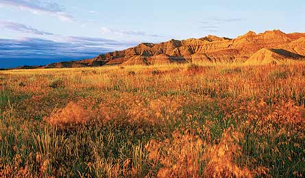
'Bison Trail, NE (Chuck Haney)'

Bison Trail, NE (Chuck Haney)

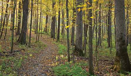
Backpack Trail, IA (Clint Farlinger)

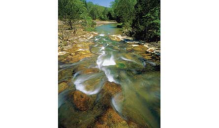
Buffalo River/Old River Trails, AR (Tom Till)

Tom Trigg (courtesy)
DAYHIKES | WEEKEND | MULTIDAY
GRASSLANDSBison Trail, NE
Take this six-mile out-and-back to tour “a moonscape of exposed bluffs and rock formations” in the Oglala National Grassland, says Tom Scheimo (above). The trail’s name? Bison mysteriously died en masse here more than 10,000 years ago. fs.usda.gov/nebraska
RIVERSElk River National Recreation Trail, KS
Stroll the north shore of Elk City Lake and then up the Elk River drainage on a 15-miler. You’ll burst uphill in the first 1.3 miles to gain the cliffy ridge overlooking the lake, before delving deep into a quiet cedar forest with hidden grottoes. americantrails.org
RIDGESRough Canyon Trail, OK
The San Bois Mountains were the hideout of 19th-century outlaw Jesse James. Hike to his refuge (a cave), then drop through Rough Canyon and rise onto the ridge overlooking Wayne Wallace and Carlton Lakes for an eight-mile out-and-back. stateparks.com/robbers_cave.html
DAYHIKES | WEEKEND | MULTIDAY
GRASSLANDSIndian Creek, SD
Roam a trailless, 48,000-acre prairie where bison and pronghorn feed in Buffalo Gap National Grassland. Hike roughly five miles to the top of 3,143-foot Sheep Mountain Table for end-of-the-earth views. It’s a good spot to survey a campsite, too. fs.fed.us/grasslands/
RIVERSBackpack Trail, IA
Notable for its wrinkled topography in a region better known for flat terrain, the Driftless Area has tight, deep, trout-stocked river valleys. Take the 25-mile Backpack Trail to visit bluffs, Big and Little Paint Creeks, and a bass-filled marsh. Camp in Brown’s Hollow. iowadnr.gov
RIDGESBuckeye-Caney Loop, AR
This 9.4-mile tour visits “the most rugged area in Arkansas’s Ouachita Mountain range,” says Tom Trigg (above). After several creek crossings, you’ll ascend 2,254-foot Buckeye Mountain before dropping back into a hidden valley with multiple waterfalls. fs.fed.us/oonf
DAYHIKES | WEEKEND | MULTIDAY
GRASSLANDSMaah Daah Hey Trail II, ND
Tackle the new 40-mile extension to the 96-mile Maah Daah Hey Trail through Theodore Roosevelt National Park. It connects Sully Creek State Park to Burning Coal Vein Campground, traversing grassy badlands home to coyotes and mule deer. nps.gov/thro
RIVERSBuffalo River/Old River Trails, AR
Link these two trails to create a 16-mile loop with limestone palisades and more than a dozen river crossings in the Ponca Wilderness. At mile 13.5, spot 209-foot Hemmed-in-Hollow Falls, the tallest between the Rockies and Appalachians. nps.gov/buff
RIDGESCentennial Trail, SD
The 111-mile Trail No. 89—named for the state’s centennial statehood party in 1989—climbs from Bear Butte State Park into the Black Hills high country, skirting lakes and trout streams before ending in the winding canyons of Wind Cave National Park. nps.gov/wica
THE EXPERTS
Tom Trigg, 55, lives 35 miles from Caney Creek Wilderness Area in Arkansas. “After sustained rains, waterfalls appear everywhere.” Nebraskan Tom Scheimo, 48, loves the panhandle’s Pine Ridge County. “The alpine quality of the hills here is amazing.”