Top 3 Night Hikes

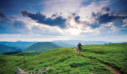
'Shining Rock Wilderness, NC (Steven McBride)'

Shining Rock Wilderness, NC (Steven McBride)

Ventana Wilderness, CA (Paige Falk)
Shining Rock Wilderness, NC | Ventana Wilderness, CA | Pecos Wilderness, NM
With silvery shadows and spooky noises, night hiking lends even the most familiar trail a hint of danger and exoticism. But these three nocturnal treks into our backcountry’s darkest zones will thrill you with the added spectacle of interplanetary storms, full moons, and other galactic bling.
Shining Rock Wilderness, NC
Catch an epic meteor shower.
Cold Mountain may be best known as the backdrop for the Civil War-era novel and movie of the same name, but you won’t see anyone in hoop skirts on your way to its 6,030-foot summit. Between November 13 and 20, it’s the best seat in the Smokies to view The Leonids, an intense meteor storm in the northern sky caused by intergalactic debris. The shower peaks on November 17, when 40 meteors per hour radiate from Leo (below the Big Dipper). From Big East Fork trailhead, take the Chestnut Ridge Trail 2.5 miles to the Art Loeb Trail and cruise four miles to Cold Mountain. Camp near the well-worn summit trail, and set your alarm for a midnight climb the last .5 mile to the top. (828-877-3265, cs.unca.edu/nfsnc)
Star Attraction
Revive at Papa’s and Beer in Hendersonville with a kicking pumpkin-seed-and-habañero salsa. Try it on an omelette. (828) 692-9915
The way
From Asheville, take I-26 east to the Blue Ridge Parkway. Turn north, and at milepost 412, turn northwest on US 276. Travel 1.25 miles to Big East Fork Parking Area.
Shining Rock Wilderness, NC | Ventana Wilderness, CA | Pecos Wilderness, NM
Ventana Wilderness, CA
Climb to a Stargazer’s Paradise.br>
Exercise your night vision during November’s new moon; it’s the optimal time to spot fall constellations from this remote chunk of Big Sur high country near Carmel Valley. Take the Pine Valley Trail six miles west from the China Camp Campground and descend into a lush meadow dotted with tall pines. Pitch your tent at one of three prime campsites along the Carmel River, and scout out a path ascending the sandstone ridges that fence the valley. Start climbing by 5 p.m. Pegasus, the winged horse, rides high in the north. Look for four stars halfway up the sky that form the front half of the horse’s body, known as the Great Square of Pegasus. (805-968-6640, fs.fed.us/r5/lospadres)
Star Attraction
Grab a bag of Foglifter beans at Carmel Valley Coffee Roasters for a late-night boost. (831-620-0844; carmel-coffee.com)
The Way
From the Arroyo Seco Rd. exit on US 101, head 16.2 miles to Carmel Valley Rd. Turn right and drive 17.2 miles to the Tassajara Rd. junction. Hang a left and ramble 11 miles on a dirt road to China Camp.
Shining Rock Wilderness, NC | Ventana Wilderness, CA | Pecos Wilderness, NM
Pecos Wilderness, NM
See moon detail without a telescope.
At 12,622 feet, Mt. Baldy is the highest peak in the southern Sangre de Cristos, a mountain range stretching 242 miles from Poncha Pass, Colorado, to Glorieta Pass, New Mexico. Hike to its chrome dome summit on November 13th to watch the full moon rising over glass-calm Lake Katherine. Santa Fe’s dry desert air and scant light pollution make this location “clear and a million” (airline pilot lingo for “good visibility for about a million miles”). Take the Winsor Trail from the Santa Fe Ski Basin four miles to the Rio Nambe. Ascend 1.5 miles to the Nambe’s east fork; set up camp at one of the designated sites. Continue about .75 mile, then head left on Trail 251 to Lake Katherine. Veer north off-trail and climb 1,000 feet and one mile up the summit ridge. Tag the top by 4:30 p.m. to catch both sunset and moonrise. (505-438-7840, fs.fed.us/r3/sfe)
Star Attraction Pick yourself up with a breakfast burrito from Tesuque Village Grocery. Ask for extra guacamole–it’s “slap-your-momma good.” (505) 988-8848
The Way
From Santa Fe, take NM 475 15 miles north to Santa Fe Ski Basin.