Top 3 Fire Tower Hikes

'McCart Mountain, MT (Photo by Gary Weber)'

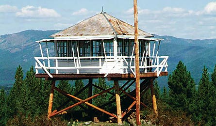
McCart Mountain, MT (Photo by Gary Weber)

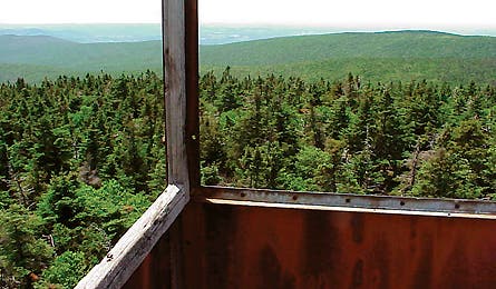
Glastenbury Mountain, VT (Photo by Gary Paull)

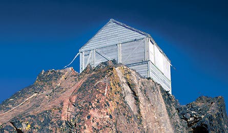
Three Fingers, WA (Photo by Draper White)
Once the domain of solitary smoke spotters–and, famously, authors such as Ed Abbey–many fire towers are now open to the public. There are 557 on the National Historic Lookout Register. Climb to one of these three for panoramic vistas and plenty of writerly inspiration.
McCart Mountain, MT
Make it a first date
Nothing says romance like a cozy wilderness cabin on stilts with a wraparound catwalk, views of the sprawling Bitterroot Range, and a front-row seat for August’s blazing Perseid meteor shower. You’ll have someone special seeing stars at the McCart Mountain Lookout. Perched at 7,115 feet, it’s furnished with a propane stove, dishes, a wood stove, bed for two, and an outhouse. Best of all, the walk up Johnson Peak Trail, two hours south of Missoula, is an easy 1.5 miles, which means there’s no excuse not to pack in wine and treats. Open from mid-May to October; make reservations up to six months in advance ($30; recreation.gov). Call the Sula Ranger District a week before your trip for the lock combo. (406) 821-3201
After the Fire
Hoist a crisp Sawtooth blonde ale and a few Alaskan halibut tacos at Bitterroot Brewing in Hamilton. bitterrootbrewing.com
The Way
From Missoula, go south on US 93 for 69 miles to Sula. Drive 17 miles east on East Fork Rd. to Johnson Peak Rd. and go 5.5 miles south to Johnson Peak trailhead.
Glastenbury MTN, VT
Brave an ancient curse
Native Americans believed this 3,748-foot-high mountain was evil, citing legends that the peak swallowed its victims. Test the hex on this 21-mile loop to the peak’s 57-foot tower. Access the Long Trail five miles east of Bennington, and gain 2,500 feet on the moderate 10-mile hike to the lookout. It’s day use only, so drop your pack at the 12-person Goddard Shelter before walking the last 0.3 mile to climb the tower to views of the Adirondacks. The next day, follow blue blazes 7.5 miles on the West Ridge Trail to 2,857-foot Bald Mountain, then descend to the junction with Bald Mountain Trail. Turn left, reaching the trailhead in 2.8 miles. Close the loop by turning right and going 0.7 mile to VT 9. Go left and road-walk another mile to your car. (802) 747-6700
After The Fire
Hit Marigold Kitchen in North Bennington for a Sophia Pie, a brick-oven pizza with basil pesto, locally grown tomatoes, and mozzarella. marigoldkitchen.net
The Way
From Bennington, go east on VT 9 for 5.2 miles. Trailhead parking is on the north side of the road.
Three Fingers, WA
Climb to Epic Views
The Three Fingers Lookout in the Mount Baker-Snoqualmie Forest seems too good to be true. From its 6,850-foot apex, you can see arguably the state’s best sunset (the orb sinking into Puget Sound) and best sunrise (up-close alpenglow on Mt. Baker). And it’s free. The catch? A tough 8-mile hike–including a technical glacier crossing–to get there. From Saddle Lake trailhead, take Trail #641 to Saddle Lake and Goat Flats, an alpine meadow. Head right to Tin Pan Gap, where you’ll put on crampons and ready the ice axe and rope for a half-mile glacier traverse before scrambling up three wooden ladders to the lookout’s front door. It’s first-come first-served, but the vast majority of climbers camp at Goat Flats. Best conditions are August to mid-October. (360) 436-1155
After The Fire
Head to Luca’s in Lake Stevens for the Romano, a panini filled with prosciutto, fontina cheese, and artichoke pesto. lucasitalianrestaurant.com
The Way
From Granite Falls, take the Mountain Loop Hwy. east 6.5 miles and turn left on FR 41. Go 18 miles and turn right to reach the trailhead.