Updated December 3, 2024 06:06PM
The Peak: Humphreys Peak, Arizona
Discover aspens and alpine hiking, plus views of the Grand Canyon, on this trek up Arizona's 12,633-foot highpoint.
'Humphreys Peak (Elias Butler)'
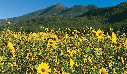
The cool, breezy perch atop Humphreys Peak, a 12,633-foot extinct volcano, may feel like it belongs in the Cascades, but this is Arizona. Visual proof: the distant Grand Canyon, shimmering like a mirage across the high-desert plateau below.
Double-take the aspens and some of the state’s only alpine tundra on this 17-mile, three-day circuit that summits the state’s highpoint, sacred to 13 Native American tribes. From Schultz Pass Road trailhead, 20 miles from Flagstaff, head up the Weatherford Trail for 5.5 miles to 10,800-foot Doyle Saddle. Camp in the spruce trees below the saddle and melt snow (until mid-July, on average) for water. No natural springs; carry four liters per person per day.
The first 3.5 miles of day two take you above treeline (11,400 feet) and across avalanche slides on the scree-strewn flanks of Fremont and Agassiz Peaks, 300 feet above the grassy Inner Basin. At Agassiz Saddle, hang a right on the Humphreys Trail for one mile of rough, exposed, class 2 scrambling. Budget 45 minutes for the sharp boulders of brick-red volcanic slag and two false summits.
ADVERTISEMENT
Drink it in: the Grand Canyon (75 miles northeast), the Painted Desert (50 miles east), the red rocks of Sedona (50 miles south), the basins of the Sonoran Desert (125 miles southwest), a panoply of beauty in every direction. Take the Humphreys Trail back down the mountain 4.5 miles to the Arizona Snowbowl ski area and fill water at the spigot, then pick up the five-mile Kachina Trail and claim a soft meadow (possibly sharing it with a resident elk herd) for that night’s camp. Day three is an easy, mid-mountain ramble on the Kachina Trail, lined with knee-high ferns and aspens. Connect to the Weatherford Trail near the trailhead to close the loop.
Camping is prohibited above treeline; permits (free) required when using Arizona Snowbowl trailhead in winter. (928) 526-0866
The Best…
Campground
Lockett Meadow, a primitive oasis in the heart of the extinct volcano ($12, fs.fed .us/r3/coconino)
Peak to view Humphreys
Climb Mt. Elden via the three-mile Elden Lookout Trail. View the San Francisco Peaks’ six majestic summits that ring the caldera like a rocky crown.
Summit dayhike
Highpointers shoot 4.5 miles up the Humphreys Peak Trail from Arizona Snowbowl ski area.
Bacon burger
The Lumberjack Burger (with cheddar and side of ranch) at Beaver Street Brewery. beaverstreetbrewery.com