The Map Vault: Inside the USGS Repository

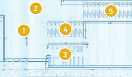
'The USGS Map Vault lobby and corridor. (Emily Davis)'

The USGS Map Vault lobby and corridor. (Emily Davis)

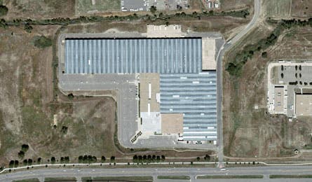
Building 810 is four football fields long. (Google Images)
LOBBY AREA & CORRIDOR
1. Colorado, carved Milled from a giant chunk of machinable plastic using a .015-inch drill bit and more than 250 million USGS digital elevation data points, this 8×6-foot relief map offers a stunning 3D perspective of Colorado’s topography .
2. T-Rex tread Made from the cast of a 66-million-year-old dinosaur fossil discovered in New Mexico during a 1983 USGS survey, this T-Rex footprint reminds visitors that exploration remains the agency’s guiding mission.
3. Topos “R” Us From historic re-creations to obscure mining maps, the USGS Map Store has more than 140,000 titles.
4. Scanning the globe The map warehouse is dominated by machines that digitally scan new quads and satellite imagery, and others that convert the USGS “National Map” into free, downloadable GeoPDFs (store.usgs.gov). USGS databases hold 579 gigabytes of geodata, but for now the printed quad still reigns: In 2009, the store sold 2.4 million paper books, maps, and reports—and served 1 million GeoPDF downloads.
5. Topo 2.0 Building 810 is also home to the USGS’s effort to transform classic 7.5-minute quads into a new “US Topo” that overlays contour lines onto layers of transportation infrastructure and aerial imagery. The new maps will show a more precise picture of treelines, water sources, and forest road access while giving backpackers a better idea of what’s happening between the contours.
Top topos (2009 unit sales)
1. Middleburg, VA (824)
2. Mt. Mitchell, NC (819)
3. Mt. McKinley (B-1), AK (719)
4. Englewood, CO (672)
5. Union Furnace, OH (653)
Tech heaven Dying to get your hands on USGS reports like “Subsurface Occurrence and Potential Source Areas of Chlorinated Ethenes”? You’re in luck. The Map Room is home to one of the richest storehouses of
geological and cartographic data on the planet.
Miles of maps The Joe Bila Map Room houses 19 million maps and at least one copy of each of the 56,700 individual quads that make up the Lower 48. If you laid out the entire set, you’d have a 1/24,000 scaled map measuring about 700 feet wide.
Golden ticket Deep in the Map Room lies the distribution center for the national parks’ America the Beautiful Annual Pass ($80, store.usgs.gov/pass). In 2009, 20,000 shipped from here.