Published June 24, 2010 07:41PM
Secret Hikes: Sequoia and Kings Canyon National Parks
Explore a granite wonderland, cross two little-used passes, and score High Sierra solitude on this point-to-point hike.
'David Stone'
| Secret Hikes: National Parks Home |
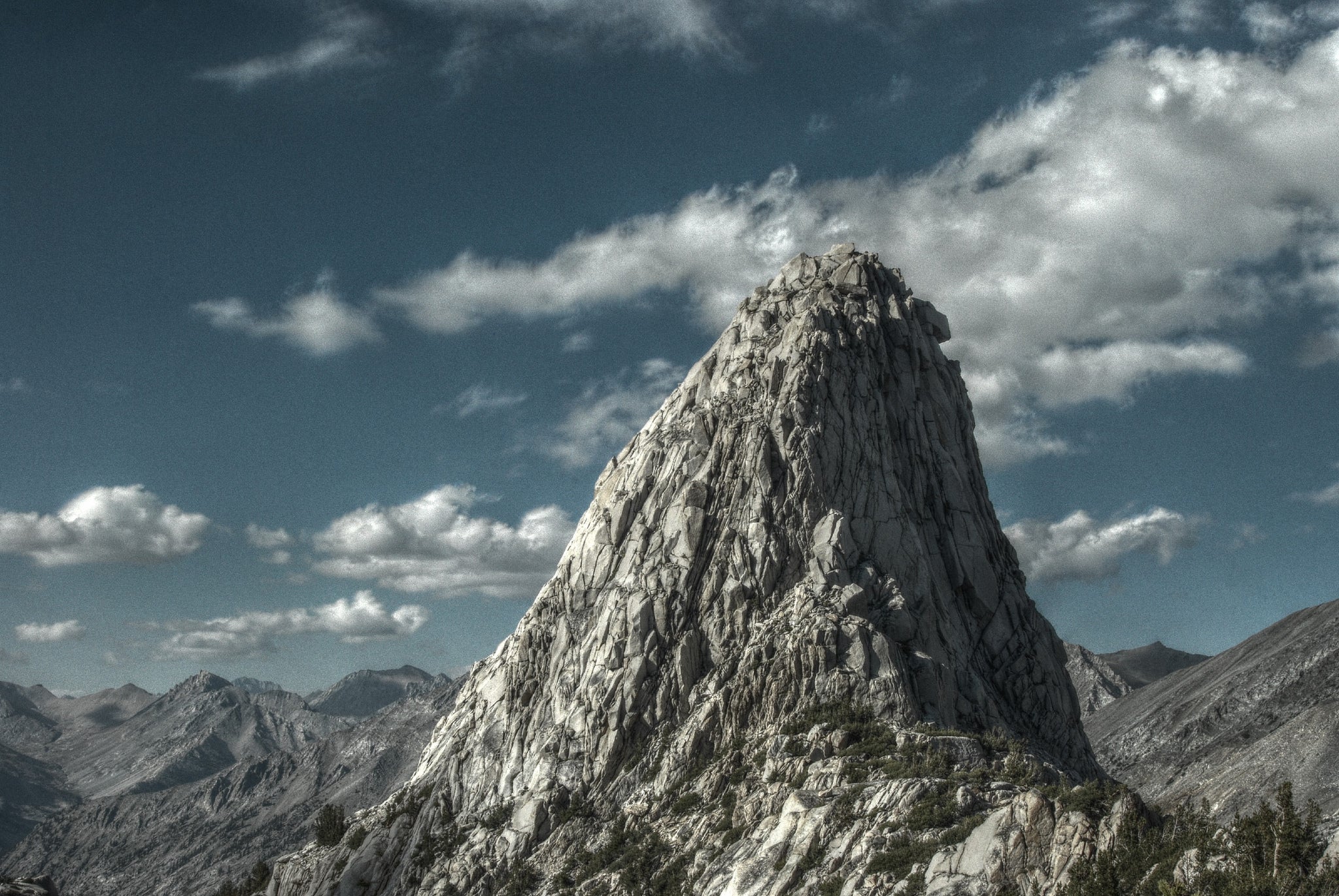
Nothing against John Muir and his beloved Yosemite Valley, but backpackers in the know hit the southern Sierra’s east side for the best high-country experience in the Range of Light. The peaks are bigger, the people fewer, and there are so many lakes above treeline that, when you gaze down from above, it’s like looking into a liquid sky.
This 43.7-mile route, joining the Baxter Pass and Sawmill Pass Trails, leads through the best of it. You’ll climb to granite-rimmed alpine basins, camp in secluded sites above treeline, and, yes, stroll 11 miles on the John Muir Trail. Start from Baxter Pass trailhead; it’s 1,500 feet higher than Sawmill, and the initial climb is more shaded. Camp in a site west of Summit Meadow at mile six, to break up the 6,300-foot ascent. The next day, finish the climb to 12,300-foot Baxter Pass—watch for rare California bighorn sheep (only a few hundred exist). Then descend and detour south on the JMT to the Rae Lakes basin, where you’ll camp in a cirque beneath an arc of 12,000- and 13,000-footers. Planning tip: This spot is so exquisite, it demands a layover day (see Magic Moment) and a dip in Dollar Lake (enter from the sandy beach at the north end). Then, backtrack north two miles on the JMT to the unmarked Sawmill Trail junction (at 10,346 feet, less than a mile south of Twin Lakes). Here, the JMT swings north below the west face of 12,372-foot Mt. Cedric Wright at mile 24. Cut south and climb two miles to Woods Lake. Spend your last night near the lake. On your last day, finish the climb to 11,347-foot Sawmill Pass, then work through a 10-mile, 6,800-foot drop to the trailhead.
ADVERTISEMENT
›› Magic Moment When the solitude and scenery ratchet up a notch in the hidden
paradise of Sixty Lakes Basin, you linger to count every single tarn in your Sierra kingdom. Hike here during your layover at Rae Lakes: Turn off the JMT on the northwest shore of the upper Rae Lake onto an unmaintained use trail; it’s four miles round-trip.
›› Local Knowledge Acclimatize by sleeping for a night pretrip at Onion Valley Campground ($16, recreation.gov), at 9,185 feet. Pack a fly rod to fish for trout in the nearby stream in Grays Meadow.
›› Do It Start: From US 395, 2.3 miles north of Independence, drive 5.8 miles west on Fish Hatchery Road (bearing right at a fork). End: From US 395, 8.6 miles north of Independence, link Black Rock Springs, Tinemaha, and Division Creek Powerhouse Roads 3.5 miles to trailhead. Map Tom Harrison Maps Kings Canyon High Country ($9; tomharrisonmaps.com) Contact (559) 565-3341; nps.gov/seki