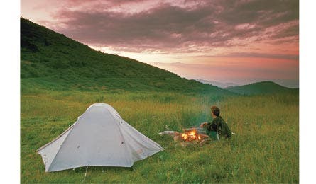
Readers' Choice 2012: Top 3 - Southeast Hikes

'Investor Gap (Kevin Adams)'

Investor Gap (Kevin Adams)

Near Fontana Lake ( Pat and Chuck Blackley)
{ LOCAL EXPERT }
Peter Rives
Winston-Salem, NC
“Pack sandals for river crossings and for exploring the region’s many swimming holes.”

{ Day }
Shining Rock Wilderness Area, NC
Climb to a glittering summit.
Want instant gratification? You’ll rise above treeline in the first half hour of this 10-mile loop from hemlock-shaded slopes to grassy balds with views of flower-packed valleys. Begin at the Art Loeb Trail for a 400-foot, .6-mile rise to Black Balsam Knob—at 6,214 feet, the hike’s tallest peak. Then ride the backbone of the wilderness, alternating between open ridges and meadows rife with rhododendron and pale-pink mountain laurel blooms in June. (Or go in August to snack on blueberries.) At mile five, follow white blazes for a .4-mile spur to a blocky, shimmering quartzite summit at 6,010 feet–the “shining rock” for which the wilderness is named. At Shining Rock Gap, take the Ivestor Gap Trail 3.7 miles downhill on an old railroad grade to close the loop. Contactfs.usda.gov/nfsncTrip ID311988
The way From Candler, NC, take NC 151 10.9 miles south to the Blue Ridge Pkwy. Turn right and go 14.8 miles to Black Balsam Rd. Turn left and park in 1.2 miles.
{ Weekend }
Cohutta Wilderness, GA
Conquer ridges in the deep south.
The good news: With nearly 80 miles of trails spider-webbing across mountainous terrain, falls-rich rivers, and evergreen-laced 4,000-foot ridges, the Cohutta is a hiker’s paradise. The bad: It can get a little crowded. Our local’s fix: Avoid the popular Jacks and Conasauga Rivers and target the gentle hills to the west for a quiet overnight. From Three Forks trailhead, set out on the East Cowpen Trail (obvious but unmarked) to start a 15.1-mile clockwise loop. Bear right onto Hickory Ridge Trail at mile 4.3, after cresting 3,460-foot Buckeye Mountain. At mile 7.4, turn right on Jacks River Trail and head .9 mile to reach Rough Ridge Trail (it’s dry, top off your tanks at Jacks) and climb 1,000 feet through mountain laurel and oak. Camp near mile 10, where you’ll find many ridgetop options overlooking the verdant valleys. Next day, close the loop with a five-mile descent. Contactfs.usda.gov/confTrip ID379572
The way From Ellijay, go 20 miles, linking GA 52, FR 18, FR 68, and FR 64 to Three Forks.
{ Multiday }
Great Smoky Mountains National Park, NC
Walk the AT’s highest miles.
This 71-mile point-to-point from Fontana Dam to Davenport Gap tours the “best features in the East’s most popular park,” says Rives. “Go in fall for thinner crowds.” Hike 1.4 miles from Fontana Road along Fontana Dam; take time to cast into 11,700-acre Fontana’s waters, which hold some of the area’s best pike and bass fishing. You’ll hopscotch the border of North Carolina and Tennessee from mile 8 to the finish, and crest Clingman’s Dome—Tennessee’s highpoint at 6,643 feet—at mile 33.8. Eight miles later, reach Newfound Gap to embark on the AT’s highest stretch: 34 miles above 5,000 feet, with stands of red spruce and Frasier fir framing mountain views. Six shelters dot this section, allowing flexible itineraries. Tip: Icewater Spring shelter (mile 44.7) has a sublime sunrise view. Contactnps.gov/grsmTrip ID1362721
The way Start: Park 2.7 miles west of Fontana, NC, on Fontana Dam Rd. End: From Newport, TN, link I-40, Tobes Creek Rd., Pine Hill Way, and TN 32 to reach Davenport Gap.